On State Highway 91 1.6 miles south of Jeb Stuart Highway (U.S. 58), on the right when traveling south.
Washington County, Virginia Formed in 1776 from Fincastle, and named for George Washington. This county was the first locality named for him. General William Campbell, hero of King's Mountain, lived in this county. Emory and Henry College is in . . . — — Map (db m228773) HM
On Milligan Highway at Cedar Grove Road, on the left when traveling east on Milligan Highway.
On Feb. 23, 1778, 0.6 mile NE at the house of Col. Charles Robertson, Trustee, on the “east (Catbird) branch of Sinking Creek” was held the First Court of the newly formed County of Washington, North Carolina, with John Carter, Chairman; John . . . — — Map (db m83061) HM
Now a mere fraction of its original size, Washington County was Tennessee’s first county and the first political division in the United States named for George Washington. Jonesborough, a planned town from its inception, claims to be the state’s . . . — — Map (db m201315) HM
On Tennessee Route 160, on the right when traveling north.
The homesite and grave of Revolutionary War officer, Colonel Robert McFarland, is located two miles north at Springvale. Born in 1759 in Orange County, North Carolina, he served in the Virginia Militia from 1776 to 1781. In 1783, McFarland moved . . . — — Map (db m80442) HM
Near Emmanuel Drive north of Cedar Grove Road, on the left when traveling north.
Washington County, then part of North Carolina, was established in 1777 during the height of the American Revolution, replacing the earlier Washington District (1776) and Watauga Association (1772). On February 23, 1778, the first court of the new . . . — — Map (db m184139) HM
On Green Spring Road at Gibson Street SE, on the right when traveling north on Green Spring Road.
Black's Fort History
from History of Southwest Virginia, 1746-1786
Washington County 1777-1870
by
Lewis Preston Summers
In 1760, what was to become Abingdon received its first name, Wolf Hills, from Daniel Boone after his hunting party was . . . — — Map (db m210058) HM
Near Main Street Southwest at South Gay Street, on the right when traveling east.
She was the love of his youth, the inspiration of his manhood, a gallant, courageous Colonial and Revolutionary patriot. Her descendants number many notable leaders of men.
Tennessee’s first Five Star Mother
(south side) Sarah Hawkins . . . — — Map (db m134859) HM WM
On South Riverside Drive north of Hattie Avenue, on the right when traveling north.
The first republic established west of the Appalachians was the Watauga Association, which was formed in May 1772 under the shade of an old Sycamore tree, located on the banks of the Doe River. The famed tree, was cut down in 1987, after efforts to . . . — — Map (db m306554) HM
On Boone Street 0.1 miles north of East Main Street (Old Route 34), on the left when traveling north.
Buried here July 4, 1979 on the two-hundredth anniversary of Jonesboro, Tennessee 1779 — 1979 to be opened on July 4, 2079 ——— Town of Jonesboro Mayor Jimmy Neil Smith Aldermen Tobie Bledsoe • Sam . . . — — Map (db m267469) HM
On West Main Street (U.S. 11) at Cummings Street SW (Alternate U.S. 58), on the right when traveling east on West Main Street.
On December 1, 1864, Union Gen. George Stoneman led 5,700 cavalrymen east from Knoxville, Tennessee, to destroy iron-, lead-, and saltworks in Virginia that were essential to the Confederate war effort. After actions at Kingsport and . . . — — Map (db m67298) HM
Near Railroad Avenue west of Depot St, on the left when traveling east.
Arthur St. Clair Colyar played a major role in the raising of Tracy City like a phoenix from the ashes of the Civil War to an industrial giant of the late 19th century. Born In Washington County near Jonesboro, he migrated at age of nine with his . . . — — Map (db m277155) HM
John Carter
- 1781
Chairman of Watauga Association and of the five commissioners who established that first written compact for civil government by American-born freemen. Chairman of Committee of Safety. In Revolution, colonel of militia . . . — — Map (db m157908) HM
On 6th Avenue North, on the left when traveling north.
Walkway of the Counties
Welcome to the Walkway of Counties, a path that commemorates the 95 governmental divisions of Tennessee and the fascinating land and plants found in the state.
The walkway is divided at points representing the . . . — — Map (db m206494) HM
Near Kasserman Switch Lane at U.S. 64, on the right when traveling west.
Revolutionary Soldier at Kings Mountain. Intrepid Indian fighter in some twenty battles. Member of First Constitutional Convention of Tennessee (1796) from Washington County. Member of Legislature from Franklin County. — — Map (db m315712) HM
Near Navasota Street at Inks Avenue, on the right when traveling north.
Served in the Army of Texas, 1836 · Born in Pennsylvania Aug. 18, 1818 · Died in Washington County, Texas March 18, 1883 His wife Mary V. (Cooper) Dallas · Born in Tennessee Jan. 22, 1826 · Died in Washington County, Texas June 6, 1875 — — Map (db m167064) HM
On U.S. 231 0.2 miles north of State Route 36, on the right when traveling north.
Abundant water and fertile land in this area south of the Tennessee River attracted pioneer settlement in the early 1800s. The community established here by three Virginia-born brothers, Hopkins, John, and Theophilus Lacy, took on their name and . . . — — Map (db m27611) HM
Near West G Street (Tennessee Route 67) 0.1 miles west of Sabine Street, on the left when traveling west.
"Happy Valley" and Sabine Hill (1778-1853) In 1778, during the Revolutionary War, Andrew Taylor traveled from Virginia to what would later become eastern Tennessee. Taylor settled near this location on the Powder Branch of Buffalo . . . — — Map (db m174640) HM
On 6th Avenue North, on the left when traveling north.
Ridge and Valley
The Ridge and Valley physiographic province is an area between the Cumberland Plateau on the west and the Mountains on the east. This 9,000 square mile great valley extends diagonally across east Tennessee from Virginia to . . . — — Map (db m206495) HM
Near Main Street Southwest at South Gay Street, on the right when traveling east.
Died in Russellville, Ala. October 7, 1836
(south side)Historical Katherine Sherrill Sevier, Bonny Kate, came when a girl with her parents, to Tennessee from North Carolina; married John Sevier August 14, 1780 when she was 26 years . . . — — Map (db m134862) HM
On South Roan Street south of Bonita Drive, on the right when traveling east.
Shortly after the Revolutionary War, Colonel John Tipton moved to then Washington County, North Carolina. He purchased over two thousand acres of land in 1784 in what is now Johnson City and nearby Elizabethton, Tennessee. He constructed a simple . . . — — Map (db m295173) HM
On Cummings Street (Alternate U.S. 58) at Mont Calm Street, on the right when traveling west on Cummings Street.
John Campbell, the brother of Governor David Campbell, was born about 1788 in part of Washington County, that is present-day Smyth County. Campbell attended the College of New Jersey (later became Princeton) and Washington College. He was a member . . . — — Map (db m45255) HM
On East Washington Street, on the right when traveling east.
The oldest remaining colonial settlement in East Alabama from Florida to the Tennessee line and older than the county of Henry and the state of Alabama. An active trading post was located here in the Alabama Territory on “The Hill” early in 1819. . . . — — Map (db m83757) HM
On Bristol Highway (Tennessee Route 126) west of Anderson Road, on the right when traveling west.
Sullivan County was established by the North Carolina Assembly’s October 1779 session; its north of the Holston River section formerly in Washington County, Virginia; and its south of the river section formerly in Washington County, North Carolina. . . . — — Map (db m69711) HM
On Ashe Street at Earnest Street, on the right when traveling north on Ashe Street.
The Johnson City Post Office building was listed in the National Register of Historic Places in September 2021. From its opening in January 1911, it functioned as a U.S. Post Office until it was relocated in 1937. It was the first Postal Savings . . . — — Map (db m308068) HM
On South Broad Street, on the right when traveling south.
Organized in March 1862 under the leadership of Capt. William Badham Jr., Lt. John M. Jones, and Lt. Nelson McClees, the Edenton Bell Battery was composed of men primarily from Chowan, Tyrrell, and Washington Counties. Lacking adequate artillery, . . . — — Map (db m34835) HM
On Farm to Market Road 1363 0.1 miles east of Front Street (County Highway 315), on the right when traveling west.
A leader in Texas colonization, Alexander Thomson, Jr., was born in St. Matthew's Parish, South Carolina, the only son of Alexander and Lucy (Fontaine) Thomson. He later lived in Georgia before moving to Tennessee. There, in 1830, he became a . . . — — Map (db m210613) HM
On 10th Street south of 3rd St, on the left when traveling south.
An Eclectic Home with a "Do It Yourself" Owner
The Frank White House is listed on the National Register of Historic Places. This two story brick house was apparently built by White circa 1890 and was reportedly used as both a residence and . . . — — Map (db m277580) HM
On Farm to Market Road 1161 0.4 miles east of Farm to Market Road 102, on the right when traveling east.
William Jones Elliott Heard was born in Tennessee in 1801, the first of Stephen R. and Jemima M. Heard's nine children. Sometime in the 1820s Heard moved to Alabama where he married America Morton.
Heard received a land certificate from . . . — — Map (db m191904) HM
On East Main Street (Kentucky Route 152) east of Walnut Street ( Route 1584), on the left when traveling east.
On Tuesday morning, December 30, thirty-nine hundred Confederate cavalrymen led by John Hunt Morgan left Bardstown, making every effort to beat the Union forces to the Cumberland River crossing at Burkesville. Their progress was hampered by a cold . . . — — Map (db m99437) HM
Born in Washington County, Tennessee, Henry Melville Doak was an adventurous young man who tried twice, at age 4 and at 7, to run away from home and join the militia headed off to fight in the Mexican War. Several years older, he gave up the study . . . — — Map (db m166491) HM
On Whitesburg Pike 0.6 miles north of East Andrew Johnson Highway (U.S. 11E), on the right when traveling north.
Tidence Lane was pastor of the
first church in Tennessee,
Buffalo Ridge Baptist Church
in Washington County, in 1778.
He also organized Bent Creek,
now Whitesburg Baptist Church
in 1785 and was first moderator
of the first Baptist . . . — — Map (db m210315) HM
On South Roan Street east of Highridge Bonita Drive, on the right when traveling east.
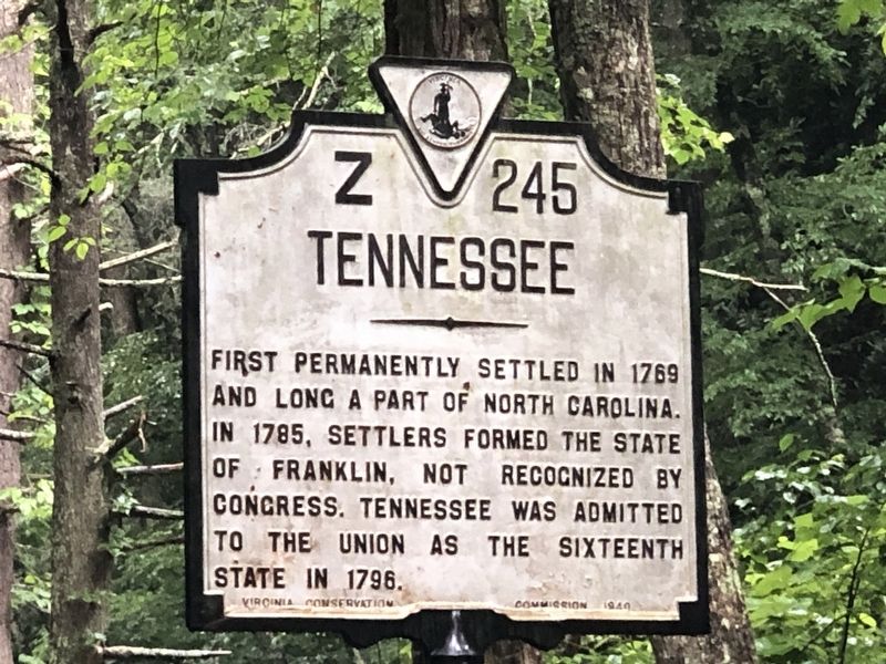
The failed State of Franklin was formed in August of 1784 and comprised the area of then western North Carolina, present-day Northeast Tennessee. John Sevier was elected governor of Franklin while Colonel John Tipton became a leading loyalist to . . . — — Map (db m295180) HM
On West Main Street (Virginia Route 91) at King Avenue, on the right when traveling west on West Main Street.
As the Confederacy's leading producer of salt, Saltville was a major Federal target. Confederate Gen. Sam Jones proposed defenses at Saltville in June 1863, and construction began that year.
The defenses consisted of a half dozen earthen forts, . . . — — Map (db m193332) HM
On W Dixie Avenue at N. Mulberry Street (U.S. 62), on the left when traveling east on W Dixie Avenue.
Shortly after Thomas and Nancy Lincoln's wedding in Washington County on June 12, 1806, the couple set up housekeeping in Hardin County where Thomas owned a farm near Elizabethtown on Mill Creek. Nancy gave birth to Lincoln's first child, a daughter . . . — — Map (db m249363) HM
On Tebbs Bend Road 0.3 miles west of New Columbia Road (Kentucky Route 55), on the left when traveling west.
Major Edward P. Byrne
Commander of the Confederate Artillery
A native Kentuckian, Byrne was living in Greenville, Washington County, Mississippi, when the war broke out. His first battery of six brass field pieces, their carriages, and . . . — — Map (db m133838) HM
On West High Street (Missouri Route 8) at South Missouri Street, on the right when traveling east on West High Street.
Early mining center, named for the famous South American silver mine, Potosi was established by Moses Austin as the seat of Washington County, organized, 1813.
Austin came here, 1797, after receiving a 3 square mile Spanish land grant, including . . . — — Map (db m119802) HM
Near Hartsville Pike (Tennessee Route 25) 0.1 miles west of Rock Springs Road.
Col. Anthony Bledsoe
Born in Culpepper Co. VA, 1733
Killed by Indians about 200 yards west from this spot, July 20, 1788.
and his wife, Mary Ramsey Bledsoe
Born in Augusta Co. VA, 1734
Died in Sumner Co. Tenn, 1808
Col. Issac . . . — — Map (db m180309) HM
On Colonial Road SW east of Reedy Creek Road, on the left when traveling east.
To the south at Craig’s (Dunn’s) Meadow, is the
likely site of the Washington County militia’s
muster ground for the Revolutionary War’s Kings
Mountain Campaign. In Sept. 1780, under the com-
mand of Col. William Campbell the militiamen . . . — — Map (db m46264) HM