By Mark Hilton, September 5, 2023
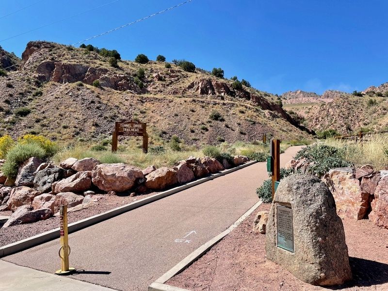
Zebulon Pike Block House Marker at the Tunnel Drive Trail Head.
GEOGRAPHIC SORT WITH USA FIRST Geographic Sort Title Sort Marker Number Sort Marker Number Sort N Marker Number Sort T Publication Order Sort Publication Order Sort A Erected Year Sort Most Viewed Sort Most Recent-Interest Sort Most Recently Changed Sort SEE FAQ #33 FOR DESCRIPTIONS
On Tunnel Drive, 0.6 miles west of U.S. 50, on the right when traveling west.
On Tomichi Avenue (U.S. 50) at Adams Street, on the right when traveling east on Tomichi Avenue.
On Washington Avenue south of 10th Street, on the right when traveling north.
On Washington Avenue just north of 12th street.
On County Highway 250, 0.5 miles east of U.S. 550, on the left when traveling east.
On State Highway 91, on the right when traveling south.
On Rist Canyon Road at North County Road 23 (County Road 23), on the left when traveling west on Rist Canyon Road.
On Bingham Hill Road (County Highway 50E) 0.2 miles east of North County Road 23 (County Highway 23), on the right when traveling east.
Near Rist Canyon Road, 0.2 miles west of North County Road 23 (County Highway 23).
On South Saint Varain Avenue (State Highway 7), on the right when traveling north.
Near Bingham Hill Rd, 0.1 miles west of North Overland Trail Rd (County Road 21C), on the right when traveling west.
On Galway Drive at Cork Drive, on the right on Galway Drive.
On North Overland Trail Road, 0.3 miles south of US 287B Highway, on the right when traveling south.
On Overland Trail, 0 miles south of US 287B Highway, on the right when traveling north.
On Red Feather Lakes Rd (County Road 74E at milepost 16) at Boy Scout Rd (County Road 68C), on the right when traveling south on Red Feather Lakes Rd.
Paid Advertisement
On N County Road 19E, on the right when traveling north.
Near Kansas Avenue at San Pedro Street.
On Grand Army of the Republic Highway (State Highway 6) at County Road 22 on Grand Army of the Republic Highway.
On Main Street east of South 4th Street, on the right when traveling east.
On Colorado 194, 0.1 miles east of County Road 35, on the right when traveling east.
On State Highway 194 east of County Highway 35, on the left when traveling west.
On Main Street (U.S. 50) at E. Beech Street, on the right when traveling north on Main Street.
Near Scenic U.S. 50/287 at State Highway 196, on the right when traveling west.
On Scenic U.S. 50/287 at State Highway 196, on the right when traveling west on U.S. 50/287Scenic .
On West 1st Street at Court Street, on the right when traveling west on West 1st Street.
On South Joplin Avenue (State Highway 227) at Damson Street, on the right when traveling south on South Joplin Avenue.
On Lane 36 (State Highway 231) at Santa Fe Drive (U.S. 50), on the left when traveling north on Lane 36.
On 14th Avenue at 13th Street, on the right when traveling north on 14th Avenue.
On Colorado Route 257 west of West 10th Street (Business U.S. 34), on the right when traveling west.
Paid Advertisement
On Wooster Street, 0.1 miles Main Street, on the left when traveling west.
On Old Post Road at Beach Road, on the left when traveling south on Old Post Road.
On Beach Road at Sunnieholm Drive, on the left when traveling west on Beach Road.
On Bronson Avenue, 0.1 miles north of Verna Hill Road, on the right when traveling north.
On Center Street at Harbor Road, on the left when traveling east on Center Street.
On East Putnam Avenue (U.S. 1) at Old Church Road, on the left when traveling north on East Putnam Avenue.
On Church Hill Road (U.S. 6) at Queen Street, on the right when traveling east on Church Hill Road.
On France Street at Adams Avenue, on the left when traveling north on France Street.
On East Avenue, on the right when traveling north.
Near Seaside Place, on the right when traveling south.
On Hillside Place at Elmwood Avenue, on the right when traveling west on Hillside Place.
On East Avenue at Fort Point Street, on the left when traveling south on East Avenue.
On Atlantic Street at Main Street, on the right when traveling north on Atlantic Street.
On Westover Road, on the right when traveling south.
Near West Broad Street at Beardsley Avenue.
On Elm Street at East Broadway, on the left when traveling north on Elm Street.
Paid Advertisement
On Danbury Road (U.S. 7) 0.2 miles south of Cricket Lane, on the left when traveling south.
On Memorial Boulevard, 0.2 miles east of East Street, on the right when traveling west.
On Bellevue Avenue at Queen Street, on the right when traveling north on Bellevue Avenue.
On Albany Turnpike (U.S. 44), on the right when traveling west.
On Enfield Street at Spier Avenue, on the left when traveling south on Enfield Street.
On Enfield Street at Spier Avenue, on the left when traveling south on Enfield Street.
On Main Street at Gold Street, on the right when traveling north on Main Street.
Near Central Row near Main Street, on the right when traveling west.
On Center Street (U.S. 6) at Linden Street, on the right when traveling east on Center Street.
On East Street, 0.1 miles south of Allen Street, on the right when traveling south.
On Eddy Glover Boulevard at Commonwealth Avenue, on the right when traveling north on Eddy Glover Boulevard.
Near Old Bridge Road, 0.1 miles south of Drake Hill Road.
Near Hopmeadow Street (Connecticut Route 10) at Station Street, on the right when traveling south.
On Hopmeadow Street (Connecticut Route 10) at Pent Road, on the left when traveling north on Hopmeadow Street.
On Main Street (Connecticut Route 10) at Academy Street, on the left when traveling north on Main Street.
On North Main Street at Brace Road, on the right when traveling south on North Main Street.
Paid Advertisement
On North Main Street at Loomis Drive, on the right when traveling north on North Main Street.
On Palisado Ave at Bissell's Ferry Road on Palisado Ave.
On Connecticut Route 159.
On Poquonock Ave at East Street on Poquonock Ave.
On East River Road, 1.7 miles south of Connecticut Route 20, on the left when traveling south.
On North Street (Connecticut Route 63) at Westwood Lane, on the left when traveling north on North Street.
On Main Street at Church Street, on the left when traveling south on Main Street.
Near Main Street (Connecticut Route 63) at French Street, on the right when traveling north.
Near Main Street (Connecticut Route 63) at French Street, on the right when traveling north.
On Main Street (Connecticut Route 63) at French Street, on the right when traveling north on Main Street.
On Park Place West at Grove Street, on the right when traveling south on Park Place West.
On Torrington Road at Willow Street, on the left when traveling south on Torrington Road.
On St. John’s Square at St. John’s Street, on the right when traveling east on St. John’s Square.
On Main Street at Water Street, on the right when traveling north on Main Street.
On Wakelee Avenue at Pork Hollow Street, on the right when traveling north on Wakelee Avenue.
On South Main Street (Connecticut Route 10) at Wallingford Road, on the right when traveling north on South Main Street.
Paid Advertisement
On Park Street at Broad Street, on the right when traveling south on Park Street.
On Boston Post Road just west of Island Avenue.
On River Street, 0.1 miles north of West River Street, on the left when traveling north.
On Maple Street, 0.1 miles west of North Street, on the right when traveling west.
On Bridgeport Avenue (U.S. 1) at Concord Avenue, on the left on Bridgeport Avenue.
On High Street east of Green Street, on the right when traveling east.
Near East Main Street, on the left when traveling west.
Near Riverside Street, 0.1 miles south of Sunnyside Avenue, on the right when traveling south.
Near Captain Thomas Blvd., 0.1 miles south of Dyke Street, on the left when traveling south.
On Voluntown Road (Route 138) at Old Bethel Road, on the right when traveling west on Voluntown Road.
On Bolton Center Road, 0.1 miles east of Bayberry Road, on the left when traveling east.
On Lake St at Cross Street, on the left when traveling south on Lake St.
On Lake St at High Street, on the right on Lake St.
On Hartford Turnpike (Connecticut Route 30) at Center Road (Connecticut Route 541), on the right when traveling south on Hartford Turnpike.
On Hyde Avenue (Connecticut Route 30) at East Street, on the right when traveling west on Hyde Avenue.
Paid Advertisement
On Huntington Road (Connecticut Route 14) at Devotion Road, on the left when traveling east on Huntington Road.
On Plainfield Pike (Route 14A) at Sterling Hill Road, on the left when traveling east on Plainfield Pike.
On Windham Green Road at Plains Road, on the left when traveling south on Windham Green Road.
On Windham Green Road at Plains Road, on the left when traveling south on Windham Green Road.
3242 entries matched your criteria. Entries 201 through 300 are listed above.
⊲ Previous 100 —
Next 100 ⊳