51 entries match your criteria.
Entries Containing All of the Phrases «kern county» AND «california»
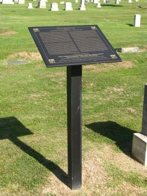
By Denise Boose, May 5, 2012
Captain Elisha Stephens Marker
RANKED BY RELEVANCE
1 ► California, Kern County, Bakersfield — Captain Elisha Stephens — and the — Stephens-Townsend-Murphy Party of 1844 —  |
| On Potomac Avenue, on the right when traveling west. | |||
| 2 ► California, Kern County, McKittrick — 498 — McKittrick Brea Pit — |
| On State Highway 58 at State Highway 33, on the left when traveling west on State Highway 58. | |||
| 3 ► California, Kern County, Cantil — 476 — Desert Spring — |
| Near Pappas Road. | |||
| 4 ► California, Kern County, Inyokern — 766 — Freeman Junction |
| On Isabella Walker Pass Road (State Highway 178 at milepost 88), on the right when traveling west. Reported missing. | |||
| 5 ► California, Kern County, Inyokern — 457 — Indian Wells — |
| On State Highway 14 2 miles north of Inyokern Road, on the left when traveling north. | |||
| 6 ► California, Kern County, Lake Isabella — 98 — Keyesville — California Historical Landmark — Keysville — |
| On Keyesville Road 2 miles west of Highway 155, on the right when traveling west. | |||
| 7 ► California, Los Angeles County, San Fernando — Cesar Chávez — March 31, 1927 - April 23, 1993 — "The end of all education should be service to others." — |
| On Wolfskill Street at Truman Street, on the right when traveling east on Wolfskill Street. | |||
| 8 ► California, Kern County, Lake Isabella — 742 — Campsite of Edward Kern — |
| On California Route 178, on the left when traveling east. | |||
| 9 ► California, Kern County, Onyx — 99 — Walker's Pass — |
| On Isabella Walker Pass Road (State Highway 178 at milepost 79.8), on the right when traveling east. | |||
| 10 ► California, Kern County, Bakersfield — Drug Store — |
| On Chester Avenue. | |||
| 11 ► California, Kern County, Bakersfield — 732 — Home of Elisha Stevens — |
| On West Columbus Street at Isla Verde Street, on the right when traveling west on West Columbus Street. | |||
| 12 ► California, Kern County, Bakersfield — Hospital — |
| Near Chester Avenue. | |||
| 13 ► California, Kern County, Garlock — 671 — Garlock — |
| On Garlock Road 1 mile north of Red Rock Randsburg Road. | |||
| 14 ► California, Kern County, Glennville — 495 — Glennville Adobe — |
| On Evans Road (State Highway 155), on the left when traveling west. | |||
| 15 ► California, Kern County, Lebec — 129 — Fort Tejon — |
| On Fort Tejon Road west of Interstate 5. | |||
| 16 ► California, Kern County, Tehachapi — 643 — "Old Town" — |
| On Old Town Road at Woodford Tehachapi Road, on the right when traveling north on Old Town Road. | |||
| 17 ► California, Kern County, Woody — 589 — Mountain House — |
| On Bakersfield-Glennville Road 6.5 miles south of Route 155, on the right when traveling south. | |||
| 18 ► California, Mariposa County, Mariposa — 518 — Agua Fria — |
| On State Highway 140 east of Yaqui Gulch Road, on the left when traveling east. | |||
| 19 ► California, Kern County, Bakersfield — Cable Tool Drilling Rig — |
| Near Chesterfield Drive. | |||
| 20 ► California, Inyo County, Lone Pine — 507 — Disaster in 1872 — Grave of 1872 Earthquake Victims — |
| Near U.S. 395 0.1 miles south of Pangborne Lane, on the right when traveling south. | |||
| 21 ► California, Kern County, Bakersfield — Assay Office — |
| Near Chester Avenue. | |||
| 22 ► California, Kern County, Bakersfield — Kern County Begins — |
| Near Chester Avenue just north of 36th Street, on the left when traveling north. | |||
| 23 ► California, Kern County, Bakersfield — 539 — Posey Station of Butterfield Overland Mail Lines — |
| On Bakersfield-Glennville/Granite Road at Round Mountain Road, on the left when traveling south on Bakersfield-Glennville/Granite Road. | |||
| 24 ► California, Kern County, Bakersfield — United States Post Office — |
| On 18th St., on the right when traveling west. | |||
| 25 ► California, Kern County, Bakersfield, Weedpatch — Weedpatch Camp — Sunset Labor Camp — Dust Bowl Camp — |
| On Sunset Boulevard east of Weedpatch Highway, on the right when traveling east. | |||
| 26 ► California, Kern County, Bakersfield — Bakersfield Californian — |
| On Eye Street, on the right when traveling west. | |||
| 27 ► California, Kern County, Bakersfield — Wells, Fargo & Company Express Office — |
| Near Chester Avenue. | |||
| 28 ► California, Kern County, Mojave — 652 — Mojave 20 Mule Team Borax Terminus — |
| On California Route 14 north of Nadeau Street, on the right when traveling north. | |||
| 29 ► California, Kern County, Rosamond — Willow Springs International Raceway — |
| Near 75th Street West north of Rosamond Boulevard. | |||
| 30 ► California, Santa Cruz County, Santa Cruz — California Pioneers — James Williams - Mary Patterson Williams — |
| Near Evergreen Street, on the right when traveling south. | |||
| 31 ► California, Kern County, Piute Springs — Piute Ranch Homesite of Elizabeth "Lizzie" McGuirk — Scobie, Shipsey, Kersey — 1860 - 1932 — |
| On Caliente Creek Road. | |||
| 32 ► California, Kern County, Shafter — The Green Hotel — Shafter's First Commercial Building — |
| On James Street north of Pacific Street, on the right when traveling north. | |||
| 33 ► California, San Bernardino County, Earp — 82 — Wyatt Earp — |
| On Aqueduct Road (California Route 62) 0.1 miles west of Parker Dam Road, on the right when traveling east. | |||
| 34 ► California, Kern County, Buttonwillow — Tule Elk State Reserve — A California State Park — |
| Near Station Road 0.2 miles west of Morris Road, on the left when traveling west. | |||
| 35 ► California, Kern County, Taft — West Kern Oil Museum — |
| Near Wood Street, on the right when traveling east. | |||
| 36 ► California, Los Angeles County, Los Angeles, Boyle Heights — 891 — Boyle Hotel — Cummings Block — |
| On North Boyle Avenue at 1st Street, on the left when traveling north on North Boyle Avenue. | |||
| 37 ► California, Kern County, Bakersfield — Adobe House — |
| Near Chester Avenue. | |||
| 38 ► California, Kern County, Bakersfield — Fairhaven Pump House — |
| Near Chester Avenue. | |||
| 39 ► California, Kern County, Bakersfield — Kern County Chamber of Commerce — |
| Near Chester Avenue. | |||
| 40 ► California, Kern County, Bakersfield — Lόpez-Hill House — |
| Near Chester Avenue. | |||
| 41 ► California, Kern County, Bakersfield — Metcalf House — |
| Near Chester Avenue. | |||
| 42 ► California, Kern County, Bakersfield — Miller and Lux Survey Office — |
| On Chester Avenue. | |||
| 43 ► California, Kern County, Oildale — Oildale Waits Drilling Company — |
| On China Grade Loop Road, on the right when traveling west. | |||
| 44 ► California, Kern County, Bakersfield — We Shall Never Forget — |
| On Buena Vista Drive, on the right when traveling south. | |||
| 45 ► California, Kern County, Tehachapi — Early Settlers — |
| On Green Street, on the left when traveling north. | |||
| 46 ► California, Monterey County, Monterey — 1 — Custom House — |
| On Olivier Street. | |||
| 47 ► California, San Benito County, San Juan Bautista — 179 & 180 — Castro/Breen Adobe and Plaza Hotel — |
| On 2nd Street, on the right when traveling east. | |||
| 48 ► California, Kern County, Bakersfield — Camp Hamilton — Veterans Memorial Park — |
| Near Lerdo Highway 1 mile west of Route 65, on the right when traveling west. | |||
| 49 ► California, Kern County, Randsburg — The Yellow Aster Mine — (above, in the Background) — |
| On Redrock Randsburg Road south of U.S. 395, on the right when traveling south. | |||
| 50 ► California, Kern County, Randsburg — Yellow Aster Gold Mine — |
| On Redrock Randsburg Road north of Butte Avenue, on the right when traveling north. | |||
| 51 ► California, Kern County, Red Mountain — Yellow Aster Gold Mine — |
| Near Red Mountain Road 0.8 miles west of U.S. 395, on the left when traveling west. | |||
Thin black lines indicate changes in relevance. Between each pair of lines entries are ordered geographically but all have the same relevance.
* Inflectional forms of words are their plurals, singulars, and possessives as well as gramatical tenses and similar variations.
Nov. 13, 2026