248 entries match your criteria. The first 100 are listed. ⊳
Historical Markers and War Memorials
in Greater Wichita Region
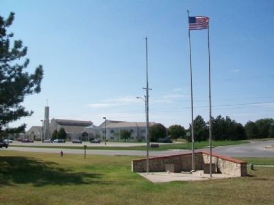
By William Fischer, Jr., September 23, 2014
1991 Tornado Victims Memorial
1 ► Kansas, Butler County, Andover — 1991 Tornado Victims —  |
| On Andover Road at 1st Street, on the right when traveling north on Andover Road. | |||
| 2 ► Kansas, Butler County, Augusta — C.N. James Trading Post — Built in 1868 — Oldest House in Augusta — |
| On State Street south of 4th Avenue, on the right when traveling south. | |||
| 3 ► Kansas, Butler County, Beaumont — 1885 Frisco Water Tower — |
| On SE 116th Terrace at SE Main Street, on the left when traveling west on SE 116th Terrace. | |||
| 4 ► Kansas, Butler County, Beaumont — Beaumont Becomes a Railroad Town — Beaumont Historical Marker — |
| On SE 116th Terrace at SE Main Street, on the left when traveling west on SE 116th Terrace. | |||
| 5 ► Kansas, Butler County, Beaumont — Livestock in the Flint Hills — Beaumont Historical Marker — |
| On SE 116th Terrace south of SE Main Street, on the right when traveling east. | |||
| 6 ► Kansas, Butler County, Beaumont — The Beaumont Grass Landing Strip — Beaumont Historical Marker — |
| On SE Main Street at SE 116th Terrace, on the left when traveling south on SE Main Street. | |||
| 7 ► Kansas, Butler County, Beaumont — The Frisco Ponds — Beaumont Historical Marker — |
| Near Southeast Beaumont Road. | |||
| 8 ► Kansas, Butler County, Beaumont — The Historic Beaumont Hotel / The Beaumont Hotel Restoration — Beaumont Historical Marker — |
| On SE Main Street north of SE 116th Terrace, on the right when traveling south. | |||
| 9 ► Kansas, Butler County, El Dorado — Alfred Washington Ellet — Oct. 11, 1820 - Jan. 9, 1895 — Dedicated to the memory of — |
| Near East Central Avenue. | |||
| 10 ► Kansas, Butler County, El Dorado — Cable Tool Drilling Rig — |
| Near East Central Avenue. | |||
| 11 ► Kansas, Butler County, El Dorado — Celebration of Freedom Memorial — |
| On Central Avenue near Gordy Street, on the left when traveling west. | |||
| 12 ► Kansas, Butler County, El Dorado — Flare — |
| Near East Central Avenue. | |||
| 13 ► Kansas, Butler County, El Dorado — Grandma Anderson's House — |
| Near East Central Avenue. | |||
| 14 ► Kansas, Butler County, El Dorado — Kansas Oil Museum — |
| Near East Central Avenue. | |||
| 15 ► Kansas, Butler County, El Dorado — Missouri Pacific Depot Veterans Memorial — |
| On Main Street (U.S. 77) at 3rd Avenue, on the right when traveling north on Main Street. | |||
| 16 ► Kansas, Butler County, El Dorado — Model K Star Spudder — |
| Near East Central Avenue. | |||
| 17 ► Kansas, Butler County, El Dorado — Mrs. Addie Cowley Bradley — |
| Near East Central Avenue. | |||
| 18 ► Kansas, Butler County, El Dorado — Oil Field Boom Towns — |
| Near East Central Avenue. | |||
| 19 ► Kansas, Butler County, El Dorado — Oil Field Lease House — |
| Near East Central Avenue. | |||
| 20 ► Kansas, Butler County, El Dorado — Pole Trailer — |
| Near East Central Avenue. | |||
| 21 ► Kansas, Butler County, El Dorado — Replica of the Statue of Liberty — |
| On Central Avenue (State Highway 254) at Star Street, on the left when traveling west on Central Avenue. | |||
| 22 ► Kansas, Butler County, El Dorado — Signers of the Declaration of Independence — |
| On Central Avenue (State Highway 254) near Gordy Street, on the left when traveling west. | |||
| 23 ► Kansas, Butler County, El Dorado — Star Drilling Machine — |
| Near East Central Avenue. | |||
| 24 ► Kansas, Butler County, El Dorado — Steel Oil Derrick / 1930's Cable-Tool Drilling Rig — |
| Near East Central Avenue. | |||
| 25 ► Kansas, Butler County, El Dorado — The Central Power Unit — |
| Near East Central Avenue. | |||
| 26 ► Kansas, Butler County, El Dorado — The Gypsy Spudder — |
| Near East Central Avenue. | |||
| 27 ► Kansas, Butler County, El Dorado — Tool Rack — |
| Near East Central Avenue. | |||
| 28 ► Kansas, Butler County, El Dorado — Union Tank Car — |
| Near East Central Avenue. | |||
| 29 ► Kansas, Butler County, El Dorado — Veterans Memorial Flagpole — |
| On Central Avenue (State Highway 254) near Gordy Street, on the left when traveling west. | |||
| 30 ► Kansas, Butler County, El Dorado — William Allen White — |
| On Main Street (U.S. 54) at Vine Street, on the right when traveling east on Main Street. | |||
| 31 ► Kansas, Butler County, Towanda — 118 — Towanda — Land of Many Waters — |
| On Interstate 35 at milepost 65, in the median. | |||
| 32 ► Kansas, Cowley County, Arkansas City — 1996 Olympic Torch Relay — Arkansas City — Heart of the Flame — |
| On Summit Street (U.S. 77) north of Maple Avenue, on the left when traveling north. | |||
| 33 ► Kansas, Cowley County, Arkansas City — Bicentennial Time Capsule — 1776 ☆ 1976 — |
| On West Central Avenue just east of North 1st Street, on the right when traveling west. | |||
| 34 ► Kansas, Cowley County, Arkansas City — 60 — Cherokee Outlet — |
| Near U.S. 77 near 312th Road, on the right when traveling south. | |||
| 35 ► Kansas, Cowley County, Arkansas City — Dedicated to the Heroes of United Flight #93 on Sept. 11, 2001 — |
| On North Summit Street (County Road 27) at East Maple Avenue, on the right when traveling north on North Summit Street. | |||
| 36 ► Kansas, Cowley County, Arkansas City — Korean War Liberty Tree Memorial — |
| On Summit Street (U.S. 77) north of Maple Avenue when traveling north. | |||
| 37 ► Kansas, Cowley County, Arkansas City — Old Arkansas City High School — |
| On West Central Avenue at North 2nd Street, on the left when traveling east on West Central Avenue. | |||
| 38 ► Kansas, Cowley County, Arkansas City — Public Library — |
| On West 5th Avenue at South 2nd Street, on the left when traveling west on West 5th Avenue. | |||
| 39 ► Kansas, Cowley County, Arkansas City — Robert Docking — 1925 - 1983 — |
| On Summit Street (U.S. 77) south of Birch Avenue, on the left when traveling north. | |||
| 40 ► Kansas, Cowley County, Arkansas City — Santa Fe Locomotive Engine No. 2542 — |
| On Summit Street (U.S. 77) north of Maple Avenue, on the left when traveling north. | |||
| 41 ► Kansas, Cowley County, Arkansas City — The Cherokee Strip — |
| On 312th Street at U.S. 77, on the left when traveling west on 312th Street. | |||
| 42 ► Kansas, Cowley County, Arkansas City — To Honor Heroes — World War II — |
| On North 1st Street at West Central Avenue, on the left when traveling south on North 1st Street. | |||
| 43 ► Kansas, Cowley County, Cedar Vale — 59 — The Gas That Wouldn't Burn — |
| On U.S. 166 at Kansas Highway 15, on the right when traveling east on U.S. 166. | |||
| 44 ► Kansas, Cowley County, Winfield — 119 East 9th — Constructed: 1897 — |
| On East 9th Avenue (U.S. 160) just east of Main Street (U.S. 77), on the right when traveling east. | |||
| 45 ► Kansas, Cowley County, Winfield — 121-123 East 9th — Constructed: 1898 — |
| On East 9th Avenue (U.S. 160) at Millington Street, on the right when traveling east on East 9th Avenue. | |||
| 46 ► Kansas, Cowley County, Winfield — 718-722 Main — Constructed 1884 — |
| On Main Street at East 8th Avenue, on the left when traveling south on Main Street. | |||
| 47 ► Kansas, Cowley County, Winfield — Cowley County National Bank Building — |
| On Main Street (U.S. 77) at 9th Avenue (U.S. 160), on the right when traveling north on Main Street. | |||
| 48 ► Kansas, Cowley County, Winfield — Jennings Building — 808 Main — Constructed: 1901 — |
| On Main Street (U.S. 77) south of 8th Avenue, on the right when traveling north. | |||
| 49 ► Kansas, Cowley County, Winfield — Platting of Winfield, Kansas — 823 Main — |
| On Main Street (U.S. 77) at 9th Avenue (U.S. 160), on the left when traveling north on Main Street. | |||
| 50 ► Kansas, Cowley County, Winfield — Vietnam & Korea War Memorial — Many Gave a Lot • Some Gave All — |
| Near College Street at East 1st Avenue, on the right when traveling north. | |||
| 51 ► Kansas, Harvey County, Halstead — Carnegie Library — |
| On Main Street at 3rd Street, on the left when traveling south on Main Street. | |||
| 52 ► Kansas, Harvey County, Halstead — Civil War Memorial — |
| On U.S. 50. | |||
| 53 ► Kansas, Harvey County, Halstead — Halstead Santa Fe Depot — 1917 — |
| On 1st Street east of Main Street (Kansas Highway 89), on the left when traveling east. | |||
| 54 ► Kansas, Harvey County, Halstead — Lt. Eldo "Pop" Steele — In Loving Memory — |
| On 1st Street east of Main Street (Kansas Highway 89), on the left when traveling east. | |||
| 55 ► Kansas, Harvey County, Halstead — Scout Park — |
| On Locust Street at 4th Street, on the left when traveling north on Locust Street. | |||
| 56 ► Kansas, Harvey County, Halstead — Sweezy House — |
| On Main Street at 2nd Street, on the right when traveling south on Main Street. | |||
| 57 ► Kansas, Harvey County, Halstead — The Horse and Buggy Doctor — |
| On Hertzler Road (Horse and Buggy Doctor Highway) (State Highway 89) south of U.S. 50, on the left when traveling south. | |||
| 58 ► Kansas, Harvey County, Halstead — The Old Hardware Store — |
| On Main Street south of 2nd Street, on the left when traveling south. | |||
| 59 ► Kansas, Harvey County, Halstead — War Memorial — |
| On Main Street (State Highway 89) at 1st Street, on the right when traveling north on Main Street. | |||
| 60 ► Kansas, Harvey County, Hesston — Chisholm Trail — |
| On Kansas Route 15 0.8 miles north of NE 96th Street, on the left when traveling north. | |||
| 61 ► Kansas, Harvey County, Hesston — Hesston — |
| On North Main Street at East Smith Street, on the right when traveling north on North Main Street. | |||
| 62 ► Kansas, Harvey County, Hesston — The Hesston Hardware Building — |
| On North Main Street at East Smith Street, on the right when traveling north on North Main Street. | |||
| 63 ► Kansas, Harvey County, Newton — 1871 Water Well Memorial — |
| On Main Street at 5th Street, on the right when traveling north on Main Street. | |||
| 64 ► Kansas, Harvey County, Newton — Anderson Book and Office Supply — |
| On North Main Street (State Highway 15) at West Broadway Street, on the left when traveling north on North Main Street. | |||
| 65 ► Kansas, Harvey County, Newton — Bernhard Warkentin — |
| On 1st Street near Oak Street, on the right when traveling east. | |||
| 66 ► Kansas, Harvey County, Newton — Coastal Defense Cannon — A Civil War Memorial — |
| On Oak Street at Broadway, on the right when traveling north on Oak Street. | |||
| 67 ► Kansas, Harvey County, Newton — First Presbyterian Church — |
| On North Main Street (State Highway 15) at East 7th Street, on the right when traveling north on North Main Street. | |||
| 68 ► Kansas, Harvey County, Newton — John Jacob Krehbiel Memorial Park — |
| On East 6th Street at North Oak Street, on the left when traveling east on East 6th Street. | |||
| 69 ► Kansas, Harvey County, Newton — Mennonite Settler — |
| On Athletic Park Drive 0.1 miles north of Fischer Field (football stadium), on the right when traveling west. | |||
| 70 ► Kansas, Harvey County, Newton — Midland National Bank — |
| On North Main Street (Kansas Route 15) at West 6th Street, on the left when traveling north on North Main Street. | |||
| 71 ► Kansas, Harvey County, Newton — Newton Carnegie Library — |
| On Main Street (State Highway 15) at 2nd Street, on the left when traveling north on Main Street. | |||
| 72 ► Kansas, Harvey County, Newton — Newton's Cowboy Era — |
| On Second Street West at Old Mill Road, on the left when traveling west on Second Street West. | |||
| 73 ► Kansas, Harvey County, Newton — Ragsdale Opera House — 1885-1915 — |
| On North Main Street (State Highway 15) at West Broadway Street, on the left when traveling north on North Main Street. | |||
| 74 ► Kansas, Harvey County, Newton — Railroad Savings and Loan Building — 1925 — |
| On Main Street at 5th Street, on the right when traveling north on Main Street. | |||
| 75 ► Kansas, Harvey County, Newton — Santa Fe Steam Locomotive #1880 — Pride of the Prairie • Work Horse of the Plains — Prairie (2-6-2) Type — |
| On Broadway at Oak Street, on the left when traveling east on Broadway. | |||
| 76 ► Kansas, Harvey County, Newton — The Harvey County Courthouse — |
| On North Main Street (State Highway 15) at East 8th Street, on the right when traveling north on North Main Street. | |||
| 77 ► Kansas, Harvey County, Newton — The Masonic Lodge — |
| On East Broadway Street at North Main Street (State Highway 15), on the right when traveling east on East Broadway Street. | |||
| 78 ► Kansas, Harvey County, Newton — Unknown Dead of the Civil War — |
| On Broadway at Oak Street, on the left when traveling east on Broadway. | |||
| 79 ► Kansas, Harvey County, Sedgwick — Purple Heart Trail in Kansas — "Freedom Isn't Free" — Dedicated to the Soldiers, Sailors, Airmen, and Marines Wounded or Killed in Action — |
| On Interstate 135 1 mile north of 125th Street (I-135 Exit 22) (Interstate 135), on the right when traveling north. | |||
| 80 ► Kansas, Harvey County, Walton — 61 — Turkey Red Wheat — |
| On U.S. 50, on the left when traveling east. | |||
| 81 ► Kansas, Sedgwick County, Derby — 1 — Arkansas River Crossing — Derby Historic Landmark — |
| On West Washington Street at North River Street on West Washington Street. | |||
| 82 ► Kansas, Sedgwick County, Derby — 4 — Derby Public School & Museum — Derby Historic Landmark — |
| On East Market Street east of North Westview Street, on the left when traveling east. | |||
| 83 ► Kansas, Sedgwick County, Derby — 2 — El Paso Business District — Derby Historic Landmark — |
| On North Baltimore Avenue at West Main Street, on the right when traveling south on North Baltimore Avenue. | |||
| 84 ► Kansas, Sedgwick County, Derby — 6 — El Paso Cemetery — Derby Historic Landmark — |
| On South Woodlawn Boulevard 0.2 miles south of East Market Street, on the right when traveling south. | |||
| 85 ► Kansas, Sedgwick County, Derby — 7 — Garrett Homestead — Derby Historic Landmark — |
| On South Red Horse Drive 0.2 miles south of East Chet Smith Avenue, on the right when traveling south. | |||
| 86 ► Kansas, Sedgwick County, Derby — 5 — Lauber Farm & Silo — Derby Historic Landmark — |
| On South Brookwood Drive south of East Redwood Road, on the left when traveling south. | |||
| 87 ► Kansas, Sedgwick County, Derby — The Santa Fe & St. Mary Bell — |
| On East Market Street west of North Woodward Boulevard, on the right when traveling west. | |||
| 88 ► Kansas, Sedgwick County, Mount Hope — Civil War Memorial — |
| On 93rd Street North 0.6 miles west of 276th Street West, on the right when traveling west. | |||
| 89 ► Kansas, Sedgwick County, Park City — 64 — Indian Treaties of 1865 |
| On North Broadway Avenue south of 63rd Street, on the left when traveling north. Reported permanently removed. | |||
| 90 ► Kansas, Sedgwick County, Park City — 64B — Indian Treaties of 1865 — |
| On North Broadway Avenue 0.2 miles north of West 61st Street North, on the left. | |||
| 91 ► Kansas, Sedgwick County, Wichita — "Minisa" Bridge — 1932 — |
| On West 13th Street North at the Little Arkansas River, on the right when traveling west on West 13th Street North. | |||
| 92 ► Kansas, Sedgwick County, Wichita — 1854 Treaty Oration Excerpt — Chief Seattle of the Suquamish — American Indian Trail Walk Path — |
| Near West Central Avenue. | |||
| 93 ► Kansas, Sedgwick County, Wichita — American Gold Star Mothers — |
| Near Veterans Parkway. | |||
| 94 ► Kansas, Sedgwick County, Wichita — Area History — |
| On Douglas Avenue at St. Francis Street, on the right when traveling east on Douglas Avenue. | |||
| 95 ► Kansas, Sedgwick County, Wichita — Bicentennial Flag Memorial — Introduction — |
| Near North Waco Avenue. | |||
| 96 ► Kansas, Sedgwick County, Wichita — Bicentennial of the Birth of George Washington — |
| On Alumni Drive, on the right when traveling north. | |||
| 97 ► Kansas, Sedgwick County, Wichita — Bicentennial of the Birth of George Washington — |
| On Rochester Street at 13th Street North, on the left when traveling north on Rochester Street. | |||
| 98 ► Kansas, Sedgwick County, Wichita — Buffalo — The Source of Life — Plains Indians Life, Beliefs and Practices — |
| Near Veterans Parkway. | |||
| 99 ► Kansas, Sedgwick County, Wichita — Ceremonial Pipes — The Ceremonial Pipe — Plains Indians Life, Beliefs and Practices — |
| Near Veterans Parkway. | |||
| 100 ► Kansas, Sedgwick County, Wichita — Chiefs — A Title of Honor — Plains Indians Life, Beliefs and Practices — |
| Near Veterans Parkway. | |||
248 entries matched your criteria. The first 100 are listed above. Next 100 ⊳