By Craig Doda, March 29, 2025
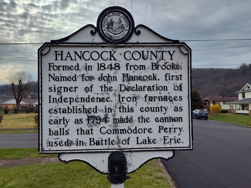
Hancock County side of marker
RANKED BY RELEVANCE
| On 1st Street at Columbia Drive, on the right when traveling north on 1st Street. |
| On Main Cross Street (Ohio Route 12) at Dorney Plaza, on the right when traveling south on Main Cross Street. |
| On Main Cross Street (Ohio Route 12) at Cory Street, on the right when traveling west on Main Cross Street. |
| On U.S. 224, on the right when traveling west. |
| On County Road 236 0.2 miles north of Carey Road (State Route 568), on the left when traveling north. |
| On Main Street, on the left when traveling south. |
| On S. Main Street (Ohio Route 12), on the right when traveling south. |
| On Washington Road (County Route 254) at Brown Road (County Route 216), on the left when traveling north on Washington Road. |
| On Park Street, in the median. |
| On Main Street (Ohio Route 12) at George Street, on the left when traveling north on Main Street. |
| On Liberty Street, on the left when traveling south. |
| On Clinton Court at McManness Avenue, on the left when traveling east on Clinton Court. |
| On Main Cross Street, on the right when traveling east. |
| On County Road 8 at County Road 26, on the left when traveling north on County Road 8. |
| On South Church Street at West South Street, on the right when traveling south on South Church Street. |
| On West South Street, on the left when traveling west. |
| On S Park Dr (Ohio Route 235), on the left when traveling south. |
| On West Park Street (County Route 24), on the left when traveling west. Reported missing. |
| On Main Street at Market Street ( Route 613), on the left when traveling north on Main Street. |
| On U.S. 68 at County Route 10, on the right when traveling south on U.S. 68. Reported missing. |
| On Washington Street at Fiesta Drive, on the right when traveling east on Washington Street. |
| On West Main Street (Ohio Route 613) west of Rader Road, on the right when traveling west. |
| On U.S. 68 at Lewis B Moore Drive (County Route 55), on the left when traveling north on U.S. 68. |
| On North River Road at Jefferson Street, on the right when traveling south on North River Road. |
| On U.S. 224 0.5 miles west of Route 186, on the right when traveling west. |
| On Elm Street east of Liberty Street. |
| On Main Street (Kentucky Route 69) at Madison Street ( Route 69), on the right when traveling south on Main Street. |
| Near County Road 236 0.1 miles north of Carey Road (State Route 568), on the left when traveling north. |
| On Indiana Route 66 just east of County Road 1290E, on the right when traveling east. |
| Near U.S. 224 0.6 miles west of Ohio Route 186, on the right when traveling west. |
| On West Main (Ohio Route 613), on the right when traveling west. |
| On Main Street (West Virginia Route 2) 0.1 miles north of Marland Avenue, on the right when traveling south. |
| On River Street north of Bridge Street, on the right when traveling north. |
| On County Road 236 0.2 miles north of Carey Road (State Route 568), on the left when traveling north. |
| On County Route 236 at Carey Road (Ohio Route 568), on the left when traveling north on County Route 236. |
| On S. Main Street (Ohio Route 37), on the left when traveling north. |
| Near Long Bend Road 0.1 miles south of Main Street (Route 346), on the right when traveling south. |
| On W Dixie Avenue at N. Mulberry Street (U.S. 62), on the left when traveling east on W Dixie Avenue. |
Thin black lines indicate changes in relevance. Between each pair of lines entries are ordered geographically but all have the same relevance.* Inflectional forms of words are their plurals, singulars, and possessives as well as gramatical tenses and similar variations.
Nov. 12, 2026
