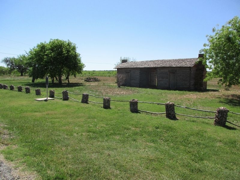
On State Highway 45 0.3 miles west of County Road 237, on the right when traveling east.
During World War II, Camp Bowie housed several thousand German prisoners of war. The first arrivals, many of whom were troops from General Rommel's division in North Africa, came in 1943. The U.S. Army allowed the prisoners to write and receive . . . — — Map (db m220763) HM
On Center Avenue 0.1 miles south of Depot Street, on the right when traveling south.
This Colonial Revival residence was constructed in 1904-05 by R. B. Rogers (d. 1935), a prominent local merchant and an active church and civic leader. The elaborate styling of the home features a distinctive two-story balconied portico with massive . . . — — Map (db m220753) HM
On Crockett Drive south of Memorial Park Drive, on the right when traveling north.
Rear Admiral Jeffrey A Lemmons is Brownwood's highest ranking veteran. Rear Admiral Lemmons was born on 25 May 1957 to Carol and Joe Lemmons. He graduated from Brownwood High School in 1975 and received a Congressional Appointment to the United . . . — — Map (db m248214) HM WM
On Crockett Drive south of Memorial Park Drive, on the right when traveling north.
Robert "Cotton" Tuggle Jr (4 January 1925 - 15 April 1945) graduated from Brownwood High School in 1942 and enlisted in the Navy in 1943. He was nicknamed "Cotton" because of the color and texture of his hair. Robert's experiences growing up in . . . — — Map (db m248146) HM WM
Born in Parker County, Robert Ervin Howard grew up in the Brown and Callahan County communities of Cross Cut, Cross Plains, and Brownwood. He attended Brownwood High School and Howard Payne College, and published his first works of fiction in school . . . — — Map (db m248264) HM
On State Highway 279 at County Road 557, on the right when traveling north on State Highway 279.
Eighteen people gathered under a brush arbor near Rocky Creek in Brown County on August 18, 1877, to organize a Baptist congregation. They called the Rev. R. L. Baker as their first pastor, and by November began construction of a one-room church . . . — — Map (db m290736) HM
On Crockett Drive south of Memorial Park Drive, on the right when traveling north.
Roy Eldon "Buck" White was born in Brownwood on 28 February 1900. He changed his date of birth so he could enlist in the Navy on 20 April 1917 when he was only 17 years old. Fireman Second Class White was on the USS Alcedo when it was sunk by a . . . — — Map (db m247848) HM WM
On Hall Street at Almond Street, on the right when traveling south on Hall Street.
George Smith, born a slave in Virginia, and later a Buffalo Soldier and school trustee in Tom Green County, arrived in Brownwood in 1885 and established the town's first school for African-American children. His home and yard on Dale Street became . . . — — Map (db m248294) HM
On Hall Street at Almonds Street, on the right when traveling south on Hall Street.
George E. Smith, a former Buffalo Soldier and elder came to Brownwood from Fort Concho in San Angelo in the early 1880's and established a school for Black children. In the beginning, school was held in various buildings and the local Black . . . — — Map (db m248295) HM
On Burnett Road south of Memorial Park Drive, on the right when traveling north.
S.J. "Skipper" Howard Jr. was born on 15 November 1913. He is a member of the Daniel Baker College Hillbilly Hall of Honor. Daniel Baker College was a Presbyterian College founded in Brownwood in 1889. Daniel Baker consolidated with Howard Payne . . . — — Map (db m247982) HM
On Crockett Drive at Memorial Park Drive, on the right when traveling north on Crockett Drive.
Born 3 June 1943 in New York City, from Goldthwaite, Texas, is one of only 71 living Medal of Honor recipients in the year 2020. He received the Medal of Honor on 6 December 1966 from President Lyndon B Johnson in Austin, Texas. His Medal of Honor . . . — — Map (db m251047) HM WM
On Burnett Road at Memorial Park Drive, on the left when traveling south on Burnett Road.
Huge World War II training base, Camp Bowie was a home of the "Texas" 36th Division and trained many other units, including the "Dixie" 31st, 4th, and 13th Armored; and 113th Cavalry. It was also Seventh Headquarters of Special Troops, Fourth Army. . . . — — Map (db m220754) HM
On Crockett Drive at Memorial Park Drive, on the right when traveling north on Crockett Drive.
The 2nd Battalion, 131st Field Artillery, 36th Infantry Division, "Texas Division", along with the rest of the 36th Infantry Division, Texas National Guard, was mobilized for Federal service on 25 November 1940. It was soon sent to Camp Bowie, . . . — — Map (db m254341) HM WM
On Center Avenue at Austin Avenue, on the right when traveling north on Center Avenue.
Founder of Howard Payne University, John David Robnett (1845-1898) was born in Missouri, where he was educated at Westminster and William Jewell colleges and was ordained to the Baptist ministry.
In 1883, Robnett was called to serve as pastor . . . — — Map (db m220766) HM
On Center Avenue at Austin Avenue, on the right when traveling north on Center Avenue.
Noah T. Byars (1808-1888) played an integral role in the establishment of the Baptist denomination in Texas. Born in Spartanburg, South Carolina, he arrived in Texas in the early 1830s and set up a blacksmith/gunsmith shop at . . . — — Map (db m220764) HM
On Crockett Drive at Memorial Park Drive, on the right when traveling north on Crockett Drive.
The UH-1 Huey helicopter was the iconic helicopter of the Vietnam War. The Bell UH-1 Iroquois (Huey) is a utility military helicopter powered by a single turboshaft engine with two-blade main and tail rotors. It was developed by Bell Helicopter to . . . — — Map (db m251086) HM
On Burnett Road at Morris Sheppard Drive on Burnett Road.
Designed and built by FMC Corporation from 1954-1959. The M59 was amphibious with two engines from General Motors Corporation. The M59 was used as an ambulance, load carrier, and command vehicle. Experimental models included a flamethrower, . . . — — Map (db m247839) HM
On Crockett Drive south of Memorial Park Drive, on the right when traveling north.
When the American Veterans of Foreign Service, organized in 1899, and the National Society of the Army of the Philippines, organized in 1898, merged in 1914, the Veterans of Foreign Wars of the United States was created. The Veterans of Foreign Wars . . . — — Map (db m248145) HM WM
On Crockett Drive at Memorial Park Drive, on the right when traveling north on Crockett Drive.
Beginning in 1950, US military advisers arrived in what was then French Indochina. After World War II, Vietnam was divided into communist North Vietnam (supported by the Soviet Union and China) and South Vietnam (supported by the United States, . . . — — Map (db m251051) HM WM
On Crockett Drive at Memorial Park Drive, on the right when traveling north on Crockett Drive.
Left Plaque In honor of all Brown County men who gave their lives during the Vietnam conflict. This marker is dedicated in behalt of their loved ones and fellow citizens of Brownwood, Texas
Right Plaque This Memorial Is . . . — — Map (db m254267) WM
On North Broadway Street near North Center Avenue, on the right when traveling west.
Credited with being the first permanent settler and first farmer in Brown County, Welcome William Chandler (1813-1870) arrived in 1856 with his wife Sarah, their children and several slaves. Their log cabin was a gathering place for other area . . . — — Map (db m220771) HM
On Crockett Drive south of Memorial Park Drive, on the right when traveling north.
The Willys M38A1 Jeep (aka Willys MD) was produced from 1952-1957. 101,488 were produced (80,290 domestic/21,198 foreign sales). This was the first appearance of the round fender Jeep. The 1955 Jeep CJ-5 was based on the M38A1. The drive train on . . . — — Map (db m248791) HM
On Crockett Drive at Memorial Park Drive, on the right when traveling north on Crockett Drive.
The Great War, the war to end all wars, 28 July 1914 to 11 November 1918. The trigger for the war was the assassination of Archduke Franz Ferdinand of Austria by Serbian Nationalist Gavrilo Princip in Sarajevo on 28 June 1914. On 28 July 1914 . . . — — Map (db m254558) HM
On Crockett Drive at Memorial Park Drive, on the right when traveling north on Crockett Drive.
To those men from Brown County who rendered valiant service in the World War; who feared not; who believed in the sacred principles upon which this republic is founded; who preferred death to slavery; who signified a willingness to give their lives . . . — — Map (db m254345) WM
On Crockett Drive at Memorial Park Drive, on the right when traveling north on Crockett Drive.
This is the original World War I Memorial which was initially placed at the old Brownwood High School on Austin avenue (now the Family Service Center) in 1919. The old Brownwood High School was closed in 1961 when the current Brownwood High School . . . — — Map (db m254507) WM
On Crockett Drive at Memorial Park Drive, on the right when traveling north on Crockett Drive.
World War II started on 1 September 1939 with the invasion of Poland by NAZI Germany and the subsequent declarations of war on Germany by France and the United Kingdom. On 22 June 1941, Germany invaded the Soviet Union. On 7 December 1941 "A date . . . — — Map (db m251079) HM
On Crockett Drive at Memorial Park Drive, on the right when traveling north on Crockett Drive.
This is the original World War II Memorial which was initially placed in Coggin Park on Austin Avenue in 1946. The memorial was moved to this location in 2016. This memorial now stands where the 36th Infantry Division headquarters building stood . . . — — Map (db m251065) HM
On Morris Sheppard Drive at Crockett Drive, on the left when traveling east on Morris Sheppard Drive.
This Japanese weapon was designed for long range fire. Distinctive features include the pronounced length of sleigh and the three step interrupted breechblock. The recoil system is hydro pneumatic. Types of projectiles used are high explosive, . . . — — Map (db m247834) HM
Near County Road 525 0.6 miles south of Farm to Market Road 1647.
William W. and Pency (Williams) Heflin settled here in 1875. According to local tradition the first burial was that of a child who died in 1876 from eating wild berries as his family camped on the Heflins’ property. The earliest marked grave is . . . — — Map (db m89618) HM
On Early Boulevard (U.S. 67/377) at Williams Drive, on the left when traveling east on Early Boulevard.
A native of Kentucky, Walter Urie Early (1868-1939) moved to Brownwood in 1893. He became a respected local attorney and in 1895 was elected city attorney. He was county attorney from 1900 to 1906, and served as district attorney from 1906 to . . . — — Map (db m72288) HM
On U.S. 183 0.1 miles south of County Road 478, on the right when traveling south.
Methodists in this area were initially served by circuit-riding preachers. First to come to the region in the 1860s was the Rev. Hugh M. Childress, and worship services were held in private homes. In 1882, the Rev. Peter Gravis organized Mt. Zion . . . — — Map (db m85759) HM
On U.S. 183 0.1 miles north of County Road 485, on the right when traveling north.
Originally part of a Mexican land grant given to Empresario John Cameron in 1827. May developed in the 1870s when several pioneer families settled here. Baptists and Methodists quickly organized churches. A one-room school known as Old Swayback . . . — — Map (db m89617) HM
This cemetery originally served pioneer settlers of the Wolf Valley community, which began about 1875. The earliest grave is that of S.T. Tollette, who was buried here May 11, 1882. Also buried that same month were James Lyon and R.P. Ramsey. The . . . — — Map (db m89616) HM
On U.S. 183 at County Road 275 when traveling north on U.S. 183.
The organizational meeting for this congregation was held at the home of John J. Driskill in 1886. The twelve charter members were first led by Pastor J.B. Greenfield, who served only one month, and then by J.A. Jarrett. The Baptist fellowship . . . — — Map (db m89651) HM
The unincorporated town of Zephyr, located on land granted to early settlers Benjamin Head and Felix Wardziski, was established in the 1860s. As the settlement grew, a school was opened in the 1870s, and churches and businesses were established. . . . — — Map (db m89654) HM
On Farm to Market Road 218 at County Road 281, on the left when traveling east on Road 218.
In 1898 John N. Coffey (1847-1919) and John Schwalm (1825-1900) deeded this site for a community tabernacle. Townspeople donated labor and material to erect this open air shelter and to rebuild it after damage from a 1909 cyclone that devastated . . . — — Map (db m89652) HM
On County Road 281 at County Road 275, on the right when traveling north on County Road 281.
The congregation of the Zephyr Presbyterian Church traces its history to 1890. In 1909 members of the church and community volunteers, with the assistance of Swiss stonemason John Chailette completed a church building. Worship services were held . . . — — Map (db m89650) HM
Organized in 1881 with nine charter members, this church first served pioneer settlers of the Admiral community. Services were conducted in a family log cabin, under brush arbors, or in local schoolhouses until members built a sanctuary here near . . . — — Map (db m79872) HM
Dedicated to the Veterans in
Admiral Cemetery
Ables, Loy C. • Bowen, James Lindy • Bowen, Ray Joe • Cargile, Thomas Ray • Davis, W.K. ★ • Eastham, J.E. ★ • Eubanks, George F. • Gibbs, George C. • Hansen, Ralph E. • Hargrove, Buel . . . — — Map (db m79871) WM
Near 4th Street (Business Interstate 20) at Market Street, on the right when traveling west.
Planted on April 26, 2003, this oak tree is a direct offspring from the famous Treaty Oak in Austin, Texas where Stephen F. Austin is reputed to have signed the treaty establishing the boundary between the Native Americans and the first Anglo . . . — — Map (db m80851) HM
On County Road 471 0.4 miles east of County Road 483, on the right when traveling east.
First official county seat of Callahan County, 1877 - 1883. The first unofficial county seat was Callahan City where the commissioners court was organized, July 30, 1877, and several civil and probate cases filed. By an invalid election, October . . . — — Map (db m79092) HM
Near County Road 473 0.1 miles north of County Road 470.
Deed for cemetery dated Dec. 10, 1884. Texas and Pacific Railway Company conveyed through E.E. Solomon, County Judge. All of its right and title to citizens of Callahan County, nine acres, one and one half miles south of Belle Plaine for a cemetery. . . . — — Map (db m79081) HM
Near County Road 473 0.1 miles north of County Road 470.
Residents of the short-lived community of Belle Plaine were burying their dead at this site as early as 1878. Although the presence of unmarked graves suggests earlier possible usage, the oldest marked grave, that of sixteen-year-old Virgil Hill, . . . — — Map (db m79079) HM
On Farm to Market Road 2228 0.1 miles south of County Road 488, on the left when traveling south.
Established prior to the organization of Callahan County in 1877. Burial place of many pioneers who came here during era of Indians and great early ranches. Served people of such bygone towns as Admiral, Callahan City, and other neighboring . . . — — Map (db m79858) HM
Near 4th Street (Business Interstate 20) at Market Street, on the right when traveling west.
Formed from Bexar Territory
Created February 1, 1858
Recreated August 21, 1876
Organized July 3, 1877
Named in Honor of
James H. Callahan, 1812-1856
Soldier in the Texas Revolution
Captain of the Texas Rangers
County . . . — — Map (db m80805) HM
On U.S. 283 1.7 miles north of County Road 326, on the right when traveling north.
Shortly after WWII, the first official Callahan County airport opened. Baird businessmen Ralph Ashlock and Earl Johnson leased this land from William H. Hardy where two decades earlier Mr. Hardy operated a county poor farm. With help from local . . . — — Map (db m79317) HM
Near 4th Street (Business Interstate 20) at Market Street, on the right when traveling west.
The county seat moved from Belle Plain to Baird in 1883, and a courthouse, designed by noted architect F.E. Ruffini, was built at this site. The county hired another noted architect, J. Riely Gordon, in 1900 for a larger courthouse; J.E. Flanders . . . — — Map (db m80804) HM
Near 4th Street (Business Interstate 20) at Market Street, on the right when traveling west.
Dedicated to the Memory
Of Those Men Who Gave
Their Lives in the Service
Of Their County to
Preserve Our Freedom
Sponsored by Baird
Rebekah Lodge No. 112
Erected by
Mr. & Mrs. W.J. Cross
World War I
Thomas H. . . . — — Map (db m80809) WM
Near 4th Street (Business Interstate 20) at Market Street, on the right when traveling west.
Camp Pecan
C.S.A.
This Civil War camp of the Texas Frontier Regiment was located 21 mi. southeast. Established in 1862 as one of a line of posts a days horseback ride apart. The number of men guarding the frontier were few. Trouble . . . — — Map (db m80810) HM
On Race Street at W. 3rd Street (Farm to Market Road 18), on the right when traveling south on Race Street.
Organized in 1881 with nine charter members, this was the first Baptist church founded in the new town of Baird. Elder G.P. Johnson led worship services until the Rev. L.S. Knight was called as the first full-time pastor. After meeting in the town . . . — — Map (db m80766) HM
Near W. 5th Street at Arch Street, on the right when traveling west.
Built 1878, Belle Plaine. Baird citizens paid bill for removal here, 1883, after election contest.
Recorded Texas Historic Landmark - 1965 — — Map (db m80778) HM
On E. 4th Street (Business Interstate 20) at Chestnut Street, on the right when traveling west on E. 4th Street.
Organized June 26, 1885, by six members of the Cumberland Presbyterian Church, under the Rev. F.E. Leach. Town of Baird was then five years old.
In 1906, the Cumberland and “Northern” branches of the church were united.
The . . . — — Map (db m80765) HM
On 4th Street (Business Interstate 20) at Market Street, on the right when traveling west on 4th Street.
The Baird area was the mid-point of the first all weather two land highway from Savannah, Ga. to San Diego, California. The Naval Division Branch connected Washington D.C. to Norfolk, Virginia.
Named for Alabama Senator John Hollis Bankhead, . . . — — Map (db m80819) HM
Near U.S. 283 0.1 miles south of County Road 328, on the right when traveling north.
The Texas and Pacific Railway arrived December 4, 1880 and the town of Baird came to be. A burial ground was soon needed so 10 acres were reserved by E.H. Newton in 1881 and in 1887. Those 10 acres were deeded by James Evans Ross, thus the name . . . — — Map (db m80935) HM
On County Road 471 0.4 miles east of County Road 483, on the right when traveling east.
Early college of west Texas. Founded in 1881 by Methodist Church. Enrollment reached peak of 300 and students attended from throughout the region.
College developed a superior course of study with special strength in music. It had an orchestra . . . — — Map (db m290760) HM
On Farm to Market Road 2228 0.1 miles south of County Road 488, on the left when traveling south.
Callahan County was created in 1858 and named for Texas Ranger James H. Callahan (1814-56). Permanent settlement of this area began after the Civil War (1861-65). Residents petitioned in 1877 for organization of county government. Callahan City, . . . — — Map (db m290761) HM
On County Road 471 0.4 miles east of County Road 483, on the right when traveling east.
This building was the early home of the Merchant family, who later moved to Abilene. Clabe Merchant, twin-brother of John Merchant, becoming the founder of Abilene and naming it after the town in Kansas, at the end of the cattle trail at that time. . . . — — Map (db m79090) HM
The Texas & Pacific Railway arrived here in 1880, platting a town near the work camp of Matthew Baird, surveyor and engineer. In 1881, the T&P built a roundhouse and immigrant house, and moved a depot building to this new railroad division point. . . . — — Map (db m80779) HM
Near East 4th Street (Business Interstate 20) at Cherry Street (U.S. 283), on the right when traveling west.
The Bankhead National Highway, from Washington, D.C. to San Diego, California, was the nation’s first all-weather, coast-to-coast highway. The southern road skirted the western mountains and was largely free from ice and snow, so it could be used . . . — — Map (db m80763) HM
Near County Road 473 0.1 miles north of County Road 470.
A native of Illinois, William Jeff Maltby gained fame as a frontiersman, veteran of the Mexican War and American Civil War and Texas Ranger. Maltby began his Texas exploits about 1850, building frontier forts for the U.S. Army. He retired to . . . — — Map (db m79083) HM
Near Farm to Market Road 1178 0.1 miles north of County Road 218, on the right when traveling north.
(Front Panel)
Alexander Charles Garrett 33
Inspector General Honorary
Ancient and Accepted Scottish Rite of
Freemasonry
This tablet erected by the Scottish Rite Masons of Dallas as a loving tribute to the memory of a great and . . . — — Map (db m78040) HM
On Oak Street at N. 3rd Street, on the right when traveling north on Oak Street.
Organized in 1884, the Methodist congregation at Clyde met in private homes until their first church building was erected on this site in 1904. The white frame structure was replaced in 1936 by this sanctuary, built of stone donated by church . . . — — Map (db m80726) HM
Near N. 1st Street at Oak Street, on the right when traveling east.
Settlers began moving to this area when the Texas and Pacific Railroad completed its line in December 1880. Many located near the commissary of railroad crew foreman Robert Clyde, for whom the town is named. A post office was established in 1881. . . . — — Map (db m80724) HM
On Farm to Market Road 1178 0.1 miles north of County Road 218, on the right when traveling north.
Alexander Charles Garrett (1832-1924), a native of Ireland, came to Canada as an Anglican missionary. Later he moved to San Francisco, and then to Omaha, Nebraska. In 1874 he was sent to Dallas as bishop of the Northern Missionary District of Texas. . . . — — Map (db m78039) HM
Near Interstate 20 at milepost 296, on the right when traveling east.
Born April 3, 1878, in Somerset, Ky., Judge Walter Raleigh Ely came to Callahan County with his parents in 1895. Largely self-educated, he entered the profession of law and had a distinguished career. He served as County Attorney and County Judge of . . . — — Map (db m79585) HM
Near Interstate 20 at milepost 296, on the right when traveling west.
Born April 3, 1878, in Somerset, Ky., Judge Walter Raleigh Ely came to Callahan County with his parents in 1895. Largely self-educated, he entered the profession of law and had a distinguished career. He served as County Attorney and County Judge of . . . — — Map (db m79586) HM
Near Cherry Street at N. 1st Street, on the right when traveling south.
Typically Victorian in style. Built in 1906 by Frank X. Prew, who emigrated from Wisconsin in 1889, desiring to live in a young country. He began a small farm and worked on railroad.
Structure is mainly pine. The oak wainscoting downstairs . . . — — Map (db m80723) HM
On East 1st Street east of S Main Street (Texas Highway 206), on the right when traveling east.
Belmont L. Shields founded the Cross Plains Review in April 1909, when the town was sited on Turkey Creek. He wanted the newspaper established before the railroad came to town, which occurred when the Texas Central arrived in 1912 and most . . . — — Map (db m310207) HM
On Farm to Market Road 1079 at County Road 429, on the left when traveling west on Road 1079.
W.F. Griffin opened a bank about 1911 in this small frame building. With Griffin as a director, Paul Ramsey served as the first president. His duties included teller, cashier, loan officer and custodian. When the railroad bypassed Cottonwood, . . . — — Map (db m79976) HM
Near Liveoak Street north of Farmer Street, on the right when traveling north.
Situated on a flat area near the edge of town, the Cross Plains Cemetery is the final resting place for the town’s key leaders and families. The land, originally granted to James Knight, one of Stephen F. Austin’s original colonists, for service . . . — — Map (db m304487) HM
On Southwest Fifth Street (State Highway 36) 0.2 miles west of South Comal Street, on the left when traveling west. Reported permanently removed.
1 mile east to
Fort Mason-Camp Cooper
Military Road
Route for U.S. 2nd Cavalry and supplies from San Antonio to Fort Mason (about 100 mi. S. of here) to Camp Cooper (about 65 mi. N.) in campaigns of 1851-1861 against Plains Indians. Great . . . — — Map (db m307848) HM
On Southwest Fifth Street (State Highway 36) 0.2 miles west of South Comal Street.
1 mile east to
Fort Mason-Camp Cooper
Military Road
Route for U.S. 2nd Cavalry and supplies from San Antonio to Fort Mason (about 100 miles south of here) to Camp Cooper (about 65 miles north) in campaigns of 1851-1861 against Plains . . . — — Map (db m307849) HM
On N Main Street (State Road 206) near E 1st Street, on the right when traveling north.
This location of the Higginbotham Brothers and Co. was opened on Nov. 20, 1914 by brothers Rufus Wilson, Joseph Martin, and Bolivar Taylor, Jr. Original glass counters, cabinets, mirrors, stairways, floors and tin ceiling are still in use today. . . . — — Map (db m310206) HM
On SW Fifth Street (State Highway 36) at Mesquite Street, on the right when traveling east on SW Fifth Street.
Adventure and fantasy writer (and creator of Conan) Robert Ervin Howard (1906-1936) moved in 1919 to this homesite with his parents, Dr. Isaac and Hester (Ervin) Howard. Robert E. Howard wrote hundreds of stories, spanning several genres, and . . . — — Map (db m201980) HM
For his military service with the Republic of Texas, George Washington Glasscock, Sr. (1810-68) received a land grant incorporating the future settlement of Cottonwood. His will conveyed this land to his daughter, Sarah Jane Glasscock Hall, whose . . . — — Map (db m79977) HM
On Farm to Market Road 1079 0.1 miles east of County Road 429, on the right when traveling east.
After Indians on High Plains were subdued (1874) by Gen. R.S. MacKenzie, settlers started to pour into this area, where they found abundant game, water, and good soil for ranching, farming. Cottonwood Springs, at head of Green Briar Creek, was one . . . — — Map (db m79978) HM
Near Farm to Market Road 1178 0.2 miles north of County Road 214.
Born in Alabama, moved to Texas 1839. Married Frances Monteith and had nine children. Was first doctor in Brown County, 1865; and in Callahan County, 1874; owned general store; planted county’s first orchard here in Tecumseh. — — Map (db m78968) HM
Near County Road 299 0.1 miles east of County Road 407.
Before Callahan County organized, settlers built homes in this area. Many more families came after the arrival of the Texas and Pacific Railroad in 1880. A town was officially named in 1898 to honor U.S. District Attorney William Hawley Atwell. For . . . — — Map (db m79979) HM
On I-20 Frontage (North) Road 1.1 miles west of Copper Creek Road (County Road 425), on the right when traveling west. Reported missing.
The original Burkett Pecan tree, bred from a native tree, 1900, by J.H. Burkett (1861-1945), Texas pecan industry leader.
Recorded Texas Historic Landmark 1966 — — Map (db m290378) HM
On Farm to Market Road 2945 0.3 miles east of County Road 425, on the left when traveling east.
Nearby Battle Creek was given its name in 1840 by a small band of men who had traveled to this area in search of hostile Indians. A fight took place near the creek when a raiding party attacked the group. Approximately twenty years later, cattleman . . . — — Map (db m79315) HM
On Farm to Market Road 174 at Buffalo Springs Road (Farm to Market Road 3077), on the right when traveling west on Road 174.
A landmark as early as 1849. Watering place for buffalo hunters. Site of a proposed permanent United States Army post, July, 1867. Abandoned due to lack of water and timber, November 19, 1867, and Fort Richardson on Lost Creek was established . . . — — Map (db m269675) HM
On Farm to Market Road 174 at Buffalo Springs Road (Farm to Market Road 3077), on the right when traveling west on Road 174.
On line of sentry forts along Red River and far frontiers of North Texas, 1861-1865. Used at intervals by cavalry, especially at such times as 1864 massing of 3,000 Federals to the north, in Indian Territory. Soldiers here saw little of war's glory, . . . — — Map (db m269676) HM
On West Ikard Street east of North Graham Street, on the right when traveling east.
Constructed in 1890 by the Pauly Jail Building and Manufacturing Company of St. Louis, Missouri, this is Clay County’s third jail building. Construction of the jail included adjacent living quarters for law officers and their families. Stuccoed in . . . — — Map (db m128677) HM
On North Bridge Street at West Ikard Street, on the right when traveling south on North Bridge Street.
Founded 1860, but abandoned to marauding Indians, 1863. Settlers returned in 1870 and installed a grist mill. Developers surveyed townsite in 1874; school, church, shops, and hotel were built. Post office was established and Fort Sill-Fort . . . — — Map (db m98010) HM
On U.S. 82 at State Highway 510 Spur, on the right when traveling east on U.S. 82.
Formed from Cooke County
Created December 24, 1857
Organized August 6, 1860
Disorganized in 1862
because of Indian raids
Reorganized August 4, 1873
Henrietta, headquarters for
buffalo hunters until 1878
The first Hereford . . . — — Map (db m96691) HM
On North Main Street at West Gilbert Street, on the right when traveling north on North Main Street.
It was at or near this spot
in the year of our Lord 1876
that the first registered
Hereford cattle set their
hooves in Texas and there-
after revolutionized the
beef cattle industry of the
United States of America.
This . . . — — Map (db m98011) HM
On U.S. 277 at Fort Chadbourne Road, on the right when traveling north on U.S. 277.
Established by the United States Army, October 28, 1852, as a protection to frontier settlers against Indians. Named in honor of
Lieutenant T.L. Chadbourne,killed at Resaca de la Palma, May 9, 1846. Occupied by Federal troops, 1852-1859; . . . — — Map (db m77861) HM
On U.S. 277 0.2 miles south of McDonald Road, on the right when traveling north.
Throughout this area during the last several centuries, rock ledges gave protection to Lipan, Kickapoo, Comanche, and Kiowa Indians. In one typical shelter archeologists found evidence of 3 periods of occupation, plus numerous intricate petroglyphs . . . — — Map (db m77615) HM
On U.S. 277 0.2 miles north of Texas Highway 70, in the median.
Passed near this site, providing for the first time combined passenger and mail service between Pacific and Atlantic Coasts. Operating west from St. Louis and Memphis, John Butterfield’s company used 1350 horses and mules and 90 Concord coaches and . . . — — Map (db m77944) HM
On State Highway 158 at U.S. 277, on the right when traveling east on State Highway 158.
Eastern gateway to Permian Basin, in Coke County called Oso and Broncho in early 1880's. Formally named for English novelist Charlotte Bronte, in 1890, incorporated 1907.
Basic agricultural economy, predominately ranching. Site of major oil . . . — — Map (db m77860) HM
On Main Street (State Highway 158) at Railroad Street, on the left when traveling west on Main Street.
Built by local stonemason James C. Lammers (1874-1942), this depot was completed in 1911, two years after the first train arrived in Bronte. Built of locally quarried materials, the depot features stone lintels and window sills and a red tile roof. . . . — — Map (db m12236) HM
On Main Street (State Highway 158) at Railroad Street, on the right when traveling west on Main Street.
(Front Side, Center Panel)
Dedicated to the veterans of all wars who freely and courageously joined in the great world-wide conflicts for the preservation of peace freedom and democracy
Killed in Action
Verdon T. Allen • Joey . . . — — Map (db m18739) HM
On S. Washington Street at W. Barclay Avenue, on the right when traveling south on S. Washington Street.
Organized by visiting minister W.G. Green and a congregation of three on June 19, 1887, the Baptist Church in Bronte met in homes. In 1890 a brush arbor was built and the Rev. R.M. Cumbie was called as first pastor. Services were later held in the . . . — — Map (db m82380) HM
On S. Washington Street at W. Holmes Avenue, on the right when traveling south on S. Washington Street.
This congregation traces its history to the summer of 1890, when a small group of worshipers led by the Rev. J.W. Montgomery gathered under a brush arbor on East Kickapoo Creek to organize a church. Later that year the Rev. G.F. Fair became the . . . — — Map (db m82379) HM
On S. Washington Street south of W. Main Street (Texas Highway 158), on the right when traveling south.
Fort Chadbourne C.S.A.
Located 8 mi. north on old Butterfield Stageline. Upon secession, company of First Regiment Texas Mounted Rifles occupied this post to give protection against Indians. Stopover on way west for many Union . . . — — Map (db m82378) HM
On U.S. 277 1.6 miles north of Texas Highway 70, on the right when traveling north.
One mile southeast to Fort Chadbourne, a station on the Butterfield Mail and Stage Line, which linked St. Louis and San Francisco, 1858-1861. The fort was established in 1852, occupied until its surrender to State forces in 1861, and garrisoned at . . . — — Map (db m143124) HM
1312 entries matched your criteria. Entries 101 through 200 are listed above. ⊲ Previous 100 — Next 100 ⊳