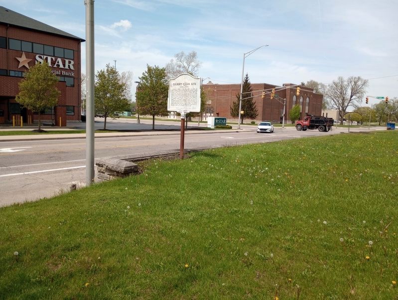
Goldsmith C. Gilbert, New York trader and miller who came to Delaware County in the early 1820s and operated a trading post on the Mississinewa River, acquired the Hackley Reserve and erected a cabin on this square in which his daughter, Mary Jane, . . . — — Map (db m222292) HM
This century old doorstep marks the nearby birthplace of Mary Jane Gilbert daughter of Goldsmith C. Gilbert and Mary Bishop Gilbert she was the first female white child born in Hackley Reserves now Muncie Indiana. Born Sept. 18th, 1825 - Died June . . . — — Map (db m222296) HM
1986 Althea Stoeckel Award
presented to:
Muncie Public Library
Main Branch
Listed on the National Register
of Historic Places
June 17, 1976
for the
interior renovation of the main library
301 E. Jackson Street
presented by . . . — — Map (db m222324) HM
Presented to the Muncie Urban Design Studio In recognition of its dedication to public education and citizen participation in historic preservation activities as a vital component of Muncie's central city revitalization efforts. MUDS operated . . . — — Map (db m222312) HM
This statue "The Passing of The Buffalo" was created by Cyrus E. Dallin in 1929. It portrays a Native American Chief in full Regalia with a bow in his hand - his foot resting on the skull of a buffalo contemplating not only the last of the . . . — — Map (db m222322) HM
built 1927
Listed on the
National Register of
Historic Places by the
United States Department
of the Interior,
February 17, 1989 — — Map (db m231343) HM
One of the oldest organized settlements in Delaware County, Smithfield was platted by David Stout and
William Duncan March 12, 1830. Its position on White River was considered advantageous as a trading point, and it thrived as such until the first . . . — — Map (db m141162) HM
Interpretive Birding Trail
Located in the watershed of the Whitewater River, Mary Gray Bird Sanctuary protects critical habitat, resources, and water quality for migrating and nesting birds.
Explore the Interpretive Birding Trail
• . . . — — Map (db m288659) HM
While attempting to improve their water wheel power efficiency in 1854 Philander H. and Francis M. Roots invented the Roots Rotary Positive Blower Principle, now known throughout the world and still manufactured in Connersville. — — Map (db m152034) HM
Erected 1831 by Oliver H. Smith. Later home of Caleb B. Smith, Secretary of Interior under Lincoln and Grand Master of Indiana Masons. Restored 1941 as home for local Masonic bodies. — — Map (db m44768) HM
1841 Built as Headquarters of
the Whitewater Valley Canal Co.
1854 Savings Bank of Indiana
Home of:
Dr. S. W. Vance 1857-1936
Congressman and Mrs. Finly H. Gray 1936-1947
1947 - 1971 V. F. W. Post 571
1971 - . . . — — Map (db m44760) HM
In 1916 during the Indiana Centennial Week, the Clio Club, a women’s organization, presented to the city of Connersville a fountain.
The fountain was designed by Lorado Taft of Ohio at the cost of $1,200.00. The Clio Club labored faithfully . . . — — Map (db m152024) HM
Heineman Corner, Site of John Conner's 1820 Trading Post
Canal House - Built 1842
Alligator Drugs - 613 Central
Farmers & Merchants - 416 Central — — Map (db m222139) HM
1669 ~ Early "Indian Trail" Connecting Cincinnati to Northern Trading Posts
1812 ~ First Blockhouse
1813 ~ First Public Square
1828 ~ Parker, then Fayette County Seminary
1858 ~ First Public School
1874 ~ First High School Added
1904 ~ . . . — — Map (db m152029) HM
(( Center Panel ))
Honoring
all who served
in the United States
Armed Forces
Defending
Liberty and Justice
in All the World
Presented by
Veterans and Citizens
of Fayette County
1986 . . . — — Map (db m44876) WM
This marker depicts the Fayette County Courthouse as it appeared when built in 1849. Subsequent renovations resulted in its present appearance.
The Courthouse was listed in the National Register of Historic Places in 2006.
Connersville's . . . — — Map (db m152030) HM
The grinding wheels around Kiddie Land Playground in Roberts Park were originally part of the manufacturing equipment in the Ansted Spring and Axle Company, located on the east side of Columbia Avenue just north of Mount Street. The Ansted . . . — — Map (db m152023) HM
Col. James E. Roberts was an industrial leader and prominent citizen of Fayette County. He moved to Connersville during the Civil War era and entered the retail hardware business. In 1874 he purchased interest in a local furniture factory and for . . . — — Map (db m152022) HM
1801 Licensed to trade with the Indians in pelts.
1808 Established here a fur trading post.
1812 Interpreter and guide for Gen. William Henry Harrison prior to and during The War of 1812.
1813 Founded . . . — — Map (db m152032) HM
John Conner laid out the town of Connersville on the north side of the west fork of the Whitewater River in March 1813 adjacent to his fur trading post. The original plat was for 62 lots bounded by what are today Central Ave to the west and Water . . . — — Map (db m152033) HM
Built by John Conner in 1815
1815
Conner's Store & Trading Post
1820
Sample's Inn & Post Office
1854
Heineman's Grocery
1954
Heineman's Glass House
2002
Lemen's Glass House Antiques — — Map (db m268401) HM
John Conner (1775~1826) FOUNDER OF CONNERSVILLE, March 4, 1813; Scout and Indian Interpreter for General William Henry Harrison; Treaty maker for the 12 Mile Purchase 1809; Indiana State Senator 1815 - 1822; First Sheriff of Fayette County 1819; . . . — — Map (db m225342) HM
The Kennedy Family
Emmett Loren Kennedy was born July 5, 1848. I 1870, he worked for his father, Archibald M. Kennedy, on the first bridge built by the Kennedy family. Upon completion of this bridge at Dunlapsville, in Union County, Indiana, . . . — — Map (db m152015) HM
The Great Depression
Money was scarce during the depression and everyone looked for ways to stretch their dollars. Roberts Park is an excellent example of how resourceful communities were in that day. The Administration Building, for example, . . . — — Map (db m152019) HM
In 1836 construction began on this fifty-six lock, one hundred one mile canal. Opened from Lawrenceburg to Brookville (1839), it was extended to Laurel and Cincinnati (1843), Connersville (1845), Cambridge City (1846), and Hagerstown (1847). — — Map (db m44741) HM
This plaque marks the western border of the twelve mile cession negotiated by Governor William Henry Harrison with the Miami, Potawatomi, and Delawares, Treaty of Fort Wayne, September 30, 1809. — — Map (db m44770) HM
Boulder erected by the community of Everion, Ind. June 18, 1935 to commemorate the birth of the worlds first county free fair held in Roberts Park Connersville, Fayette Co., Ind., Sept. 9, 1903. — — Map (db m152021) HM
Lexington Automobiles were produced in Connersville from 1910 to 1926. The Lexington Automobile Company was founded in Lexington, Kentucky, in 1908, but Connersville businessmen enticed the company to move here to replace Connersville's dying . . . — — Map (db m281494) HM
Indiana Association of United Ways was the proud sponsor of the statewide Bison-tennial Public Art Project. This legacy project helped celebrate Indiana's 200th birthday by decorating and displaying 5 foot tall fiberglass bison with an end goal . . . — — Map (db m222135) HM
Construction began on the Wabash and Erie Canal in 1832 to connect Lake Erie to the Ohio River, making travel and trade easier and cheaper. Towns along the route prospered as increased commerce fostered urban and agricultural growth. By 1846, the . . . — — Map (db m305786) HM
In fall 1846, residents of Covington and Attica skirmished at Lock 35 over lack of water to Covington. Heavy rains eventually resolved the problem. Competition among canal towns over water control was often intense. First boat reached Attica 1846 . . . — — Map (db m305785) HM
Ladies Library Association of Attica, created 1885, deeded its library building to city; city library opened 1902 with a collection of 1,500 books. Funds from Andrew Carnegie made it possible to build a new library here on land originally owned . . . — — Map (db m3317) HM
Platted 1832
Addition 1836
Population in 1840 - - 800
First polling place in Davis Township.
Many years Largest Town South of Chicago. — — Map (db m9874) HM
Doctor – Educator – Builder – Financier.
Attica, Indiana Doctor, 1839–1845
Founder: Indiana Hospital for Insane.
Chicago Mercy Hospital: City of Evanston, Ill.
Northwestern University - U. of Denver.
Rush . . . — — Map (db m9947) HM
Historic Landmarks of Fountain County
Award presented to
Dr. Peter and Ann Petrich
for the Restoration and Preservation of This
Italianate Style House built c. 1850 — — Map (db m7969) HM
Milford Home
has been placed on the
National Register
of Historic Places
by the United States
Department of the Interior
Built 1845 — — Map (db m9310) HM
American Indians frequented this area, rich in natural resources. The ravine provided water from natural springs, marl for lime, and clay for bricks for nineteenth-century residents of Attica, platted 1825. City became owner of ravine 1906 when . . . — — Map (db m3311) HM
John Feuristien - Co. D - 113 Eng.
Robert L. Goans - Battery C - 150 F.A.
Edward Harty - 306 U.S. Inf.
Arch Hope
Earle Ireland - 131 U.S. Inf.
Lloyd Ireland - Battery B - 70 F.A.
Frank J. Kight - Battery C - 6 F. A.
Chas. W. . . . — — Map (db m22801) HM
Historic Landmarks of Fountain County
award Presented to Craig and Dawn Dixon for Restoration and Preservation of 413 Washington Street Covington, In. Built 1903 — — Map (db m7906) HM
The 1st wife of Governor David Wallace and Mother of General Lew Wallace, soldier, author of Ben Hur, statesman & diplomat, is here buried. She influenced the lives of two important Hoosiers. — — Map (db m3382) HM
Fountain County Court House
1937
has been placed on the
National Register of Historic Places
by the United States Department
of the Interior — — Map (db m37241) HM
1826 - - 1926
Fountain County Centennial Memorial
Erected by The Richard Henry Lee Chapter Daughters of the American Revolution in Memory of The Pioneers and Illustrious Dead of Fountain County and In Honor of our Heroes Who Have Defended us in . . . — — Map (db m7907) WM
Historic Landmarks of Fountain County
Award Presented to Fountain County Art Council
for Restoration and Preservation of
Fountain County Clerk's Building Built 1842. — — Map (db m21155) HM
has been designated a
National Natural Landmark
This site possesses exceptional value as an illustration of the nation's natural heritage and contributes to a better understanding of the environment — — Map (db m10093) HM
Shawnee Township
Wabash - Erie Canal
1846 - 1875
The Canal extended from Toledo, Ohio to Evansville, Indiana. Construction on the 376 mile section in Indiana began in 1832 and completed through Fountain County in 1846.
One to six horses in . . . — — Map (db m20364) HM
World War - I
Orel A. Smith, Born 1898, 32nd Co. 6th Marine Vol., Killed In Action, Nov. 2, 1918 • Lieut. W. E. G. Cooper, Born March 29, 1888, Killed In Action at Chateau Thierry, July 20, 1918 • Claude L. Wilkinson, Born June 9, 1893, Killed . . . — — Map (db m7884) WM
David J. Ratliff platted his farm land just North of State Street through which the new Chicago, Attica, & Southern railway passed. The town was named after the foreman of the construction crew. The town South of State Street was Fountainville until . . . — — Map (db m36101) HM
Silver Island Cemetery
Established 1832
A Historic Cemetery Listed in
Indiana’s Cemetery and Burial Grounds
Registry of the Indiana Department of
Natural Resources
Installed 2013 Indiana Historical Bureau . . . — — Map (db m77555) HM
Richland Township
Site of National Corn Husking Contest in 1935.
4 Blocks West - - -
Cobb Farms and L.K. Mitchell and Family Hosts.
Lawrence Pitzer of Fountain County Represented Indiana and later became National Champion in 1939. . . . — — Map (db m3405) HM
Salt discovered by Norbourn Thomas in 1829.
Capacity: 200 bushel of salt every 24 hours.
Depth 1,135 feet - Deepest in the United States at that time.
Artesian water of Medicinal value was discovered.
Became a Health Spa in 1921.
Water . . . — — Map (db m20482) HM
Birch - Colvert Cemetery
Also Known As
Stone Bluff Cemetery
Beneath this hallowed ground rests the souls of many long-forgotten loved ones. Their gravestones destroyed by the hand of man: and the physical boundaries of . . . — — Map (db m77583) HM
This original stone and bell donated to the Tangier community by the family of Paul E. Patton who graduated with the class of 1950 — — Map (db m163064) HM
HISTORIC LANDMARKS
OF FOUNTAIN COUNTY, INC.
Award
Presented to
BOOE - INLOW - D'ARLIER
CHARITABLE FOUNDATION
for the restoration
and preservation of the
Prairie / Craftman House
D'Arlier Cultural Center
Built in . . . — — Map (db m19174) HM
Famous orator - Representative in Congress, 1861-66, 1869-73; U.S. Senator, 1877–1897; chief promoter of the building of the Library of Congress. — — Map (db m3232) HM
Erected by the town of Veedersburg in memory of Cal Scherer who used old Curfew Bell over 30 years.
—Board of Trustees: Leon L. Ewbank, L. R. Owens M.D., Leon Wiggins. — — Map (db m34092) HM
Historic Landmarks of Fountain County
Award presented to
Lee and Mike Ramsey
for restoration and preservation of
115 North Main Veedersburg, IN
Built 1886 — — Map (db m9010) HM
John Gilmore entered first land in Township — 1826.
Alanson Savage built steam saw mill produced timbers for “Plank Road” — 1840.
Rev. Jones organized Methodist Church — 1852.
Early Families: Furrs, Booes, . . . — — Map (db m3805) HM
Peter and James Layton, half brothers, came from New York, 1853. Here was the train stop for the residents of the area of the Plank Road ½ mile south. There a blacksmith shop, grocery, the stage stop, “Halfway House” were located. — — Map (db m3466) HM
Church: Established by United Brothers in 1828.
Building erected 1847 - Used until 1900.
Cemetery 1837 to present time.
The last resting place of pioneers and soldiers who served our country in seven wars. — — Map (db m3403) HM
1919 - 1991
American Legion
Veedersburg Post 288
In Memory of those from
Veedersburg & Vanburen Twp.
who served, and those who
gave their lives in the
service of their Country.
(Left Side):
World War . . . — — Map (db m7779) WM
Built 1934 for "Boy Scouts" by W.P.A. - Local Workers Guy Smith - Project Mgr., Logs - Walter Marshall Farm, Bricks - Veedersbrg Paving. — — Map (db m34089) HM
(Engraved near the top are the Seals of the United States Army, United States Navy, United States Army Air Corps, United States Marine Corps, and United States Coast Guard) — — Map (db m7804) WM
One of the most iconic brand names in the world of sports has its origins here in the town of Veedersburg. The famed Indianapolis Motor Speedway is known the world over as “The Brickyard”, because the track surface was once composed entirely of . . . — — Map (db m175835) HM
Scott, Hultz, and Sigler commissioners appointed by State Legislature to form the newly formed Fountain County Seat of Justice, met here at William B. White Home.
He erected the County's first mill here near the covered bridge, the County's . . . — — Map (db m20411) HM
Organized in 1832 by German speaking families of the Evangelical Lutheran Church of Rowen County, North Carolina. Migrating to Indiana in 1828. August 7, 1836 Jacob and Elizabeth Linebaugh Bowman deeded land for the First Church and Cemetery. — — Map (db m10027) HM
Korea * U.S. Armed Forces * Viet Nam
Dedicated to those who gave their lives from Fairmont and Liberty Townships
Charles Edwin King · Marvin Edward Glassburn · Robert Eli Titus · Keith Alan Locher · Roy Leon Whitenack · Richard W. Wood . . . — — Map (db m168992) WM
In honor of those who gave their lives
21 names not transcribed
Donated by: the Town of Fairmont
Sponsored by the Fairmont Chapter
American War Mother
September 26, 1982
Fairmont & Liberty Township Honor Roll
World War II . . . — — Map (db m168993) WM
Dedicated to those who
served from Fairmont and Liberty Twp. Those who made the supreme sacrifice
Edward L. Addison ·
Rex E. Dickey ·
Charles H. Ford ·
Wesley Grahl ·
William Jessup ·
Earl E. Kepler ·
Charles Kimbrough ·
Millard . . . — — Map (db m168991) WM
James Dean is standing next to long-time friend, Bill Beck, twelve-year old cousin Marcus Winslow, Jr., and Everett Hiatt in front of Corn Auctioneers (now Fairmount Helping Hands) at 119 N. Main Street, as Bill's wife, Roma walks along Main Street . . . — — Map (db m182717) HM
Garfield is dressed in honor of his fellow
Fairmount native, 1950's film star,
James Dean
To hear more about this Garfield and others on the trail call 765-997-7034 and follow the prompts
Garfield @Paws, Inc. all rights . . . — — Map (db m182733) HM
The Eternal Flame of Peace is a tribute to all veterans.
I pledge allegiance to the Flag of the United States of America and to the Republic for which it stands, One Nation under God, indivisible, with Liberty and Justice for all. — — Map (db m182704) WM
Carol & Edward Trice donated in November 2018, this building to the Fairmount Masonic Lodge #635 F & AM and is so named Clarence R. Maynard Fellowship Hall. — — Map (db m182731) HM
Built circa 1888. Occupied by civic leaders (Nixon Winslow, Levi Scott, and Joseph Patterson) who made significant contributions to Fairmount's economic, educational, and cultural development. Patterson was community's medical doctor, 1889-1913. . . . — — Map (db m63799) HM
This is not a monument to a rebel, those were only roles he played James Dean was an American original who on a basis of high school honors and in a period of five years time rose to the very pinnacle of the theatrical profession and through the . . . — — Map (db m182711) HM
1649 entries matched your criteria. Entries 101 through 200 are listed above. ⊲ Previous 100 — Next 100 ⊳