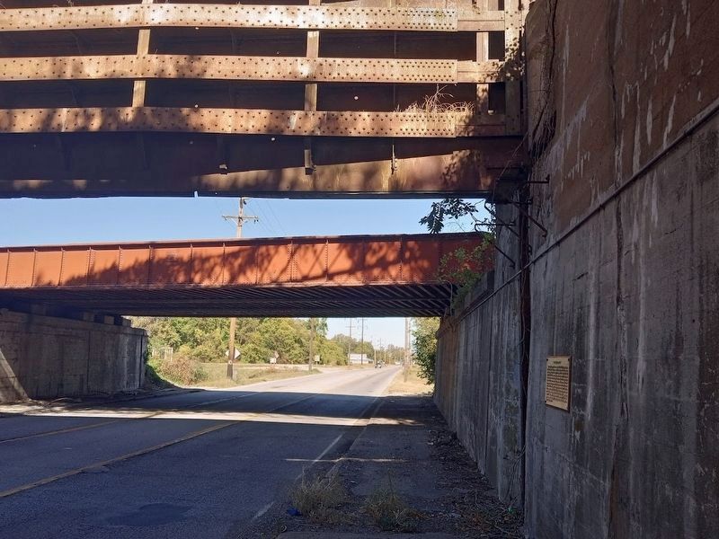
On Sycamore Street (U.S. 51) 0.2 miles north of Union Street, on the right when traveling north.
The "Big Subway Gate" was constructed in 1914 by Stupp Brothers of St. Louis, MO. The gate was built on the plan of the Gatum Dam at the Panama Canal and weighs 80 tons, is 60 ft. wide, 24 ft. high and 5 ft. thick. The counter weights used to raise . . . — — Map (db m195776) HM
On Washington Avenue (U.S. 60/62), on the right when traveling south.
The beginning of the Third Principal Meridian is located in the Ohio River 1,810 feet directly north of this point. In November, 1803, this was the mouth of the Ohio River. At this location, the Lewis & Clark Corps of Discovery encamped for six . . . — — Map (db m19420) HM
On Washington Avenue (U.S. 51) at 15th Street, on the right when traveling north on Washington Avenue.
This building (built 1869-1872), listed in the National Register of Historic Places, served as a customs house, post office, and courthouse. In 1873, Cairo's John Bird became the first elected African American judge in Illinois, and later worked . . . — — Map (db m307522) HM
On Fort Defiance Road, on the right when traveling south.
Long known to the Indian who used the two great rivers as his highways for trade and war, this junction of the Ohio and the Mississippi was first sighted by Europeans when Marquette and Joliet glided past in 1673. Ten years later La Salle explored . . . — — Map (db m19390) HM
On Ohio River Scenic Byway (U.S. 62) 0.1 miles south of Fort Defiance Road, on the right when traveling west.
Purchased in the public interest March 24, 1942 by the Cairo Bridge Commission
The bridge was operated and maintained by the commission until May 22, 1954 when, as a result of the untiring efforts of many public spirited citizens, the . . . — — Map (db m174560) HM
On Washington Avenue (U.S. 60/62) at U.S. 51, on the right when traveling north on Washington Avenue.
Completed November 11, 1933 Freed of Tolls November 11, 1948 by The Cairo Bridge Commission The Ohio River Bridge was conceived and built in the public interest by the Cairo Bridge Commission with the cooperation of the Federal Emergency . . . — — Map (db m19421) HM
On 17th Street south of Washington Avenue (U.S. 51), on the left when traveling east.
Dedicated to the founders and the congregation of Ward Chapel African Methodist Episcopal Church. Founded in 1863 in Cairo at the home of Maria Renfro who resided at 16th and Poplar Streets. Ward Chapel throughout the years has served as a . . . — — Map (db m307525) HM
On 17th Street south of Washington Avenue (U.S. 51).
Founded in 1863, the AME Church in Cairo served the physical and spiritual needs of freedman and provided a center for activism. The church aided enslaved people seeking freedom and later supported the Civil Rights Movement, hosting important . . . — — Map (db m307523) HM
On Washington Avenue (U.S. 51) at 15th Street, on the right when traveling north on Washington Avenue.
York was the first known African American to cross the American continent. In the company of the Lewis and Clark Corps of Discovery, from 1803-1806, he shared equally with them the rigors of the journey, but when the corps was honored, he . . . — — Map (db m41063) HM
On Bunch Road west of Illinois Route 3, on the right when traveling south.
In 1673 Louis Jolliet and Father Jacques Marquette explored the Illinois country for France. By the 1763 Treaty ending the French and Indian War, this area passed to England. During the American Revolution, George Rogers Clark's men captured it for . . . — — Map (db m161171) HM
On East Side Drive at Promised Land Road, on the right when traveling south on East Side Drive.
On November 21, 1803, Meriwether Lewis, William Clark and their party camped on an island near this place. In his instructions to Lewis, President Jefferson directed him to describe the plants and animals he saw on the journey. As they moved slowly . . . — — Map (db m265687) HM
On Miller City Road just south of Island Road, on the left when traveling south.
This memorial recognizes the 109 year legacy of Rev. Nathan London, born a slave in 1830. Known then as "Nate Lundy", he distinguished himself, attaining the rank of sergeant and assistant paymaster in the Union army during the Civil War. His . . . — — Map (db m40405) HM
On Miller City Road 2 miles south of Illinois Route 3, on the right when traveling north.
The church, founded by Rev. Nathan London in 1882, was located near this section of road. The cornerstone, unearthed a few yards west, was donated by his family to the Cairo custom house. — — Map (db m40409) HM
On Miller City Road, on the right when traveling south.
In 1879, Nathan London, of St. Louis, bought this 20 acre land tract. His son, Filmore, was deeded the land. Now the Jos. Blakemore family owns it. Ruth B. Chambers, only living grandchild, was honored here, Labor Day, 1999. — — Map (db m40411) HM
On Pecan Street south of Illinois Route 3, on the right when traveling south.
In November of 1803, Meriwether Lewis, William Clark and their party camped on the slate rock bank of the Mississippi River near here. They found moving the boats up river very difficult and traveled only about one mile per hour against the strong . . . — — Map (db m161185) HM
On Oak Street west of 5th Street, on the right when traveling west.
"Original handhewn pier block from the Mississippi River Bridge at Thebes built in 1905. Recovered from the river in 1990. Block weight 6000 lbs." — — Map (db m265685) HM
In 1817 the Zebulon M. Pike reached St. Louis, the northern-most steamboat port on the Mississippi River. The western steamboat of later years was a credit to the frontier American mechanic who drew upon experience to build a large craft (eventually . . . — — Map (db m161177) HM
On Oak Street west of 5th Street, on the left when traveling west.
The courthouse, completed in 1848, was the county seat of Alexander County until 1864 when the county seat was moved to Cairo.
The building was constructed with local sandstone, hewn timbers, hand sawed boards, plaster, and with a split . . . — — Map (db m303525) HM
On Old U.S. 51 (Illinois Route 37) 1.1 miles south of Redman Road.
Pierre Francois Xavier de Charlevoix, a French Jesuit, reported as early as 1721 that the land at the confluence of the Mississippi and Ohio Rivers would be a strategic location for settlement and fortification. Nearly a century later, in 1818, . . . — — Map (db m161727) HM
On Main Street near 2nd Street, on the right when traveling west.
[East Face]
In Memory of All
Who Followed the Flag From
1861 to 1865
Living and Dead.
Erected 1903
SHILOH
[South Face]
This monument is erected
by the Grand Army of the Republic
Women's Relief Corps, Sons of . . . — — Map (db m34161) HM
On 3rd Street (Illinois Route 127), on the right when traveling north.
Lest We Forget
This memorial is dedicated
to the men and women of
Bond County who served in
the Armed Forces of the
United States of America
Dedicated Nov. 11, 1997
In memory of those from
Bond County who gave their lives . . . — — Map (db m34189) WM
On 2nd Street at College Avenue, on the left when traveling south on 2nd Street.
S.B. Bulkley's first business here was in a frame business house in 1833. In 1840, he tore it down and rebuilt in brick. His clerk, Alexander Buie, later became his partner and the store was enlarged. Buie also sold Bibles in his store. When Daniel . . . — — Map (db m34148) HM
On Museum Avenue 0.9 miles east of Route 127, on the right when traveling east.
This Steam Engine was installed at the National Stockyards in the Armour Meatpacking Plant in 1908 by the De La Vergne Refrigeration Company. The engine is a Horizontal Corliss Steam that is powering a 250 ton double acting compressor that was . . . — — Map (db m291312) HM
On 2nd Street at College Avenue, on the right when traveling north on 2nd Street.
In 1870, W. S. Dann opened a small one room store at this location. Additions were built in 1880 and 1886. Mr. Dann was one of those most interested in the founding of Greenville College. F. P. Joy joined Dann within a few months of the store's . . . — — Map (db m34147) HM
The building cost $15,000 and took 5 months to complete. "For the first time in Greenville's 119 years of history in which great progress was made in every other direction, the city really had its own building in which to conduct its business. In . . . — — Map (db m34183) HM
On North 4th Street at West Main Street, on the right when traveling south on North 4th Street.
Imagine a world without books--a frontier where print is a luxury, often out of reach. It's the world you would have known in 1815, when George Davidson settled the bluff overlooking Little Shoal Creek, just a short walk from where you stand. . . . — — Map (db m144131) HM
Hill's Fort, a War of 1812-era fort that stood on the western perimeter of the Territory of Illinois, was located six miles southwest of this spot. A reconstruction of the original fort is located here at the Farm Heritage Museum. On September 9, . . . — — Map (db m232486) HM
On 3rd Street (Illinois Route 127) at Main Street, on the right when traveling north on 3rd Street.
Illinois Confederacy Indians roamed this prairie land, rich in game, which became Illinois County of Virginia. Ceded in 1784 to the United States it was successively included in the Northwest, Indiana; and in 1809, Illinois Territory. Formed in . . . — — Map (db m34169) HM
On 3rd Street (Illinois Route 127) at College Avenue ( Route 127), on the left when traveling north on 3rd Street.
The earliest records show Samuel Colcord's Sorghum Mill once stood here. In 1870 Charles R. Bennett opened his new drugstore. Four drugstores were operating on the square during this time. It was Kate Benneett, Charles' wife, who prevailed on her . . . — — Map (db m34176) HM
On College Avenue, on the right when traveling west. Reported missing.
In 1912, at age 24, John Posch came to the United States with a dime in his pocket and a bag of tools. In Austria, he had apprenticed for four years as a shoemaker and passed his test to work the trade. In Greenville, he started up his business in a . . . — — Map (db m144104) HM
On West Main Street just west of North 3rd Street ( Route 127), on the right when traveling west. Reported missing.
Constructed as a two story house, this is thought to be the oldest building still standing in Greenville. It as built by Kendall Morse, younger brother of Stephen Morse, who co-founded Almira College. The brothers were some of the most prosperous . . . — — Map (db m144598) HM
On West Main Street at 2nd Street, on the right when traveling west on West Main Street.
Dedicated to the memory of Ronald Reagan, who spoke at this intersection on October 18, 1980, while campaigning for the United States Presidency. — — Map (db m34158) HM
On Main Street at 2nd Street, on the left when traveling west on Main Street.
This bank was established in August, 1869, by Charles Hoiles and Charles D. Hoiles. In December of 1895 the bank was incorporated as the State Bank of Hoiles & Sons with a capital of $25,000. In September, 1903, the capital stock was increased to . . . — — Map (db m34155) HM
In honor of those brave pioneers who sought refuge & fought valiantly against the attacking Native Americans near Hill's Fort on the foggy morning of September 9, 1814. After being alerted to the hostile presence, 13 men left the fort to scout. They . . . — — Map (db m232492) HM
On South 3rd Street (Illinois Route 127) south of W S Avenue, on the right when traveling south.
Greenville's third jail, built at a cost of $5,000, now houses an antique shop. The only recorded hanging in Bond County took place behind this building. Changes to the front of the building were made by John Pepin and his sons to convert it into . . . — — Map (db m169986) HM
On Main Street at 3rd Street ( Route 127), on the right when traveling west on Main Street. Reported missing.
This building used to be balanced by another more ornate one at the northern most part of the block. The old Post Office and the Cyclone Hose Company, Greenville's first Fire Station, were located in what was known as the Demoulin block before the . . . — — Map (db m34174) HM
On Franklin Street at South 2nd Street, on the right when traveling north on Franklin Street.
In December of 1868, the rails were laid to the Greenville Depot. One of the first locomotives on the Vandalia Line was named "Greenville". The original depot was improved, enlarged and destroyed by fire about 1910. The present structure was . . . — — Map (db m224459) HM
Near College Avenue at 3rd Street ( Route 127), on the left when traveling west.
In memory of the
who are buried in
Bond County
Amos Balch • Ansel Birge
Welshier Buchanan • William Burgess
Allen Comer • John Etzler
Daniel Ferguson • John Floyd
Boling Grigg • Bonham Harlan
T. S. Hubbard • Joseph Hunter . . . — — Map (db m34127) HM
On 3rd Street at College Avenue, on the right when traveling north on 3rd Street.
On this northwest corner of the square, the former Hotel Eureka (better known as the Franklin House) once stood. It served as the old stage coach house and was "the best house in town, two stories high, with a double porch on the front, and withal . . . — — Map (db m34185) HM
On North 2nd Street just south of West Oak Street, on the right when traveling south.
Built in 1918, this site was headquarters for Wells Judd Tire Sales, a Goodyear Tire Dealer for over 50 years. Managed by Earl Wildermann, it served the local tire and battery trade, as well as customers traveling on the National Trail. Restored in . . . — — Map (db m144108) HM
On West Main Street (Illinois Route 140) just east of North Maple Street ( Route 140), on the right when traveling east.
In the 1820s, not far from where you stand, passengers could board a stagecoach traveling west to Alton, Ill., or east to the Illinois Capitol at Vandalia.
According to local lore, if passengers at the town tavern were waiting for a coach, the . . . — — Map (db m144132) HM
On Maple Street at Banks Lane, on the right when traveling north on Maple Street.
In honor and remembrance of the heroes and victims in the fight against terrorism and to celebrate the enduring sprit of all Americans. — — Map (db m265870) WM
On Jefferson Street at Shoal Creek Avenue, on the right when traveling west on Jefferson Street.
United Mine Workers of America (UMWA) president and Congress of Industrial Organization (CIO) founder John L. Lewis (1880-1969) came to Panama, Illinois, from Iowa with his family in 1908 to work in the mines; within one year he was president to . . . — — Map (db m186233) HM
On West Cemetery Road east of Calvin Avenue, on the right when traveling east.
(front:)
"The public does not understand, and I think never will. That almost spiritual fealty that exists between men who go down into the dangers of the mine and work together. That fealty of understanding and brotherhood that exists . . . — — Map (db m186238) HM
On State Street at Park Street, on the right when traveling east on State Street.
The village square may be quiet today, but from the mid-1800s through the early 1900s, the ring of hammers bending iron and shaping steel echoed down these streets.
Northwest of where you stand, blacksmiths shaped horseshoes, linked chains, . . . — — Map (db m144110) HM
On 2nd Street west of Washington Street, on the left when traveling west.
Where the Illinois Central Railroad saw land it didn't need, Henry Hedrick Smith saw opportunity.
In the mid 1800s, Smith, an ambitious outspoken entrepreneur, bought 800 acres of Bond County prairie from Illinois Central. When the St. Louis, . . . — — Map (db m169984) HM
On East Taylor Street (County Road 18) at South Main Street, on the left when traveling east on East Taylor Street.
This building was donated to the Village of Sorento December 10, 1995 by Kessinger Post 713 of the American Legion in honor of all veterans past and present who passed through these doors — — Map (db m226482) WM
On South State Street at East Locust Street, on the right when traveling north on South State Street.
This ladle was used to pour molten iron into molds, creating cast iron products in Belvidere's National Sewing Machine Company foundry. From the early 1900s, this particular ladle was used to make parts for cast iron toys, washing machines, sewing . . . — — Map (db m199796) HM
On North Main Street at East Menomonie Street, on the right when traveling south on North Main Street.
Born in South Carolina
Admitted to the bar - 1837
Came to Belivdere - 1845
Member of the Constitutional Convention - 1847
State House of Representatives - 1859 to 1861 & 1867
Civil War service - 1861 to 1865
Brigadier General of . . . — — Map (db m199840) HM
On Webster Street north of East Harrison Street, on the right when traveling north.
Thomas Hart born in 1757 in Farmington, Connecticut to John Hart and Hildah Gould, enlisted in the Connecticut Troops the first time, May 1, 1775, serving 8 months in Captain Sedgwick's Company. His second service was for three months in . . . — — Map (db m199799) WM
On Northwest Cross Street at West Lincoln Street, on the left when traveling north on Northwest Cross Street.
Near this spot, then known as Curry's Grove, on October 19, 1858, Abraham Lincoln delivered an address in his campaign for the United States Senate. His words were little noted nor long remembered, but of such things too is history made. — — Map (db m149876) HM
On Highway 24 (U.S. 24) west of County Road 1250 E (County Route 1250), on the left when traveling west.
In 1824 Cornelius Vandeventer a native of Ohio, became the first permanent settler in this area. Additional pioneers came over the next few years from Kentucky, Tennessee, Virginia, and North Carolina. In 1829 Alexander Curry purchased a claim on . . . — — Map (db m149875) HM
On Main Street (State Highway 89), on the right when traveling south.
Just north of town are remnants of the Cherry Coal Mine, where 259 miners lost their lives in one of the worst mine disasters in United States history.
The St. Paul Coal Company began mining coal at Cherry in 1905 and by 1909 was mining . . . — — Map (db m308284) HM
On North Main Street (Illinois Route 89) 0.1 miles south of Plank Road (County Highway 13).
Honor Roll
World War I
P. Francisco • J. Bobbio
World War II
J. Soldati • A. Shima • B. Manahan • W. Waite
World War One & World War Two
Ampusaitus J. • Bobbio M. • Branstatter J. • Burlech F. • Burnes J. • Calzia G. • Ciocketti J. • . . . — — Map (db m310291) WM
On East Maple Avenue (County Road 2125 N) west of North 2nd Street, on the right when traveling west.
The First State Bank of Manlius was organized March 21, 1902, by
Max P. Seibel with an initial capital of $25,000. It officially opened
June 14, 1902. Its original location was on the west side of Main
Street in Manlius, IL. The first officers . . . — — Map (db m253261) HM
On East Maple Avenue (County Road 2125 N) west of North 2nd Street, on the right when traveling west.
The Manlius Historical Society was incorporated on October 31,
2001 with the purpose of purchasing the old First State Bank
building, preserving its unique style of architecture and reopening
it as a museum.
Original 2001 Officers:
Dee . . . — — Map (db m253274) HM
On North Main Street (Illinois Route 26) north of Elm Place (U.S. 34), on the right when traveling north.
1005 N. Main St., c. 1885, originally a Meat Market.
This building has been placed on the National Register of Historic Places
Princeton North Main Street Historic District — — Map (db m253181) HM
On East Peru Street (U.S. 6) at 8th Street, on the left when traveling east on East Peru Street.
1849 land grant by Chauncey Colton - Three directors elected - School constructed 1850 - First session 1850 - Walls 12" thick - cedar shingles heated by pot bellied stove - outside dimensions 22'x 26 - Moved 12 miles from John Nelson farm to its . . . — — Map (db m253092) HM
On South Main Street (U.S. 34) south of West Marion Street, on the right when traveling south.
Originally a Grocery Store
This building has been placed on the National Register of Historic Places
Princeton South Main Street Historic District — — Map (db m253177) HM
On South Main Street west of Park Avenue, on the right when traveling north.
52nd Illinois Infantry
Colonel Edwin A Bowen
Co B
Captains
David D Bailey • DeWitt C Smith
1st Lieut Charles H Fish
1st Lieut Moses Canon
2nd Lieut George W Graves
2nd Lieut Chas D Tewksbury
Sergeants . . . — — Map (db m311346) WM
On South Main Street (U.S. 34) south of Lovejoy Way, on the left when traveling south.
originally a Furniture Store
This building has been placed on the National Register of Historic Places
Princeton South Main Street Historic District — — Map (db m253179) HM
On South Main Street south of Lovejoy Way, on the left when traveling south.
Originally a Dry Good Store
This building has been placed on the National Register of Historic Places
Princeton South Main Street Historic District — — Map (db m253156) HM
On North Main Street (U.S. 34) south of West Marquette Street, on the right when traveling south.
Originally
a Gentleman's
Clothing Store
This building has been placed on the
National Register of Historic Places
Princeton North Main Street Historic District — — Map (db m253137) HM
On North Main Street (U.S. 34) north of East LaSalle Street, on the right when traveling north.
Originally
a 5 & 10 Cent Store
This building has been placed on the
National Register of Historic Places
Princeton North Main Street Historic District — — Map (db m253134) HM
On N Main Street at W Marquette Street on N Main Street.
Originally a dry good store
This building has been placed on the National Register of Historic Places
Princeton North Main Street Historic District — — Map (db m253107) HM
On County Road 1950E 0.2 miles south of County Road 1900N, on the right when traveling north.
In memory of Enos and Elizabeth Mercer Matson
who came here in 1836
Peter and Jane Dawson Matson
who came here in 1845
these two brothers and their families
came from St. Clairsville, Belmont County, Ohio — — Map (db m195957) HM
On South Main Street (U.S. 34) at East Mechanic Street, on the right when traveling north on South Main Street.
In 2005 the Flags of Freedom were raised on Interstate 80, Exit 56 to honor our veterans, past, present and future. These flags symbolize the brave men and women who now serve and have served this great nation. These magnificent flags which are 30 . . . — — Map (db m253139) HM
On South Main Street at Park Avenue, on the right when traveling north on South Main Street.
In 2005 the Flags of Freedom were raised on Interstate 80, Exit 56 to honor our veterans, past, present and future. These flags symbolize the brave men and women who now serve and have served this great nation. These magnificent flags which are 30 . . . — — Map (db m253182) HM
On South Wyanet Walnut Road (County Road 8) 0.3 miles south of County Road 1900, on the right when traveling north.
First permanent white settlers in Bureau Co located here May 5, 1828. Col Zachary Taylor later Pres of U.S. and Jefferson Davis lodged here enroute to Galena on Peoria Galena State Road at beginning of Black Hawk War. Site of Ft Thomas. Also . . . — — Map (db m257428) HM
On County Road 1950 East 0.5 miles north of North Main Street ( Route 26), on the right when traveling north.
Conserving Both Nature and Culture
Throughout the Illinois River valley, human
history is entwined with a beautiful and abundant
landscape. In Bureau County, we're committed
to conserving our cultural and natural treasures.
One . . . — — Map (db m253253) HM
On South Main Street (U.S. 34) at West Central Avenue, on the right when traveling south on South Main Street.
World-renowned organist, master teacher, recording artist, innovative arranger, and concert star.
Son of Miles S. and Birdie Nichols Fox. Native of Princeton, IL. and graduate of Princeton High School. First organ lessons at Hampshire Colony . . . — — Map (db m253142) HM
Near East Peru Street (U.S. 6) at 8th Street, on the left when traveling east.
First permanent white settlers in Bureau County
May 5, 1828
First farmer, plowing first furrow
June 10, 1828
Parents of first white child born within county
Jan.15, 1830
First County . . . — — Map (db m310286) HM
On East Peru Street 0.1 miles east of South Bureau Valley Parkway/County Road 2100 E, on the left when traveling east.
This house was one of the most important stations in the Underground Railroad movement in Illinois. Runaway slaves were harbored by the Lovejoy family until arrangements could be made for them to travel to the next station on their way to Canada. — — Map (db m259404) HM
On Lovejoy Way at South Main Street (U.S. 34), on the left when traveling east on Lovejoy Way.
Lovejoy Way is a tribute to Owen Lovejoy. Lovejoy came to
Princeton in 1838 to minister at the Hampshire Colony
Church. He spent 17 years here. When he arrived, he
resided with the Butler Denham family, who lived on the
east edge of town. When . . . — — Map (db m253166) HM
On East Peru Street (U.S. 6) just west of 8th Street, on the right when traveling west.
This two-story frame structure was the home of abolitionist Owen Lovejoy, who was born in Maine in 1811. Lovejoy moved into the house in 1838, when he became a Congregationalist minister. He was leader in the formation of the Republican Party in . . . — — Map (db m310285) HM
On Lovejoy Way at South Main Street (U.S. 34), on the right when traveling east on Lovejoy Way.
Dick Nelson was born in Princeton to Francis and
Malcolm Nelson. He graduated from Princeton High
School in 1953. He served in the U.S. Army as a radar
operator in Virginia and Alaska from 1955 to 1957.
Dick married his wife, Judy, on . . . — — Map (db m253175) HM
On Princeton Street (U.S. 6) near East Street, on the right when traveling west.
In memory of Bureau County Pioneers. Sunk the first third Vein Coal mine in Hall Township in 1879. Sold in 1888 to C.W. & V. Coal Co. Mine closed in 1913. The town of Seatonville located on land owned by Seaton Brothers was named for them. This . . . — — Map (db m307719) HM
On West Dakota Street (U.S. 6) just east of North Strong Avenue, on the right when traveling east.
Pioneer resident of Spring Valley. Achieved national prominence in the settlement of the Pennsylvania Anthracite Miners Strike in 1902 with the co-operation of President Theodore Roosevelt. President of United Mine Workers, 1889-1908. Author of . . . — — Map (db m308286) HM
On South Spaulding Street at East Caroline Street, on the right when traveling north on South Spaulding Street.
Pioneer resident of Spring Valley. Achieved national prominence in the settlement of the Pennsylvania anthracite miners strike in 1902 with the co-operation of President Theodore Roosevelt. President of United Mine Workers, 1889-1908. Author of . . . — — Map (db m308287) HM
On North Greenwood Street north of East Erie Street, on the right when traveling north.
Honor Roll
1950 Korean War 1955
These made the supreme sacrifice
Joseph Cieslak • Frank Ogden
Spring Valley Korean veterans
Actis J • Alpaugh W • Anderson R • Andes J • Belski T • Bertalot F A • Bertotti R • Blum W • Bobbio L • . . . — — Map (db m185181) WM
On North Greenwood Street north of East Erie Street, on the right when traveling north.
[Top plaque]
Dedicated to the armed services men
and women of the Spring Valley area
who volunteered their lives to
preserve the freedom of our country.
American Legion Post 182
Spring Valley, Illinois
1994
[Bottom . . . — — Map (db m185185) WM
On North Greenwood Street north of East Erie Street, on the right when traveling north.
Honor roll
1961 Vietnam War 1975
He made the supreme sacrifice
Harry Lewis Jr.
Spring Valley Vietnam veterans
Actis R • Acuncius W • Andes J • Andreoni P • Andreoni W L • Angelo R • Ballerini L E • Ballerini L F • Ballerini L J • . . . — — Map (db m185172) WM
6716 entries matched your criteria. Entries 101 through 200 are listed above. ⊲ Previous 100 — Next 100 ⊳