662 entries match your criteria. Entries 301 through 400 are listed.⊲ Previous 100 — Next 100 ⊳
National Cemeteries Historical Markers
The human carnage of the American Civil War led Congress in 1862 to authorize President Lincoln to purchase cemetery grounds to be used as national cemeteries. By 1870, the remains of nearly 300,000 Union dead had been buried in 73 national cemeteries. As of late 2018, there are 150 National Cemeteries, with the Department of Veterans Affairs' National Cemetery Administration maintaining most, while the US Army and the US Department of the Interior maintain several, with more than four million veterans of all US wars interred.
This series is intended to capture all markers about these national cemeteries as well as any war and veterans memorials on their grounds.
By Jason Voigt, May 1, 2024
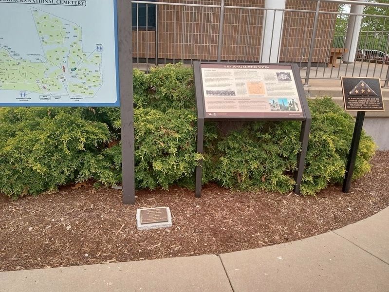
In Honor of Those Who Gave the Ultimate Sacrifice Marker
In honor of those who gave the Ultimate Sacrifice in service to the United States of America and the families they left behind. The sacrifice will not be forgotten. — — Map (db m246427) WM
On Mississippi River Greenway, on the right when traveling north.
An Artery of Growth
From this vantage point at Jefferson Barracks, you can see the Mississippi River, the second longest river in the United States. It extends 2,320 miles, from Lake Itasca, Minnesota to the Gulf of Mexico. . . . — — Map (db m168697) HM
Near CCC Road 0.2 miles north of Grant Road, on the right when traveling north.
Powder Magazine Museum
This is one of the two remaining limestone powder magazines. This structure, which today houses the Powder Magazine Museum, was constructed in 1857. The walls are 4-foot thick limestone with arched ceiling and a . . . — — Map (db m151405) HM
On North Road east of Grant Road, on the right when traveling west.
History of the Visitors Center
The building which today houses the Visitors Center for Jefferson Barracks County Park was built in 1878 as a two-level barn for the animals and wagons used by the artillery department. The lower level was . . . — — Map (db m151403) HM
On Sheridan Road 0.3 miles east of Telegraph Road (Missouri Route 231), on the left when traveling east. Reported missing.
The Jefferson Barracks National Cemetery was established by joint resolution of Congress in 1866, among the first burial grounds officially designated in the wake of the Civil War. Under the care of the Veterans Administration, the facility is . . . — — Map (db m124986) HM
On Monument Drive at Longstreet Drive, on the right when traveling south on Monument Drive.
Civil War Jefferson Barracks
Jefferson Barracks, established by the U.S. Army in 1826, was in continuous use until 1946. Early in the Civil War, both pro-Union and pro-Confederate militia occupied St. Louis. Union militia drilled at . . . — — Map (db m163592) HM
On North Drive west of Middle Drive, on the left when traveling east.
U.S. Marine Corps
Herbert R. Aldridge, PFC. Nov. 28 1949 •
David G. Anderson, PFC. Jun. 13, 1949 •
Charles G. Boyer, PFC. Feb. 28, 1949 •
Joseph P. Brignac, Cpl. Nov. 6 1943 •
Donald R. Bumstead, PFC. Mar 30, 1949 •
George L. . . . — — Map (db m192808) WM
Front Michael Joseph Blassie 1st Lt. US Air Force Vietnam Apr 4 1948 May 11, 1972 Beloved Son and Brother Back Silver Star, Distinguished Flying Cross, Purple Heart, Air Medal and 4 OLC. Killed in Action-Unknown Soldier May 28, 1984 . . . — — Map (db m124995) WM
On Graves Drive at Flagstaff Drive, on the left when traveling south on Graves Drive.
The Third Infantry Division was organized on November 21, 1917, and was in France by March, 1918. On July 18 it distinguished itself in defense at the Marne River at Chateau-Thierry, 45 miles northeast of Paris. Thus, the proud motto: "Rock of . . . — — Map (db m124978) HM WM
On South Drive 0.1 miles west of Monument Drive, on the left when traveling west.
Who knows but it may be given to us, after this life, to meet again in the old quarters, to play chess and draughts, to get up soon to answer the morning roll call, to fall in at the tap of the drum for drill and dress parade and again to hastily . . . — — Map (db m124979) WM
On Monument Drive south of Middle Drive, on the right when traveling south.
Died May 13 1945 in an air crash
Hidden Valley Dutch New Guinea
MAJ Herman F Antonini
Illinois June 4 1915
MAJ Phillip J Dattilo
Kentucky March 18 1914
PFC Alethia M Fair
California September 16, 1894
CAPT Louis E . . . — — Map (db m124980) HM WM
On Rostrum Drive at Graves Drive, on the left when traveling north on Rostrum Drive.
This monument is dedicated to the
52 United States Submarines
lost during World War II and
their crewmen and officers
who perished in that war.
Erected in 2003 by the
surviving members of the
Ill-Mo Rebel Squadron,
a chapter of the . . . — — Map (db m124981) WM
Memorial to the Unknown Soldiers who died while in camp between 1806 and 1826 at Fort Bellefontaine, which was on the Missouri River bluffs near St. Louis. In 1826 this cantonment was closed and the troops removed to Jefferson Barracks. The . . . — — Map (db m246429) HM WM
On Circle Drive east of Bundy Drive, on the left when traveling east.
These U.S. prisoners of war of the Japanese were on the island of Palawan, P.I. as slave laborers building an airfield for the Japanese military. Believing that an invasion by the U.S. forces was imminent, the prisoners were forced into three tunnel . . . — — Map (db m124984) HM WM
On Flagstaff Drive at Rostrum Drive, on the right when traveling east on Flagstaff Drive.
Dedicated to the memory of
Merchant Marine Seamen
and
Navy Armed Guard
who gave their lives in
World War II
in the service of
their country
United States Merchant Marine
World War II Losses
Ships - 731
Merchant Seamen - 6700 . . . — — Map (db m124985) WM
On Cemetery Road north of Fort Mott Road, on the left when traveling north.
Civil War Dead An estimated 700,000 Union and Confederate soldiers died in the Civil War between April 1861 and April 1865. As the death toll rose, the U.S. government struggled with the urgent but unplanned need to bury fallen Union troops. . . . — — Map (db m312872) HM
On Cemetery Road, on the left when traveling north.
Four score and seven years ago our fathers brought forth on this continent, a new nation, conceived in Liberty, and dedicated to the proposition that all men are created equal.
Now we are engaged in a great civil war, testing whether that . . . — — Map (db m114213) HM
On Cemetery Road 0.7 miles north of Fort Mott Road, on the left when traveling north.
The Fort Delaware Prison
The federal government constructed Fort Delaware between 1848 and 1859. Located on Pea Patch Island in the Delaware River, the fort was built to defend Philadelphia.
In the second year of the Civil War, Fort . . . — — Map (db m312861) HM
On Cemetery Road, on the left when traveling north.
Erected by the United States to mark the burial place of 2436 Confederate soldiers who died at Fort Delaware while prisoners of war and whose graves cannot now be individually identified. — — Map (db m21655) WM
On Cemetery Road, on the left when traveling north.
Though located far from any site of armed conflict, Finn’s Point National Cemetery exists as a direct result of the American Civil War. It is the resting place for the remains of 2,436 Confederate soldiers whose military careers ended as . . . — — Map (db m21651) HM
On Cemetery Road 0.7 miles north of Fort Mott Road, on the left when traveling north.
Historical Information
Finn's Point National Cemetery is located about six miles northwest of Salem, N.J., at the north end of what was Fort Mott Military Reservation. Today, the picturesque cemetery is entirely surrounded by the . . . — — Map (db m312858) HM
On Cemetery Road 0.7 miles north of Fort Mott Road, on the left when traveling north.
Fort Delaware
Fort Delaware on Pea Patch Island, in the Delaware River, was part of a system of permanent fortifications built between 1817 and 1861 to protect the U.S. coastline. Built over ten years, the fort protected the ports of . . . — — Map (db m312873) HM
On Cemetery Road, on the left when traveling north.
Near this stone lie the remains of 105 United States soldiers whose names so far as known are hereon inscribed, but whose graves cannot be identified.
They died for their country. — — Map (db m21656) WM
On U.S. 180 at milepost 120.5 at Bayard Road, on the right when traveling north on U.S. 180. Reported permanently removed.
Fort Bayard - 1866-1900. One of the several posts created on the Apache frontier, Fort Bayard protected the Pinos Altos mining district. Company B of the black 125th Infantry served here, as did Lt. John J. Pershing. In 1900 the fort became a . . . — — Map (db m316620) HM
Civil War Dead
An estimated 700,000 Union and Confederate soldiers died in the Civil War between April 1861 and April 1865. As the death toll rose, the U.S. government struggled with the urgent but unplanned need to bury fallen Union . . . — — Map (db m184764) HM
Dedicated to the honor and in memory of those men and women who served their country in the interest of freedom for all mankind — — Map (db m184785) WM
In honor of those who gave the Ultimate Sacrifice in service to the United States of America and the families they left behind. The sacrifice will not be forgotten. — — Map (db m184769) WM
On North Guadalupe Street at Alamo Drive on North Guadalupe Street.
This is placed in honor of all the Vietnam veterans on the 50th anniversary of the war to pay tribute to the valor of those who served proudly and courageously. Our heartfelt thanks and gratitude for your service and sacrifice on behalf of the . . . — — Map (db m184777) WM
Civil War Dead
An estimated 700,000 Union and Confederate soldiers died in the Civil War between April 1861 and April 1865. As the death toll rose, the U.S. government struggled with the urgent but unplanned need to bury fallen Union . . . — — Map (db m90119) HM
Four score and seven years ago our fathers brought forth on this continent, a new nation, conceived in Liberty, and dedicated to the proposition that all men are created equal. Now we are engaged in a great civil war, testing whether that . . . — — Map (db m114217) HM
Near Davis Street, on the right when traveling south.
Between July 1864 and August 1865, 2973 Confederate soldiers were buried here with kindness and respect, by John W. Jones, a runaway slave. They have remained in these hallowed grounds of Woodlawn National Cemetery by family choice because of the . . . — — Map (db m32239) HM
Elmira Prison Camp
Overcrowding at the military prison at Point Lookout, Maryland, led the U.S. Army to establish Elmira Military Prison in May 1864. Elmira, New York, initially a rendezvous point for enlisting Union soldiers, had barracks, . . . — — Map (db m90076) HM
Near Davis Street, on the right when traveling south.
In Memory of The Confederate Soldiers in the War Between the States who died in Elmira Prison and lie buried here erected by the United Daughters of the Confederacy November 6, 1937 — — Map (db m32179) HM
Near Davis Street, on the right when traveling south.
(Federal Side):
Erected by the
United Statesto the memory of the following soldiers, privates in the Eleventh Veteran Reserve Corps. Comprising the Union guard who were killed with their Confederate prisoners of war in the railroad . . . — — Map (db m32180) HM
Elmira Military Depot
On April 15, 1861, President Abraham Lincoln issued a call for volunteers to put down the Confederate rebellion. Three days later, New York Gov. Edwin G. Morgan appealed for 13,280 troops to fill the state's quota of . . . — — Map (db m90151) HM
This tree dedicated by the Veterans Administration in 1976 to America’s Medal of Honor Recipients who helped make this Bicentennial Observance possible “By gallantry above and beyond the call of duty” — — Map (db m61576) WM
Four score and seven years ago our fathers brought forth on this continent, a new nation, conceived in Liberty, and dedicated to the proposition that all men are created equal. Now we are engaged in a great civil war, testing whether that . . . — — Map (db m114218) HM
Near Duell Road, on the right when traveling north.
U.S.S. Saratoga (CV 60) and Carrier Air Wing Seventeen (CVW 17) Deployment August 7, 1990 – March 28, 1991 In memory of our twenty-three fallen shipmates during Operation Desert Shield / Desert Storm Dedicated by the crew of the U.S.S. . . . — — Map (db m66825) WM
Civil War Dead
An estimated 700,000 Union and Confederate soldiers died in the Civil War between April 1861 and April 1865. As the death toll rose, the U.S. government struggled with the urgent but unplanned need to bury fallen Union troops. . . . — — Map (db m154121) HM
Four score and seven years ago our fathers brought forth on this continent, a new nation, conceived in liberty, and dedicated to the proposition that all men are created equal.
Now we are engaged in a great civil war, testing whether that nation, . . . — — Map (db m154105) HM WM
Soldiers' and Sailors' Home
In 1872, the New York legislature passed an unfunded bill to create the New York Soldiers' and Sailors' Home. The Grand Army of the Republic, a Union Army veterans group, raised money to construct the . . . — — Map (db m154122) HM
Near National Avenue at Court Street, on the right when traveling south.
Civil War Dead
An estimated 700,000 Union and Confederate soldiers died in the Civil War between April 1861 an April 1865. As the death toll rose, the U.S. government struggled with the urgent but unplanned need to bury fallen Union . . . — — Map (db m76959) HM
On National Avenue at Court Street, on the right when traveling south on National Avenue.
On March 14, 1862, Union Gen. Ambrose E. Burnside captured New Bern after seizing Roanoke Island in February and moving his army inland. After the battle for the town, the Federals established hospitals in the New Bern Academy, the Masonic Lodge, . . . — — Map (db m76946) HM
Near Market Street (Business U.S. 17) at North 20th Street, on the left when traveling east.
Civil War Dead
An estimated 700,000 Union and Confederate soldiers died in the Civil War between April 1861 an April 1865. As the death toll rose, the U.S. government struggled with the urgent but unplanned need to bury fallen Union . . . — — Map (db m77249) WM
Near Market Street (Business U.S. 17) just east of North 20th Street, on the left when traveling east.
Four score and seven years ago our fathers brought forth on this continent, a new nation, conceived in Liberty, and dedicated to the proposition that all men are created equal. Now we are engaged in a great civil war, testing whether that nation, . . . — — Map (db m222492) HM
Near Market Street (Business U.S. 17) just east of North 20th Street, on the left when traveling east.
Civil War Wilmington Wilmington was a minor Atlantic port when the Civil War started and the U.S. Navy did little to secure it. In fall 1862, the Confederate Ordnance Bureau designated it as the port of entry for its blockade runners. At night . . . — — Map (db m223962) HM
You are facing the 18 trenches used by the Salisbury Confederate Prison for the burial of prisoners, most of whom died after October 1864. — — Map (db m35270) HM
Maine’s tribute to her soldiers who died while prisoners of war at Salisbury, N.C. 1864 – 1865 [ Right of Monument: ] “They fought for peace, - for peace they fell, - they sleep in peace, and all is well.” [ Rear of . . . — — Map (db m34406) HM
On Government Road, on the left when traveling south.
[ Left Tablet: ] This monument is erected by authority of an Act of the Pennsylvania Legislature approved June 13th 1907. To commemorate the patriotic devotion, heroism, and self-sacrifice of the officers and soldiers of the Pennsylvania . . . — — Map (db m34410) HM
Salisbury Prison and Trench Graves Salisbury Prison was established by the Confederate government in October 1861 on the site of an old cotton factory. In preparation for the first prisoners, a portion of the grounds was enclosed by a stockade . . . — — Map (db m34398) HM
In 18 trenches, just south of this spot, rest the bodies of 11,700 soldiers of the United States Army, who perished during the years 1864 and 1865 while held by the Confederate Military Authorities as prisoners of war in a stockade near this place. . . . — — Map (db m34403) HM
Near Rock Quarry Road north of Robinson Avenue, on the right when traveling north.
Civil War Dead
An estimated 700,000 Union and Confederate soldiers died in the Civil War between April 1861 an April 1865. As the death toll rose, the U.S. government struggled with the urgent but unplanned need to bury fallen Union troops. . . . — — Map (db m233612) HM
Near Rock Quarry Road north of Robinson Avenue, on the right when traveling north.
Civil War Raleigh After President Abraham Lincoln called for troops to put down the Confederate rebellion in April 1861, North Carolina seceded from the Union. Raleigh became a hub of Confederate activity as recruiting and training camps sprang . . . — — Map (db m233591) HM
On Monument Avenue, on the right when traveling south.
Memorial
to the
Thirty-three soldiers of the War of 1812
buried in this cemetery
Honoring
Josephine C. Diefenbach
state president 1935-1937
erected by
The Ohio Society United States Daughters of 1812
on the anniversary of . . . — — Map (db m116623) WM
On Confederate Drive, on the left when traveling south.
Confederate Prison On November 15, 1861, the War Department leased one half of Johnson’s Island, in Sandusky Bay, Ohio, and began constructing a 15-acre prison camp on the southeast shore. When complete, the prison complex included a . . . — — Map (db m165777) HM
In memory of the 304th Rescue Squadron aircrew members, who lost their lives on board aircraft King 56, while performing a training mission on the night of November 22, 1996. These men were Citizen Soldiers committed to the preservation of the . . . — — Map (db m11977) HM
Dedicated to the memory of these men and women from Oregon so their sacrifice will never be forgotten.
Oh, could our fallen brothers know the honor they helped bring to God, and to our country, to their memory now we sing.
You gave your . . . — — Map (db m11979) HM
[Main/Bottom Marker]:
These Carillon Bells
in honor and loving memory of
all Veterans
were donated by the Oregon State
Federation of Garden Clubs, Inc.
[Top Marker]:
June [The Oregon Federation of . . . — — Map (db m11973) HM
On Taneytown Road (State Road 134), on the right when traveling north. Reported permanently removed.
"Here where they fell, Oft shall the widow's tear be shed, Oft shall fond parents mourn their dead; The orphan here shall kneel and weep…"
Hymn by Benjamin B. French Sung at cemetery dedication November 19, 1863
On Baltimore Street (State Highway 97), on the right when traveling north.
Nearby, Nov. 19, 1863, in dedicating the National Cemetery, Abraham Lincoln gave the address which he had written in Washington and revised after his arrival at Gettysburg the evening of November 18. — — Map (db m15129) HM
On Baltimore Street (State Highway 97), on the right when traveling south.
"Here where they fell, Oft shall the widow's tear be shed, Oft shall fond parents mourn their dead; The orphan here shall kneel and weep…" Hymn by Benjamin B. French Sung at cemetery dedication November 19, 1863
Erected to the memory of the 4,000 brave men of Allegheny County. Who fell in the great struggle to maintain the integrity of our union. The eye of God rests upon their graves even when unmarked by man. And their sleeping dust shall arise in the . . . — — Map (db m58142) WM
Near Highland Road 0.1 miles north of Washington Crossing Road (Pennsylvania Route 532).
Four score and seven years ago our fathers brought forth on this continent, a new nation, conceived in Liberty, and dedicated to the proposition that all men are created equal.
Now we are engaged in a great civil war, testing whether that nation, . . . — — Map (db m136467) HM
Near York Road (Pennsylvania Route 74) south of Ashland Avenue, on the right when traveling south.
500 U.S. Soldiers of the Civil War are here Interred John Barney • John P. Beirne • John C. Biglow • William H. Brown John Conway • Albert D. Dailey • Charles David • John Driskell George Earlenbough • Marmaduke Foster • Soloman Francis John . . . — — Map (db m135200) WM
Near York Road (Pennsylvania Route 74) south of Ashland Avenue, on the right when traveling south.
Carlisle At War (center panel) After Confederate forces fired on Fort Sumter, South Carolina, in April 1861, the men of Carlisle responded to the national calls to put down the southern rebellion. Four companies of Pennsylvania infantry . . . — — Map (db m135169) HM WM
Near Fisher Avenue (State Highway 934) 0.5 miles north of Interstate 81, on the right when traveling north.
Four score and seven years ago our fathers brought forth on this continent, a new nation, conceived in Liberty, and dedicated to the proposition that all men are created equal.
Now we are engaged in a great civil war, testing whether that nation, . . . — — Map (db m135099) HM WM
Near Limekiln Pike at Haines Street (69th Avenue).
Civil War Dead An estimated 700,000 Union and Confederate soldiers died in the Civil War between April 1861 and April 1865. As the death toll rose, the U.S. government struggled with the urgent but unplanned need to bury fallen Union troops. . . . — — Map (db m136474) HM
Near Limekiln Pike at Haines Street (69th Avenue).
Four score and seven years ago our fathers brought forth on this continent, a new nation, conceived in Liberty, and dedicated to the proposition that all men are created equal.
Now we are engaged in a great civil war, testing whether that nation, . . . — — Map (db m136476) HM WM
Near Limekiln Pike at Haines Street (69th Avenue).
The Confederate Section All of the Confederate prisoners of war buried here died in a Civil War military hospital in or near Philadelphia. All were originally interred near the hospital where they died. In the late 1880s, the dead were moved . . . — — Map (db m136479) HM
Near Limekiln Pike at Haines Street (69th Avenue).
Erected by the United States to mark the burial place of 184 Confederate Soldiers and Sailors,
As shown by the records, who, while prisoners of war, died either at Chester, Pa., and were there buried, or at Philadelphia and were buried in . . . — — Map (db m136480) HM WM
Near Limekiln Pike at Haines Street (69th Avenue).
The left wing of the American Army, under General Greene moved down Limekiln Pike. The first opposition encountered was west of this spot when a conflict occurred with a regiment of British light infantry. Tablet erected 1928 by the Citizens . . . — — Map (db m136475) HM
Near Limekiln Pike at Haines Street (69th Avenue).
(north side)To the soldiers of the Mexican War (east side)Vera Cruz, Cerro Gordo, Huamantla, Puebla, Atlixco, Valley of Mexico. — — Map (db m136481) WM
Near Limekiln Pike at Haines Street (69th Avenue).
Civil War Philadelphia At the time of the Civil War, Philadelphia was the second-largest American city. Its factories supported the Union war effort by producing everything from blankets to gunboats. In less than three months, its navy yards . . . — — Map (db m136477) HM
Near Limekiln Pike at Haines Street (69th Avenue).
U.S. Colored Troops Beginning in March 1863, the federal government began actively recruiting black men for the Union Army. A few months later, the War Department created the Bureau of United States Colored Troops (USCT). USCT regiments fought . . . — — Map (db m136478) HM
Erected in memory of the
Defenders of the Union
1861-5
United States Hospital,
Established at York.
1862.
The dead here interred
were soldiers of the
Union from sixteen states
who died in hospital,
at their homes or
on battle . . . — — Map (db m82395) HM WM
On N. George St. near Prospect Hill Cemetery entrance, on the left when traveling north.
One of the Signers of the Declaration of Independence; died in June, 1778, while attending Continental Congress as delegate from New York. His grave is about 300 feet west of here. — — Map (db m4599) HM
Near North George Street (Business Interstate 83) south of East 3rd Avenue, on the right when traveling south.
York at War (center panel) On April 23, 1861, less than two weeks after Confederate forces attacked Fort Sumter in South Carolina, Gov. Andrew G. Curtin established Camp Scott at York, Pennsylvania. By early May, six regiments were . . . — — Map (db m135168) HM WM
Near South County Trail (Rhode Island Route 2) 0.2 miles south of Main Street (Exeter Road), on the right when traveling south.
Four score and seven years ago our fathers brought forth on this continent, a new nation, conceived in Liberty, and dedicated to the proposition that all men are created equal.
Now we are engaged in a great civil war, testing whether that nation, . . . — — Map (db m138220) HM WM
Near South County Trail (Rhode Island Route 2) 0.2 miles south of Main Street (Exeter Road), on the right when traveling south.
Dedicated to all Patriots, particularly those who pledged their lives, their fortunes and their sacred honor so that we may enjoy the freedoms of this great land. — — Map (db m152522) WM
Near South County Trail (Rhode Island Route 2) 0.2 miles south of Main Street (Exeter Road), on the right when traveling south.
In faithful memory of the veterans of all Wars of the United States of America, the Rhode Island State Society of the Daughters of the American Revolution established this”Patriots Memorial Grove” 1979 — — Map (db m152521) WM
On Boundary Street (Business U.S. 21) east of Hogarth Street, on the right when traveling east.
The 1st South Carolina Volunteer Infantry Regiment
was raised from sea island slaves living around Port
Royal. Elements of the regiment were formed on Hilton
Head in May 1862. In August 1862, the regiment was
reorganized near Beaufort at the . . . — — Map (db m7094) HM
Near Boundary Street (Business U.S. 21) west of Bladen Street, on the right when traveling west.
Civil War Dead An estimated 700,000 Union and Confederate soldiers died in the Civil War between April 1861 and April 1865. As the death toll rose, the U.S. government struggled with the urgent but unplanned need to bury fallen Union troops. . . . — — Map (db m134423) HM
Near Boundry Street, on the right when traveling west.
Four score and seven years ago our fathers brought forth on this continent, a new nation, conceived in liberty, and dedicated to the proposition that all men are created equal.
Now we are engaged in a great civil war, testing whether that . . . — — Map (db m114214) HM
Near Boundary Street (Business U.S. 21) west of Bladen Street, on the right when traveling west.
National Cemetery Beaufort National Cemetery was established in 1863. The U.S. Army Quartermaster General's Office laid out the 22 acres in sections that radiate outward from a central plaza to form a half circle. Of the 9,226 interments here . . . — — Map (db m134421) HM
The Governor of the Commonwealth of Massachusetts Michael S. Dukakis, and descendant's of the African-American Civil War Volunteers of the 54th and 55th Infantry Regiments and the 5th Cavalry Regiment of Massachusetts, . . . — — Map (db m20211) HM
662 entries matched your criteria. Entries 301 through 400 are listed above. ⊲ Previous 100 — Next 100 ⊳