1929
Dedicated to those of this
community who served in
the World War and to the
memory of those who gave
their last full measure of
devotion.
Erected by
American Legion Auxiliary to
Harry D. Jerred Post No. . . . — — Map (db m39566) HM
In the autumn of 1828 a permanent fort was built on this site by the First Regiment of the United States Infantry under the command of Maj. David E. Twiggs, later a general in the Confederate Army. The fort was constructed primarily to control the . . . — — Map (db m2364) HM
Home of Army Surgeons 1834 - 1845 Occupied by Francis LeRoy before 1828 Restored by Wisconsin Society, Daughters of the American Revolution 1954 — — Map (db m42904) HM
Considered the most important historian of the United States in the twentieth century, Frederick Jackson Turner brought a new understanding to the meaning of the American experience. He was born in Portage; his father was Andrew Jackson Turner, a . . . — — Map (db m216262) HM
The Indian Agency House was built in 1832 by the United States Government for John Harris Kinzie and his wife Juliette Magill Kinzie. John Kinzie was the Indian Agent to the Ho-Chunk (Winnebago) Indians. He had been assigned by the Government to . . . — — Map (db m230836) HM
Ketchum’s Point, named for a local family, stands above the low, marshy Portage connecting the Fox River and Great Lakes with the Wisconsin and Mississippi rivers. This waterway served as a vital thoroughfare for supplies and furs during the fur . . . — — Map (db m2407) HM
On June 14, 1673 Jacques Marquette and Louis Jolliet started the portage (1.28 miles) from here to the Wisconsin River, which led to their discovery of the Upper Mississippi June 17, 1673 at Prairie du Chien. The expedition, in two birch bark . . . — — Map (db m2341) HM
Landing place of the ferry built by Pierre Pauquette and operated by him from about 1828 until his death in 1836. This ferry was in use until the first bridge was built across the Wisconsin River in 1857. — — Map (db m74344) HM
Near here in 1849 Thomas Twiggs began a settlement of unemployed potters from Staffordshire, England. To help farmers on both sides of the Fox River reach his store and blacksmith shop at Twiggs' Landing, he operated Emancipation Ferry, named to . . . — — Map (db m20084) HM
Patriots Cooper Pixley and Alexander Porter served the cause of gaining our nation's independence while dedicated members of the military. Both are buried in Section 33 of this National Soldiers Rest. Cooper Pixley, born in Great Barrington, . . . — — Map (db m42899) HM
1828 — 1845
Surrender of Red Bird
Noted Winnebago Chief
1827
Erected by Wau-Bun Chapter Daughters of the American Revolution 1924 — — Map (db m4609) HM
This 137 building district is bounded, in part, by Emmett, Cass, Wisconsin and MacFarlane streets. Most of the houses were constructed between 1870 and 1910 and are in the Italianate and Queen Anne architectural styles.
Society Hill reflects . . . — — Map (db m20042) HM
This home, constructed for Indian sub-agent John H. Kinzie, served as an embassy between the Federal Government and the Hoocak (Ho-Chunk, Winnebago) Nation during a turbulent period of cultural convergence and the initiation of the Hoocak Trail . . . — — Map (db m230837) HM
Trinity United
Church of Christ
Has been placed on the
National Register
of Historic Places
by the United States
Department of the Interior
Trinitatus Evangelische
1871 — — Map (db m108279) HM
Zona Gale was born August 26, 1874, in Portage. She graduated in 1899 from the University of Wisconsin-Madison with a Masters in Literature. Gale then spent six years as a journalist in Milwaukee and New York.
Her visits to Portage . . . — — Map (db m20009) HM
John Muir (1838-1914), world famous naturalist and "father of the national park system," often stopped to rest and admire this view as he walked from his home in Marquette County to the University of Wisconsin. Muir loved the wilderness from which . . . — — Map (db m20148) HM
Early roadside rest areas were rural school grounds and country churchyards with their two little houses in back.
In Wisconsin, by 1920, curves were built to eliminate sharp road corners. Local garden clubs, with the American Legion and . . . — — Map (db m22690) HM
Wisconsin has a unique heritage as the birthplace of circuses. More than a hundred had their beginnings in Wisconsin, with Delavan providing winter-quarters for twenty-six between 1847 and 1894. New York brothers Edmund and Jeremiah Mabie brought . . . — — Map (db m109259) HM
Before the introduction of the railroad, the Wisconsin River
provided one of the most practical means of transporting lumber
and farm products to distant markets. The old Village of Dekorra was
beautifully situated to take advantage of this . . . — — Map (db m165534) HM
A living memorial to and in honor of veterans who are buried in Wisconsin who served this nation in the American Revolution and who, by their efforts, were responsible for the founding of our country.Veterans of the American Revolution After the . . . — — Map (db m43824) HM
Wallis/Wallace Rowan (1800-1847) was born in Kentucky of Scotch Irish descent. He was a lead miner, trader, innkeeper, land speculator, farmer, and mill owner. In 1818 he married Elizabeth “Betsy” Metcalf in Illinois. By 1828 Rowan was . . . — — Map (db m67233) HM
A living memorial to and in honor of all Wisconsin veterans living and deat, of all wars in which the United States of America has engaged. Color guard of the 8th Wisconsin Infranty Regiment with Old Abe at Vicksburg, Mississippi, 1863 The . . . — — Map (db m43825) HM
In memory of
Samuel & Chloe Leonard Doud
1793 – 1860 · 1791 – 1874
Donors of Ohio Cemetery
First burial their grandson
Winfield Doud 1848
– 1955 – — — Map (db m25656) HM
Welcome to Witches Gulch
In the 1800s, Witches Gulch was a far from accessible. Centuries of fallen trees and other debris made a hike through the gorge a physical and mental marathon.
In H.H. Bennett's search for new places to . . . — — Map (db m157076) HM
In 1873, steamboats began overtaking rowboats for river excursions to see the famous Dells. One such steamer was built in 1878 by the Kilbourn Boat Company and named after Alexander Mitchell, a successful Milwaukee banker and railroad magnate. By . . . — — Map (db m156991) HM
This natural harbor is named for Gen. Joseph Bailey, original owner of the property. It has been the gateway to the magnificent dells of Wisconsin for millions of visitors for over 100 years. Sight-seeing boats have developed from spoon-oared . . . — — Map (db m7757) HM
This building was constructed on the home site of General Joseph Bailey Civil War hero and a founder of Kilbourn City (now Wisconsin Dells) in 1856. Bailey became a national Civil War hero in 1864 when Porter's Red River Fleet was stranded in low . . . — — Map (db m7966) HM
Born May 9, 1844 in Martinsburg, VA.
Died June 11, 1900 at Kilbourn, WI.
On May 23, 1862 at the Battle of Front Royal, VA., Belle Boyd, then 18, ran across the battlefield between the firing lines with information for Gen. Stonewall . . . — — Map (db m8023) HM
The word "Dells" was derived from the French word "Dalles," meaning flat-layered or slab rock. These layers of rock were formed during the Cambrian period, 500 million years ago, when the North American Continent was completely covered by an ocean, . . . — — Map (db m157040) HM
Claiming that "no man can own the Dells." George H. Crandall - son-in-law to H.H. Bennett - ensured his legacy with extraordinary efforts to preserve the scenic landscape. Even though Crandall himself was involved in the tourist trade, managing . . . — — Map (db m157128) HM
This building was constructed in 1875 by Henry Hamilton Bennett, pioneer landscape photographer, nationally known for his artistry, technical excellence and inventive genius. His views of this area brought the earliest tourists to his beloved Dells . . . — — Map (db m7851) HM
Henry Hamilton (H.H.) Bennett (1843-1908) is recognized as on of the countries foremost landscape photographers.At the age of only 22, with little formal education and a damaged right hand, he began his photographic career in Kilbourn City (now . . . — — Map (db m157084) HM
Arriving in the developing Kilbourn City as a teenager in 1857, Henry Hamilton Bennett began work as a carpenter. After suffering a hand injury during the Civil War, he chose a new career and opened a photography studio that still stands on Broadway . . . — — Map (db m157131) HM
A Wisconsin Pioneer
One of the founders of Wisconsin Dells, Joseph Bailey completed the first dam across the Wisconsin River here in 1859. Opposition from upriver lumbermen required the dam's removal in 1860. Bailey's dream to build an . . . — — Map (db m134610) HM
In 1634, Jean Nicolet was the first white man to have contact with the Indians of Wisconsin. He was soon followed to this area by French and British explorers, missionaries, adventurers and fur traders. The first white settlers came in the 1840's . . . — — Map (db m157039) HM
(two panels, side-by-side)
Indians
Indian tribes have lived in this area of Wisconsin for centuries. Jean Nicolet, a French Government representative, was the first white man to have contact with the Indians in 1634. . . . — — Map (db m157082) HM
The first bridge on this site, a wooden structure, was completed in 1857. Byron Kilbourn, land speculator and politician promoted the site. Through his influence the LaCrosse and Milwaukee Railroad crossed the river here instead of at Newport, 2 . . . — — Map (db m8047) HM
Downriver sits the ruins of the lost city of Newport. In the early 1850s, the settlement on the Lower Dells developed rapidly, amidst rumors the town was to be the spot of the new LaCrosse and Milwaukee Railroad bridge. Speculators' hopes were . . . — — Map (db m157129) HM
The mounds of this group are a fairly representative sample of those built by the people of the Effigy Mound Culture between A.D. 700-1000. It has been through excavation of other burial mounds quite similar to these that archeologists have learned . . . — — Map (db m7731) HM
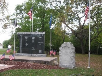
Praise be to God
K.I.A.
Korea Durlin
Morse
Vietnam Dennis Beard
Korea
Deceased Korean War Members of Harold B. Larkin Post 187 The American Legion
"We honor those veterans who gave of themselves to . . . — — Map (db m80461) WM
WHI 2101
Ashley Bennett, son of photographer H.H. Bennett, jumping to Stand Rock, caught in midair by the instantaneous shutter. — — Map (db m157080) HM
Abundant stands of white pines throughout Northern Wisconsin spurred the first era of big business to the Dells beginning in 1833. Timber logs 70-feet long were floated down to sawmills, where they were cut into rough planks. Lumbermen made their . . . — — Map (db m157133) HM
From early settlers and lumber raftsmen, to row boat guides, steamboat captains and modern-day tour operators, love for this unique stretch of the Wisconsin River runs deep as its history. Tourism remains the driving economy for the waterway. Today, . . . — — Map (db m157132) HM
River excursions in Wisconsin Dells were born from one man's a-ha moment. Leroy Gates gained notoriety as an expert lumber raft pilot, guiding the bundled wood planks through the tricky waters of the Dells. He began to make a show of his skills, . . . — — Map (db m157036) HM
Perry G. Stroud, a young attorney from New York, established this early bank in Kilbourn City, now Wisconsin Dells, in ca. 1870. Over his thirty-year career as the town's first attorney, Stroud preserved much of the city's early documentary history. . . . — — Map (db m7850) HM
For thousands of years, indigenous people have lived on this land. Wisconsin Dells is home to the Ho-Chunk, whose native land extends from Michigan to Illinois. For centuries, the Ho-Chunk people have gathered in the Dells to revitalize themselves . . . — — Map (db m157127) HM
The year 1908 brought dramatic changes to the Wisconsin River and the Dells. After many attempts at harnessing the power of the river with smaller dams, a new high dam and hydroelectric power plant were built. The Kilbourn Dam split the river into . . . — — Map (db m157126) HM
The arrival of the railroad in 1857 created a boom in tourism as an increased number of sightseers arrived by rail to take scenic boat tours. The Dells of the Wisconsin River had gained notoriety through the photographs of H.H. Bennett. But the . . . — — Map (db m157035) HM
Picture before you a white-rapids river raging between its rocky banks. The early days of the Wisconsin River flowing through this region were not the serene postcard scenes of today. The riverbed and towering sandstone bluffs were formed more than . . . — — Map (db m157037) HM
Henry Hamilton Bennett, pioneer photographer, discovered, pictured and named many of the scenic spots including this, The Witches Gulch.
George H. Crandall, and his wife, Nellie Bennett Crandall here acquired, preserved and reforested hundreds of . . . — — Map (db m157073) HM
Deceased WW I Members of Harold B. Larkin Post 187
The American Legion "They Served with Honor"
Roll of Honor (W.W. I War Dead)
Lawrence S. Christianson Otto Christopherson
Hubert Coon
Harold B. Larkin
Keith L. . . . — — Map (db m80577) WM
In memory of
our comrads.
Buried in
unknown graves.
———
Henry R. Coffin. Charles Bloom. John Chapman.
Co. G. 2d Reg. Wis. Vol. •
Clovis V. Bushnell.
Co. B. 40th Reg. Wis. Vol. • . . . — — Map (db m37975) HM
This plot of land, locally known as "Potter's Field", served as the final resting place for nearly 250 residents of the Columbia County Asylum. Indigent asylum residents left unclaimed by family members were buried here from 1871 until 1971, nearly . . . — — Map (db m185566) HM
Major Dickason
Major Elbert Dickason founded Wyocena in 1843. He platted and named the village in 1846. He was instrumental in Wyocena being temporarily named the county seat. He died in 1848 and is buried in the Wyocena Cemetery.
Erhardt . . . — — Map (db m37115) HM
Major Elbert Dickason
Major Elbert Dickason founder of Wyocena, was born in Virginia in 1799. He moved to Illinois where he joined their militia during the Black Hawk War. Representing a Milwaukee land investor, he founded Columbus in 1839. . . . — — Map (db m22839) HM
Wyona Park
This site has traditionally been a popular picnic area for Wyocena residents. As early as 1905, approximately 1,000 people attended an insurance company picnic at this location. In 1948, Gordon Spear, a lifetime Wyocena resident, . . . — — Map (db m36448) HM
Patrick J. Lucey was born in La Crosse on March 21, 1918, to Ferryville parents, Gregory C. and Ella McNamara Lucey. He was educated at Campion Academy, College of St. Thomas, and the University of Wisconsin.
Lucey served in the U.S. Army . . . — — Map (db m35407) HM
In the spring of 2003, after the old bridge on Hwy 171 over the Kickapoo River was replaced with this new one, Cliff Swallows started breeding under the concrete structure. Cliff Swallows are one of 6 species of swallows breeding in Wisconsin. . . . — — Map (db m40391) HM
Farmers in this area learned early that the land on both sides of the Kickapoo River offered excellent conditions for apple-growing. In 1905 John Hays and Ben Twining collected apples from eight or ten farmers around Gays Mills for exhibit at the . . . — — Map (db m31676) HM
In the year 1847 James B. Gay, a civil engineer and native of Indiana, journeyed to the unsettled Kickapoo Valley. Here he was impressed by acres of untouched forest which covered the hills and valleys. Finding a good rock bottom in the river and . . . — — Map (db m40057) HM
After 1837 the vast timber resources of northern Wisconsin were eagerly sought by settlers moving into the mid-Mississippi valley. By 1847 there were more than thirty saw-mills on the Wisconsin, Chippewa, and St. Croix river systems, cutting . . . — — Map (db m23456) HM
On August 2, 1832, the Black Hawk War effectively ended when the U.S. Military massacred many followers of Sauk Indian leader Black Hawk at the Battle of Bad Axe, located about 35 miles north of here. Black Hawk, known as Ma-ka-tai-me-she-kia-kiak, . . . — — Map (db m43531) HM
The War of 1812 convinced America that in order
to control their vast country they must occupy and
develop it. In Prairie Du Chien this process began
with the construction of Fort Crawford
in the summer of 1816
Symbol of government and . . . — — Map (db m125191) HM
Lieutenant United States Army
Assigned Fort Crawford 1831
Served here with distinction
during Black Hawk War
Hero in Mexican War 1846-1848
United States Congressman
Senator, Secretary of War
President
Confederate States of America . . . — — Map (db m43642) HM
L'ancien Cimetiere Francais
Blessed by Father Dunand May 6, 1817
Here, on grounds long used by Indians,
French 'hommes du nord' buried their loved ones.
Present Markers - Mr. & Mrs. Alexander Gardipi 1845 • Jean Joseph Rolette . . . — — Map (db m43649) HM
The Second Fort Crawford Military Hospital was built here in 1831. In 1934 this portion of it was restored with original stone as a memorial to William Beaumont, M.D. (1785-1853), pioneer military surgeon.
Among prominent military personnel . . . — — Map (db m43641) HM
In 1673, Louis Jolliet, Canadian fur-trader and explorer, and Father Jacques Marquette, French Jesuit Missionary, with five French Canadian boatmen, were the first white men to enter the upper Mississippi River.
Indians directed them to the . . . — — Map (db m43530) HM
In prehistoric times water from melting glaciers cut a wide valley between the bluffs of the Mississippi River to form a broad flood plain. On it French explorers, traders and missionaries found a large and well-established Fox Indian village. The . . . — — Map (db m43529) HM
The first Fort Crawford was built in 1816, and stood on the site now occupied by the "Villa Louis." After a decade of Mississippi River flooding, the U. S. Army relocated Fort Crawford to this site, constructing the new fort of locally quarried . . . — — Map (db m43532) HM
In the summer of 1823 the steamboat Virginia
successfully negotiated the dangerous rapids at the
mouth of the Des Moines River and became the first
steam-powered vessel to navigate the upper
Mississippi.
By the 1830’s steamboats were common . . . — — Map (db m125202) HM
Lest We Forget
For us they served
For us they gave
Now in one accord
We do them honor
Dedicated to all
men and women
of Crawford County Wisconsin
who served this great nation
for God and country
in military service
. . . — — Map (db m44716) HM
On the site of old Fort Crawford, Col. Hercules Louis Dousman, important agent in John J. Astor's fur company, built his "house on the mound" in 1843. Later it was named Villa Louis. Today this luxurious mansion appears much as it did in the days . . . — — Map (db m23589) HM
This hilltop mansion commands a sweeping view of a landscape steeped in history. Descendants of pioneer fur trader Hercules Dousman built the house in 1870 atop a mound overlooking the Mississippi River, which drew European explores to this spot in . . . — — Map (db m23586) HM
Although Prairie du Chien belonged to the United States after the American Revolution, its pioneer residents were tied by trade, tradition and family to the French-British community at Mackinac and to the St. Lawrence River ports.
During the . . . — — Map (db m23591) HM
Born Lebanon, Conn. 1785
Died St. Louis, Mo. 1853
At old Fort Crawford, one mile and a half northwest of this spot, one hundred years ago, Doctor Beaumont, a surgeon in the United States Army, performed those experiments on Alexis St. Martin . . . — — Map (db m44696) HM
700 Sac Indians July 31,
1200 Soldiers Aug. 1, 1832
followed this ridge west
into Vernon County over this
ground.
_____________________
Two human skeletons were
found at a spring west of
Wilder's Hotel, Rising
Sun in 1852.
. . . — — Map (db m32003) HM
Technical Sergeant, U.S. Army, 381st Infantry, 96th Infantry Division, was born at Eagle, WI. on July 6th, 1922. He entered the service at Soldiers Grove, WI. in October, 1942. While serving his country in Okinawa, . . . — — Map (db m32769) HM
Product of a small American community, James O. Davidson's life illustrates the romance of citizenship in a democracy. Born 1854 in Norway, where he received little formal education, he emigrated in 1872 and was a farmer and tailor before coming in . . . — — Map (db m31671) HM
In late July, during the Black Hawk War of 1832, Sac Indian leader Black Hawk led his starving followers through this area in their escape from the General Henry Atkinson and his military forces. After Black Hawk's brilliant delaying tactics at the . . . — — Map (db m31659) HM
(side 1)
Early Belleville
Finding a mill site on the Sugar River, founder John Frederick settled here in 1845. His mill prompted "Yankee" settlement and a village developed with a hotel/tavern, blacksmith, harness maker and general . . . — — Map (db m59539) HM
In the mid-nineteenth century, many newly arrived Norwegian immigrants in southern Wisconsin depended upon the spiritual and practical guidance of itinerant Lutheran ministers to help successfully adapt to the new land. One of the most influential . . . — — Map (db m55047) HM
Final resting place of early French emigrants and their descendants. Coming directly to the Montrose-Belleville community from St. Germain in eastern France, 32 families arrived beginning in the early 1850's. Unique and isolated, the group . . . — — Map (db m37296) HM
Town of Vermont farmers, beset by a depressed economy in the early 1890's, organized a company to obtain quality products at fair prices. Amos Thorsrud was the first general manager. He and Nels Simley toured local farms to sell $10 shares in a . . . — — Map (db m41930) HM
This once clear tributary to the Wisconsin River now carries tons of soil from croplands on ridges and slopes. Silver maples, willows and box elders grow on the soil deposited by erosion. The low peaty meadows on both sides of the creek serve as a . . . — — Map (db m36987) HM
The onset of the Black Hawk War in northwestern Illinois in April, 1832 triggered panic in southwestern Wisconsin's lead mining region, prompting erection of over a dozen stockades. On an open prairie knoll 3/4 mile south of this marker, area miners . . . — — Map (db m35412) HM
You are looking north from the Military Ridge toward Mazomanie, which lies in the Wisconsin River Valley. Beyond the Wisconsin River bluffs, on a clear day, the higher Baraboo Hills can be seen 35 miles away. These hills, with some of the oldest . . . — — Map (db m224707) HM
Ebenezer Brigham (1789-1861), first permanent white settler of Dane County, came here as a prospector in 1828. The inn he built for his miners became popular with travelers on the old Military Road, and Blue Mounds became a well-known landmark. . . . — — Map (db m224706) HM
This corner has a colorful background as the site of a saw mill, grist mill, post office, grocery store, hotel, blacksmith shop, dance hall and until 1958 the Town Hall. In 1847 Samuel Lattimer built a saw mill that operated until 1865 when it was . . . — — Map (db m55592) HM
German immigrant families from Hesse began settling in this area of Blue Mounds Township in the 1840s. As early as 1856, Lutheran missionaries conducted home services for the rural community. In 1867, on acreage purchased from Justus Heuser, a frame . . . — — Map (db m75828) HM
Built in May 1832 by the miners and settlers of the neighborhood and garrisoned by them as volunteer members of General Henry Dodge's Iowa-Michigan Brigade from May 20 to September 20, 1832 during the Black Hawk War
This site was donated . . . — — Map (db m36980) HM
Koshkonong Prairie with its twin churches at both East and West Koshkonong is one of the focal points from which Norwegian Lutheranism spread to many parts of the American continent.
In 1844 at the request of pioneer Norwegian immigrants . . . — — Map (db m36145) HM
The Cottage Grove Grange, which became a leader in the state and national Grange movement, had its meeting hall near this site shortly after the Civil War. As a community center it became a significant cultural and social influence for pioneer farm . . . — — Map (db m37290) HM
You are looking across a deep preglacial valley. Once glacial meltwaters drained west to the Wisconsin River, depositing sand and gravel brought south to Middleton by the giant ice sheets. Today, winding through this unglaciated outwash plain is . . . — — Map (db m36988) HM
In 1838 at the foot of this bluff Berry Haney, a migrant from Cross Plains, Tennessee, established the Cross Plains Post Office in a log house. Early Cross Plains was the site of important military road crossings and Haney became the pioneer . . . — — Map (db m32617) HM
Land for the Kerl School was donated by Otto Kerl, farmer and homeopathic practitioner. The school was built of native limestone by John Miller for $325 and opened in 1874. Early teachers earned $25 to $30 per month. From 1887 to 1907, there were . . . — — Map (db m41963) HM
The Matz Farmhouse, approx. 1907 [photo] You are standing in front of the stone remnants of the Matz farmhouse. The land was first homesteaded in 1852. Friedrich describes the initial living quarters as, “An American farmer isn’t set . . . — — Map (db m108764) HM
3248 entries matched your criteria. Entries 301 through 400 are listed above. ⊲ Previous 100 — Next 100 ⊳