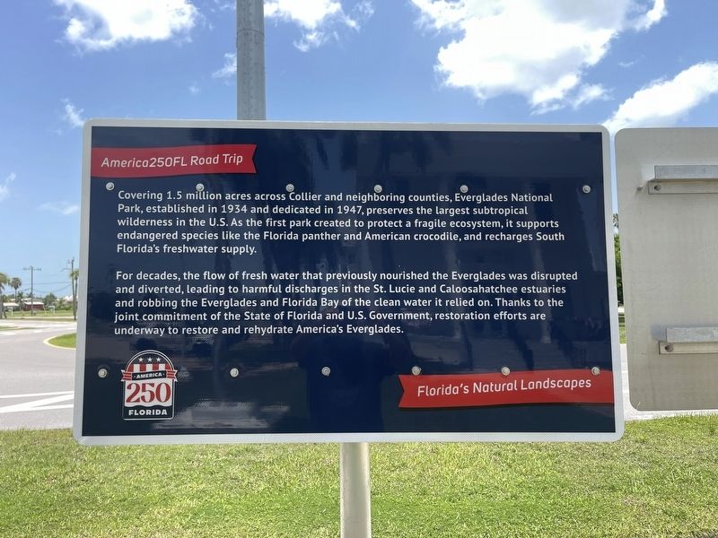
Covering 1.5 million acres across Collier and neighboring counties, Everglades National Park, established in 1934 and dedicated in 1947, preserves the largest subtropical wilderness in the U.S. As the first park created to protect a fragile . . . — — Map (db m306926) HM
Barron G. Collier Founder of Collier County Admired for talents Esteemed for vision Beloved for kindness Whom the nation owes the Tamiami Trail Erected by Board Commissioners Collier County To commemorate opening of the Tamiami . . . — — Map (db m213651) HM
This pleasant 4-lane avenue was laid out in 1923. An electric streetcar ran from Dupont down Copeland Avenue and then along Broadway to the river.
The median had a goldfish pond and dish were replaces frequently after the raccoons feasted on . . . — — Map (db m213485) HM
Bulit in 1923, the first Collier County jell was located on this site, the southwest corner of the Circle. It was a small, wooden structure that housed a few dozen inmates on the first floor and included living accommodations for the sheriff and . . . — — Map (db m267644) HM
Hours: April to November 9:00-4:4:30
November to April 8:00 -4:30
Come upstairs to the National Park visitor center for information, park maps, exhibits, videos and more!
Along
The Tamiami Trail
Things to see and do (From West to . . . — — Map (db m106245) HM
This building was completed by April 1940 on land donated in May 1939 by the estate of Barron Gift Collier, founder of the county which bears his name and its largest landholder. The congregation at that time was Presbyterian, officially . . . — — Map (db m309606) HM
Everglades National Park is known for stunning wildlife viewing and it unique mix of temperature and topical plants and animals. Its diverse habitat are a refuge for many endangered species. Take time to discover this subtle landscape by walking . . . — — Map (db m309604)
Monday, October 24, 2005
In the hours before dawn Hurricane Wilma made landfall just a few miles Northwest of Everglades City at Cape Romano.
Leaving Mexico's Yucatan Peninsula as a Category I storm, she moved into Southwest Florida as a . . . — — Map (db m213650) HM
The Ochopee area was founded in 1928 as a tomato farming community and included a prosperous town of homes, packing house, and a general store with Post Office (established in 1932).
This building was originally a cattle barn and then became a . . . — — Map (db m184177) HM
This building was completed in 1928 to be the first seat of government for Collier County which was founded in 1923 by entrepreneur and landowner Barron Gift Collier. The Town of Everglades was also headquarters for the building of the Tamiami . . . — — Map (db m309607) HM
The first permanent white settlers arrived in this region in the late 19th century. A community dependent on hunting, fishing, and farming soon emerged. The land upon which Everglades City now stands was acquired in 1921-22 by Barron Collier, a . . . — — Map (db m309605) HM
The Atlantic Coast Line Railroad (ACL) ran between Immokalee (40 miles north) and Everglades from 1928 to 1956. It carried passengers as well as freight and was an important link for the tomato farms in the area.
The station, in typical . . . — — Map (db m190702) HM
This site was the home of William Smith Allen who settled here in the 1870s. He sold the property to George Storter, Jr., in 1889 and it was expanded to include a Post Office, trading post, and warehouses for the thriving sugar cane syrup trade. . . . — — Map (db m190547) HM
The Tamiami Trail links the two great cities for which it was named -- Tampa and Miami. It bridges the Everglades, tying together south Florida’s Atlantic and Gulf coasts.
Its official opening on April 28, 1926, by Governor John W. Martin . . . — — Map (db m115634) HM
On February 22, 1936, this pine hammock was the site of a conference attended by about 275 Seminoles and several representatives of state and local governments. Florida's New Deal governor, David W. Sholtz (1933-37), had aided the state's economic . . . — — Map (db m190699) HM
The Bank received its charter in 1923 and moved into this impressive building in 1927. It was designed by William O Sparklin who was also the architect for the Court House. There were offices on the second floor.
After the Bank moved to . . . — — Map (db m213483) HM
Imagine alligator relatives dating back to the days of dinosaurs, over 150 million years ago. Gators today still look similar to their 50 foot long relatives. Present day American alligators can grow to over 15 feet and many weigh up to 1,000 . . . — — Map (db m106227) HM
Rain-the Swamp's Lifeblood
Nearly 55 inches of rain falls here annually-drenching Big Cypress National Preserve during the summer wet season.
The fresh water flowing through the national preserve replenishes the local aquifer and sustains . . . — — Map (db m106230) HM
The watery areas of Big Cypress National Preserve attract colorful flocks of long-legged wading birds that sweep across the shallow wetlands stalking their prey, while other waterbirds dive below the surface to search for food.
Anhingas . . . — — Map (db m106235) HM
Invasive species are destructive or aggressive plants and animals that greatly alter the natural balance of native area. They out compete native species for resources and reduce biodiversity.
Invasives are extremely expensive to eradicate and . . . — — Map (db m106233) HM
Things to see
Cypress Knees
Cypress trees sprout curious
Appendages called knees. They are believed to help stabilize the parent tree in swamp environments.
Florida Panther
The solitary Florida panther ranges throughout a wide . . . — — Map (db m106231)
Considered to be the smallest post office in the United States, this building was formerly an irrigation pipe shed belonging to the J. T. Gaunt Company tomato farm. It was hurriedly pressed into service by postmaster Sidney Brown after a disastrous . . . — — Map (db m90091) HM
He laid the foundation of the National Park Service. Defining and establishing the policies under which its areas shall be developed and conserved unimpaired for future generations. There will never come an end to the good that he has done. — — Map (db m213487) HM
The watery forest was born from a slow-moving creek whose waters rise and fall year after year, flooding the shallow banks and then withdrawing.
Here brown waters reflect the tall trees, Spanish-moss and clouds in the sky. Alligators, birds and . . . — — Map (db m100647)
Wildlife & You How you behave can save The thrill of watching an animal in it native surroundings can be spectacular and awe inspiring. The memories made while experiencing such events can last a lifetime, and so can your actions.While visiting . . . — — Map (db m106229)
Shortly after Florida became a state in 1845, its leaders began to consider draining the swampy areas of south Florida to create prime farmland as an inducement to settlement. In 1850 Florida received title to all swamp and overflowed lands within . . . — — Map (db m16414) HM
In the Ortona cemetery, eight miles west of here, lie the remains of a noble citizen of the Seminole Tribe of Florida, a faithful representative of his people and a true friend of the white man. — — Map (db m218232) HM
This monument from the people of Glades County Florida is dedicated to the Men and Women who served honorably in all parts of the world to defend our nation’s freedom and preserve the dignity of the human spirit. It is beyond our capability to . . . — — Map (db m224273) WM
The Okeechobee Hurricane of 1928 was the most deadly hurricane ever to strike the state of Florida. An estimated 2500 persons in South Florida died when the storm came ashore on September 16, 1928 near the Jupiter Lighthouse and traveled west across . . . — — Map (db m128832) HM
Started 1932 Completed 1938
Herbert Hoover Dike
During the 1926 and 1928 hurricanes, 2500 lives were
lost in the Lake Okeechobee area due to inadequate flood control.
President Herbert Hoover personally supported and was . . . — — Map (db m276761) HM
The combined pressure of growing white settlement in Florida and federal policy of relocating Indian tribes west of the Mississippi sparked the outbreak of the 2nd Seminole War in 1835. Controlling the coasts and campaigning in the heart of Seminole . . . — — Map (db m128831) HM
The men and women of Labelle’s Volunteer Firefighters thoughtfully named this 1953 Ford fire truck "Old Betsy." "Old Betsy" was in service 1953-2006, housed in what is now the Firehouse Community Theatre. The late Jimmy Pendry, Fire Chief (1953), . . . — — Map (db m218721) HM
As proclaimed by the City Commissioners of LaBelle that July 26 will be deemed as Fallen Heroes Day to honor the sacrifice of those who have given their lives in service to their country.
Robert Hammett
KIA Jun 24 2008
Army CWO Iraq . . . — — Map (db m224343) WM
Abney, David B., Sr - Army • Alexander, Norman F. - Army • Allen, William D. - Army • Amey, Edwin V. – Army • Anderson, Archie • Anderson, Leonard • Awbrey, Michael H. - Marines • Bailey, Duke B. - Army • Baker, Bob - Marines • Baker, Carl - Army . . . — — Map (db m224274) HM WM
In 1895, prominent landowner and cattleman Captain Francis A. Hendry (1833-1917) platted a townsite at LaBelle, which was first settled as a center for cattle and citrus industries. A post office, general store, school, and a church were . . . — — Map (db m72614) HM
Designed and built in 1938 by inventor Edward Christopher Warren, former associate of famed inventor Nicola Tesla, to install in a 114 foot shuttle yacht “Navette,” originally commissioned by financier J. Pierpont “Jack” Morgan and built by . . . — — Map (db m239974) HM
LaBelle's history begins here, along the Caloosahatchee River, on this old Fort Thompson site. Fort Thompson began c.1838 as a military post during the 2nd Seminole War, named for Lt. Colonel Alexander Thompson, who died in the battle of Okeechobee . . . — — Map (db m127268) HM
Nicholas J Cutinha
SP4 US Army
CO C BN 9 Inf Reg25 Inf Div
Vietnam
Medal of Honor Bronze Star Medal Purple Heart
Jan 23 1945 † Mar 2 1968
On March 2 1968, Nicholas J Cutinha was
engaged by overwhelming Vietnam Cong . . . — — Map (db m221290) WM
You Are Not Forgotten
Since World War I, more than 82,000
American soldiers are unaccounted for.
This unoccupied seat is dedicated to the
memory of those brave men and
women and to the sacrifices each made
in . . . — — Map (db m221282) WM
The huge drainage basin that supplies the Everglades with water begins 240 miles north, near Orlando, Florida. Prior to man's intervention, Lake Okeechobee overflowed its banks during the wet season, initiating the summer pulse of water that fed . . . — — Map (db m292707) HM
On this site, which was officially known as the Florida City Shelter of the Catholic Welfare Bureau’s Children’s Program, thousands of Operation Pedro Pan children found refuge from Communist Cuba between 1961 and 1966. Operation Pedro Pan . . . — — Map (db m71917) HM
Through the collective recognition of the community of nations
expressed within the principles of the
convention concerning protection of the world,
cultural and natural heritage
Everglades National Park
has been designated a . . . — — Map (db m213490) HM
United Nations Educational Scientific and Cultural Organization MAB Program on Man and the Biosphere By Decision of the Bureau of the International Coordinating Council of the Program on Man and the Biosphere, duly authorized to that . . . — — Map (db m213494) HM
First Baptist Church has been designated a City of Homestead Historic Landmark
This building, constructed in 1944, replaced a wooden structure constructed in 1912 at the same location. It is the only remaining neoclassical structure in downtown . . . — — Map (db m73366) HM
Historic Site
First United Methodist Church
Dedicated November 25, 1951
Designated by the
Historic Preservation Board of
the City of Homestead, Florida
1992 — — Map (db m73275) HM
Historic Town Hall has been designated a National Historic Landmark.
This building was designed by Miami architect H. Hastings Mundy and built in 1917. As the Homestead Town Hall, it housed the City Fire Department, the Police Station and the . . . — — Map (db m73367) HM
Palm Lodge was built in 1912 for Colonel Henry Wallace Johnston, a hardware merchant from Lebanon, Kentucky. Col. Johnson planted an avocado grove and experimented with specimens of tropical fruits and flowers. One of his specialties was the . . . — — Map (db m142235) HM
The Redland District, named for the color of its soil, was settled in the early 1900s. Dan Roberts, Claude Jenkins and George Kosel were the first pioneers to file homestead claims in Redland. The pioneer community was concentrated along Redland . . . — — Map (db m73271) HM
He laid the foundation of the National Park Service. Defining and establishing the policies under which its areas shall be developed and conserved unimpaired for future generations. There will never come an end to the good that he has done. — — Map (db m213488) HM
has been designated a
City of Homestead Historic Landmark
This building, built by W.D. Horne as the Homestead Inn, was originally constructed in 1904 and reconstructed several times after that. It served as a supply store and rooming house . . . — — Map (db m73274) HM
The Seminole Theater has been designated a City of Homestead Historic Landmark
This building, originally constructed in 1921, was subsequently restored in 1940 with an Art Deco facade following a devastating fire. The theatre was mainly used as . . . — — Map (db m73365) HM
W.K. Walton built this home circa 1919. Walton planted four acres of avocados and eventually established one of the first commercial avocado nurseries in south Dade. This wood frame, stucco covered residence is designed in the style of an English . . . — — Map (db m72983) HM