265 entries match your criteria. Entries 201 through 265 are listed.⊲ Previous 100
Idaho State Historical Society Historical Markers
Markers of the Idaho Highway Historical Marker Program administered by the Idaho State Historical Society in cooperation with the Idaho Transportation Department.
On Oak Street (State Highway 162) at 6th Avenue, on the left when traveling north on Oak Street.
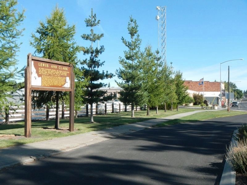
On their eastbound journey, the Corps of Discovery and several Nez Perce reached the Nezperce Prairie from present-day Peck on May 8, 1806, and camped on "a Small hansom Stream".
On May 9 the party arrived at the root-digging camp of . . . — — Map (db m140898) HM
On U.S. 95 at milepost 286, on the left when traveling north.
Seven tunnels - one a horseshoe more than a quater mile long -- had to be blasted in this canyon so that a railroad could be completed to Grangeville in 1908. Building a railroad up this canyon was exceptionally difficult and expensive. . . . — — Map (db m121219) HM
On State Highway 75, 0.9 miles south of West Magic Road, on the right when traveling north.
Completed in 1910 at a cost of $3,000,000 Magic Dam stores water for 89,000 acres of irrigated farms near Shoshone and Richfield.
Rising 129 feet high, it is 700 feet wide.
An adjacent 1600-foot embankment with a concrete spillway helps . . . — — Map (db m109633) HM
On U.S. 93, 0.2 miles south of State Highway 24, on the right when traveling north.
Historic District of Branch rail lines to Wood River and Camas Prairie served distant farmers and miners, while a stage line to Shoshone Falls accommodated wealthy tourists who visited Idaho’s foremost nineteenth century attraction.
Vast sheep . . . — — Map (db m109628) HM
On State Highway 33 at Plano Road, on the right when traveling east on State Highway 33.
Beaver Dick
This park is named for “Beaver Dick, “ a mountain man of late fur trade days, who lived on in this locality until 1899.
He was born in England, and his real name was Richard Leigh. He came west as a trapper, but the . . . — — Map (db m103902) HM
Brigham Young University - Idaho had its beginning in 1888 as an academy affiliated with The Church of Jesus Christ of Latter-Day Saints.
Initially known as Bannock Stake Academy. It was renamed Fremont Stake Academy, Smith Academy, and Ricks . . . — — Map (db m35477) HM
On State Highway 33, 1.5 miles east of Butte Road, on the right when traveling east.
Menan Buttes
Two cones of glassy lava are located directly south of here. The largest rises 800 feet above the surrounding plain.
Hot molten lava, erupting from great depth, met cold surface water in the wet flood plain of Snake river: the . . . — — Map (db m103901) HM
On State Highway 33 at Plano Road, on the right when traveling east on State Highway 33.
The Three Tetons
The giant peaks to the southeast were a famous early western landmark known to fur hunters and mountain men.
Perhaps as early as 1819, French-speaking trappers were calling them the Trois Tetons - - the three breasts. More . . . — — Map (db m103907) HM
On State Highway 24 at milepost 10 at North 374 Lane East, on the right when traveling east on State Highway 24.
An important pioneer federal reclamation dam and power plant provides water and electricity for farms and cities nearby.
Constructed 5 miles east of here between 1904 and 1906 at a cost of $675,000, Minidoka Dam diverts water into . . . — — Map (db m124027) HM
On 100 South Road (State Highway 25) near 1150 West Road, on the right when traveling east.
Camp Rupert was the largest prisoner of war camp in Idaho. Housing some 4000 POWs most were German and Italian.
The Camp was built at an initial cost of $500,000 and maintained by nearly 1000 army personnel and civilians. Over 170 buildings . . . — — Map (db m138488) HM
On U.S. 95 at Lyle Gulch Road, on the right when traveling north on U.S. 95.
A chapel was built a mile up Mission Creek in 1868, but a permanent location was not established until construction of Saint Joseph’s Mission was completed at a more secluded site in 1874.
It now is open to visitors as a part of Nez Perce . . . — — Map (db m109654) HM
On U.S. 12 at milepost 11 near U.S. 95, on the right when traveling east.
According to a Nez Perce Indian legend the stone arch up the hill was once two fighting insects.
Ant and Yellowjacket had an argument and came to blows over who had the right to eat dried salmon here. Fighting fiercely, they failed to notice . . . — — Map (db m121412) HM
On U.S. 95 at milepost 300 at South Tom Beall, on the right when traveling north on U.S. 95.
Henry Harmon Spalding established Idaho’s earliest mission near here, Nov. 29, 1836, at a site chosen by the Nez Perce Indians.
Ever since they met Lewis and Clark in 1805-6, the Nez Perce had wanted to find out more about the white mans . . . — — Map (db m121638) HM
On U.S. 95 at milepost 295 near Elk Horn Lane, on the left when traveling north.
“A bluff jolly good fellow.” He joined the rocky mountain fur trade in 1829, married a Nez Perce in 1838, and settled with the Lapwai Band in 1840.
In 1850 the Oregon Donation Land Act gave free farms to pioneers who had come to . . . — — Map (db m121592) HM
On Highway 12 at 5th Street, on the right when traveling west on Highway 12.
Lewiston's first bridge across the Clearwater River
was constructed in 1913 and replaced in 1951.
Early efforts for a bridge were opposed by ferryboat owners, but other business leaders recognized the need for a link to northern . . . — — Map (db m109711) HM
On U.S. 12, 1 mile east of Nez Perce Road, on the right when traveling east.
Coyote, the all-powerful animal spirit, was having a good time until Black Bear, the busybody, began to tease him.
Finally losing his temper, Coyote tossed his huge fishnet onto the hills across the river.
To teach Black Bear a lesson, Coyote . . . — — Map (db m109727) HM
On U.S. 12 at 5th Street, on the right when traveling west on U.S. 12.
Pioneer businessman and politician,
he owned and operated ferries in the Lewiston and Spokane areas.
Early in the 1860’s, John Silcott ran a ferryboat across the Snake River at Lewiston.
He soon put in a ferry across the Clearwater River . . . — — Map (db m109713) HM
On U.S. 95, 3 miles south of Old Spiral Highway, on the right.
Lewis Clark State College was created by the legislature in 1893 as a two year normal school to train teachers.
After more than half a century of growth, Lewiston State Normal School expanded into a four-year college in 1947.
An area . . . — — Map (db m109721) HM
On Old Spiral Highway at Beacon Drive, on the left when traveling west on Old Spiral Highway.
When automobile traffic made steep old wagon roads obsolete, a remarkable new highway grade was built down this hill in 1917.
With a series of sharp curves that let cars go 20 or 30 miles an hour -- a good speed for that time -- a gradual . . . — — Map (db m121917) HM
Near D Street near Dike Bypass, on the right when traveling west.
The discovery of gold in 1860 and the founding of Lewiston in 1861 attracted many Chinese to the area.
By 1870 approximately 1500 Chinese lived here. They worked as merchants, laborers, laundrymen and vegetable farmers. Exhausted gold fields, . . . — — Map (db m121808) HM
On U.S. 95, 3 miles south of Old Spiral Highway, on the right when traveling south.
Disappointed to find that beaver were unavailable in this area, he built only a store and two houses out of driftwood.
Then the War of 1812 and Indian trouble tangled his plans; in May 1813 he abandoned this site, since Astor’s venture had failed . . . — — Map (db m109724) HM
On U.S. 12, 1 mile east of Nez Perce Road, on the right when traveling east.
Two styles of houses were used. Some were fairly square with interior benches dug out for use by a family or two.
Others were round – 20 to 30 feet wide and two to three feet deep – but lacked benches.
This village reached its height . . . — — Map (db m109725) HM
On U.S. 12, 2 miles east of U.S. 95, on the right when traveling east.
Spalding began his mission and school nearby, but moved here in 1838.
Believing in secular as well as religious teaching, he taught the Indians irrigated farming, brought in the Northwest’s first printing press, and built saw and flower mills.
But . . . — — Map (db m109729) HM
On Old Spiral Highway at Beacon Drive, on the left when traveling west on Old Spiral Highway.
Started May 13, 1861, as a steamboat landing, Lewiston immediately became a primary commercial center for Idaho miners during their hectic gold rush to Pierce that spring. Steamboats continued to dock there until 1940, mainly after Columbia . . . — — Map (db m121918) HM
On U.S. 95, 3 miles south of Old Spiral Highway, on the right when traveling south.
When Lewiston served as the capital, Idaho Territory included modern Montana and practically all of Wyoming – an area much larger than Texas.
Then in 1864, after Montana was established as a separate territory and most of Wyoming was attached . . . — — Map (db m109720) HM
On 1st Street at Capital Street, on the left when traveling north on 1st Street.
When the Nez Perce named this site, they viewed a desolate yet beautiful landscape.
Near a large island at the confluence, crystal waters from the Clearwater joined the murky flow of the Snake. Scattered willows grew along the broad river . . . — — Map (db m121810) HM
On Rockland Highway at County Road 002, on the right when traveling south on Rockland Highway. Reported damaged.
This was a major campground in the days of the California Gold Rush after Hudspeth's Cutoff brought the trail by here in 1849
Except in wet seasons, there was no water for 22 miles to the east. Parties often had to travel late into the . . . — — Map (db m124142) HM
On Interstate 84 at milepost 269, on the right when traveling north.
20,000 years ago, this land was under water. Not far to the north, you can see the old shore of Lake Bonneville. Formed in a basin from which no river reached the ocean, this became the largest lake in North America. Finally the lake rose high . . . — — Map (db m32888) HM
On State Highway 55 at milepost 3,, 0.1 miles east of River Front Drive, on the left when traveling west.
In 1888 George Froman built a ferry about a mile downstream from here. It operated until a bridge was built here in 1921.
The ferry barge was connected by ropes to a pulley which slid along a cable spanning the river. By angling the barge into . . . — — Map (db m26192) HM
On I.O.N. Highway No. 456 (U.S. 95 at milepost 14) near Summer Camp Road, on the left when traveling south.
The name applied to these mountains and the whole surrounding region is an outdated spelling of the word "Hawaii".
Fur-trading ships brought Hawaiian natives -- then called "Owyhees" -- to the Northwest. In 1818, Donald Mackenzie brought the . . . — — Map (db m110212) HM
On State Highway 45 at milepost 10,, 0.5 miles south of Ferry Road, on the right when traveling south.
The boat was built in 1866 to provide easy river travel for a part of the route from the Columbia to Boise and Silver City. It was intended to ply 105 miles between here and Old's Ferry. Once it even explored the river for 60 miles above here, . . . — — Map (db m32175) HM
On Marsing Murphy Road (State Highway 78) at Silver City Road, on the left when traveling west on Marsing Murphy Road.
In December, 1865, Idaho's Governor -- Caleb Lyon of Lyonsdale -- set off a wild rush to Diamond Gulch, visible a few miles west of here, with as story that was to good to be true.
He told miners in Silver City that a prospector had given . . . — — Map (db m110187) HM
On Murphy Grandview Road (State Highway 78) at Wees Road, on the left when traveling west on Murphy Grandview Road.
On September 9 & 10, the Utter Wagon Train engaged in a life-and-death struggle with attacking Indians.
The assault on the wagon train of forty-four emigrants led by Elijah P. Utter just north of here resulted in the death of six men, two . . . — — Map (db m110183) HM
On Marsing Murphy Road (State Highway 78 at milepost 34) at Silver City Road, on the left when traveling west on Marsing Murphy Road.
For decades after 1884, most of Silver City's fabulous mineral wealth came from Upper War Eagle Mountain, which rises a vertical mile above here.
With lodes far richer than those found elsewhere, War Eagle miners fought a series of violent . . . — — Map (db m110186) HM
On Interstate 84 at milepost 1,, 1.9 miles north of U.S. 95, on the right when traveling east.
Long before fur hunters explored here in 1811, an annual Indian salmon festival was held each July in this area.
Indian peoples came great distances to trade, celebrate, and arrange intertribal marriages. Cheyenne and Arapaho bands brought . . . — — Map (db m23197) HM
On Interstate 84 at milepost 1,, 1.9 miles north of U.S. 95, on the right when traveling east.
The valley of the Snake, historic passage from the Midwest to the Northwest, has been a primary route for travel since the days of Indians and fur traders.
The Oregon Trail forded the river at Old Fort Boise, the Hudson's Bay Company 12 miles . . . — — Map (db m23195) HM
On Southeast Avenue (U.S. 30) at Elm Street on Southeast Avenue.
In 1894, the National Irrigation Congress designed a model town and canal system. New Plymouth was founded to demonstrate it, and farming began here in 1896.
Organizers and settlers came from Cleveland, Boston and Chicago to try out their . . . — — Map (db m119313) HM
Near 6th Avenue South near South 8th Street, on the right when traveling east.
This park memorializes the Pacific Northwest's most successful French Canadian fur trapper, for whom this city and county are named.
In 1812, he came from Quebec to the Columbia at the age of 18. Moving inland to the Snake country in 1818, . . . — — Map (db m119320) HM
On Harrison Street near Bannock Avenue, on the left when traveling east.
The town is named for the nearby falls of Snake River, a famous landmark for fur trappers and early western travellers (sic).
The Oregon Trail passed close to the falls, which had been named in contrast to "Canadian Falls" -- now known as . . . — — Map (db m124074) HM
Near Aberdeen Highway (Highway 39 at milepost 3) at Lamb Weston Road, on the right when traveling north.
More than two decades before American Falls Dam was built, water power was generated in a series of plants at America Falls.
Starting with an island plant to serve Pocatello in 1902, this superlative site was utilized soon after long . . . — — Map (db m124073) HM
Near Interstate 86 at milepost 18 near Cold Water Road, on the right when traveling east.
Early California and Oregon Trail Ruts -- left by thousands of emigrant wagons as they ascended this bluff -- still are visible below this viewpoint.
In 1859 F.W. Lander's wagon road builders dug and improved grade that shows more clearly. . . . — — Map (db m123842) HM
On Interstate 86 at milepost 30 near Register Road, on the right when traveling west.
Immediately west of here you will cross a small canyon that Oregon Trail emigrants regarded as their most dangerous exposure to Indians.
After 1854, they had good reason to be alarmed. Wagon traffic has ruined important traditional Indian . . . — — Map (db m124148) HM
On West Cameron Avenue at Bunker Avenue, on the right when traveling east on West Cameron Avenue.
With a grubstake of one jackass and $18.75 worth of flour, bacon, and beans, Noah Kellogg came here prospecting in 1855.
Not far from here, his jackass strayed away. Kellogg finally found his wandering burro grazing on a tremendous . . . — — Map (db m122876) HM
On Interstate 90, 7.9 miles Exit 69 at Mullan, on the right.
In more than a century after rich lodes were discovered in 1884, this valley has become North and South America’s largest producer of silver.
More than 5 billion dollars worth of lead, silver, and zinc—including more than a billion ounces . . . — — Map (db m91487) HM
On Interstate 90, 7.9 miles east of Exit 69 at Mullan, on the right.
A spectacular avalanche, Feb. 10, 1903, swept away part of a trestle—300 feet high—that let Northern Pacific Railway trains descend from this pass since 1890.
An engine that plunged 80 feet was buried in 30 feet of snow; a passenger . . . — — Map (db m91447) HM
Near Interstate 90 at milepost 61 near Silver Valley Road (Old U.S. 10).
Founded as a mining town in 1884, Wallace became a railroad center in 1887 and the Shoshone County seat in 1898.
Rebuilt after a disastrous fire in 1890, Wallace has preserved its pioneer mining heritage. North Idaho's 2,000,000-acre forest . . . — — Map (db m27170) HM
On State Highway 33 near South 500 West, on the left when traveling south.
Teton Valley was known originally as Pierre's Hole. Rich in beaver, it was a favorite stamping ground for British and American fur traders and trappers between 1819-1840.
"Old Pierre" Tevanitagon, an Iroquois Indian fur trapper of the Hudson . . . — — Map (db m108457) HM
On State Highway 33 at milepost 136.5 at Trouts Ranch Road, on the left when traveling south on State Highway 33.
Discovered this valley in 1808 while exploring the Yellowstone and Upper Snake country in search of beaver.
Setting out all by himself with it gun and a 30 pound pack he tried to get the Indians to join in his trapping business. On his . . . — — Map (db m108352) HM
On State Highway 33 at milepost 136.5 at Trouts Ranch Road, on the left when traveling north on State Highway 33.
Flanked by rock formations more than 2 1/2 billion years old, these 3 granite peaks rose up less than 9 million year (ago), very new as mountains go. They are still rising.
Hinged at the base of the ridge before you, a block of rock 40 . . . — — Map (db m108353) HM
On U.S. 30 at milepost 190,, 0.6 miles north of N 1000 E, on the right when traveling north.
When John C. Fremont came this way mapping emigrant roads in 1843, he found an important Indian village at Fishing Falls (Kanaka rapids) about 4 miles above here. He reported that native salmon spearers there were "unusually gay...fond of laughter; . . . — — Map (db m31652) HM
On U.S. 30 at milepost 190,, 0.6 miles N 1000 E, on the right.
A scow powered by oarsmen let Oregon Trail wagons cross Snake River here from 1852 to 1870. Then Overland Stage service from Boise to a rail terminal in Kelton, Utah was moved to this crossing, and M.E. Payne installed a large (14 by 60 foot) new . . . — — Map (db m31653) HM
On U.S. 30 at milepost 187,, 0.1 miles Chisholm Drive, on the left when traveling north.
In 1812, Joseph Miller found 100 lodges of Indians spearing thousands of salmon each afternoon at a cascade below here. Each summer they dried a year's supply. After 1842, they also traded salmon to Oregon Trail emigrants. John C. Fremont marveled . . . — — Map (db m31597) HM
On U.S. 30 at milepost 187,, 0.1 miles south of Chisholm Drive, on the left when traveling north.
Old lava flow changed the geologic structure of this area and thus created a multitude of famous springs here. Over thousands of years, volcanic activity repeatedly spread lava over the Snake River plain, slowly forcing the river southward in a . . . — — Map (db m31595) HM
Near State Highway 50, 0.3 miles north of County Road E3900N, on the left when traveling north.
Until 1919, when a high suspension bridge was completed here, this 16-mile long river gorge could be crossed only in a rowboat. With 14 cables, each more than 900 feet long, a $100,000 suspension bridge was wide enough to accommodate two lanes of . . . — — Map (db m62131) HM
On U.S. 30 at milepost 227,, 0 miles east of Rock Creek Road, on the left when traveling east.
An 1864 overland stage station at Rock Creek, 5 miles south and a mile west of here, offered a desert oasis for 40 years before irrigated farming transformed this area. James Bascom's 1865 store and Herman Stricker's 1900 mansion have been . . . — — Map (db m31521) HM
On U.S. 30 at milepost 234,, 0.2 miles west of E 3500 N, on the right when traveling east.
In 1811 the Hunt party likened the terrific torrent of the Snake River three miles east of here to a boiling caldron, adding the the old Scottish word "linn," meaning a waterfall. They had lost a man and a canoe in a roaring chute upstream. . . . — — Map (db m31523) HM
On U.S. 93 at milepost 11 near 1900 East Road, on the right when traveling south.
Constructed in 1910 about 8 miles west of here, Salmon Dam was a spectacular early irrigation structure.
220 feet high, it blocks a narrow lava gorge of Salmon Falls Creek. Intended to create a large reservoir to irrigate desert lands . . . — — Map (db m125620) HM
On U.S. 93 at milepost 50,, 0.1 miles north of Bridgeview Road, on the right when traveling south.
In 1964, Twin Falls County voters established a community college, and Jerome County soon voted to join their college district. Started in 1965 as part of a state and national effort to expand local educational opportunity, College of Southern . . . — — Map (db m31519) HM
On U.S. 93 at milepost 50,, 0.1 miles Bridgeview Road, on the right when traveling south.
4 miles east of here, the Snake River falls in thunder 210 feet over a rocky ledge higher than famous Niagara. Indians, trappers, and travellers all knew the "Great Shoshonie." Now the waters upstream have been harnessed for irrigation and power, . . . — — Map (db m31520) HM
On State Highway 55 at milepost 115 at Old State Highway, on the left when traveling south on State Highway 55.
While hunting stolen horses on Aug. 20, 1878, WM. Monday, Jake Groseclose, Tom Healy, & "Three Finger" Smith were ambushed in a rocky basin 9/10 mile by road from here.
Monday and Groseclose were killed immediately, and Healy wounded; Smith, . . . — — Map (db m23231) HM
On State Highway 55 at milepost 95,, 3.3 miles south of Smiths Ferry Drive, on the left when traveling south.
Prior to the arrival of the railroad in 1912, the North Fork of the Payette River provided an avenue for logs destined to downstream mills in Horseshoe Bend and Emmett.
In 1903, $100,000 was spent to dynamite open a clear channel in the . . . — — Map (db m23233) HM
On State Highway 71 at milepost 2,, 10 miles west of Camp Creek Road, on the left when traveling north.
Guiding Oregon Trail emigrants and a party of prospectors who had discovered gold in Boise Basin, Tim Goodale opened a new miners' trail through here in August 1862.
A gold rush followed that fall, and John Brownlee operated a ferry here from . . . — — Map (db m23227) HM
On State Highway 71 at milepost 2,, 10 miles west of Camp Creek Road, on the left when traveling north.
More than a century ago, miners faced a hopeless problem of hauling copper ore to this canyon for shipment to smelters.
They started with Albert Kleinschmidt's road grade down from their mine, more than a vertical mile above Snake River, and more . . . — — Map (db m23228) HM
On U.S. 95 near Sage Creek Road, on the left when traveling north.
At the top of this hill 3 to 5000 years ago, Prehistoric men had a rock quarry where they made a variety of stone tools.
Projectiles, knives, and scrapers were among the tools made by these people who camped at the foot of the hill. These . . . — — Map (db m119369) HM
On U.S. 95 at milepost 82,, 0.1 miles south of Appleton Lane, on the right when traveling north.
The Weiser Valley provided an abundant environment for early hunters and food gatherers.
Archaeological excavation along Monroe Creek in conjunction with US-95 realignment yielded one of the most significant prehistoric sites in the . . . — — Map (db m23220) HM
265 entries matched your criteria. Entries 201 through 265 are listed above. ⊲ Previous 100