57 entries match your criteria.
National Natural Landmarks Historical Markers
Department of the Interior markers at sites possessing exceptional value illustrating the nation’s natural heritage and contributing to a better understanding of man’s environment.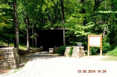
By Sandra Hughes, August 13, 2014
Cathedral Caverns Marker
| 1 ► Alabama, Jackson County, Woodville — Cathedral Caverns — |
| Near Cave Road, 0.7 miles east of Cathederal Caverns Road, on the left when traveling east. | |||
| 2 ► American Samoa, Vaifanua County, Vatia — Vai'ava Strait — |
| Near American Samoa Route 006. | |||
| 3 ► Arizona, Coconino County, Jacob Lake — Kaibab Squirrel Area — |
| On Arizona Route 67 at U.S. 89A, on the right when traveling south on State Route 67. | |||
| 4 ► Arkansas, Fulton County, Mammoth Spring — Mammoth Spring — National Natural Landmark — |
| Near U.S. 63 at Main Street (State Route 9), on the right when traveling north. | |||
| 5 ► California, San Bernardino County, Amboy — 92 — Amboy Crater — National Natural Landmark — |
| On Crater Road, 0.5 miles west of National Trails Highway, on the right when traveling west. | |||
| 6 ► California, San Bernardino County, Trona — Welcome to the Trona Pinnacles — ... a National Natural Landmark — |
| Near California Route 178. | |||
| 7 ► California, Shasta County, Burney — Burney Falls — |
| Near Highway 89, on the left when traveling north. | |||
| 8 ► California, Siskiyou County, Mt. Shasta — Mount Shasta — |
| Near West Alma Street near Maple Street when traveling south. | |||
| 9 ► Colorado, El Paso County, Colorado Springs, West Colorado Springs — A Priceless Gift — Garden of the Gods Park — |
| Near Garden Drive. | |||
| 10 ► Colorado, El Paso County, Colorado Springs, West Colorado Springs — Garden of the Gods Park — |
| On Gateway Road, on the right when traveling east. | |||
| 11 ► Colorado, El Paso County, Colorado Springs, West Colorado Springs — Time Frozen In Stone — Garden of the Gods Park — |
| Near Garden Drive. | |||
| 12 ► Colorado, Jefferson County, Morrison — Morrison Fossil Area — National Natural Landmark — |
| On West Alameda Parkway, 0.1 miles south of Hog Back Road (County Road 93), on the left when traveling south. | |||
| 13 ► Florida, Alachua County, Gainesville — Devil's Millhopper — Registered Natural Landmark — |
| Near Millhopper Road (NW 53rd Avenue), 0.2 miles east of NW 52nd Terrace, on the left when traveling east. | |||
| 14 ► Florida, Collier County, Naples — What Makes Corkscrew Swamp Special? — National Natural Landmark — |
| Near Rookery Lane north of Sanctuary Road West, on the left when traveling north. | |||
| 15 ► Florida, Wakulla County, Wakulla Springs — F-394 — Wakulla Springs Archaeological & Historic District — |
| Near Wakulla Park Drive, 0.5 miles north of Wakulla Springs Road (State Road 61). | |||
| 16 ► Idaho, Cassia County, Oakley — 344 — City of Rocks — |
| On State Highway 27 at milepost 1,, 0.2 miles north of 1800 South Road, on the right when traveling south. | |||
| 17 ► Illinois, Monroe County, Fults — Fults Hill Prairie — |
| On Bluff Road (County Road 3) 0.2 miles south of Kidd Lake Road, on the right when traveling west. | |||
| 18 ► Indiana, Crawford County, Marengo — Marengo Cave National Landmark — |
| Near State Road 64, 0.2 miles east of Main Street (State Road 66). | |||
| 19 ► Indiana, Fountain County, Covington — Portland Arch Natural Preserve — |
| Near West Scout Camp Road (County Road 600 N) 0.4 miles south of North Walnut. | |||
| 20 ► Indiana, Porter County, Dune Acres — Dune Creek Watershed: What Makes It Special? — |
| Near County Road 25E, 0.1 miles north of Indiana Dunes State Park Drive, on the right when traveling north. | |||
| 21 ► Indiana, Wabash County, Lagro — Hanging Rock — National Natural Landmark — |
| Near E. Hanging Rock Road, 0.8 miles east of State Road 524, on the left when traveling east. | |||
| 22 ► Kansas, Ottawa County, Minneapolis — Welcome to Rock City — |
| 23 ► Missouri, Oregon County, Koshkonong — Grand Gulf — |
| Near County Highway 378 at State Highway W. | |||
| 24 ► Missouri, Stone County, Branson — Marvel Cave — |
| On Foods Warehouse Lane, 0.2 miles west of Silver Dollar City Parkway, on the right when traveling east. | |||
| 25 ► Nebraska, Grant County, Hyannis — Nebraska Sand Hills — National Natural Landmark — |
| On Harrison Street just west of Grant Avenue, on the right when traveling west. | |||
| 26 ► Nevada, Clark County, Overton — Valley of Fire — |
| Near Visitor Center Road. | |||
| 27 ► New Jersey, Somerset County, Franklin Twp — William L. Hutcheson Memorial Forest — National Natural Landmark — |
| Near Amwell Rd (County Route 514). | |||
| 28 ► New York, Albany County, Albany — National Natural Landmark — |
| Near New Karner Road (New York State Route 155) at Old State Road. | |||
| 29 ► New York, Monroe County, Fairport — Hart's Woods — |
| Near Clarkes Crossing. | |||
| 30 ► Ohio, Ashland County, Loudonville — 6-3 — Clear Fork Gorge — A Feature of Ohio's Forests — |
| Near Gorge Overlook. | |||
| 31 ► Ohio, Champaign County, Urbana — Cedar Bog — |
| On Woodburn Road (County Road 91) 0.9 miles west of U.S. 68, on the right when traveling west. | |||
| 32 ► Ohio, Champaign County, Urbana — 6-11 — Cedar Bog Nature Preserve — |
| On Woodburn Road (County Route 91), on the right when traveling west. | |||
| 33 ► Ohio, Cuyahoga County, Walton Hills, Sagamore Hills Township — Tinker's Creek is Gorgeous — Cleveland Metroparks — |
| On Gorge Parkway, 1 mile west of Egbert Road, on the right when traveling west. | |||
| 34 ► Ohio, Fulton County, Archbold — Goll Woods — 100 Acres of Virginia Timber — |
| On County Road 26, 0.3 miles south of County Road F, on the right when traveling north. | |||
| 35 ► Ohio, Greene County, Clifton — Clifton Gorge Marker — The Old Trail Head — The Obscure Marker — |
| On Jackson Street, 0.1 miles south of St Rt 343 (Ohio Route 343), on the right when traveling south. | |||
| 36 ► Oregon, Lake County, Fort Rock — Fort Rock State Park — |
| Near County Road 5-11A west of Cabin Lake Road. | |||
| 37 ► Pennsylvania, Berks County, Kempton, Albany Township — Hawk Mountain Sanctuary — |
| On Hawk Mountain Road just north of Pennsylvania Route 895, on the left when traveling north. | |||
| 38 ► Pennsylvania, Carbon County, White Haven — Hickory Run Boulder Field — Hickory Run State Park — |
| Near Pennsylvania Route 534. | |||
| 39 ► Pennsylvania, Erie County, Erie, Millcreek Township — Presque Isle — |
| On Peninsula Drive, on the right when traveling north. | |||
| 40 ► Pennsylvania, Fayette County, Connellsville — Connellsville — Trail Map and Points of Interest — |
| Near Great Allegheny Passage (North). | |||
| 41 ► Pennsylvania, Lycoming County, Jersey Shore, Watson Township — Glacier to Gorge — An Incredible Diversion — Pine Creek Rail Trail — |
| Near Pennsylvania Route 44, 0.1 miles north of Furnace Run Road, on the left when traveling north. | |||
| 42 ► Pennsylvania, Philadelphia County, Philadelphia, Logan Square — Wissahickon Valley — 1868 — Parkway Museums District — |
| On North 18th Street just south of Vine Street, on the left when traveling north. | |||
| 43 ► Pennsylvania, Philadelphia County, Philadelphia, Roxborough — Park Directory — Wissahickon Valley Park — |
| On Wissahickon Bike Trail at Ridge Avenue (County Road 3009), on the left when traveling north on Wissahickon Bike Trail. | |||
| 44 ► Pennsylvania, Philadelphia County, Philadelphia, Wissahickon Valley Park — Forbidden Drive — 1869 — |
| On Forbidden Drive at Lincoln Drive, on the right when traveling west on Forbidden Drive. | |||
| 45 ► Pennsylvania, Philadelphia County, Philadelphia, Wissahickon Valley Park — Park Directory — Wissahickon Valley Park — |
| On Forbidden Drive just south of Valley Green Road, on the left when traveling north. | |||
| 46 ► Pennsylvania, Tioga County, Shippen Township — Pine Creek — Grand Canyon of Pennsylvania — |
| 47 ► Pennsylvania, Wayne County, Lake Ariel — Lake Lacawac — |
| 48 ► South Dakota, Charles Mix County, Pickstown, White Swan Township — Fort Randall Eagle Roost — |
| 49 ► South Dakota, Fall River County, Hot Springs — 680 — Mammoth Site of Hot Springs, SD — |
| On Bypass U.S. 18 near South 19th Street, on the right when traveling west. | |||
| 50 ► South Dakota, Harding County, Reva — The Castles — |
| Near Forest Road 31261, 0.2 miles south of Forest Road 3126. | |||
| 51 ► South Dakota, Roberts County, Browns Valley — 547 — Ancient River Warren Channel — |
| On an unnamed road, 0.2 miles east of State Highway 10, on the left when traveling east. | |||
| 52 ► South Dakota, Roberts County, Sisseton — Sieche Hollow — |
| 53 ► Vermont, Lamoille County, Stowe — Mount Mansfield Natural Area — National Natural Landmark — |
| Near Mount Mansfield Auto Toll Road, 4.5 miles Mountain Road (State Route 108). | |||
| 54 ► Virginia, Page County, Luray — Luray Caverns — |
| Near Cave Hill Road, 0.2 miles west of Lee Highway (U.S. 340), on the left when traveling west. | |||
| 55 ► Virginia, Page County, Luray — The Beautiful Caverns of Luray — Welcome to Luray Caverns — |
| Near Cave Hill Road, 0.2 miles west of Lee Highway (U.S. 211/340), on the left when traveling west. | |||
| 56 ► Washington, Whitman County, Steptoe — 31 — Steptoe Butte — The Evergreen State — |
| On U.S. 195, 0.4 miles south of Kerns Avenue (State Highway 23), on the right when traveling north. | |||
| 57 ► West Virginia, Greenbrier County, Caldwell — Confederate Saltpeter Works — Civil War Industrial Center — |
| On West Virginia Route 63. | |||