284 entries match your criteria. Entries 101 through 200 are listed.⊲ Previous 100 — The final 84 ⊳
Former U.S. Presidents: #34 Dwight D. Eisenhower Historical Markers
By Cajun Scrambler
Superdome Vietnam Wall Markers
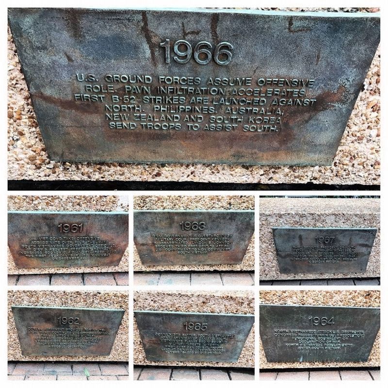
| 101 ► Louisiana, Orleans Parish, New Orleans, Central Business District — Superdome Vietnam Wall — |
| Near Sugar Bowl Drive near Poydras Street. | |||
| 102 ► Louisiana, Orleans Parish, New Orleans, Central City — Higgins Boat (LCVP) — |
| On St. Charles Avenue at Felicity Street on St. Charles Avenue. | |||
| 103 ► Louisiana, Orleans Parish, New Orleans, Navarre — Site Of Higgins' Industries at Delgado Trade School — |
| On City Park Avenue at North Anthony Street, on the right when traveling west on City Park Avenue. | |||
| 104 ► Louisiana, Rapides Parish, Alexandria — Central Louisiana Connection — |
| On Elliot Street at Fourth Street on Elliot Street. | |||
| 105 ► Louisiana, Rapides Parish, Alexandria — Louisiana Maneuvers — |
| On DeSoto Street north of 3rd Street, on the left when traveling north. | |||
| 106 ► Louisiana, Tensas Parish, Saint Joseph — Tensas Parish Veterans — |
| On Second Street near Hancock Street, on the right when traveling south. | |||
| 107 ► Louisiana, Vernon Parish, Leesville — Great Louisiana Maneuvers — |
| On 3rd Street north of East Lula Street, on the right when traveling north. | |||
| 108 ► Maine, Cumberland County, Cape Elizabeth — Looking South — Cape Elizabeth — |
| 109 ► Maryland, Anne Arundel County, Fort Meade — Eisenhower's Quarters — Fort George G. Meade — United States Army — |
| On Chamberlin Avenue, 0.1 miles north of 4th Street, on the right when traveling north. | |||
| 110 ► Maryland, Anne Arundel County, Fort Meade — The Tank School and Tank Corps — Fort George G. Meade — United States Army — |
| On Chamberlin Avenue at 4th Street, on the right when traveling south on Chamberlin Avenue. | |||
| 111 ► Maryland, Baltimore, Johns Hopkins Homewood — The 1958 Johns Hopkins University Commencement — |
| Near North Charles Street (Maryland Route 139) at East 32nd Street, on the left when traveling north. | |||
| 112 ► Maryland, Baltimore, Mid-Town Belvedere — Mount Royal Station — Icon for the Industrial Age — |
| On Cathedral Street. | |||
| 113 ► Maryland, Baltimore, Pigtown — The Car That Carried Ike on His Last Trip — C&O Baggage-Express Car No. 314 built by Pullman Car and Mfg. Co., 1929 — |
| On West Pratt Street. | |||
| 114 ► Maryland, Frederick County, Emmitsburg — Interstate and Defense Highways — |
| On South Seton Avenue (Business U.S. 15) 0.1 miles north of Old Emmitsburg Road, on the right when traveling north. | |||
| 115 ► Maryland, Frederick County, Myersville — The Dwight D. Eisenhower Highway — "Father of the Interstate Highway System" |
| On the West Welcome Center and Rest Area (Interstate 70) west of Exit 42 (Maryland Route 17), on the right when traveling west. Reported permanently removed. | |||
| 116 ► Maryland, Montgomery County, Silver Spring, Downtown Silver Spring — Veterans Plaza — |
| On Ellsworth Drive at Fenton Street, on the right when traveling north on Ellsworth Drive. | |||
| 117 ► Maryland, Montgomery County, Silver Spring, Layhill — Matthew Henson — A Lifetime of Exploration — |
| On Layhill Road (Maryland Route 182) north of Middlevale Lane, on the left when traveling north. | |||
| 118 ► Maryland, Prince George's County, Oxon Hill, National Harbor — Dwight D. Eisenhower — 1890 - 1969 — American Way Visonary — |
| Near Waterfront Street east of National Harbor Boulevard, on the right when traveling south. | |||
| 119 ► Maryland, Washington County, Hagerstown — Washington Confederate Cemetery — |
| Near South Potomac Street near E Memorial Drive. | |||
| 120 ► Maryland, Washington County, Hagerstown — Washington Confederate Cemetery — |
| On outh Potomac Street (Maryland Route 65), on the right when traveling north. | |||
| 121 ► Michigan, Berrien County, New Buffalo — Eisenhower Interstate System — |
| On Interstate 94. | |||
| 122 ► Michigan, Van Buren County, South Haven — Corporal Duane E. Dewey — |
| On Phoenix Street west of Broadway Street, on the right when traveling west. | |||
| 123 ► Minnesota, Dodge County, Dodge Center — Plowville — |
| On County Highway 34, 0.4 miles west of 220th Avenue (County Highway 9), on the right when traveling west. | |||
| 124 ► Minnesota, Steele County, Owatonna — Rock Island Railway Station 1901 — Owatonna, Minnesota 1985 — |
| On Riverside Drive, 0.1 miles north of Hillsdale Street, on the left when traveling south. | |||
| 125 ► Mississippi, Lawrence County, Monticello — 145 — J. B. Lenoir — |
| 126 ► Mississippi, Warren County, Vicksburg — 34 — President Dwight Eisenhower — Vicksburg Heritage Walking Trail — |
| On Cherry Street at Belmont Street, on the right when traveling south on Cherry Street. | |||
| 127 ► Missouri, Buchanan County, St. Joseph — Patee House - 1858 — The Pony Express — |
| On Penn Street at 12th Street, on the right when traveling east on Penn Street. | |||
| 128 ► Missouri, Gasconade County, Owensville — Operation Silent Witness — |
| On East Mcfadden Avenue west of North 1st Street, on the right when traveling west. | |||
| 129 ► Missouri, Lafayette County, Concordia — The Dwight D. Eisenhower Highway — "Father of the Interstate Highway System" — |
| 130 ► Missouri, Moniteau County, California — Eisenhower Green Ash — |
| On Main Street (Missouri Route 87) east of High Street, on the left when traveling east. | |||
| 131 ► Missouri, St. Louis County, Lemay — Jefferson Barracks - At the Confluence of American History — |
| On Mississippi River Greenway, on the right when traveling east. | |||
| 132 ► Nebraska, Dawson County, Gothenburg — The Pony Express — |
| On 15th Street, on the left when traveling east. | |||
| 133 ► Nebraska, Deuel County, Big Springs — The Pony Express — |
| On Pine Street at West Second Street on Pine Street. | |||
| 134 ► Nebraska, Keith County, Ogallala — Sand Hill Station — |
| On Lawrence Road at West Road 80, on the left when traveling north on Lawrence Road. | |||
| 135 ► Nebraska, Keith County, Ogallala — 8 — The Lincoln Highway — |
| On West First Street (U.S. 30). | |||
| 136 ► Nebraska, Platte County, Columbus — 424 — Andrew Jackson Higgins — (1886-1952) — |
| Near U.S. 30, 0.3 miles south of 6th St, on the right when traveling south. | |||
| 137 ► Nebraska, Platte County, Platte Center — 431 — Alfred Maximilian Gruenther — 1899-1983 — |
| On 4th Street just east of D Street, on the right when traveling east. | |||
| 138 ► Nevada, Carson City — "Pony" Bob Haslam — |
| On North Carson Street (Lincoln Highway) (Business U.S. 395) north of West Robinson Street, on the left when traveling north. | |||
| 139 ► Nevada, Carson City — Nevada Pony Express Centennial Reenactment Riders Monument — |
| On North Carson Street (Lincoln Highway) (Business U.S. 395) north of West Robinson Street, on the left when traveling north. | |||
| 140 ► Nevada, Douglas County, Genoa — The Pony Express — 1860 - 1960 ** 1861 - 1961 — |
| On Jacks Valley Road/Main Street (Nevada Route 206), on the right when traveling south. | |||
| 141 ► Nevada, Lander County, Austin — The Pony Express — |
| On Highway 50, on the right when traveling east. | |||
| 142 ► Nevada, Washoe County, Wadsworth — The Dwight D. Eisenhower Highway — "Father of the Interstate Highway System" — |
| Near Interstate 80. | |||
| 143 ► New Jersey, Burlington County, Bordentown — 50 Star Flag — |
| On Farnsworth Avenue (County Road 545) at Railroad Street, on the right when traveling south on Farnsworth Avenue. | |||
| 144 ► New Jersey, Mercer County, Trenton, Downtown — World War II Memorial — |
| On West State Street, 0.1 miles west of North Willow Street, on the right when traveling west. | |||
| 145 ► New Jersey, Middlesex County, Monroe Township, Whittingham — Eisenhower Tree — |
| On School House Road at Perrineville Road, on the right when traveling west on School House Road. | |||
| 146 ► New York, Cayuga County, Auburn — John Foster Dulles — Born 1888 - Died 1959 — |
| On South Street (New York State Route 34) 0.1 miles south of Logan Street, on the right when traveling south. | |||
| 147 ► New York, Monroe County, Brighton, Strong — The Genesee Expressway — |
| On Kendrick Road, on the left when traveling west. | |||
| 148 ► New York, Montgomery County, Amsterdam — Town of Florida Veterans Memorial — |
| On Fort Hunter Road (County Route 145) 0.6 miles east of New York State Route 161, on the left when traveling east. | |||
| 149 ► New York, New York County, Manhattan, Financial District — June 19, 1945 — ★ — |
| On Broadway just south of Exchange Alley, on the right when traveling south. | |||
| 150 ► New York, Orange County, West Point — Dwight David Eisenhower — 1890 – 1969 — Class of 1915 — |
| Near Washington Road, on the left when traveling north. | |||
| 151 ► New York, Orange County, West Point — The Hand of the Aggressor — |
| Near Howard Road, on the left when traveling north. | |||
| 152 ► New York, Queens County, Queens, Corona — New York Worlds Fair — 1939 - 1940 1964 - 1965 — New Amsterdam Entrance — |
| On Shea Road at Calvert Circle when traveling south on Shea Road. | |||
| 153 ► North Carolina, Currituck County, Corolla — Ray T. Adam's Landing Strip — |
| Near Ocean Trail (State Highway 12) at Club Road. | |||
| 154 ► Ohio, Athens County, Athens — Ohio University's Distinguished Visitors — |
| 155 ► Ohio, Belmont County, Belmont — The Dwight D. Eisenhower Highway — "Father of the Interstate Highway System" — |
| Near Interstate 70 at milepost 210, on the right when traveling east. | |||
| 156 ► Ohio, Carroll County, Minerva — 3-10 — Charles E. Wilson — |
| On Alliance Road Northwest (Ohio Route 183) 0.5 miles south of Bridge Street, on the right when traveling east. | |||
| 157 ► Ohio, Coshocton County, Coshocton — Ike & Dick — as told by Dan Moore in 2011 — |
| On Main Street just west of South 5th Street, on the right when traveling east. | |||
| 158 ► Ohio, Crawford County, Galion — 9-17 — Big Four Depot — |
| On Washington Street at Harding Way East (Ohio Route 61), on the right when traveling north on Washington Street. | |||
| 159 ► Ohio, Fairfield County, Lancaster — 5-23 — The Fifty Star Flag — A Symbol of America — |
| On Arbor Valley Drive, on the left when traveling north. | |||
| 160 ► Ohio, Franklin County, Columbus, Olentangy West — 69-25 — Jesse Owens — |
| 161 ► Ohio, Franklin County, Columbus, South Columbus — 110- 25 — Hanford Village — Although the highway divides us, our memories are never lost — |
| On South Nelson Road at Gault Street, on the right when traveling north on South Nelson Road. | |||
| 162 ► Ohio, Franklin County, Westerville — Veterans Memorial — |
| Near State Street (Ohio Route 3) 0 miles north of Bishop Drive, on the right when traveling north. | |||
| 163 ► Ohio, Guernsey County, Derwent — Eisenhower Interstate System — |
| On Interstate 77, on the right when traveling north. | |||
| 164 ► Ohio, Guernsey County, Old Washington — Eisenhower Interstate System — |
| On Interstate 70, on the right when traveling east. | |||
| 165 ► Ohio, Licking County, Hebron — Eisenhower Interstate System — |
| Near Dwight D. Eisenhower Highway (Interstate 70) 3.9 miles west of Cristland Hill Road (Ohio Route 596), on the right when traveling west. | |||
| 166 ► Ohio, Licking County, Hebron — Eisenhower Interstate System — |
| On Interstate 70 at milepost 130, on the right when traveling east. | |||
| 167 ► Ohio, Licking County, Pataskala — Veterans of Foreign Wars Post 3496 Veterans Memorial — |
| On Main Street (Ohio Route 310) at Front Street, on the right when traveling south on Main Street. | |||
| 168 ► Ohio, Montgomery County, Riverside — Resistance Fighters — |
| 169 ► Ohio, Muskingum County, Zanesville — Eisenhower Interstate System — |
| Near Dwight D. Eisenhower Highway (Interstate 70) 5 miles west of Ohio Route 82, on the right when traveling west. | |||
| 170 ► Ohio, Stark County, Louisville — 3-76 — Constitution Day — |
| On East Gorgas Street at South Mill Street, on the right when traveling west on East Gorgas Street. | |||
| 171 ► Ohio, Summit County, Twinsburg — "Eisenhower" Green Ash Tree — |
| 172 ► Pennsylvania, Adams County, Gettysburg — Dwight D. Eisenhower — |
| On North Washington Street (U.S. 15) at West Water Street, on the right when traveling north on North Washington Street. | |||
| 173 ► Pennsylvania, Adams County, Gettysburg — Dwight D. Eisenhower — 1890-1969 — |
| Near Carlisle Street at West Stevens Street. | |||
| 174 ► Pennsylvania, Adams County, Gettysburg — Gettysburg College's Majestic Theater — The Grandest Small-Town Theater in America — |
| On Carlisle Street (Business U.S. 15) just south of West Railroad Street, on the right when traveling north. | |||
| 175 ► Pennsylvania, Adams County, Gettysburg — Lincoln Square Building — Formerly Hotel Gettysburg — |
| On Lincoln Square. | |||
| 176 ► Pennsylvania, Adams County, Gettysburg — Presidents Attended Service Here — |
| On Baltimore Street (Business U.S. 15) at East High Street, on the right when traveling north on Baltimore Street. | |||
| 177 ► Pennsylvania, Adams County, Gettysburg — 94 — Temples of Mercy — American Presbyterian and Reformed Historical Site — |
| On Baltimore Street (Business U.S. 15) at East High Street, on the right when traveling north on Baltimore Street. | |||
| 178 ► Pennsylvania, Adams County, Gettysburg — The Camp Colt Officers Club — |
| On West Middle Street, on the right when traveling west. | |||
| 179 ► Pennsylvania, Adams County, Gettysburg — The History of Gettysburg College — |
| Near West Broadway, 0.2 miles west of College Avenue, on the left when traveling west. | |||
| 180 ► Pennsylvania, Adams County, Gettysburg — The Majestic Theater — |
| On Carlisle Street (Business U.S. 15) at Racehorse Alley, on the right when traveling north on Carlisle Street. | |||
| 181 ► Pennsylvania, Adams County, Gettysburg — The Office of a President — Dwight D. Eisenhower — |
| On West Stevens Street at Carlisle Street (Business U.S. 15), on the right when traveling west on West Stevens Street. | |||
| 182 ► Pennsylvania, Adams County, Gettysburg, Cumberland Township — A Herd of Modest Size — Eisenhower National Historic Site — National Park Service, U.S. Department of the Interior — |
| Near Eisenhower Farm Road. | |||
| 183 ► Pennsylvania, Adams County, Gettysburg, Cumberland Township — Ankonian has been invaluable. – President Eisenhower — Eisenhower National Historic Site — National Park Service — |
| Near Eisenhower Farm Road. | |||
| 184 ► Pennsylvania, Adams County, Gettysburg, Cumberland Township — Barlow and General Eisenhower — |
| On Taneytown Road (Pennsylvania Route 134) at Barlow Greenmount Road, on the right when traveling south on Taneytown Road. | |||
| 185 ► Pennsylvania, Adams County, Gettysburg, Cumberland Township — Barnyard Diplomacy — Eisenhower National Historic Site — National Park Service, U.S. Department of the Interior — |
| Near Eisenhower Farm Road. | |||
| 186 ► Pennsylvania, Adams County, Gettysburg, Cumberland Township — Camp Colt |
| Near Emmitsburg Road at Long Lane, on the right when traveling south. Reported permanently removed. | |||
| 187 ► Pennsylvania, Adams County, Gettysburg, Cumberland Township — Dwight D. Eisenhower Farmstead — |
| On Millerstown Road, 0.3 miles west of West Confederate Avenue, on the left when traveling west. | |||
| 188 ► Pennsylvania, Adams County, Gettysburg, Cumberland Township — Eisenhower National Historic Site |
| On Taneytown Road (State Road 134), on the right when traveling south. Reported missing. | |||
| 189 ► Pennsylvania, Adams County, Gettysburg, Cumberland Township — Follow in the Footsteps — Eisenhower National Historic Park — National Park Service, U.S. Department of the Interior — |
| Near Eisenhower Drive. | |||
| 190 ► Pennsylvania, Adams County, Gettysburg, Cumberland Township — Gettysburg National Military Park Museum & Visitor Center — |
| Near Gettysburg National Military Park, 0.6 miles east of Taneytown Road (Pennsylvania Route 134), on the right when traveling east. | |||
| 191 ► Pennsylvania, Adams County, Gettysburg, Cumberland Township — I shall leave the place better than I found it. — Eisenhower National Historic Site — National Park Service, U.S. Department of the Interior — |
| On Eisenhower Farm Road. | |||
| 192 ► Pennsylvania, Adams County, Gettysburg, Cumberland Township — Longstreet Tower - South View — |
| On West Confederate Avenue at Millerstown Road, on the left when traveling south on West Confederate Avenue. | |||
| 193 ► Pennsylvania, Adams County, Gettysburg, Cumberland Township — President Eisenhower’s Gettysburg Farm — Eisenhower National Historic Site — National Park Service, U.S. Department of the Interior — |
| On Eisenhower Farm Road, on the right when traveling south. | |||
| 194 ► Pennsylvania, Adams County, Gettysburg, Cumberland Township — Second best, he didn’t want. – Robert Hartley, herdsman — Eisenhower National Historic Site — National Park Service — |
| Near Eisenhower Farm Road. | |||
| 195 ► Pennsylvania, Adams County, Gettysburg, Cumberland Township — Secret Service Office — Eisenhower National Historic Site — National Park Service, U.S. Department of the Interior — |
| On Eisenhower Drive. | |||
| 196 ► Pennsylvania, Adams County, Gettysburg, Cumberland Township — The Guest House — |
| Near Eisenhower Drive. | |||
| 197 ► Pennsylvania, Adams County, Gettysburg, Cumberland Township — The Helicopter Landing Pad — Eisenhower National Historic Park — |
| On Eisenhower Drive, on the right when traveling south. | |||
| 198 ► Pennsylvania, Adams County, Gettysburg, Cumberland Township — The Pond — Eisenhower National Historic Site — National Park Service — |
| Near Eisenhower Drive. | |||
| 199 ► Pennsylvania, Adams County, Gettysburg, Cumberland Township — The Stables — Eisenhower National Historic Park — |
| Near Eisenhower Drive, on the left when traveling south. | |||
| 200 ► Pennsylvania, Adams County, Gettysburg, Cumberland Township — United States Army Tank Corps — |
| On Emmitsburg Road (Business U.S. 15), on the right when traveling north. | |||
284 entries matched your criteria. Entries 101 through 200 are listed above. ⊲ Previous 100 — The final 84 ⊳