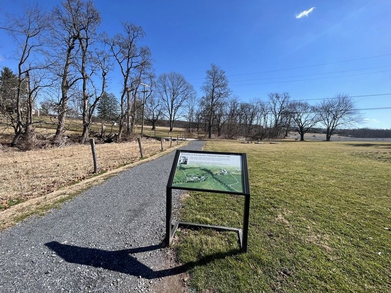
On Eisenhower Farm Road west of Emmitsburg Road (Business U.S. 15), on the right when traveling west.
This was a chance, I thought, to prove that careful husbandry could restore land to its original fertility…Although we haven't achieved the greatest success…there are enough lush fields to assure me that I shall leave the place . . . — — Map (db m217037) HM
Near Eisenhower Farm Road west of Emmitsburg Road (Business U.S. 15), on the right when traveling west.
This was a chance, I thought, to prove that careful husbandry could restore land to its original fertility…Although we haven't achieved the greatest success…there are enough lush fields to assure me that I shall leave the place . . . — — Map (db m217038) HM
Near Eisenhower Farm Road west of Emmitsburg Road (Business U.S. 15), on the right when traveling west.
This was a chance, I thought, to prove that careful husbandry could restore land to its original fertility…Although we haven't achieved the greatest success…there are enough lush fields to assure me that I shall leave the place . . . — — Map (db m217039) HM
Near Wexford Bayne Road at Stone Mansion Drive, on the right when traveling west.
Built by Robert G. Woodside (1876-1964) to resemble his father's ancestral Irish cottage. Woodside was an attorney, decorated war veteran, founder of the VFW, co-chair of American Battle Monuments Commission, Allegheny Co. Sheriff & Controller. . . . — — Map (db m78052) HM
Near Wexford Bayne Road at Stone Mansion Drive, on the right when traveling west.
Home of Robert G. Woodside (1876-1964). Decorated war veteran, attorney, American Battle Monuments Commission, founder of VFW, Allegheny Co. Sheriff & Controller. Awarded Medal of Freedom by Pres. Eisenhower in 1954. — — Map (db m78055) HM
On Main Street south of U.S. 6, on the right when traveling south.
1773 - 1917
16 December 1773 - "The Boston Tea Party"
19 April 1775 - "Shot heard round the world"
Lexington & Concord, MA
15 June 1775 - The first Continental Congress
elects George Washington as the first military
Commander in . . . — — Map (db m110397) HM WM
On North Street (Pennsylvania Route 903) 0.1 miles north of 13th Street, on the left when traveling north.
1887 · Born May 22 on the Sac and Fox Reservation near Belmont, Oklahoma Territory.
1904 · Enters Carlisle Indian School in Pennsylvania, scene of his brilliant career in college football.
1911 · First Team All-American Football Team at . . . — — Map (db m116566) HM
On North Street (Pennsylvania Route 903) 0.1 miles north of 13th Street, on the left when traveling north.
The Indian wars were over and the Army had moved the Indians to forts and reservations. A young Army officer named Richard Henry Pratt had taken part in the Indian fighting and subsequent subjugation of the Indians. His observations had caused . . . — — Map (db m116601) HM
On Hastings Road west of University Drive, on the right when traveling west.
Penn State in 1955 became the first university licensed by the Atomic Energy Commission to operate a nuclear reactor as part of U.S. President Dwight Eisenhower's "Atoms for Peace" program. Named for Wm. Breazeale, Penn State's first Professor of . . . — — Map (db m135648) HM
On Soldiers Drive south of Army Heritage Drive, on the right when traveling east.
The Beginning of the End
D-Day was the largest amphibious invasion ever recorded in history. It consisted of efforts from eight nations from the Allied powers: America, Great Britain, France, Canada, Poland, Denmark, Norway, and Greece. . . . — — Map (db m217159) HM
On West Main Street (U.S. 209), on the right when traveling east.
Built in 1854 by Jacob F. Eisenhower Grandfather of Dwight D. Eisenhower 34th President of the United States of America From this farm the family migrated to Kansas in the summer of 1878. — — Map (db m12495) HM
On Forster Street north of North Street, on the right when traveling north.
Bethel During the World Wars
When the Commonwealth purchased the State Street Church to extend the Capitol Complex, church leaders—Mr. C. Sylvester Jackson and his wife—purchased a lot on Briggs Street at Ash Avenue for a new sanctuary. . . . — — Map (db m134672) HM
On West King Street near US 11, N. Main Street, on the left when traveling west.
Was planted by the Veterans of Foreign Wars, Post 1599 in honor of all those men and women who served in the U.S. Armed Forces during World War II. This living memorial will stand as a humble reminder of the sacrifices and dedication of these men . . . — — Map (db m8115) WM
On Game School Road at Empire Ridge Road, on the right when traveling west on Game School Road.
Within State Game Lands 54 is the original site of the first academy in the nation devoted entirely to the training of Game Protectors, later known as Wildlife Conservation Officers. Established in 1932, it was an important component in the . . . — — Map (db m76761) HM
On Lackawanna Avenue at Maple Street, on the right when traveling north on Lackawanna Avenue.
Honor Roll
Mayfield Borough
In memory of our boys
who gave their lives
that we may live
• • •
World War One
Aleck Hrapchak • John Kulenich • John Powlack
Michael Tomasky • George Stafursky . . . — — Map (db m128154) WM
On Arch Street west of Benjamin Franklin Parkway, on the right when traveling west.
Bearing Witness
Dwight David Eisenhower, Supreme Commander of Allied Forces in Europe, wrote to General George Marshall of his trip to Ohrdruf Concentration Camp on April 12, 1945:
"The things I saw beggar . . . — — Map (db m192758) HM
On Walnut Street (County Road 3006) at South 8th Street, on the right when traveling west on Walnut Street.
The southwest corner of 8th and Walnut Streets, shown here in 1957, tells of an ever-changing Walnut Street. Built as townhomes for the elite, these buildings were later converted to commercial use as Walnut Street became an important link to the . . . — — Map (db m221068) HM
In August 1973, the U.S. Congress designated a cross-country stretch of Interstate as the “Dwight D. Eisenhower Highway,” in tribute to President Eisenhower’s early recognition of the need for a national network of highways to enhance . . . — — Map (db m7239) HM
On Lincoln Highway (U.S. 30) near South Market Street.
President Dwight D. Eisenhower, seen by 30,000 in Ligonier on September 26, 1958, climaxed his visit with a public address on this site. He sealed into the Century Chain the open Bicentennial Link, using as ax from the fort’s artifacts. The . . . — — Map (db m61087) HM
On Broad Road, 0.3 miles north of Church Road, on the left when traveling north.
The "Father of World Weightlifting" & founder of the York Barbell Club was the U.S. Olympic weightlifting coach, 1948-64; also actively promoted the sports of powerlifting & bodybuilding. Served as an official advisor on youth physical fitness for . . . — — Map (db m4607) HM
On Avenida de la Constitución/Constitution Avenue (State Highway 25/26) west of C.Reverendo Gerardo Dávila/Rev. Gerardo Dávila St., on the right when traveling east.
Prior to being sworn in, President Eisenhower served as a five star general in the United States Army, and through WW II as Supreme Commander of the Allied forces in Europe, where he was responsible for the successful invasion of France and . . . — — Map (db m193239) HM
On Wellington Avenue at Columbus Avenue, on the right when traveling west on Wellington Avenue.
Newport Harbor has been a center of commerce and industry since the days Narragansetts and Wampanoags, Native Americans, fished the waters of this bay. The first European explorer was Giovanni da Verrazzano, an Italian who sailed for the King of . . . — — Map (db m189621) HM
On Huger Street, 0.1 miles north of McDonald Street, on the left when traveling north.
John Birks "Dizzy" Gillespie was born in a house on this site on Oct. 21, 1917. His family lived here until they moved to Philadelphia in 1935. A founder of modern jazz, Gillespie was an innovative trumpeter and bandleader known for his bent . . . — — Map (db m28273) HM
On South Main Street at Broad Street on South Main Street.
"Old Glory" or "The Stars and Stripes" as our present day American flag is referred to, is the most recognizable symbol of freedom, unity and hope on earth. Our flag and its meaning are described in the lyrics of our national anthem, "The Star . . . — — Map (db m10861) HM
On Jackson Boulevard near Johnson Street, on the left when traveling south.
Activated in 1918 and inspected by Gen. Dwight D. Eisenhower and Lt. Gen. George S. Patton during World War II, the 8th landed in France 28 days after D-Day (the invasion of Normandy) and participated in three other campaigns during the war. The . . . — — Map (db m59249) HM
זכרר
Remember
(Star of David)
In Sacred
Memory
Of The
6,000,000
(Map Included)
(Left Panel)
During the Holocaust, 1933 - 45, six million European Jews were murdered by Nazi Germany and its . . . — — Map (db m44184) HM
On Federal Route 12, 0.2 miles W. 7th Street, on the right when traveling west.
Born at Arendal, Norway, January 22, 1904, and came to the United States when three years old, settling in Lincoln County near Canton. Taught history and speech at Webster High School, 1932 to 1935. Completed law course at University of South Dakota . . . — — Map (db m179945) HM
On Bakerville Road (County Road 570) 0.1 miles north of Sycamore Landing Road (County Road 1647), on the left when traveling north.
Born 1/2 mile north of here on June 17, 1921, William Robert Anderson was a 1943 graduate of the U.S. Naval Academy. He served during World War II and participated in 11 combat patrols in the Pacific. Anderson was the commanding officer of the first . . . — — Map (db m171327) HM
In 1956 Senator Albert Gore, Sr. authored legislation to create the largest public works project ever undertaken in the United States, the Interstate Highway System. The legislation was signed by President Dwight D. Eisenhower on June 29, . . . — — Map (db m18195) HM
392 Beale Avenue
"There were two types of
culture, I guess you could
say, on Beale Street.
There were the sinners
and there were the saved.
You had your professional
people, your doctors and
business folk. Then you
had those who . . . — — Map (db m107601) HM
On Beale Street east of South 4th Street, on the right when traveling east.
In 1952, Roberta Church became the first black woman in Memphis to be elected to public office and to the Tennessee Republican State Executive Committee. She served as an official in the administrations of Presidents Eisenhower and Nixon. In 1987, . . . — — Map (db m63290) HM
The C-121, so designated by the USAF in 1948, was developed from the C-69 military transport that had originated as a commercial transport for TransWorld and Pan American Airlines. The C-69's were assigned to Air Transport Command during the last . . . — — Map (db m31584) HM
Birthplace
October 14, 1890
of
Dwight David Eisenhower
President of the
United States of America
Presented to the People of Texas
by the
Eisenhower Birthplace Foundation
Amon G. Carter • Sid W. Richardson
Web Maddox • . . . — — Map (db m72845) HM
Thirty-fourth President of the United States; born here Oct. 14, 1890, third son of David J. and Ida Elizabeth Stover Eisenhower.
Dwight Eisenhower graduated from the U.S. Military Academy, 1915; in 1943, during World War II, was appointed . . . — — Map (db m215133) HM
On U.S. 59 south of Farm to Market Road 350, on the right when traveling south.
Businessman and politician William Pettus Hobby was born near this Moscow site, the son of Eudora Adeline (Pettus)and Edwin E. Hobby, a state senator and judge. At age 17, William joined the staff of the Houston Post and rose to managing editor at . . . — — Map (db m35316) HM
On East 1st Street at South Cedar Street (U.S. 285), on the left when traveling west on East 1st Street.
Nationally famed melon, originated in this city. Residents from 1880s grew melons in gardens, noting sun and soil imparted a distinctive flavor. Madison L. Todd (March 22, 1875-Sept. 10, 1967) and wife Julia (Jan. 30, 1880-Feb. 5, 1969) came here . . . — — Map (db m61270) HM
Near South Main Street north of Local Road 200S, on the right when traveling north.
Pony Express Division Headquarters
Here, Ben Ficklin, General Superintendent, and Major Howard Egan and James C. Bromley, Division Superintendents, had their headquarters.
The Following Were Honored Utah Riders
Howard Egan • . . . — — Map (db m200662) HM
Locomotive 220 was the last coal-burning steam ten-wheeler used on the Central Vermont Railway. As a medium-sized engine it moved both freight and passenger trains and became known as the [sic] "The Locomotive of Presidents" for its use on special . . . — — Map (db m109152) HM
The Rail Locomotive No. 220, built in 1915 by the American Locomotive [C]ompany of Schenectady, New York, was the last coal-burning, steam ten-wheeler used on the Central Vermont Railway. As a medium-sized 4-6-0 engine (4 leading wheels, 6 driving . . . — — Map (db m109153) HM
Near North Glebe Road (Virginia Route 120) just north of Fairfax Drive (Virginia Route 237), on the left when traveling north.
Arlington County in 1921
This 1921 aerial photograph shows the immediate surroundings and transportation networks of both the streetcar line and roads from Clarendon from Ballston. The Washington-Virginia Railway, successor to the Washington, . . . — — Map (db m145151) HM
On Clarendon Boulevard just east of Washington Boulevard, on the right when traveling west.
Arlington During the Conflict
By the mid-20th century, there was an overwhelming housing and transportation problem in Arlington County as the population more than doubled from 57,040 in 1940 to 135,449 in 1950. Thousands moved to . . . — — Map (db m236047) HM
On Clarendon Boulevard just east of Washington Boulevard, on the right when traveling west.
Arlington During the Conflict
Fifteen years after the U.S. ended its official military involvement in Korea, Arlington continued its association with the nation's military and intelligence operations. In place of the U.S. Army Signal . . . — — Map (db m236008) HM
Near Memorial Drive north of Porter Drive, on the right when traveling north.
Under authority of Public Resolution 67, of the 66th Congress, approved March 4, 1921, an unknown American soldier was exhumed from each of the four American cemeteries in France. They were placed in identical caskets and assembled at Chalons Sur . . . — — Map (db m61934) HM WM
On Marshall Drive near Richmond Highway. Reported permanently removed.
The United States Marine Corps War Memorial stands as a symbol of our nation's high regard for the honored dead of the Marine Corps. Although the statue depicts one of the most famous events of World War II, the memorial is dedicated to all Marines . . . — — Map (db m129450) HM
On Wine Street just south of Old Brandy Road, on the left when traveling south.
Honoring Culpeper citizens who gave their lives in service to their country
World War II
William Robert Baker •
Joseph Evan Beach •
John Travers Bickers •
Claude Powell Bradley •
Staunton Montgomery Brown •
George Washington . . . — — Map (db m170740) WM
On East Broad Street (State Highway 7) at Church Place, on the right when traveling south on East Broad Street.
Neo-colonial Brice residence, built in 1870 on 95-acre farm of John Green (Part of 1742 208-acre Harrison grant). Yale Rice, descendant of founder of Yale Univ., bought the property in 1890. Dr. and Mrs. Milton Eisenhower owned the house 1938-1943; . . . — — Map (db m2838) HM
On Letcher Avenue, on the left when traveling east.
The Virginia Military Institute is a school that has given to the United States and to the armed services many of its most distinguished members. Among these is a man who in World War II stood out as one of the great soldiers and later as one of . . . — — Map (db m58704) HM
On East Market Street (Business State Highway 7) at Loudoun Street, on the right when traveling west on East Market Street.
(Left Side Plaque): George Catlett Marshall (1880-1959) Born Union Town, Pennsylvania, educated at Virginia Military Institute, class of 1901, serving in the United States Army thereafter, resident of Leesburg, Virginia, 1941 to 1959. . . . — — Map (db m4962) HM
On Main Street just east of 8th Street, on the right when traveling west.
The NS Savannah was the world's first nuclear-powered merchant ship. Authorized in 1956 during Pres. Dwight D. Eisenhower's Atoms for Peace initiative, its purpose was to demonstrate to the world the safe and peaceful use of atomic power. The . . . — — Map (db m179542) HM
On Monument Terrace just south of Church Street, on the right when traveling south.
"This war has been an array of the forces of evil against those of righteousness…
No matter what the cost, the war had to be won." — Dwight D. Eisenhower
Those who died
John W. Acree •
Clifton Earl . . . — — Map (db m179599) WM
On Center Street (Virginia Route 28) at East Street, on the right when traveling west on Center Street.
Harry J. Parrish—The Man. Harry Jacob Parrish was born February 22, 1922 and has made Manassas his lifelong home. He attended Prince William county schools, Virginia Polytechnic Institute, Wofford college, and schools of the US Air Force. . . . — — Map (db m702) HM
Near Washington Boulevard, 0.5 miles south of Warwick Boulevard (U.S. 60), on the right when traveling north.
The need for a swift and safe landing craft was recognized by Marine Lieutenant Victor Krulak who had observe a Japanese amphibious landing in China. In March of 1941, he met with Andrew Higgins, who was experienced in building shallow-draft . . . — — Map (db m167548) HM
Near Washington Boulevard just north of Jefferson Avenue, on the right when traveling north.
The Sikorsky H-34 Choctaw first flew on March 8, 1954 and the Army brought it into service in 1955 as a transport vehicle. The Choctaw was one of the Army's two standard light helicopters. It was to be used to transport supplies, equipment and . . . — — Map (db m167674) HM
On Lejeune Road, on the right when traveling east.
Conducted on this Post July 23-26, 1953
Guest of Honor
Dwight D. Eisenhower
President of the United States
Attended by
Richard M. Nixon
Vice President of the United States
and
One hundred . . . — — Map (db m3120) HM
On Colonel Joe Jackson Boulevard east of 6th Street SW, on the right when traveling north.
The C-47 first entered service in 1941 and became the backbone of the U.S. Army Air Forces airlift capability during World War II. Between 1942-1945, C-47s helped the 62d Troop Carrier Group make their mark on the front lines of North Africa and . . . — — Map (db m43916) HM
On West Piedmont Street (West Virginia Route 46) just west of North Davis Street, on the left when traveling west.
You will enter the Continent of Europe and…undertake operations aimed at the heart of Germany and the destruction of her armed forces.
Mission statement to General Eisenhower
On East Piedmont Street (West Virginia Route 46) just west of North Davis Street, on the left when traveling west.
The final defeat of the enemy, which we had long calculated would be accomplished in the spring and summer campaign of 1945, was suddenly, now, just around the corner.
General Dwight D. Eisenhower
On Piedmont Street (West Virginia Route 46) just west of North Davis Street, on the left when traveling west.
This Memorial is to pay tribute to Keyser's Medal of Honor recipient Jonah Edward Kelley. Born and raised in this area, Ed Kelley represented the best of West Virginia—character, values, hard work and sheer determination to do what's . . . — — Map (db m152792) HM
On West Piedmont Street (West Virginia Route 46) just west of North Davis Street, on the left when traveling west.
Two Armies, two objectives, one piece of ground... Kesternich
The Allied Army
While Berlin was the political heart of Germany, the Ruhr Industrial Valley — with its coal mines, blast furnaces, . . . — — Map (db m152803) HM
On East Piedmont Street (West Virginia Route 46) just west of North Davis Street, on the left when traveling west.
The Aftermath of Kesternich
February, 1945
The reason for fighting over Kesternich was so fierce became evident upon Ed Kelley's death and the final taking of the town — US artillery observers found they could direct observed fire on . . . — — Map (db m152815) HM
On West Piedmont Street (West Virginia Route 46) just west of North Davis Street, on the left when traveling west.
Hitler had decided to make one final attempt for victory, using his best SS troops — the ones with the highest moral — to cut the Allied forces in two. He chose the Ardennes Forest, knowing US Forces would not expect an attack there. . . . — — Map (db m152807) HM
On East Piedmont Street (Route 46) just west of North Davis Street, on the left when traveling west.
"The whole Allied force is delighted to cheer the U.S. First Army whose speed and boldness have won the race to establish our first bridgehead over the Rhine. Please tell all ranks how proud I am."
Eisenhower
On East Piedmont Street (West Virginia Route 46) just west of North Davis Street.
"Rounding the bend in the road, he emerged from the woods and found himself confronted by a breath-taking view - - the prize no man dared hope for - - the Ludendorff Bridge, still intact, spanning the Rhine." This is how Ken Heckler military . . . — — Map (db m152817) HM
On East Piedmont Street (West Virginia Route 46) just west of North Davis Street, on the left when traveling west.
When the Germans tried to frantically reset the charges, American assertiveness took over. The on-scene commander, LT Timmerman began to send his men up onto the Bridge. He followed, right behind the first few men. One soldier, Joe DeLisio, moved . . . — — Map (db m152818) HM
Near West Virginia Welcome Center (Interstate 70) west of the Pennsylvania state line, on the right when traveling west. Reported missing.
In August 1973, the U.S. Congress designated a cross-country stretch of Interstate as the “Dwight D. Eisenhower Highway,” in tribute to President Eisenhower’s early recognition of the need for a national network of highways to enhance the . . . — — Map (db m511) HM
On East State Avenue (West Virginia Route 7) just west of East High Street, on the right when traveling east.
World War II divided Korea into a Communist, Northern half and an American-occupied Southern half, divided at the 38th Parallel. The Korean War (1950-1953) began when the North Korean Communist Army crossed the 38th Parallel and invaded . . . — — Map (db m152732) HM
June 17, 1906
July 9, 1958
Navy Cross
May 7 - 8, 1942
Distinguished Service Medal
July 1953 - June 1958
Legion of Merit W/Combat "V"
Dec. 1944 - May 1945
Distinguished Flying Cross W/Two Gold Stars
Nov 1942 - . . . — — Map (db m145609) HM
Hank Aaron
is born February 5th, 1934 in Mobile, Alabama
1952
Hank Aaron
Joins the Negro Leagues as shortstop for the Indianapolis Clowns. Later that year, he signs with the Boston Braves for $350/month and reports to the Braves . . . — — Map (db m142109) HM
On East Main Street (U.S. 310) near Montana Avenue, on the right when traveling east.
was developed for the U.S. Army during WWII by the Willys Motor Company. Its tough four-wheel drive made it the first all-terrain vehicle. By 1945 over 500,000 had been delivered to the Army and other branches of the armed forces. The Jeep was also . . . — — Map (db m91259) HM
Near High Plains Road near Interstate 25, on the left when traveling east.
Interstate 25 serves as a primary north-south corridor for the western states. Skirting the eastern edge of the Rocky Mountains, it stretches 1,059 miles from southern New Mexico to northern Wyoming. A vital junction with east-west interstates, it . . . — — Map (db m239725) HM
The Welland Ship Canal is the fourth in a series of successively larger canals that were built to join Lakes Ontario and Erie - the first being completed in 1829. The present Canal was opened in 1932. It forms part of the St. Lawrence Seaway/Great . . . — — Map (db m76328) HM
On Boulevard du Palais, on the left when traveling south.
Ce bâtiment, siège de la Préfecture de police, a été, le samedi 19 août 1944, le lieu du déclenchement de l'insurrection des Parisiens contre l'armée d'occupation allemande à l'initiative des mouvements de résistance de la police. Pendant plusieurs . . . — — Map (db m85028) HM
Near Rue de la Percée close to Boulevard de Cauvigny (Route D517).
On three outer walls of the U-shaped monument are quotes from three major Allied leaders:
We too born to freedom and believing in freedom are willing to fight to maintain freedom. We and all others who believe as deeply as we do would . . . — — Map (db m88750) HM
Left panel:
Étretat
Où pendant la guerre 1914 - 1918
fonctionnèrent un hôpital britannique,
puis un hôpital américain,
où reposent pour toujours
549 combattants britanniques
de la première guerre mondiale,
où, le 2 . . . — — Map (db m58948) HM
When an advance detachment of the US 9th Armored Division reached the Rhine at Remagen on March 7th, 1945, the Americans found the Bridge undestroyed. “Cross the Rhine with dry feet…” was what they proudly wrote on the Bridge in large . . . — — Map (db m92243) WM
Dwight David Eisenhower
October 14, 1890 - March 28, 1969
General of the Army
President of the United States
A Life of Service to Freedom
★ 1915 Graduated from West Point
★ 1916 . . . — — Map (db m112857) HM WM
On St James's Square just north of Pall Mall, on the left when traveling south.
The United States of America recognizes the selfless service and manifold contributions of General Dwight David Eisenhower, Supreme Allied Commander, 1944-1945. At this site, General Eisenhower, on behalf of freedom loving peoples throughout the . . . — — Map (db m116814) HM WM
On St Jame's Square just north of Pall Mall, on the left when traveling south.
In this buiding 24 June 1942 - 8 November 1942 General of the Army Dwight D Eisenhower Supreme Allied Commander formed the first Allied force headquarters and in conjunction with the commanders of the fighting services of the Allied nations and . . . — — Map (db m116820) HM
284 entries matched your criteria. Entries 201 through 284 are listed above. ⊲ Previous 100