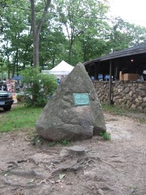
Erected June 25 1921
When The British Attacked Forts
Clinton And Montgomery Oct. 6 1777
The First Fighting Occurred Over
The Outworks Located At This Point
Gen. Geo. Clinton Commanded the American Forces
Sir Henry Clinton Commanded the . . . — — Map (db m47777) HM
The 19th century mill pond and dam, sawmill, icehouse and farmhouse had outlived its productive days when Omley, Hansen and Hall of an American Scandinavian group discovered it in 1926. With the Depression, the summer community soon became . . . — — Map (db m44210) HM
This dam, constructed in 1995, replaced an original weakened stone and earthen dam built more than a century ago to create a recreational area for the St. Rita Parish of New York City. The Dutch called this stream, an easterly branch of the . . . — — Map (db m44281) HM
The Congers School opened in 1928 as a high school. Students came from as far away as West Nyack and Tappan, often traveling by train to the Congers Station. Centralization of Clarkstown’s schools resulted in the building of the Clarkstown . . . — — Map (db m44286) HM
In 1880 the fledgling Jersey City & Albany Railway Co. completed a track through this area on easements granted by Abraham and Mary Conger, large landholders and prominent citizens. In 1883 a new railroad timetable listed the stop as . . . — — Map (db m44285) HM
This farm homestead built c. 1836 was part of a 450-acre farm extending from Rockland Lake to the Hudson River. In 1891, this portion of the farm became the home of artist Arthur Bowen Davies, a pioneer in modern art in America, and his wife, Lucy . . . — — Map (db m44211) HM
This road was a main artery of travel through the county for more than two centuries, connecting Hudson River communities from New Jersey to Albany. Originally an Indian trail, it was gradually widened by fur traders, post riders, farm carts, . . . — — Map (db m44207) HM
Proclaimed by royal decree almost three centuries ago this onetime Indian trail wound its way northward through Long Clove to the Hudson River below. Kings Highway's original purpose was military as the English Crown feared invasion by the French . . . — — Map (db m84080) HM
The easterly section of this Dutch farmhouse was constructed by John Paul in the early 19th Century. Soon after the similar westerly addition was added resulting in a rare style of twin front door entrances. The structure, a frame of sawn heavy . . . — — Map (db m44282) HM
The Snedeker family occupied this portion of the Pond Patent from c. 1730 until 1909 – about 179 years. Part of this stone house was built c. 1747 by Tunis Snedeker’s son Johannes, a captain in the colonial militia. As patriots in the . . . — — Map (db m131428) HM
Within these woods, in the early morning hours of September 22, 1780, American General Benedict Arnold and British Major John André plotted the surrender of the American fortress at West Point. While attempting to return to British lines, André was . . . — — Map (db m165783) HM
In 1832 Jacob J. and Margaret (Remsen) Blauvelt built the main section of this Dutch Colonial-style farmhouse. Jacob was a farmer, inspector of common schools, a justice of the peace for the Town of Clarkstown and an officer in the 83rd Regiment of . . . — — Map (db m73064) HM
This cemetery, named after an early owner of the land, began in the 18th century as a family or community burial ground. Abandoned and forgotten, it was rescued by the Martinus Hogenkamp Cemetery Association. Several stones are inscribed in Dutch, . . . — — Map (db m44209) HM
Rockland County
Court House
Our forebears commitment to the rule of law was manifested in the first court house built in Tappan in 1691. In 1774 a small frame court house was constructed on this more convenient site, replaced in 1827 by a larger . . . — — Map (db m32552) HM
Early in the 19th century the Snedeker family’s landing on the Hudson shore below came into use for local shipping. In 1845 the Snedekers established a shipyard with marine railway for repairing brickyard vessels and a dock for scheduled steamboats. . . . — — Map (db m33212) HM
Erected by the Rockland County Society to commemorate the establishment of the New Hempstead Presbyterian Church as the second religious organization in the present County of Rockland, New York. This church was founded a few years after 1713, when . . . — — Map (db m44223) HM
Erected by the
Rockland County Society
To commemorate the opening of the
Nyack Turnpike
Between Nyack and Suffern
The first direct highway across the County of Rockland and the first important public work undertaken therin by private . . . — — Map (db m33648) HM
Ca. 1830 a group of local residents of Dutch Reformed faith began holding private religious services in Nyack. They built their first small church on this site in 1836 and in 1853 incorporated as The First Reformed Protestant Dutch Church of Nyack. . . . — — Map (db m44226) HM
Birthplace and boyhood home of the eminent realist painter Edward Hopper (1882-1967). The Hoppers’ forebears came from Holland in 1652, and the artist’s grandfather built this house in 1858. After graduating from Nyack High School, Hopper moved to . . . — — Map (db m44206) HM
The Tappan Indians, from time immemorial, occupied these lands fronting on the river shore. Here, in summer, they lived upon the fish and oysters which the waters produced in abundance. In the Algonkian dialect, spoken by them, they called this . . . — — Map (db m44310) HM
This nonsectarian cemetery was dedicated on June 27, 1848 before a crowd of 3,000 people. The establishment of the cemetery reflected a transition from small family or religious cemeteries. Oak Hill Cemetery has been enlarged several times and . . . — — Map (db m18274) HM
Placed by the Rockland County Society to mark the oldest building dedicated to God’s service now standing in the County of Rockland, New York ----- this ----- “Old Stone Church” was erected in the year 1813 by a newly organized Society of the . . . — — Map (db m44304) HM
Rockland Brink's Robbery
On October 20, 1981, a three-year crime spree in the New York Metropolitan area came to an end at this site. Members of the Weather Underground, a radical domestic terrorist group, robbed a Brink's armored car at the Nanuet . . . — — Map (db m33649) HM
The “Towne of Orange” formed in the Tappan Patent grant of 1686-7 became the seat of provincial government of all Orange County, established in 1683, which then included this area, south of the mountains, set off as Rockland County in . . . — — Map (db m43777) HM
Skunk Hollow or, “the mountain,” was a free black community from 1806-1905. The first known deed dated 1806 belonged to Jack Earnest from Palisades. In 1841, William Thompson, an African Methodist Episcopal itinerant preacher bought Jack’s house, . . . — — Map (db m8630) HM
Carson McCullers, writer and dramatist, made this house her home from 1945 to her death on September 29, 1967. Born in Columbus, Ga., on February 19, 1917, she achieved fame with The Heart is a Lonely Hunter 1940 and Reflections in a . . . — — Map (db m44279) HM
Built in 1854 for A. J. Storms of the Storms Tub & Pail Factory. 1875-1882 home of Edwin Stillwell, Captain of the Nyack-Tarrytown Ferry. Purchased 1885 by the Couch Family. Dr. Louis Couch used the tower for his Homeopathic practice. Daughter . . . — — Map (db m44276) HM
After crossing the Hudson, Commander-in-chief of the French army in America, General Jean-Baptiste Rochambeau, encamped here with his 5000 troops en route from Newport, R.I. to Virginia. Joining with Gen. Washington, the two armies hurried to . . . — — Map (db m189603) HM
The ground at this intersection, “Historic Crossroads of the American Revolution,” had long been a grassy triangle. In 1908 Charles E. Suffern gave the village this cannon, and the stone wall was built around it. Some residents, disliking the new . . . — — Map (db m24978) HM
Erected Oct. 4, 1924 Site of Suffern’s Tavern a noted hostelry of the Revolution Headquarters of • General • George Washington • July 15th to 20th, 1777 • Headquarters of Colonel Aaron Burr commanding the troops guarding the Ramapo . . . — — Map (db m24974) HM
Here in 1950 a group of WWII G.I. Bill student-veterans from Shanks Village planned and built a community of homes cooperatively on McGillicuddy’s farmland. Houses and road were sited to preserve the natural environs. Low on funds, each family . . . — — Map (db m52951) HM
Organized 1694
Used as a military hospital and prison during the Revolution. The trials of Major John Andre as a spy, and of Joshua Heit Smith for treason, were held here in 1780. — — Map (db m7375) HM
A log structure, with whipping posts and stocks, was erected on this Tappan green C. 1691. Here justice was administered to all of Orange County, which then included present Rockland. A more permanent courthouse and "gaol," built in 1739, was . . . — — Map (db m8542) HM
Commemorating the 200th anniversary of the meetings between General George Washington and General Sir Guy Carleton at Tappan and aboard H.M.S. Perseverance. Jointly by the Historical Society of Rockland County and Tappantown Historical Society. . . . — — Map (db m7291) HM
At Joshua Hett Smith’s home here, Sept. 22, 1780 Benedict Arnold betrayed the plans of West Point to British spy Maj. Andre[.] Historical Soc. Rockland County — — Map (db m165656) HM
Worship services in this hamlet were held as early as 1740 in a log meeting house at the old burial ground northwest of historic Pye’s Corner. The First Reformed Protestant Dutch Church was organized there in 1750. Initially services were in Dutch . . . — — Map (db m44204) HM
The Nyack Turnpike Toll Road c. 1825 crossed the Oblenis Farm here, creating a busy intersection knows as Oblenis Corners at Strawtown and Sickeltown roads. The first post office named Nyack Turnpike was established in the New Oblenis Store in 1834. . . . — — Map (db m21381) HM
This historic inn built by Thomas Warner in 1840 was a stopping place for stage coaches and travelers to and from the Port of Nyack. It was a center of social life for more than a century and the scene of farewell balls for recruits during the . . . — — Map (db m15351) HM
Ancient Indian trails intersected at this place adjoining a large Indian village which extended to the Hackensack Creek. Early in the 18th century the De Clark family built a gristmill on these premises, scene of the last witchcraft trial in New . . . — — Map (db m44200) HM
This "Burying ground for Colored people", was deeded on July 7, 1849 by James Benson and Jane Benson, his wife, to William H. Moore, Stephen Samuels and Isaac Williams, trustees. The cemetery has provided burial space for colored people, including . . . — — Map (db m21378) HM
A Dutch meeting house and burial ground occupied this site ca. 1740. The First Reformed Protestant Dutch Church was organized here in 1750. A sandstone building replaced the old wooden structure in 1826. This cemetery, in use for almost two . . . — — Map (db m44201) HM
In 1798 Hendrick Van Orden, owner of a sandstone house on this site, sold the house and surrounding farm to Dr. Abraham Cornelison, who lived here 51 years. He became the first president of the Rockland County Medical Society in 1829. Isaac Pye . . . — — Map (db m26199) HM
Dutch farmers first settled here early in the 18th century on land purchased from Indians who had occupied this region for millennia. Under mounting pressure for a cross-county road between the port of Nyack and Ramapo a turnpike was built. The . . . — — Map (db m15352) HM
For almost a century the Clarkstown Reformed Church shared the services of its pastor with the church at Tappan. In 1834 a full-time pastor was called and this building, on a site across the road, was purchased for him. It was enlarged in 1835. . . . — — Map (db m26196) HM
In 1937 Ralph Borsodi, author, economist and philosopher, organized a group for the purchase of this 106-acre Dutch farm to be divided into leased acreage plots. This became the largest self-administered, back-to-the-land community in Rockland . . . — — Map (db m44203) HM
This property on lot 13 in the 1727 division of the Kakiat Patent was part of the DeClark farm from which the name Clarkstown originated. In August 1780 General Washington and his troops encamped here on an ancient Indian village site. In 1880 the . . . — — Map (db m54842) HM