70 entries match your criteria.
Former U.S. Presidents: #08 Martin Van Buren Historical Markers
By Mark Hilton, December 16, 2017
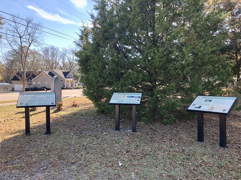
Marker (on far left) looking south on Main Street.
| 1 ► Alabama, Barbour County, Louisville — The Opening of the Second Phase of the Second Creek War — Creek Heritage Trail — |
| On North Main Street (Alabama Route 51) 0.6 miles south of West Street, on the right when traveling south. | |||
| 2 ► Alabama, Colbert County, Tuscumbia — Sacred Tears — By Branko Medenica — September 19, 2003 — |
| On South Main Street at Spring Park Road, on the left when traveling south on South Main Street. | |||
| 3 ► Alabama, Lauderdale County, Florence — John McKinley Associate Justice, U.S. Supreme Court — |
| Near South Court Street. | |||
| 4 ► Alabama, Lauderdale County, Florence — Justice John A. McKinley — City of Florence Walk of Honor — |
| Near Hightower Place south of Veterans Drive (Alabama Route 133), on the left when traveling south. | |||
| 5 ► Arkansas, Van Buren County, Clinton — E-3 — Van Buren County — First Court House — |
| On Griggs Street at Elm Street, on the left when traveling north on Griggs Street. | |||
| 6 ► District of Columbia, Washington, Northwest Washington, Downtown — Decatur House — |
| On H Street Northwest at Jackson Place Northwest, on the right when traveling east on H Street Northwest. | |||
| 7 ► District of Columbia, Washington, Northwest Washington, Downtown — Discover DC / McPherson Square — |
| On Vermont Avenue Northwest at I Street Northwest, on the right when traveling south on Vermont Avenue Northwest. | |||
| 8 ► District of Columbia, Washington, Northwest Washington, Georgetown — The Colonial — Erected 1820 · Restored 1953 — |
| On 30th Street Northwest north of N Street Northwest, on the right when traveling north. | |||
| 9 ► District of Columbia, Washington, Northwest Washington, Penn Quarter — Discover DC / Metro Center — |
| On 13th Street Northwest at G Street Northwest, on the right when traveling north on 13th Street Northwest. | |||
| 10 ► District of Columbia, Washington, Northwest Washington, Woodley Park — Woodley Estate — |
| On Cathedral Avenue Northwest east of Woodley Road Northwest, on the right when traveling west. | |||
| 11 ► Georgia, Forsyth County, Cumming — 058-2 — Forsyth County — |
| On Veterans Memorial Boulevard (Georgia Route 9) south of Main Street (Georgia Route 20), on the right when traveling south. | |||
| 12 ► Georgia, Habersham County, Demorest — 068-5 — Habersham Iron Works & Mfg. Co. — <------<<<< — |
| On Habersham Mills Village Drive just south of Habersham Mills Complex Drive, on the left when traveling south. | |||
| 13 ► Georgia, Monroe County, Forsyth — 102-4 — Forsyth — |
| On West Johnson Street at North Jackson Street, on the left when traveling west on West Johnson Street. | |||
| 14 ► Illinois, Sangamon County, Springfield — The American House — Looking for Lincoln — 1838 — |
| On Southeast Old State Capitol Plaza at East Adams Street, on the left when traveling south on Southeast Old State Capitol Plaza. | |||
| 15 ► Kentucky, Fayette County, Lexington — Henry Clay — 1777 - 1852 — |
| Near East Main Street (U.S. 60) at Midland Avenue (U.S. 60), on the right when traveling west. | |||
| 16 ► Kentucky, Johnson County, Paintsville — 1125 — County Named, 1843 — |
| On Court Street south of 2nd Street, on the left when traveling south. | |||
| 17 ► Kentucky, Scott County, Georgetown — 739 — U.S. Vice President — |
| Near Stamping Ground Road (State Highway 227) 0.4 miles north of Frankfort Pike (U.S. 460), on the left when traveling east. | |||
| 18 ► Louisiana, Lafourche Parish, Thibodaux — Felix Grundy Winder — |
| On Jackson Street south of Seventh Street, on the right when traveling south. | |||
| 19 ► Maine, Aroostook County, Fort Kent — The Aroostook War — |
| On Blockhouse Road at Island Road, on the right when traveling west on Blockhouse Road. | |||
| 20 ► Michigan, Allegan County, Martin — Stop 27 — Early History of Martin — Martin was First Settled a Year Before Michigan Became a State — Allegan County Heritage Trail — |
| On 10th Street at Templeton Street, on the right when traveling north on 10th Street. | |||
| 21 ► Missouri, Boone County, Rocheport — History of Rocheport — |
| 22 ► Missouri, Cass County, Harrisonville — Cass County — |
| On East Wall Street, on the left when traveling east. | |||
| 23 ► New Jersey, Middlesex County, Woodbridge — Henry Inman — |
| On N Park Drive. | |||
| 24 ► New York, Albany County, Albany, Downtown — Site of Martin Van Buren Residence — |
| On State Street at South Pearl Street, on the right when traveling east on State Street. | |||
| 25 ► New York, Columbia County, Claverack — First Court House — |
| On New York State Route 23B at Old Lane, on the left when traveling south on State Route 23B. | |||
| 26 ► New York, Columbia County, Kinderhook — “… a Farmer in my native Town” — Martin Van Buren Nat’l Hist Site — National Park Service, U.S. Department of the Interior — |
| Near Old Post Road, on the left when traveling north. | |||
| 27 ► New York, Columbia County, Kinderhook — 1849-50 A House Transformed — Martin Van Buren Nat’l Hist Site — National Park Service — |
| On Old Post Road, on the right when traveling south. | |||
| 28 ► New York, Columbia County, Kinderhook — A Bustling Household — Martin Van Buren Nat’l Hist Site — National Park Service — |
| On Old Post Road, on the right when traveling south. | |||
| 29 ► New York, Columbia County, Kinderhook — An Agrarian Lifestyle… — Martin Van Buren Nat’l Hist Site — National Park Service — |
| On Old Post Road, on the right when traveling south. | |||
| 30 ► New York, Columbia County, Kinderhook — Birthsite — |
| On Hudson Street (County Route 21) at Jarvis Lane, on the right when traveling east on Hudson Street. | |||
| 31 ► New York, Columbia County, Kinderhook — Farm Operations — Martin Van Buren Nat’l Hist Site — National Park Service — |
| On Old Post Road, on the right when traveling south. | |||
| 32 ► New York, Columbia County, Kinderhook — Farmhands and Fishing — Martin Van Buren Nat’l Hist Site — National Park Service — |
| On New York State Route 9H, on the right when traveling south. | |||
| 33 ► New York, Columbia County, Kinderhook — Fertile Political Ground — Martin Van Buren Nat’l Hist Site — National Park Service — |
| On Old Post Road, on the right when traveling south. | |||
| 34 ► New York, Columbia County, Kinderhook — Gravesite — |
| On Albany Avenue (County Route 21), on the right when traveling west. | |||
| 35 ► New York, Columbia County, Kinderhook — Lawrence Van Buren House — c. 1812 — |
| On Hudson Street (New York State Route 21) north of Silvester Street, on the right when traveling north. | |||
| 36 ► New York, Columbia County, Kinderhook — Lindenwald — |
| On Old Post Road, on the left when traveling south. | |||
| 37 ► New York, Columbia County, Kinderhook — Lindenwald and the Old Post Road — Martin Van Buren Nat’l Hist Site — National Park Service — |
| On Old Post Road, on the right when traveling south. | |||
| 38 ► New York, Columbia County, Kinderhook — Marble Mounting Block — |
| Near Old Post Road, on the right when traveling south. | |||
| 39 ► New York, Columbia County, Kinderhook — Martin Van Buren — 1782 – 1862 — |
| On Broad Street (U.S. 9) at Hudson Street (County Route 21), on the left when traveling south on Broad Street. | |||
| 40 ► New York, Columbia County, Kinderhook — Soil Improvers — |
| 41 ► New York, Columbia County, Kinderhook — Uncovering the Past — Martin Van Buren Nat’l Hist Site — National Park Service — |
| On Old Post Road, on the right when traveling south. | |||
| 42 ► New York, Columbia County, Kinderhook — Welcome to Lindenwald — Martin Van Buren Nat’l Hist Site — National Park Service — |
| On Old Post Road, on the left when traveling south. | |||
| 43 ► New York, Columbia County, Valatie — Hoes House — c. 1760 — |
| On River Street, on the left when traveling south. | |||
| 44 ► New York, Columbia County, Valatie — John Vanderpoel Home c.1825 — |
| On Main Street at Merwin Lane, on the left when traveling east on Main Street. | |||
| 45 ► New York, Columbia County, Valatie — U.S. Hotel — |
| On Main Street, on the right when traveling west. | |||
| 46 ► New York, Greene County, Catskill — Martin Van Buren — |
| On West Main Street, on the right when traveling south. | |||
| 47 ► New York, Niagara County, Lockport — 11 — Old Locks West — |
| Near Pine Street. | |||
| 48 ► New York, Niagara County, Lockport — Residence of Washington Hunt — |
| On Market Street at Adam Street, on the left when traveling west on Market Street. | |||
| 49 ► New York, Ulster County, Kingston — Van Leuven Mansion — |
| On Wall Street at Main Street, on the right when traveling south on Wall Street. | |||
| 50 ► North Carolina, Beaufort County, Washington — B-36 — C. C. Cambreleng — |
| On Bridge Street (U.S. 17), on the right when traveling north. | |||
| 51 ► Ohio, Hamilton County, North Bend — 47-31 — Benjamin Harrison / William Henry Harrison — |
| On Symmes Avenue at Washington Avenue, on the left when traveling north on Symmes Avenue. | |||
| 52 ► Ohio, Hamilton County, North Bend — The Political Desert / Tippecanoe and Tyler Too! — William Henry Harrison Memorial Trail — |
| On Cliff Road, 0.1 miles north of Brower Road, on the right when traveling north. | |||
| 53 ► Ohio, Hancock County, Van Buren — 7-32 — The Village of Van Buren — |
| On Main Street at Market Street (Ohio Route 613), on the left when traveling north on Main Street. | |||
| 54 ► Ohio, Medina County, Seville — 1-52 — "The Giants of Seville" — |
| On W. Main St at Pleasant St, on the left when traveling west on W. Main St. | |||
| 55 ► Ohio, Shelby County, Anna — Rumley — An African American Settlement in Rural Shelby County, Ohio — |
| On Hardin- Wapak Road (County Route 20) 0.2 miles south of Blanke Road (County Route 76), on the right when traveling south. | |||
| 56 ► Pennsylvania, Philadelphia County, Philadelphia, Torresdale — Glen Foerd on the Delaware — City of Philadelphia, Neighborhood of Torresdale — The King's Highway Foundation — |
| Near Milnor Street at Grant Avenue, on the right when traveling east. | |||
| 57 ► Tennessee, Bradley County, Charleston — A New Home — |
| Near Market Street NE north of Hiwassee Street (U.S. 11), on the left when traveling north. | |||
| 58 ► Tennessee, Coffee County, Pelham — 2 E 3 — Coffee County / Grundy County — |
| On Hillsboro Highway (U.S. 41) at Tyree Cove Road, on the right when traveling south on Hillsboro Highway. | |||
| 59 ► Tennessee, Greene County, Greeneville — 1C 76 — Dickson - Williams Mansion — |
| On West Church Street, on the right when traveling east. | |||
| 60 ► Tennessee, Grundy County, Monteagle — 2 E 4 — Grundy County / Marion County — |
| On West College Street (U.S. 41) at West Main Street (U.S. 41A), on the right when traveling south on West College Street. | |||
| 61 ► Tennessee, Grundy County, Pelham — 2E3 — Grundy County — |
| On Hillsboro Highway (U.S. 41), on the right when traveling south. | |||
| 62 ► Tennessee, Meigs County, Birchwood — "Your Fate is Decided" — |
| Near Blythe Ferry Road, 2 miles north of Hiwassee Highway (Tennessee Highway 60), on the right when traveling north. | |||
| 63 ► Tennessee, Meigs County, Birchwood — "Your Fate is Decided" — |
| Near Blythe Ferry Road, 2 miles north of Hiwassee Highway (Tennessee Highway 60), on the right when traveling north. | |||
| 64 ► Tennessee, Meigs County, Birchwood — General Winfield Scott — |
| Near Blythe Ferry Road, 2 miles north of Hiwassee Highway (Tennessee Highway 60), on the right when traveling north. | |||
| 65 ► Vermont, Chittenden County, Burlington, South End — Site of the American House — 1808 - 1893 — |
| On Main Street (U.S. 2) at St. Paul Street, on the right when traveling east on Main Street. | |||
| 66 ► Virginia, Portsmouth, Olde Towne — Q-8-M — Crawford House — |
| On Crawford Street south of Queen Street, on the left when traveling north. | |||
| 67 ► Virginia, Rockingham County, Bridgewater — Famous Travelers Along the Turnpike — |
| On North Main Street (State Highway 42), on the right when traveling north. | |||
| 68 ► West Virginia, Greenbrier County, White Sulphur Springs — President's Cottage — |
| Near W. Main Street (U.S. 60). | |||
| 69 ► West Virginia, Monroe County, Union — Salt Sulphur — |
| On Koontz Road (U.S. 219) at County Route 10/5, on the left when traveling south on Koontz Road. | |||
| 70 ► Wisconsin, Waukesha County, Muskego — "Do I Smell Pizza-Burgers?" — |
| On Janesville Road, on the right when traveling west. | |||