177 entries match your criteria. Entries 101 through 177 are listed.⊲ Previous 100
Lost at Sea Historical Markers
Markers honoring merchant mariners, fishermen/women, crew and passengers who have been lost at sea during warfare and peacetime. Includes those lost in freshwater disasters as well.
Dedicated to those who served aboard the Texas Towers. Built in the 1950's and placed on the eastern Continental Shelf, these platforms were part of the first line of air defense in the Cold War. 32 men lost their lives to the sea.
[Dedicated 14 . . . — — Map (db m85747) HM WM
Garrettsville, Ohio
Birthplace of the internationally known poet
Hart Crane
Born July 21, 1899
Lost at sea April 27, 1932
Son of Grace Hart and Clarence A. Crane — — Map (db m122074) HM
On Saint Clairsville Road just east of East Main Street (U.S. 36), on the left when traveling east.
In recognition of Patriotism far beyond the ordinary, in support of the World War II effort, Margaret and Frank Eckfield of Port Washington, Ohio gave seven sons, one daughter and one grandson to serve in the Armed Forces of the United States of . . . — — Map (db m211327) HM WM
On Oregon Coast Highway (U.S. 101) north of Central Avenue, on the right when traveling north.
The first tugs on Coos Bay were steam-powered, usually towing log rafts or piloting sailing ships in and out of port.
Gasoline and diesel internal combustion engines arrived in the early 1900s and began to replace steam engines. By . . . — — Map (db m114182) HM
On Harbor Way (U.S. 101), on the right when traveling south.
In 1876 Mr. R.D. Hume of Astoria, Oregon, decided to move his commercial salmon fishing, processing and shipping business to the mouth of the Rogue River. Mr. Hume anticipated huge profits due to the large run of "King" Salmon which entered the . . . — — Map (db m73202) HM
On SW Naterlin Drive east of Oregon Coast Highway (U.S. 101), on the right when traveling east.
Built by USCG Yard August 30, 1946
Retired from active service April 8, 1970
In memory of those lost at sea, and
to those men whose courage, initiative
and unwavering devotion to duty were
in keeping with the highest traditions
of . . . — — Map (db m113503) HM WM
On Main Street at U.S. 6, on the left when traveling south on Main Street.
1775 - 1917
"In 1790 a predecessor of the U.S. Coast Guard was established by the First Congress of the United States. This newly formed maritime force did not have an official name. Rather, it was referred to simply as "the cutters" or "the . . . — — Map (db m154404) HM WM
Near Jordan Road south of Technology Drive, on the left when traveling north.
John Joliffe Yarnall (1786-1815) was born in Wheeling, West Virginia. Enlisting as a midshipman in the US Navy in 1809, he performed blockade duties during the Napoleonic Wars before being assigned as a first lieutenant on Commodore Perry's flagship . . . — — Map (db m132221) HM
On Legion Street (Pennsylvania Route 166) at Legion Street, on the right when traveling north on Legion Street.
In commemoration of the men and women who were killed in action, missing in action or lost at sea during hostilities and wars of the United States — — Map (db m200731) WM
On Main Street at Lackawanna Avenue (Pennsylvania Route 347), on the right when traveling east on Main Street.
This anchor is preserved here as a memorial to Captain Johnston Blakely, captain of the sloop-of-war "Wasp" during the War of 1812. Captain Blakely was born in October 1781 and after a courageous naval career was lost at sea in October 1814. The . . . — — Map (db m128042) HM
On Constitution Avenue at South 12th Street, on the right when traveling west on Constitution Avenue.
Dedicated to the Chapel of the Four Chaplains
In memory of Cav. Paolo Recchia, President and Founder 1982 - 2010, Italian Navy Veterans Association of Philadelphia
A.N.M.I. Gruppo Giovanni Caboto di Filadelfia — — Map (db m191616) HM WM
On Ridge Church Road north of Penn Hill Road, on the right when traveling north.
Pvt. Philo Paul Co. D 140th Pa. Vol. killed at Spottsylvania 1864
Pvt. John Smith Co. B 85th Pa. Vol. died of fever at Fair Oaks 1862 Pvt. Abe Jams Co. B 85th Pa. Vol. mortally wounded at Fair Oaks 1862 Howard Paul G/M USSS Colombia lost at . . . — — Map (db m202916) WM
On River Street north of 2nd Avenue, on the left when traveling north.
Battle of the Atlantic September 1939 - May 1945 The Battle of the Atlantic lasted the entire duration of World War II in Europe. It was the desperate struggle by the Allies to organize, man and succeed in convoy operations from North America to . . . — — Map (db m197271) HM WM
On River Street north of 2nd Avenue, on the left when traveling north.
Pearl Harbor December 1941 At 7:48 AM Hawaiian time on Sunday, December 7, 1941 naval air forces of Imperial Japan attacked the American naval base at Pearl Harbor, Hawaii. The attack was carried out by more than 350 aircraft launched from six . . . — — Map (db m197274) HM WM
The S.S. Black Point was built in 1918 at Camden, New Jersey as a coal collier. She was owned by Sprague Steamship Co. of Boston, Mass. And was 369’ long 55’ at the beam and was carrying 7500 tons of coal. Captain Charles Prior was master with a . . . — — Map (db m76004) HM WM
On Point Pleasant Road, on the right when traveling south.
In Memoriam
To those who sacrificed their
lives while serving in and
supporting our submarine
forces during the Cold War.
USS Thresher (SSN 593)
Lost at sea with all hands
April 10, 1963
USS Scorpion (SSN 589) . . . — — Map (db m42756) HM
Thomas Lynch, Jr., signer of the Declaration
Of Independence, was born here Aug. 5, 1749.
He was elected from St. James Parish, Santee,
to 1st Provincial Congress, Dec. 19, 1774; to
2nd Provincial Congress, Aug. 7-8, 1775; to
the Continental . . . — — Map (db m16299) HM
On North Grand Avenue south of Key Corner Street, on the right when traveling south.
Born in Brownsville, TN, Jan. 9, 1900, the son of Wesley and Nell Halliburton. Moved to Memphis at an early age. Came back to Brownsville many times to visit family and friends. Graduated from Princeton 1921. Set out on a world tour, the results his . . . — — Map (db m194158) HM
On Main Street SW at Locust Street, on the right when traveling east on Main Street SW.
Immature Red-tailed Hawk, 1944
Tempera on Board, 13 5/8 x 16 inches
Earl Henry, a local naturalist and taught artist, is often better known as the Knoxville dental officer who perished on the ill-fated USS
Indianapolis at the . . . — — Map (db m221831) HM
Features of national significance include the world's largest underground lake and the rare anthodite formation (cave flowers). The cave also contains numerous other forms of stalactites and stalagmites. The bones and footprints of a giant . . . — — Map (db m82274) HM
Near Seawolf Park Boulevard east of Coastwide Road, on the right when traveling east.
U.S.S. Seawolf (SS-197)
Lost in action, October 3, 1944
The Seawolf was the greatest warship in the history of the United States until her loss
Winner of two Presidential Unit Citations and 13 battle stars.
Marion Lee Asa
· John . . . — — Map (db m179127) HM WM
Near Main Street at McKinney Street when traveling south.
On this site on May 30, 1942, 1,000 Houston volunteers took the oath of service in the United States Navy and dedicated their lives to avenging the cruiser USS Houston and her valiant crew lost in the Battle of the Java Sea — — Map (db m66151) HM WM
On Fisher Street at Laurel Street, on the left when traveling west on Fisher Street.
Prospective Colonial leader who in 1832 hoped to settle thrifty Europeans on a Mexican Grant, which she never received. Mrs. McManus, daughter of a U.S. Congressman from New York, was a family friend of Stephen F. Austin "Father of Texas". . . . — — Map (db m158737) HM
Near Sunset Drive (Old State Highway 35) east of U.S. 181.
In the early morning hours of Sunday, September 14, 1919, a hurricane made landfall in Corpus Christi after gathering strength in the Gulf of Mexico for two weeks. Crowds packed the North Beach area for their last weekend of the summer season, . . . — — Map (db m220811) HM
On Saturday, September 13, 1919, the last swarms of vacationers who packed the Corpus Christi beaches were warned that a massive hurricane, which had gathered strength in the Gulf for two weeks, was approaching the shore. Most ignored the . . . — — Map (db m211993) HM
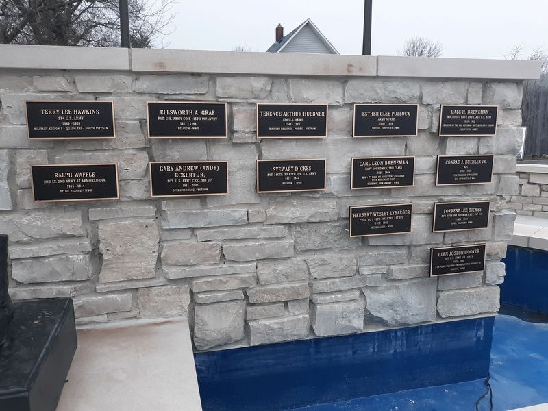
Nine men of Praha a rural community
in Fayette County died in service for
their country during World War II
between February 3, 1944 and February 12, 1945.
PFC Rudolf L. Barta
United States Army
PFC Robert V. Bohuslav
United . . . — — Map (db m212222) HM WM
Northwest faceCoast Guard Emblem
Semper Paratus - 1790
United States Coast Guard
World War
Northeast face
Officers and Men U.S. Coast Guard Cutter Tampa Sunk by enemy submarine in Bristol Channel . . . — — Map (db m15386) WM
On Bousch Street near Wisconsin Square ft of Harbor St..
USS Scorpion, a Skipjack class nuclear-powered attack submarine homeported in Norfolk, Virginia began a Mediterranean deployment in February 1968. The following May 22nd, while homeward bound from that deployment, she was lost with her entire crew . . . — — Map (db m34958) HM
On Harborview Drive at Rosedale Street NW, on the right when traveling north on Harborview Drive.
In memory of the fishermen of Gig Harbor who have gone to sea
at great risk with passion and hard work, this statue is a tribute
to an industry upon whose labor our community was founded.
LOST AT SEA
John Ancich, Jr. • . . . — — Map (db m179979) HM
On South 1st Street at Wilson Street, on the right when traveling south on South 1st Street.
Listed on the National Register of Historic Places
In the waters off Outer Island lies the wreck of the Pretoria, one of the largest wooden vessels ever to sail the Great lakes. On September 1, 1905, Captain Charles Smart and nine crew . . . — — Map (db m98244) HM
Keel Laid 11 January 1944
Launched 28 May 1944
Commissioned 14 October 1944
On 24 January 1945 the U.S.S. Lagarto departed Pearl Harbor to begin her first patrol. During this patrol she sank 2 vessels totalling 1,845 tons. One of . . . — — Map (db m98808) HM WM
The unwritten code of the lakes dictates that seamen come to the aid of anyone in peril. In this regard the fishermen of Port Washington time and again showed their mettle.
At the time of the September equinox, 1895 a furious gale was . . . — — Map (db m88885) HM
Andrew Lodde was working on fish tugs by the time he was sixteen in 1888. He started with the Van Ells in Port Washington, then off of Jones Island and back to Port when the fish company relocated here. In 1913 Andrew formed a partnership with the . . . — — Map (db m88899) HM
Near Broughton Drive at New York Avenue, on the right when traveling north.
On November 21, 1847 the propeller steamer Phoenix burned, with the loss of 190 to 250 lives, seven miles north of the Sheboygan Harbor. At the time of her loss the Phoenix carried close to 300 passengers and crewmen. Most of the . . . — — Map (db m41888) HM
Near Broughton Drive at New York Avenue, on the right when traveling north.
The history of the Lifesaving Service dates back to 1789, when Congress authorized the formation of a Revenue Cutter Service and a Lighthouse Service. During its early years the Revenue Cutter Service (which was not primarily a lifesaving unit) was . . . — — Map (db m47545) HM
Near Unnamed road just east of Drill Hall Beach, on the left when traveling south.
1939-1945 To the enduring memory of those Barbadian Merchant Seamen who gave their lives in the Second World War Alle, E SS Inanda ∙ Anderson, FW SS Traveller ∙ Ashby, V SS Africa ∙ Atkins, G SS Traveller ∙ Bancroft, D SS . . . — — Map (db m135152) WM
On Newfoundland and Labrador Route 10, on the left when traveling north.
A “Fishing Capital” and Colony
This was one of the first harbours in the New World to be frequented by European fishing ships. From the early 1500s The Pool was well known to the Portuguese, Spanish and French fleets. . . . — — Map (db m79471) HM
Near Esplanade at Dorchester Street, on the left when traveling north.
English: "Voyage after voyage, men who had seen a dozen ships go down about them, men who had been torpedoed once, twice, three times, sailed and sailed again." —Joseph Schull, Merchant Seaman During the Second World War, . . . — — Map (db m171490) HM
On Windsor Street, on the right when traveling north.
Established in 1893, this non-denominational burial ground was originally known as the Green Lawn Cemetery. In 1894, the Fairview Lawn Cemetery Ltd. took over management of the cemetery which it operated for 50 years. Unable to fulfill its . . . — — Map (db m77857) HM
On Bluenose Drive close to King Street, on the right when traveling west.
English
Seafaring of all kinds, and fishing especially, is one of most dangerous occupations. Lunenburgers have lived with the dangers associated with making a living from the sea. Fishermen in dories would get lost in the fog, unable to . . . — — Map (db m78204) HM
Harbour of Deception
For almost two centuries, Yarmouth's False Harbour has lived up to its name. Located at the end of Cape Forchu, False Harbour's rocky shores have fooled the most experienced and capable of mariners, especially during . . . — — Map (db m107719) HM
The year 1879 was a disastrous one for Yarmouth County, Nova Scotia, with no fewer than 31 vessels lost along with 106 persons. The ships lost were among the best of the Yarmouth fleet, some carrying valuable cargoes. The loss of life left 26 . . . — — Map (db m107392) HM
Watching the waves crashing around Cape Forchu provides a small glimpse of the awesome and terrifying power of the sea. It continually shapes the lives of those who live and work by it. A source of beauty, bounty and economic prosperity, the . . . — — Map (db m107284) HM
On the Lighthouse Route (Nova Scotia Route 3), on the right when traveling north.
The year 1879 was a disastrous one for Yarmouth County, Nova Scotia, with no fewer than 31 vessels lost along with 106 persons. The ships lost were among the best of the Yarmouth fleet, some carrying valuable cargoes. The loss of life left 26 . . . — — Map (db m112154) HM
On Water Street at Glebe Street, on the right when traveling north on Water Street.
Dedicated to the memory of all those
residents of Yarmouth County
and crew members of ships owned
in Yarmouth County who have been
lost to the sea
We honour those here named as well
as those not yet known to us
[Remembered Dead . . . — — Map (db m107927) HM
On Water Street at Glebe Street, on the right when traveling north on Water Street.
The year 1879 was a disastrous one for Yarmouth County, Nova Scotia, with no fewer than 31 vessels lost along with 106 persons. The ships lost were among the best of the Yarmouth fleet, some carrying valuable cargoes. The loss of life left 26 . . . — — Map (db m107934) HM
On Broad Street just south of Flint Street, on the left when traveling south.
On the occasion of the
first port of call
The City of Brockville expresses tribute and
commemoration to the legendary H.M.S. Bounty
built in Lunenburg, Nova Scotia, Canada
Lost to the sea in November 2012
during Hurricane Sandy . . . — — Map (db m146969) HM
Near Place du Six Juin 1944, 0.1 kilometers west of Rue F.Jourdan de la Passardière, on the left when traveling east.
In memorial of
Merchant Navy Seamen who lost their lives in the Naval
"Operation Neptune"
June 6 ~ September 1944
They manned the merchant ships that provided the supply line for the Armies, and as such they were a prime target in . . . — — Map (db m88595) WM
On Rue Bernard Anquetil, on the left when traveling east.
Le 6 Juin 1944, sur Omaha Beach, les Américains avaient prévu d'occuper une espace 25 km (16 miles) de long sur 10 km (6 miles) de profondeur, mais le soir, seule une zone de 8 km de long sur 2 km de large était tenue au prix d'un . . . — — Map (db m85962) HM WM
Ag Críost an mhuir
Ag Críost an t-iasc
I líontaih Dé go gcastar sinn
This monument was erected to honour the
contributions of the traditional seafaring
fishing community in Murrisk.
We celebrate their memory and ask you to remember . . . — — Map (db m80404) HM
The monument was erected by
The Howth Fishermens Association
and commemorated the lives
of all persons lost at sea,
no matter where or no matter how.
[Representative memorial plaques follow]
Fishermen
Brian Faherty and . . . — — Map (db m26806) HM
On Local Route L1011, 0.6 kilometers east of Leinster Route R115, on the left when traveling east.
The general layout of the cemetery is fan-shaped with eight curved pathways alongside which the graves are laid out. The remains are buried in pairs with two names, where these are known, on each flat grave slab. The average age of the . . . — — Map (db m135749) HM WM
On Skyline Drive south of Mbokonavera Road, on the left when traveling west.
Welcome to the Guadalcanal American Memorial This monument is a tribute to those Americans and their Allies who participated in the Guadalcanal Campaign from 7 August 1942 to 9 February 1943. It especially honors those soldiers, sailors, . . . — — Map (db m213032) HM WM
On Byward Street (Route A100) at Great Tower Street, on the left when traveling west on Byward Street.
[South face]
Malta G.C.
In 1940 the sinister shadow of fascism spilled across Europe and into North Africa. Malta, under the protection of Great Britain, found herself alone in a hostile Mediterranean 800 miles from her nearest allies . . . — — Map (db m187812) HM WM
On Tower Hill (England Route A100) at Trinity Square, on the right when traveling west on Tower Hill.
The CWGC commemorates the dead of British and Commonwealth forces of the two World Wars at cemeteries and memorials in over 150 countries.
The Tower Hill Memorial bears the names of 12,000 First World War merchant seamen who have no known . . . — — Map (db m117321) HM
On Tower Hill (England Route A100) at Trinity Square, on the right when traveling west on Tower Hill.
The Tower Hill Memorial extension bears the names of almost 24,000 men and women who died in the Second World War and have no known grave, their bodies lost or buried at sea.
During the war, the merchant Navy risked attack from submarine, air . . . — — Map (db m117322) HM
Near Marina Way at The Highlight, on the left when traveling south.
In Memory Of All Those
Who Lost Their Lives At Sea
( eleven granite tablets, set into the pavement, list the names of lost sailors ) — — Map (db m125687) HM
On Station Road at Dock Street, on the left when traveling south on Station Road.
This is the funnel of the trawler Goth which disappeared in a fierce storm off the North Cape of Iceland in December, 1948. There were 21 men onboard who had hoped to return from the fishing grounds to spend Christmas with their families.
. . . — — Map (db m73282) HM
Near Western Avenue at Main Gate Road, on the left when traveling north.
1939
HMS Blanche · HMS Duchess · HMS Gipsy
1940
HMS Acasta · HMS Acheron · HMS Ardent · HMS Basilisk · HMS Brazen · HMS Cameron · HMS Codrington · HMS Daring · HMS Delight · HMS Escort · HMS Esk · HMS Exmouth · HMS Glowworm · HMS Grafton · HMS . . . — — Map (db m118416) HM
On Osborne Place at Citadel Road, on the left when traveling south on Osborne Place.
The Plymouth Naval Memorial
This memorial commemorates officers, ranks and ratings of this Port who died at
sea during the wars of 1914 to 1918 and 1939 to 1945. Actions in which they
fought are recorded in the registers and on the memorial . . . — — Map (db m123779) HM WM
Near Osborne Place at Citadel Road, on the left when traveling south.
Welcome to the CWGC Plymouth Naval Memorial
The CWGC Plymouth Naval Memorial commemorates more than 7,200 Royal Navy personnel and 75 sailors of the Royal Australian Navy who died during the First World War. Designed by Sir Robert Lorimer . . . — — Map (db m123781) HM WM
On Clarence Esplanade at Serpentine Road, on the right when traveling north on Clarence Esplanade.
( south side )
1914 – 1918 1939 – 1945
In Honour of the Navy and to the Abiding Memory of These Ranks and Ratings of this Port Who Laid Down Their Lives in the Defence of the Empire and have No Other Grave Than the Sea . . . — — Map (db m123456) WM
On Clarence Esplanade at Serpentine Road, on the right when traveling north on Clarence Esplanade.
More than 45,000 men and women lost their lives while serving with the Royal Navy during the First World War. Many of these were members of the Royal Naval Division who died while fighting on land, but the majority were lost at sea and have no . . . — — Map (db m123464) WM
On Clarence Esplanade at Serpentine Road, on the right when traveling north on Clarence Esplanade.
In 1946 it was decided that the existing naval memorials should be extended in order to commemorate the naval dead of the Second World War who had no grave but the sea. The architect of the Second World War extension at Portsmouth was Sir Edward . . . — — Map (db m123466) WM
On Donegall Square East just south of Donegall Square North (Northern Ireland Route A1), on the right when traveling south.
Titanic Memorial Garden is a permanent tribute to over 1,500 passengers and crew who died after the ship struck an iceberg and sank in the North Atlantic during its maiden voyage in April 1912.
When RMS Titanic departed Southampton on 10 . . . — — Map (db m134337) HM
[Front]
On 31 May 1911, SS 401, Titanic, slid down Slipway No. 3 at the Queen's Yard of Harland and Wolff and settled on the waters of the Victoria Channel in Belfast Lough. In her brief life she would be the largest, most luxurious vessel ever . . . — — Map (db m135088) HM
On East Shore just east of Haddfoot Wynd, on the right when traveling east.
On the night of January 31st 1918, a disaster took place just a few miles off Anstruther when the British Grand Fleet left Rosyth for exercises in the North Sea. With wartime news restrictions in force, few if any people onshore were aware of . . . — — Map (db m88928) HM
On Marine Terrace at Bank Street, on the right when traveling north on Marine Terrace.
HMS Natal — A Naval warrior destroyed
HMS Natal was a Warrior class Cruiser of 13,550 tons with a complement of 704 officers and men. She was launched at Barrow-in-Furness on 30th September 1905 and had a distinguished peacetime career. This . . . — — Map (db m128195) HM WM
On Ferry Road at Victoria Street, on the right when traveling south on Ferry Road.
( panel 1 )
Violet, Dorothy and Kathleen ON-1236 (17-16)
Severn class lifeboat
The Severn class all-weather lifeboat is the largest in the RNU fleet. Severn class lifeboats are allocated to stations where they can lie afloat . . . — — Map (db m127565) HM
177 entries matched your criteria. Entries 101 through 177 are listed above. ⊲ Previous 100