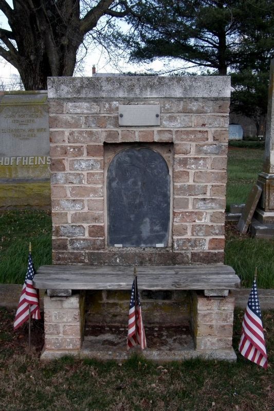
This old stone marked the grave of John Abbott, son of town’s founder. Since 1763, in a fence row at upper end of town at a site 128 ft east of Abbott Street 35 feet south of Water Street. Moved to this place in 1976 to make way for a parking lot — — Map (db m118927) HM
The Lincoln Highway was the first coast-to-coast highway built in 1913. A group of visionary businessmen from the automotive industry, led by Henry B. Joy and Carl Fisher, formed the Lincoln Highway Association. The Association successfully . . . — — Map (db m167234) HM
Arendtsville serves as serves as a Gateway to South Mountain and its earliest history was connected to the Native American tribes who hunted its rich forestlands. Various artifacts and arrowheads can still be found along local streams in the . . . — — Map (db m159861) HM
Agriculture has always been a part of the culture of the South Mountain area. Settlers were originally drawn to a wild land to cultivate the soils and raise crops, and today agricultural and community leaders to work together to inspire a new . . . — — Map (db m159876) HM
"Don't let forest land area fall below 15 percent of the state's surface; save land with trees, for the air we breathe, to protect watersheds, and for future timber. Stop wasting and burning ripe trees."
The rising hills you see . . . — — Map (db m159875) HM
The Historic South Mountain Fruit Belt encompasses about 20,000 acres and forms a fertile crescent (half moon shape) covering the southeastern slopes of South Mountain in the western half of Adams County. The soils are deep, well drained and . . . — — Map (db m159877) HM
In the early hours of July 24, 1845, five men left their horses at Myers' Tavern, got into a wagon, and proceeded north to Bear Mountain. There they entered the cabin where Kitty Payne and her children slept, forced them into the wagon at gunpoint, . . . — — Map (db m38972) HM
This historical hidden treasure
was once owned by the Ambassador
from Mexico to the United States and
was visited by
President Franklin Delano Roosevelt
on the eve of his Gettysburg Address in 1938. — — Map (db m242301) HM
The Historic
Thomas Bros. Country Store
Biglerville, PA.
Est. 1909
has been placed on the National Register of Historic Places by the United States Department of the Interior.
— — Map (db m159880) HM
Founded in 1918, FREC was established in response to management challenges faced by Pennsylvania fruit growers. Originally located in Arendtsville, the center moved here in 1971. Groundbreaking research has been conducted at . . . — — Map (db m192372) HM
Charles W. Johnson was the proprietor of the general store in McKnightstown for 62 years. This store is now the site of the post office. Johnson began working at the General Store under Calvin T. Lower and then later purchased the store. Oil, . . . — — Map (db m150317) HM
Surveyed in 1766. Named for an estate in England. The Manor was about 6 miles wide and 12 miles long with the southern boundary at present Mason-Dixon Line. It was the second largest reserved estate of the Penns in Pennsylvania. The western boundary . . . — — Map (db m11623) HM
Advancing Thunder
In late June 1863, the Confederate Army of Northern Virginia, commanded by General Robert E. Lee, advanced over South Mountain to the village of Cashtown. Tens of thousands of men, horses, cannons and wagons rumpled over . . . — — Map (db m137364) HM
Pennsylvania is well known for its beautiful farming country, fruit belts and unique barns. Many are located along the historic Lincoln Highway route. The Round Barn is one of the more unique examples.
Considered an "endangered species," . . . — — Map (db m167237) HM
To the Glory of God, St. John Neumann, then Bishop of Philadelphia, laid the original cornerstone of St. Joseph's Church on July 31, 1859. The church was completed the following year through the work of Rev. Basil A. Shorb, founding pastor. This . . . — — Map (db m130320) HM
(Around the Base): First Brigade Second Division Cavalry Corps Army of the Potomac (Back Inscription):July 2nd 1863 Reached the field at noon from Hanover engaged dismounted a Confederate brigade of infantry on Brinkerhoff's Ridge from . . . — — Map (db m9273) HM
After a stunning victory at Chancellorsville in May 1863, Confederate Gen. Robert E. Lee led the Army of Northern Virginia through Maryland into Pennsylvania, marching east to threaten Philadelphia, Baltimore, and Washington, D.C. The Army . . . — — Map (db m27034) HM
Crossing South Mountain from Chambersburg, Gen. Hill's Corps of Lee's army assembled here on June 29-30, 1863. On July 1, his advance guard moved up from near Marsh Creek and met Union Troops west of Gettysburg. — — Map (db m5814) HM
Army of Northern Virginia Stuart's Cavalry Division Imboden's Brigade 18th Virginia Cavalry, 62nd. Virginia Infantry Virginia Partisan Rangers and Virginia Battery July 3 Command guarding trains. Reached the field at noon and retired with the . . . — — Map (db m11622) HM
In 1758, during the French & Indian War, a party of French soldiers and Shawnee took Mary Jemison from her home 3 miles north of here. Although most of her family and neighbors were killed, Mary was adopted by two Seneca women. Jemison lived with . . . — — Map (db m11620) HM
During the French and Indian War, Mary Jemison was kidnapped from this valley on April 5, 1758 by a band of Frenchmen and Shawnee Indians. Taken to Fort Duquesne, now Pittsburgh, she was adopted by Seneca Indians who named her "Deh-Ge-Wa-Nus." In . . . — — Map (db m121191) HM
The historic Cashtown Inn has been offering lodging and dining to weary travelers since the turn of the 19th Century. Roads were important to town development, just as the automobile was important to their prosperity. As roads brought travelers . . . — — Map (db m167235) HM
Historic Gettysburg
Lion and the Lamb
1810
Adams County
Honored 1990
This property has been listed on the National Register of Historic Places by the United States Department of the Interior — — Map (db m217257) HM
You are looking at an M60-A3 tank. I arrived at the Richard J. Gross VFW Post 8896 on March 25, 1997. M60 tanks were in service from 1960 to 1997 for the U.S. military. I'm here due to the hard work and dedication of Past Commander Peter Kopp. — — Map (db m224435) HM
Built ca. 1790 by David Studebaker, carpenter, farmer, and minister. He was related to the family that later built wagons and automobiles. The house is privately maintained as a museum. — — Map (db m11638) HM
U.S. Navy F-14 Tomcat No. 162916 was delivered to the Richard J. Gross Post #8896 Veterans of Foreign Wars on February 15, 2007. This was accomplished due to the hard work and dedication of Past Commander Gary L. Kopp.
Dedication services . . . — — Map (db m224433) HM WM
Founded 1681 by William Penn as a Quaker Commonwealth. birthplace of The Declaration of Independence and The Constitution of The United States — — Map (db m8055) HM
First Corps marched from Gettysburg to Emmitsburg. Fifth Corps from Marsh Run to Moritz's Cross-Roads. Sixth Corps from Fairfield to Emmitsburg except the Third brigade, Second Division which in conjunction with the First Brigade, Second Cavalry . . . — — Map (db m10770) HM
(Preface): After Confederate Gen. Robert E. Lee's stunning victory at Chancellorsville in May 1863, he led the Army of Northern Virginia west to the Shenandoah Valley, then north through central Maryland and across the Mason-Dixon Line . . . — — Map (db m60301) HM
Wounded of the Sixth U.S. Cavalry and Sixth Virginia Cavalry C.S.A. were cared for in this church building after a severe engagement that took place two miles north of here on July 3, 1863. — — Map (db m10773) HM
This "fire gong" came from the Fairfield farm of
Harry E. Brown
1874-1951
Volunteer Fireman
Church leader
Civic elder
School Board president
First "Pennsylvania Master Farmer" of Adams County (1935)
Given in memory by his grandsons
Thomas . . . — — Map (db m103690) HM
This bell is from St. John's United Church of Christ which united with Zion Lutheran to form a new congregation in 1968, St. John Lutheran Church. It is a reminder of God's call to the faithful to worship in this region and a symbol of Christian . . . — — Map (db m159858) HM
Begun in 1836 by the State of Pennsylvania, largely through the efforts of Thaddeus Stevens. The meandering railroad's nickname was provided by its opponents. It was put up for sale in 1842. Just west of here stands its granite stone viaduct. — — Map (db m10767) HM
On June 22, 1863, a skirmish erupted at Monterey Pass when Company D of the 4th Virginia Cavalry attacked portions of Union cavalry under the command of Captain Robert Bell, Captain Samuel Randall, and several members of the Gettysburg Home Guard. . . . — — Map (db m148604) HM
The Jacks Mountain Road Covered Bridge has been placed on the National Register of Historic Places by the United States Department of the Interior — — Map (db m136403) HM
Fountain Dale is located between Jack's Mountain and Beard's Hill, and is also connected to two major mountain gaps, Monterey Pass and Fairfield Gap, which would prove to be fighting ground all of it's own. Troops on both sides needed to keep the . . . — — Map (db m8512) HM
On the morning of July 4, Union General Judson Kilpatrick's Cavalry Division consisting of General George Custer and Colonel Nathaniel Richmond's Brigades were ordered from Gettysburg to attack the wagon trains that were moving on the road between . . . — — Map (db m30968) HM
On the afternoon of July 4, Union General Judson Kilpatrick left Emmitsburg with three brigades of cavalry, supported by three batteries of rifled artillery. Kilpatrick was ordered to locate and attack a Confederate wagon train that was moving over . . . — — Map (db m104827) HM
Indian trader and interpreter of Maryland and Pennsylvania. First settler in this valley. Born of Swedish parents along the Delaware. This tablet erected by Liberty Twp. and Fairfield Area Bicentennial Cmte. First Marker Placed in 1924 by . . . — — Map (db m29543) HM
At this site, on December 8, 1842, the Lutheran Church of Fountaindale was consecrated by pastor Solomon Sentman. The church was built on land owned by Joseph and Isaac Baugher, and previously owned by Daniel Sprenkle. In 1842, there were 55 . . . — — Map (db m134154) HM
On the afternoon of June 26, 1863, Confederate cavalry dashed up Chambersburg Street and into the square. Shocked and frightened citizens fled the streets. Sara Broadhead recorded in her diary: "They came with such horrid yells that it was enough to . . . — — Map (db m32437) HM
"We will close...you know nothing about the lesson anyhow." With those words, Pennsylvania College Professor Michael Jacobs reluctantly gave in to the distraction of mounting cannon and musketry fire on the morning of July 1, 1863, and dismissed his . . . — — Map (db m32375) HM
In 1863 this building was the home of the John and Martha Scott family, and Martha's sister, Mary McAllister. On the morning of July 1st, Mary McAllister went across the street to the Christ Lutheran Church to volunteer as a nurse. During the . . . — — Map (db m18117) HM
The original German Reformed Church located here in 1814, served as a “Union brick church” with the town’s Lutheran congregation until 1848. The core of the present building, erected in 1851, was newly refurbished at the time of the battle. On . . . — — Map (db m65780) HM
The students of Rebecca Eyster's Young Ladies Seminary were studying in this "old Academy Building" on June 26, 1863. One of those students, Tillie Pierce, described the arrival of the Confederate troops from Seminary Ridge in her book, At . . . — — Map (db m12003) HM
Four years after Gettysburg became the county seat in 1800, the first Adams County Courthouse was placed in Lincoln Square (one block to your right). In 1859 this larger building was erected to serve the growing populace. The arrival of the Union . . . — — Map (db m19251) HM
On July 8, 1863, the U.S. Sanitary Commission commandeered the three story Fahnestock Bros. buildings as their "stone house" for food and other supplies. From here these critical provisions were distributed daily to the many field hospitals in and . . . — — Map (db m32509) HM
Completed in 1836, Christ Evangelical Lutheran Church's building is the oldest in Gettysburg used continuously for religious worship. During the battle of Gettysburg it became a haven for serving humanity. When the first wounded appeared along . . . — — Map (db m18121) HM
This building was the Professor Michael Jacobs residence which remained in the family from 1834 until 1901. One of the town's leading citizens, Professor Jacobs was a member of the Gettysburg College faculty from its foundation in 1832 until his . . . — — Map (db m168189) HM
On July 1, 1863, Gettysburg's center square was the eye in the storm of panic and confusion that swirled in the town's streets and alleys as the routed Union 1st and 11th Corps fled toward the safety of Cemetery Hill. Some Union soldiers rallied . . . — — Map (db m32458) HM
The rare image reproduced at right, courtesy of William A. Frassanito, Gettysburg Then & Now (Thomas Publications), is one of only 9 photos known to have been taken of the dedication ceremonies in Gettysburg on Nov. 19, 1863, during which . . . — — Map (db m19064) HM
This was the site of the GLOBE INN, one of Gettysburg's oldest hotel-taverns, originally owned and operated in 1798 by townfounder James Gettys, and traditionally the unofficial headquarters for the local Democratic party. Such political . . . — — Map (db m32474) HM
Here was the yard and the site of the Samuel McCreary house, along the extreme advance of the Confederate skirmish line before Cemetery Hill. The 1863 McCreary residence, along with its architectural twin, the Winebrenner house (standing to your . . . — — Map (db m66435) HM
During the retreat on July 1st by the Union 11th Corps, this area was a mass of demoralized troops and military vehicles frantically trying to escape pursuing Confederate rifle fire. Captain Fred Winkler, 26th Wisconsin Regiment, stood here and . . . — — Map (db m32436) HM
On July 1-4, 1913, the 50th Anniversary of the Battle of Gettysburg was celebrated with the first joint reunion for all Union and Confederate veterans, many of whom fought here in 1863.
53,407 veterans attended. 44,713 Union and 8,694 . . . — — Map (db m19063) HM
"I received an order... to move my regiment...to the front of our position...and to hold my line to the last man." Lt. Col. Franklin Sawyer, 8th Ohio At 4:00 p.m. on July 2nd the 209 men of the 8th Ohio were ordered to advance and hold this . . . — — Map (db m15122) HM
Following the retreat of Union forces to Cemetery Hill on the afternoon of July 1, 1863, the Confederates occupied the town of Gettysburg until early morning, July 4th. The main Confederate battle line facing the Union forces on Cemetery Hill ran . . . — — Map (db m18129) HM
This tablet commemorates the founding of the College Alumni Association, September 16, 1835, and honors its eleven founders,
Bacon — Barnitz — Smith — Bittle
Dale — Keller — Ruthrauff — Shuman
Stevenson . . . — — Map (db m130280) HM
Erected in 1853, this church served as a field hospital during and after the Battle of Gettysburg in 1863. While the church was substantially altered in 1925, much of the original Civl War era structure remains intact. Within its walls some 200 . . . — — Map (db m65783) HM
In 1863 this was the home of James and Catherine Foster and their daughter, Catherine. Prior to the battle the town was cut off from communications, and rumors of approaching “Rebels” and the whereabouts of the Union army prompted the . . . — — Map (db m16353) HM
On the morning of July 1st, Gettysburg resident Jennie Wade and her family fled their town home to this brick double house shared by her sister Georgia McClellan, to distance themselves from the fighting. The Union retreat to Cemetery Hill soon . . . — — Map (db m37616) HM
The High Street or “Common” School was Gettysburg’s first consolidated public school building. Prior to its erection in 1857 classes were held in individual buildings, often the home of the teacher. Like the rest of the town’s public facilities . . . — — Map (db m65781) HM
This building was the home of the James Pierce family during the Battle of Gettysburg. Tillie Pierce, a 15 year old school girl at the time, provided a vivid account of events from those days. The alarm that “The Rebels Are Coming!” . . . — — Map (db m155307) HM
This building was constructed in 1869 as a dormitory for “The National Homestead at Gettysburg,” a school for soldiers’ orphans established in 1866 in the brick building to your right. Among its first students were Alice, Frank and . . . — — Map (db m37620) HM
(Top):Position held by the 106th Regt. P.V. 2nd Brig. 2nd Div. 2nd A.C. July 3, 1863. (Bottom):Organized Aug. 21, 1861 Mustered out June 30, 1865 From Balls Bluff to Appomattox "Your batteries can be withdrawn when that regiment . . . — — Map (db m17152) HM
(Front):134th New York Infantry, 1st Brigade, 2nd Division, 2nd Division, 11th Corps. (Back):July 1st 1863 This Regiment was engaged about one quarter mile east of Gettysburg near York Road July 2d and 3d held this position . . . — — Map (db m17151) HM
Lieut Colonel A. H. Jackson Commanding 1st Brigade Colonel Charles R. Coster 2d Division Brigadier General A. Von Steinwehr 11th Corps Major General O.O. Howard July 1st, 1863 The regiment with the brigade was thrown forward to check the rapid . . . — — Map (db m11039) HM
13th New York Indpt. Light Battery (Wheeler's) Artillery Brigade 11th Corps ——— July 1, 1863. Engaged here. July 2. On Cemetery Hill. July 3. At repulse of Pickett's Charge — — Map (db m11155) HM
(Front): 154th New York Infantry 1st Brigade, 2nd Division, 11th Corps, July 1, 1863 (Left):July 2nd and 3rd occupied position on East Cemetery Hill. (Back):Casualties. Killed, Men 1, Wounded, Officers 1, Men 20, Captured or . . . — — Map (db m11038) HM
(Front):157th New York Infantry 1st Brigade 300 yards in advance of this position were killed 4 officers, 23 men - 27 wounded 8 officers, 158 men - 166 captured 6 officers, 108 men - 144 total casualties 307 July 1st 1863. . . . — — Map (db m11070) HM
(Front):Erected by the Survivors of the 157th Reg't New York Vol's in Memory of their Gallant Comrades Who Fell Here, July 1, 1863 1st Brigade, 3rd Division, 11th Corps (Back):Gettysburg ——— Lost here 18 Officers . . . — — Map (db m14023) HM
In honor of the 1971 T.C. Williams High School state championship football team that held its preseason camp at Gettysburg College in the summer of 1971. It was here that members of the newly integrated high school in Alexandria, VA, formed the . . . — — Map (db m96251) HM
This home was built in 1834 by George Heck. It was originally a "large, two story brick home, 1 room deep, with a framed kitchen and dirt basement" (most likely a four room house with lean-to kitchen on the back). The original 2" x 16" oak flooring . . . — — Map (db m75565) HM
13036 entries matched your criteria. The first 100 are listed above. Next 100 ⊳