On Bellevue Avenue south of Marine Avenue, on the left when traveling south.
The 1940s brought enormous change to houses on this block of Bellevue Avenue as Gilded Age glamour faded due to demolitions, fire, and acquisition of many properties for use by schools. Increasing income and real estate taxes and a changing . . . — — Map (db m48598) HM
On Bellevue Avenue, on the left when traveling south.
This part of Bellevue Avenue reflects the architectural variety of 19th century Newport houses, from the Gothic Revival and Second Empire French villas of the early 1850s to the Stick Style cottages of the 1870s and the Beaux Arts Classical . . . — — Map (db m48591) HM
On Bellevue Avenue north of Rovensky Avenue, on the right when traveling south.
Endowed with spectacular natural scenery and a gentle climate, Newport was a gardener’s paradise. This section of Bellevue Avenue reflects the rich horticultural heritage of the city and centuries of garden design, estate development, and land . . . — — Map (db m48616) HM
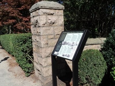
On Market Square west of America's Cup Avenue (Rhode Island Route 138A), on the left when traveling west.
Seamen's Church Institute
of Newport
has been placed on the
National Register
of Historic Places
by the United States
Department of the Interior
1983 — — Map (db m223220) HM
On Pelham Street just east of Corne Street, on the right when traveling east.
This property has been
placed on the
National Register
of Historic Places
by the United States
Department of the Interior
Built 1855 — — Map (db m223169) HM
Near Fort Adams Drive, on the left when traveling north.
During the late 19th century the Southwest battery was the advanced position for directing fire against the enemy’s warships. It was here that the giant Rodman cannons hurled their massive 15’ projectiles, each weighing over 300 pounds, to a range . . . — — Map (db m48143) HM
On Broadway at Calvert Street, on the left when traveling north on Broadway.
Dedicated to the memory of the citizens of Newport who served in the War with Spain. A brief war, but one where results were many, startling and of world-wide meaning. — — Map (db m223293) WM
On Spring Street at John Street, on the right when traveling south on Spring Street.
Charles Handy, Sr., owned land between Pelham and Bowery Streets that once belonged to Abraham Redwood. Handy died in 1793, leaving the estate to his sons Thomas, Levin, John, and William. About 1800 they sub-divided the land and laid out . . . — — Map (db m223179) HM
On Barney Street west of Mount Vernon Street, on the left when traveling east.
Known locally as the "Barney Street Cemetery", this plat was purchased by the Diocese of Boston in April, 1828. The site had on it a small schoolhouse, built in 1809, and this was used as the first church, dedicated to St. Joseph. Two adjoining . . . — — Map (db m223137) HM
St. Mary's Parish
was founded April 8, 1828 and is the oldest Parish in the Diocese of Providence
Present structure begun
August 7, 1848. Dedicated on
July 25, 1852. Consecrated
on August 15, 1884. President John F. Kennedy
and Jacqueline . . . — — Map (db m190084) HM
Built 1893 - 1895 has been designated a National Historic Landmark This building possesses National significance in commemorating the history of the United States of America 1994 National Park Service United States Department of the . . . — — Map (db m76659) HM
On Washington Square, on the right when traveling east.
Because of its commitment to religious toleration, Newport had no established church during the colonial period. There was no Puritan meeting house on the town square as was the norm elsewhere in New England. Instead, the Colony House and the Brick . . . — — Map (db m48556) HM
Demolition threatened The Elms and the surrounding summer houses in the 1960s, a critical period when the architectural landmarks of Bellevue Avenue were on the verge of complete destruction. In 1962, The Preservation Society of Newport County . . . — — Map (db m107353) HM
On Touro Street east of Spring Street, on the right when traveling west.
The famous letter by President George Washington to the Hebrew Congregation in Newport, August 21, 1790, in which religious freedom is laid out as a basic principle of the new republic.
To the Hebrew Congregation in Newport, Rhode Island . . . — — Map (db m223103) HM
On Ruggles Avenue near Bellevue and Ruggles Avenue.
Stoneacre, these three acres opposite Vernon Court on Bellevue Avenue (American’s most elegant street), are named for the mansion designed in 1884, by architect William Potter for John W, Ellis, which once occupied this site. Potter recommended . . . — — Map (db m107402) HM
On Commercial Wharf west of America's Cup Avenue (Rhode Island Route 138A), on the left when traveling west.
The Hammetts Bell was manufactured in 1872 by Vanduzen & Tift at its Buckey Bell Foundry in Cincinnati, and likely hung in a church steeple. The company made thousands of bells until it closed in the early 1950's, and has the distinction of founding . . . — — Map (db m223196) HM
Near Fort Adams Drive, on the left when traveling north.
Problem . . . Insufficient workforce to build a Fortress. The solution would come from Ireland. Five hundred families came to not only escape famine and economic hardship, but here they obtained the freedoms they so longed for in their homeland. . . . — — Map (db m48703) HM
During the 1870s and 1880s, architects pioneered a new type of American house based on a more open design and the use of organic materials.
Queen Anne, Stick, and Singles Style houses, with their half-timbering and rustic shingles, contrasted . . . — — Map (db m107356) HM
On Touro Street east of Spring Street, on the right when traveling west.
The Letter from Moses Seixas, Warden of the Hebrew Congregation in Newport, Rhode Island to President George Washington, August 17, 1790.
To the President of the United States of America
Sir,
Permit the children of the . . . — — Map (db m223099) HM
On Ocean Drive, on the right when traveling south.
This rocky outcrop is sometimes eroded by waves powerful enough to tear a hole in them. Colonies of small marine animals living on the shore, however, can withstand these forces. Some withdraw into narrow crevices, others attach themselves . . . — — Map (db m48463) HM
On Poplar Street at Thames Street, on the right when traveling east on Poplar Street.
To commemorate the repeal of the Stamp Act in March 1766, William Read deeded a small triangle of land at this site where grew the original Tree of Liberty, to William Ellery and others in trust. This tree was cut down by British occupation forces . . . — — Map (db m48095) HM
Near Fort Adams Drive, on the left when traveling north.
The Fast Passage provides easy entry to Narragansett Bay. So in wartime, an enemy fleet could have sailed right into Newport, with cannons blazing! To answer this potential threat, Fort Adams focused its firepower here on the west wall. Top tier . . . — — Map (db m48133) HM
On Touro Street at Division Street, on the right when traveling south on Touro Street.
The results of the religious toleration upon which Newport was founded are nowhere more evident than in the houses of worship clustered within a few hundred feet of this location: Touro Synagogue, the Seventh Day Baptist Meeting House, the United . . . — — Map (db m48580) HM
On Touro Street at Division Street, on the left when traveling east on Touro Street.
Touro Synagogue of Jeshuat Israel Congregation Founded 1658 Ths oldest synagogue building in the United States was designed by Peter Harrison. Ground was broken August 1, 1759. It was dedicated on December 2, 1763. Here, 1781-84 The Rhode Island . . . — — Map (db m48698) HM
On Lincoln Drive, on the right when traveling north.
In memory of our shipmates and members of Air Task Group 181 lost in an accidental explosion on the USS Bennington while operating off the coast of Rhode Island on May 26, 1954 [ List of those killed in the explosion. ] “As long as . . . — — Map (db m48623) HM
This model of Fort Adams provides an overview of the Fort’s design, including the main structure and the outworks for land defense. The drawings of the Fort show details of its construction and reveal the complexity of its design along with the . . . — — Map (db m66374) HM
On Washington Square, on the left when traveling east.
Washington Square, originally called the Mall and later the Parade, is ringed by buildings constructed over two centuries. The Square reflects Newport’s transformation from a rudimentary outpost to one of the five major trading posts in colonial . . . — — Map (db m48545) HM
On Hillside Avenue north of Admiral Kalbfus Road (Rhode Island Route 138), on the left when traveling north.
Frederick C. Mayer · George Mayhew · Alexander I. McElheran · Peter Moir · Andrew Mowat · John Francis Murphy · William Dennis Nagle · Guy Norman · Christos Papathanasopoulos · Albert Paulus · Sidney D. Reynolds · Caldwell Colt Robinson · Harold . . . — — Map (db m186855) WM
On West Main Road (Rhode Island Route 114) at Anselmo Drive, on the right when traveling south on West Main Road.
During the American Revolution the British strategy focused on controlling American ports and blockading the coast. Because of Newport’s significance as a deep-water port and as a center of trade, British forces landed in Newport in December of . . . — — Map (db m48348) HM
On Fort Street south of Sprague Street, on the right when traveling east.
These fortifications erected by the British 1777 were occupied by the Americans 1778, becoming the island base of the Continental Army under General Sullivan in the Battle of Rhode Island. They are now consecrated to the immortal memory of those . . . — — Map (db m48069) HM
On West Main Road (Rhode Island Route 114) at Anselmo Drive, on the right when traveling south on West Main Road.
The Use of the Land The scenic landscape that can be seen from this vantage point has had a rich and vibrant history. The Narragansett Indians inhabited this area of Rhode Island for thousands of years before its discovery by European . . . — — Map (db m48738) HM
Near Anthony Road Extention/Old Boyd's Lane, 0.1 miles west of Boyds Lane.
Erected to honor the memory and
perpetuate the spirit and ideals of
the founders of the first government
in the world to allow and to insure to
its citizens civil and religious liberty.
Established on this Site in the Year 1638
Portsmouth . . . — — Map (db m29736) HM
On W Main Road (Rhode Island Route 114), on the left when traveling north.
has been designated a --------------------------------- National Historic Landmark ---------------------------------- This site possesses national significance in commemorating the history of the United States of America 1975 National Park . . . — — Map (db m48094) HM
On W Main Road (Rhode Island Route 114), on the left when traveling north.
The 1st Rhode Island Regiment of the Continental Line 1775 – 1783 The war for American Independence was a long and arduous struggle that demanded much of the American people. Rhode Island responded to those demands with patriotic fervor, . . . — — Map (db m48374) HM
Near Highland Road at Lawton Avenue, on the left when traveling south.
The earthen mounds on this site are the original fortifications that defended Tiverton against British forces that occupied Aquidneck Island. With hand tools & human toil colonists dug the breastworks then pulled artillery pieces up the hill to the . . . — — Map (db m48078) HM
On Highland Road at Lawton Avenue, on the left when traveling south on Highland Road.
Through the unrelenting efforts of Dr. James W. Holt, Jr. Fort Barton was preserved. It was given to the town of Tiverton by the Newport Historical Society in 1968. In 1777 the site was fortified by the colonial army to defend against British . . . — — Map (db m48225) HM
Near Highland Road at Lawton Avenue, on the left when traveling south.
By the sincerity of his dedication and perseverance Dr. James W. Holt, Jr. motivated by the love for his community and the understanding of his environment, has served to preserve here an unspoiled display of our historical foundation which will . . . — — Map (db m48873) HM
On Douglas Tpke. (Rhode Island Route 7) at Victory Hwy., on the left when traveling south on Douglas Tpke..
Dedicated to the Memory
of the Men and Women, who
So Valiantly Served in the
Defense of Their Country
Naldor P. Berard
Born August 10, 1921
Died at Age 22
September 11, 1943
Enlisted in the U.S. Navy July
22, 1942. Was Seaman 1st . . . — — Map (db m191223) WM
Due to land disputes and broken peace treaties between local natives and early English settlers, King Philip's War took place for 14 months during 1675 and 1676. Captain Michael Pierce's fight with the natives occured on this spot in March of 1676. . . . — — Map (db m45093) HM
On Putnam Pike (Rhode Island Route 102) south of Sherman Lane, on the right when traveling south.
May 25, 1826 = May 25, 1976
Diverse hands fired upon
Betty
One of America's first elephants at the the north end of the rustic span that arched Chepachet River
Given in observation of the 150th anniversary of the event by Richmond and . . . — — Map (db m243023) HM
Near Diamond Hill Road (Rhode Island Route 114), on the left when traveling north.
This bell was cast by George Holbrook in East Medway MA in 1840, and was installed at 22 Broad St. It remained there until 1977 when it was dismantled by the Knights of Columbus and brought to the Hayden Library and dedicated to the departed . . . — — Map (db m55663) HM
On Taunton Avenue (Route 44) just east of Ivy Street, on the right when traveling east.
East Providence - Ribeira Grande
Sister Cities Committee
Established 1982
Recipient of the
Sister Cities International Award
for Professional Assistance
Sister Cities International Conference
Los Angeles, California . . . — — Map (db m222607) HM
On Purchase Street at Taunton Avenue (U.S. 44), on the right when traveling north on Purchase Street.
Composed of men who in the dark days of the Civil War
from 1861 to 1865 offered their lives that this Union
might be preserved ★ ★ ★ There is a debt this nation
can never pay that is the debt of gratitude to the soldiers . . . — — Map (db m198157) WM
On Purchase Street at Grove Avenue, on the right when traveling north on Purchase Street.
In honor of the men and women of East Providence who served in all wars and in memory of those who made the supreme sacrifice for our country. — — Map (db m222606) WM
On East Bay Bike Path north of Warren Avenue, on the right when traveling east.
This bridge opened for traffic in 1930 and known as the Washington Bridge first opened to traffic on April 12th 1793 and which carried the following inscription on an abutment
Washington Bridge.
Built by John Brown . . . — — Map (db m222506) HM
Near Cullen Hill Road, 0.7 miles north of Martin Street, on the left when traveling east.
Banking on the Riverbank's Value
This house exists because of Wilbur Kelly, who owned the land and a small mill just up the canal. In his younger years, Wilbur Kelly had worked as a ship captain in a fleet owned by Brown and Ives. Later, he . . . — — Map (db m195922) HM
Near Cullen Hill Road, 0.7 miles north of Martin Street, on the left when traveling east.
Kelly’s Mill Left An Impression
Do you see a rectangular footprint in front of you? It marks the site where the Kelly Mill stood. Starting in the early 1800s, the mill used water from the Blackstone River to power its spinning machines. . . . — — Map (db m195921) HM
On Front Street (Rhode Island Route 123) at Lonsdale Avenue (Rhode Island Route 122), on the right when traveling east on Front Street.
1914 1918
Dedicated to the Glory of God, the Exhaltation
of Patriotism and the Promotion of Education
in Honor of Those from Lincoln
Who Served in the World War — — Map (db m195925) WM
On Main Street at N Main Street, on the left when traveling east on Main Street.
The Mercantile Center
The two brick and stone buildings in front of you played an important role in the planned mill village of Slatersville. Known as the Commercial Blocks they were built by the Slater Company for the use of their workers. . . . — — Map (db m197767) HM
On N Main Street (Rhode Island Route 5) at Victory Hwy (Rhode Island Route 102), on the right when traveling north on N Main Street.
James Slater Memorial Park In Honor of James S. Slater Born Apr.23, 1841 Died Nov. 11, 1915 Town Clerk No Smithfield 1903-1914 General Assembly 1914-1915
To whom the State of Rhode Island and Providence Plantations owes recognition for the . . . — — Map (db m197766) HM
On Main Street at N Main Street, on the left when traveling east on Main Street.
Dedicated in Honor of
The patriotic Men and Women of the
Town of North Smithfield
Who Served Their Country in Time of War
Vietnam Era
★Leon Atterbridge · ★Rene Bois · ★Frederick Carter · ★Robert Labrecque · . . . — — Map (db m197769) WM
On Victory Hwy. (Rhode Island Route 102) at N Main Street (Rhode Island Route 5), on the left when traveling north on Victory Hwy..
Vietnam War Memorial
From the people of
The town of North Smithfield
In recognition of those who defended
Freedom during the Vietnam War
and to those Men and Women
who sacrificed their lives that we may
live in Freedom and . . . — — Map (db m192605) WM
On Pascoag Main Street at Nahant Place, on the right when traveling south on Pascoag Main Street.
Dedicated to the men and women of Burrillville who answered the call for Enduring Freedom, Iraqi Freedom and the Global War on Terrorism — — Map (db m191222) WM
Near Roosevelt Avenue south of Slater Street, on the left when traveling south.
Just six years after building Slater Mill, Samuel Slater's partners, William Almy and Obadiah Brown, bought another mill on their own. They even copied some of Slater's machine designs for their mill.
This annoyed Slater so much that he . . . — — Map (db m151663) HM
On Slater Street just east of Roosevelt Avenue, on the left when traveling west.
Tradition holds that Ebenezer Jenks built the house in front of you in the mid-1700s. He was the grandson of Pawtucket's first settler, Joseph Jenks, Jr.
By the end of the 1700s, Sylvanus Brown, a mechanic owned the place. He welcomed Samuel . . . — — Map (db m151660) HM
On Roosevelt Avenue, 0.1 miles north of Main Street (Rhode Island Route 15), on the right when traveling north.
Samuel Slater came here from England in 1789. He had just finished a seven-year apprenticeship at an English cotton mill, which gave him great knowledge of the water-powered spinning process developed over the previous two decades.
With the . . . — — Map (db m151668) HM
Built in 1685, this is the oldest standing house in Pawtucket and is on the National Register of Historic Places. It is now operated by the Pawtucket Chapter of the Daughters of the American Revolution.
For tour Hours Contact the Park Office — — Map (db m45087) HM
In commemoration of the 150th anniversary of the First Successful Cotton Mill in America this tablet was presented to the Old Slater Mill Association, present owners of this historic building in honor of the textile pioneer whose name they . . . — — Map (db m1613) HM
Near Roosevelt Avenue, 0.1 miles north of Main Street (Rhode Island Route 15), on the right when traveling north.
Control of waterpower meant control of economic, political, and social power.
A mill developer's first "power grab" was to build a walled dam. This created a pond that stored water to power the mill.
Other villagers didn't willingly . . . — — Map (db m151665) HM
On Main Street at Mineral Spring Avenue (Rhode Island Route 15), on the right when traveling east on Main Street.
First Rhode Island woman to make the supreme sacrifice as an Army Nurse with the Armed Forces of the United States in France during the World War
"She laid him with the dead as she turned to soothe the living and bind the wounds . . . — — Map (db m151678) WM
1885-1918
During his flying career, Jack McGee, one of Pawtucket's most famous sons and a pioneer in this country's aviation history, used this general area of Darlington to make many of his historic flights.
On June 11th 1918 he was killed . . . — — Map (db m45089) HM
This is the oldest stander carousel in the world it was built by pioneer craftsman Charles I. D. Looff in 1895, and was installed in Slater park in 1910.
Open weekends April, May, June, September, October and daily in July and August. Available . . . — — Map (db m45091) HM
On Slater Street just east of Roosevelt Avenue, on the left when traveling west.
David Wilkinson and his father built this mill together, finishing it in 1811. It made sense to build it next to Slater Mill. When Slater married Wilkinson's sister, Hannah, the families grew even closer and shared several ventures.
At . . . — — Map (db m151661) HM
Samuel Slater (1768-1835) opened this water-powered cotton spinning factory in 1793. Slater had left England in 1789 with working knowledge of mechanical yarn-making, and in Pawtucket he discovered artisans with the skills necessary for starting . . . — — Map (db m118316) HM
On Slater Street just east of Roosevelt Avenue, on the right when traveling east.
The American Industrial Revolution began right here. In 1793, Samuel Slater teamed up with investors and local artisans. Together, they built a first for the United States—a successful cotton spinning mill that was run by water power. . . . — — Map (db m151657) HM
On Summer Street (Rhode Island Route 15) just east of Maple Street, on the right when traveling west.
This building is a contributing structure of the
Downtown Pawtucket
Historic District
in the
National Register of Historic Places
United States Department of the Interior
The Deborah Cook Sayles . . . — — Map (db m151674) HM
On Summer Street (Rhode Island Route 15) just west of High Street, on the right when traveling west.
This building is a contributing structure of the
Downtown Pawtucket
Historic District
in the
National Register of Historic Places
United States Department of the Interior
[Top plaque:]
The . . . — — Map (db m151672) HM
On Exchange Street at Roosevelt Avenue, on the right on Exchange Street.
Honor to our gallant men and women
who served their nation
in the military during times of peril
They gave their yesterdays
in order to insure our tomorrows
Lest we forget
A grateful community
wishes to acknowledge all . . . — — Map (db m151653) WM
On Slater Street just east of Roosevelt Avenue, on the right when traveling east.
Slater Mill was America's first successful water-powered cotton spinning mill. For a small fee, tour the mill and learn how Samuel Slater and local craftsmen created machines that spun cotton into thread. Explore the Wilkinson machine shop and see a . . . — — Map (db m151659) HM
Near Roosevelt Avenue south of Leather Avenue, on the left when traveling south. Reported permanently removed.
The American Industrial Revolution began at Slater Mill. Here, in 1793, Samuel Slater, with Providence investors and Pawtucket artisans, built the first water-powered, cotton spinning factory in the United States. Beginning with this wooden mill, . . . — — Map (db m118324) HM
On Spring Street at Exchange Street, on the left when traveling north on Spring Street.
To perpetuate the memory of all who with unfailing loyalty defended on land and sea the nation's honor in the War with Spain, Phillipine Insurrection and China Relief Expedition. — — Map (db m151652) WM
667 entries matched your criteria. Entries 201 through 300 are listed above. ⊲ Previous 100 — Next 100 ⊳