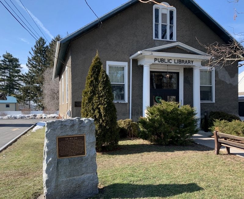
A village of the Cayuga Nation,
stood near this spot. It was occupied and
destroyed by a detachment from the army
of General John Sullivan, commanded by
Lieut-Col. William Butler, which bivouacked
here on the night of September 21, . . . — — Map (db m145819) HM
front face
An expedition against the hostile Indian nations which checked the aggressions of the English and Indians on the frontiers of New York and Pennsylvania, extending westward the dominion of the United States.
rear face . . . — — Map (db m145834) HM
American Revolution Lieutenant John Docksteder (British) was stationed here. Sept. 1, 1779, he led Senecas down Allegany Road to battle the Americans under Col. Brodhead near the Allegheny River. — — Map (db m108609) HM
American Revolution In early summer of 1782 a force of 250 Senecas led by Sayengaraghta and accompanied by a few British military foresters and Indian Department officers passed along Chautauqua Lake and outlet on its way to attack Hannastown, PA. . . . — — Map (db m94786) HM
Findley Lake, N.Y., Settled by Alexander Findley, Sergeant Revolutionary War & War of 1812 - Built dam in 1815 to power his mill - This created lake from two ponds. — — Map (db m117546) HM
Veterans Memorial. Placed in honor of the citizens of the town of Mina who served in the armed forces of the United States. Revolutionary War Memorial. Honoring Mina citizens •Alexander Findley •Josiah Morse •Juvenile Winters, who served in the . . . — — Map (db m117544) WM
Antietam To the perpetual memory of the defenders of the Union in the wars of 1776, 1812, and Civil War 1861-1865. Revolutionary War. Dutton, Moses War of 1812. Corse, Cyrus; Cross, George; Eades, Elisha A.; Eastman, Daniel; Graham, Aretus . . . — — Map (db m117538) WM
5 years a
Drum Major
in the
Continental Army,
was present at the
surrender of
Cornwallis,
and received an
Honorable Discharge
written by the hand of
Washington.
Died
April 1, 1856
In the . . . — — Map (db m154253) HM WM
General Sullivan's troops were attacked by Indians posted on this ridge. A valorous charge led by Colonel Hubley drove the Indians to the swamp a quarter mile west. The American dead were conveyed to Tioga and buried at Fort Sullivan.
(Reverse . . . — — Map (db m66976) HM
Generals John Sullivan and James Clinton were appointed by George Washington to lead a punitive expedition against the hostile tribes of the Iroquois Confederacy and to capture the British forts at Oswego and Niagara. The objectives were to . . . — — Map (db m198208) HM
In memory of the more than 170 soldiers of the American Revolution known to be buried in Chemung County, and of their pioneer wives and families. — — Map (db m90174) HM
The Delaware village near this site included 30 to 40 buildings and farm fields burned by Continental troops on August 13, 1779. — — Map (db m242356) HM
Erected by his fellow citizens to the memory of
a Revolutionary officer, a brave soldier,
a faithful citizen, and an honest man
who died Mar. 15, 1840 Ag'd 82 y'rs, 6 mos, 12 dy's
He was one of the oldest settlers and
the first white man . . . — — Map (db m154284) HM WM
The Revolutionary War divided communities and shattered ancient alliances. Along New York's frontier, simmering rivalries among settlers of European descent boiled over with threats and violent clashes. Many who remained loyal to King George III . . . — — Map (db m33553) HM
In 1778, the British government encouraged loyal colonists and Native American allies to attack frontier settlements. In July, Major John Butler led an attack on the Wyoming Valley, leaving more than 300 patriot soldiers dead, and by Butler's . . . — — Map (db m33548) HM
Dedicated to those of the Iroquois Indians, the British Army and the Continental Army who died at the Battle of Newtown August 29, 1779 Dedicated August 28, 1994 — — Map (db m33542) HM
1779 - 1929 in memoriam Major General John Sullivan commander-in-chief and the officers and men of the New Hampshire Brigade who participated in the memorable "Sullivan Campaign" against the Six Nations of Indians Erected by The State of New . . . — — Map (db m33543) HM
In 1879, a crowd of thousands celebrated the 100th anniversary of the Battle of Newtown and dedicated a monument built by the Newtown Monument Association atop the hill that figured prominently in accounts of the battle. Soon after, the monument . . . — — Map (db m33484) HM
The climactic battle of the Sullivan-Clinton campaign occurred here as approximately 5,000 soldiers defeated a British force of Native Americans, Loyalists, and regulars. — — Map (db m33545) HM
Delaware Captain who, with 20-40 Delaware men, defended their homes and land here on August 13, 1779 at the Battle of Chemung. — — Map (db m242357) HM WM
To protect the village of Newtown, about 600 Native American warriors, 200 loyalists, and a handful of British soldiers erected and camouflaged a half-mile-long breastwork of logs in the village overlooking a creek, hoping to surprise Sullivan's . . . — — Map (db m33550) HM
(Front Plaque):Near this site Sunday August 29, 1779 was fought The Battle of Newtown between Continental troops commanded by Major General John Sullivan and combined force of Tories and Indians under Colonel John Butler and Joseph . . . — — Map (db m33554) HM
Congress and General George Washington planned a major offensive campaign against the Seneca, Cayuga, and loyalists in 1779. Washington chose Major General John Sullivan to lead the expedition up the Susquehanna River, while Brigadier General . . . — — Map (db m33547) HM
In 1779 near this spot
General John Sullivan
mercifully disposed of his pack horses
worn out by faithful service
in the campaign against the
Six Nations of the Iroquois.
——————
The first white . . . — — Map (db m90382) HM
On September 24, 1779, General Sullivan's military park horses, returning through the valley from their 450 mile journey, had reached the end of their endurance. The General was compelled to dispose of these partners in the cause of American . . . — — Map (db m90386) HM
An expedition against the hostile Indian nations which checked the aggressions of the English and Indians on the frontiers of New York and Pennsylvania, extending westward the dominion of the United States. — — Map (db m90383) HM
From this Hidden Stronghold British, Indians and Tories Ravaged the Frontier From the West Branch to the Mohawk Destroyed by Sullivan-Clinton Expedition August 13, 1779 — — Map (db m81210) HM
The 1779 campaign drove
native peoples from their
villages. Seneca and Delaware
fought to protect their
family, homes and way of life. — — Map (db m243110) HM
The Seneca and Delaware urged
British allies to help block
Continental troops advance
resulting in Battle of
Newtown on August 29, 1779. — — Map (db m243111) HM
An expedition against the hostile Indian nations which checked the aggressions of the English and Indians on the frontiers of New York and Pennsylvania extending westward the dominion of the United States
( back )
Newtown 1779 . . . — — Map (db m220619) WM
Libertas et Patria Soldiers of the American Revolution Buried in this Cemetery Lt. Israel Parshall Pa. • Lt. Christopher Denn Pa. Sgt. Daniel McDowell Pa. • Sgt. Alexander Murry N.Y. Pvt. Abraham Brewer N.Y. • Pvt. John Brewer N.Y. Pvt. Thomas . . . — — Map (db m33359) HM
Libertas et Patria Soldiers of the American Revolution Buried in this Cemetery Lt. Israel Parshall Pa. • Lt. Christopher Denn Pa. Sgt. Daniel McDowell Pa. • Sgt. Alexander Murry N.Y. Pvt. Abraham Brewer N.Y. • Pvt. John Brewer N.Y. Pvt. Thomas . . . — — Map (db m90334) HM
Continental soldiers were delayed crossing nearby swamp in attempt to surround British forces at Battle of Newtown on August 29, 1779. — — Map (db m242615) HM WM
On the pinnacle near this site, the Movable Lodge of Free Masons, connected with the army of
Major General John Sullivan
of New Hampshire
held a command under a large oak tree, while on a military expedition against the Six Nations of . . . — — Map (db m220541) HM
About two miles down The Susquehanna River on an island and adjacent shores was the camp site of the army of General James Clinton on the night of August 13, 1779. The site of Afton was occupied by the Indian village of Conihunto Destroyed by a . . . — — Map (db m93323) HM
Routes of the Armies of
General John Sullivan
and General
James Clinton
1779
An expedition against the hostile Indian nations which checked the aggressions of the English and Indians on the frontiers of New York and Pennsylvania, extending . . . — — Map (db m92996) HM
Indians living in the valleys of the Unadilla and Susquehanna Rivers played an important role in the region's early history. Fur traders from Albany and the Mohawk Valley reached out to Oquaga (now Windsor), and a mission to the Indians was . . . — — Map (db m93549) HM
Routes of the Armies of
General John Sullivan
and
General James Clinton
1779
An expedition against the hostile Indian nations which checked the aggressions of the English and Indians on the frontiers of New York and Pennsylvania, extending . . . — — Map (db m92998) HM
Columbus Memorial
Columbus named by Dr. Tracy Robinson
First settlement by Col. Converse on lot 44 in 1781.
Revolutionary Soldiers buried in Columbus
Church, C.
Church, J.
Dennison, J.P.
Howard, T.
Kinney, N.
Loomis, . . . — — Map (db m168968) WM
To the memory of the Revolutionary Soldiers who settled and lived in the town of Guilford
Col. Stephen Winsor · Capt. Elihu Murray · Capt. David Richmond · Aaron Jewel · Daniel Johnson · Samuel Mead · Ezekiel Wheeler · Joseph Rhodes · Abner . . . — — Map (db m241148) WM
A Memorial to
Revolutionary Soldiers
Buried in the
Town of Oxford
Maj. Benjamin Throop · Maj. Gerrit Vanwagenen · Lieyt. Solomon Fenton · Sgt. Maj. Samuel Stow · Hezekiah Brockett · Henry Balcolm · Dr. Samuel Baldwin · Zophar Bets · John . . . — — Map (db m204633) WM
Colonel William S. Smith,
aide to Washington, owned
150,000 acres hereabout in
1791; married Abigail Adams.
Buried at rear, due north. — — Map (db m93154) HM
This wasn't always the quiet, peaceful place you find today. Point au Fer was once an important strategic military post.
The northern half of Lake Champlain used to be controlled by the French. On June 6, 1760, during the French and Indian War . . . — — Map (db m234761) HM
In 1774, a two-story white stone garrison was built here by the British, fortified by American Gen. John Sullivan with entrenchment and stockade in 1776 and destroyed by fire in 1805. British occupation 1774 - 1775 and 1776-1796. American . . . — — Map (db m49069) HM
1763 homestead site of Jean LaFramboise first settler in Clinton County driven out by Burgoyne in 1777-Returned 1783 Estab. 1st North Country apple orchard — — Map (db m105856) HM
Valcour Bay
has been designated
registered a National
Historic Landmark
under the provisions of the
Historic Sites Act of August 2, 1935.
This site possesses exceptional value
in commemorating or illustrating
the history of the United . . . — — Map (db m194591) HM
In 1789, four years after settling in Plattsburgh, residents built a block house for
protection against the British - only miles away on Point au Fer on Lake Champlain.
Though no British or Indian raids initially materialized, the . . . — — Map (db m46595) HM
11 October 1776. Across this strait a small colonial fleet fought the British to a standstill causing a 3 day running conflict that delayed the British advance to divide the colonies. This action allowed time for the Americans to rebuild their . . . — — Map (db m108649) HM
1776. Benedict Arnold for twelve September days opposite Chazy readied his fleet and planned his strategy for the Battle of Valcour. — — Map (db m106264) HM
1776. Benjamin Franklin, Samuel Chase & Charles Carroll of Carrollton paused near here April 26 en route to Montreal as Delegates of Congress. — — Map (db m106115) HM
Final resting place of 28 known Revolutionary War patriots in this Mountain View Cemetery and nearby Dewitt Brown Cemetery, honored May 19, 2012 by the Sons and the Daughters of the American Revolution, the Veillette-Nifosi Foundation and the . . . — — Map (db m158652) HM
October 1777 marked a defining moment in Clermont's history. Seeking to put down the rebellious colonists, British forces burned Kingston, several private homes, and the Livingston estate. Upon receiving word of the potential danger only days . . . — — Map (db m149833) HM
Robert R Livingston
Born 1746 - Died 1813
Recorder Of New York 1773-1775
Member Of Continental Congress
1775-77, 1779-81, 1784-85
On Committee Of Five Which Drafted
Declaration Of Independence
Member Of Provincial Congress, 1775-77 . . . — — Map (db m149811) HM
Through this place passed Gen. Henry Knox in the winter of 1775-1776 to deliver to Gen. George Washington at Cambridge the train of artillery from Fort Ticonderoga used to force the British Army to evacuate Boston Erected by The State of New York . . . — — Map (db m24003) HM
Through this place passed Gen. Henry Knox in the winter of 1775-1776 to deliver to Gen. George Washington at Cambridge the train of artillery from Fort Ticonderoga used to force the British Army to evacuate Boston Erected by The State of New York . . . — — Map (db m24004) HM
New York Side:Through this place passed Gen. Henry Knox in the winter of 1775-1776 to deliver to Gen. George Washington at Cambridge the train of artillery from Fort Ticonderoga used to force the British Army to evacuate Boston Erected by . . . — — Map (db m24006) HM
On Sept. 17, 1824, General Lafayette was welcomed in Hudson on his way upriver to Albany. A procession led him around the main streets. — — Map (db m228826) HM
Through this Place Passed
Gen. Henry Knox
In the Winter of 1775 - 1776
To Deliver To
Gen. George Washington
At Cambridge
The Train of Artillery
From Fort Ticonderoga
Used to Force the British
Army to Evacuate Boston . . . — — Map (db m23750) HM
as prisoner of war was entertained in this house on night of October 22, 1777 while being taken from Battle of Saratoga to Boston. — — Map (db m37478) HM
On June 13, 1825 General Lafayette Visited Kerr and Hull's Colombia Hall. Viewed Medicinal Springs, then departed for Pittsfield. — — Map (db m203368) HM
Col. David Pratt 1738-1828,
Revolutionary War veteran,
built this house in 1777.
Led petition for 1793 law
clearing local land titles. — — Map (db m145517) HM