The mural reveals important moments in the city’s development by “peeling through” eight of the numerous layers of time from the present to the past.
An aspect of the mural is the transition of color through the piece. It was . . . — — Map (db m58564) HM
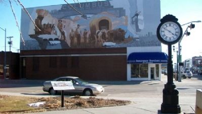
The West produced many fighting men and ranking high among them are Frank and Luther North of Columbus, leaders of the legendary Pawnee Scouts. The Pawnee, located at their nearby reservation, were eager to cooperate with the Army in fighting their . . . — — Map (db m53147) HM
In June 1720 a Spanish military force led by Sir Pedro de Villasur left Santa Fe, New Mexico, to gather information on French activities near the Missouri River. The force included 45 veteran soldiers, 60 Pueblo Indian allies, some Apache scouts, . . . — — Map (db m53143) HM
The Republican Valley was the center of one of the major buffalo ranges of the Great Plains. It was a favorite hunting ground of several Indian tribes. Pawnee, Sioux, Oto and Cheyenne spent much time here as late as 1874. These tribal hunts, . . . — — Map (db m152923) HM
Big Elk
Indian Name
(Ong-Pa-Ton-Ga)
1770 - 1846
Last full blooded chief of the Omaha Tribe; Friend of the pioneers, and grandfather of Logan Fontenelle. — — Map (db m80771) HM
In November 1833 Moses and Eliza Merrill, missionaries sponsored by the Baptist Missionary Union, arrived at the government Indian agency at Bellevue and opened a mission school for the Oto and Missouri Indians living in eastern Nebraska. The . . . — — Map (db m78023) HM
The Lower Platte River valley landscape is dotted with villages affiliated with the Central Plains Tradition—the term used by archaeologists to define the vast prehistoric Native American population that lived in Nebraska from A.D. 1000 to . . . — — Map (db m2147) HM
Unlike the Native Americans, many 19th century European-Americans did not see the abundance and beauty of the prairie. At first it was just a barrier between them and their goals further west. Oregon had the fertile Willamette Valley, California . . . — — Map (db m164140) HM
Pioneers saw the Great Plains as an endless and monotonous "Sea of Grass," but it was much more. It was a land inhabited by nomadic people who followed the immense herds of bison. These Native American tribes knew and understood the prairie, its . . . — — Map (db m191415) HM
While emigrants were mostly self-sufficient, there were
times when they needed extra help. Since there were few
forts in the early years, aid often came from the feared
"savages.” Instead of attacking the wagon trains as the
eastern . . . — — Map (db m174496) HM
In 1849 Joseph Rogidoux III of St. Joseph, Missouri, licensed in the Indian trade, ordered removal of his outfit from the vicinity of Fort Laramie to this strategic pass over Scotts Bluff, where there was ample wood and water. Evidence from several . . . — — Map (db m99134) HM
The river is life. Animals made their paths along it and leading to and from it. Humans followed next; the first traveled lightly, leaving little trace of their passing. Occasionally they would climb the tall bluffs where the height allowed . . . — — Map (db m164108) HM
Three panels make up this marker
“The Great Smoke”
From all directions they came in late summer 1851 - Plains Indian tribes, summoned by government officials so their chiefs could smoke the peace pipe and sign a . . . — — Map (db m79439) HM
In 1877 the Ponca Tribe and Chief Standing Bear were forced from their Nebraska homeland along the Niobrara River to an Oklahoma reservation. Hardships followed them during the more than 500-mile trek. Standing Bear’s daughter Prairie Flower died . . . — — Map (db m179391) HM
This rest site is near the center of Nebraska's tall-grass prairie on the eastern edge of the hunting grounds once used by the Pawnee Indians. Nebraska's largest tribe, the Pawnee located villages on major area streams, including the Blue, Loup, and . . . — — Map (db m92536) HM
This is the country of Mari Sandoz — historian, novelist, teacher — who brought its history and its people to life in her many books, articles and stories. She was born in Sheridan County, Nebraska. Although she lived much of her life in the East, . . . — — Map (db m180957) HM
A single willow tree on the banks of Antelope Creek served as a landmark along the Gordon Trail for settlers, fur traders, and Native Americans. In 1885, Reverend John Scamahorn and 104 settlers from Indiana set up camp at the Lone Willow. Later . . . — — Map (db m235938) HM
About ten miles north are the sites of Spotted Tail Agency and Camp Sheridan. Named for Brule Sioux Chief Spotted Tail, the agency was built in 1874 to supply treaty payments, including food, clothing, weapons, and utensils, under the terms of the . . . — — Map (db m159081) HM
Ample water from the Niobrara River, protective bluffs, and good grazing land made this an ideal place for a ranch. Established in 1879, it was one of the first ranches in the frontier territory of Sioux County. By the early 1900s, it encompassed . . . — — Map (db m202236) HM
Based on his friendship with Chief Red Cloud and others, James Cook regularly invited Lakota families from the Pine Ridge Reservation to stay at Agate Springs Ranch. Arriving by wagon and horseback, they made the 150-mile, one-week journey almost . . . — — Map (db m202237) HM
During this time of scientific exploration, other gatherings took place at James Cook's Agate Springs Ranch. Red Cloud, an Oglala Lakota leader, and many of his friends and family often made the 150-mile trip by wagon to visit from the Pine Ridge . . . — — Map (db m202252) HM
During the time of scientific exploration, other gatherings took place at Agate Springs Ranch. Red Cloud of the Oglala Lakota and many of his friends and family members would make the 150-mile trip by wagon from the Pine Ridge Reservation. While . . . — — Map (db m202227) HM
On September 9, 1878, after a year of suffering on an Oklahoma reservation, some 300 Northern Cheyenne Indians began a trek back to their homeland. Dull Knife's band of 149 Indians were captured and taken to Fort Robinson. For months they refused to . . . — — Map (db m9594) HM
Site where seven companies of the Fifth U.S. Cavalry under Col. Wesley Merritt intercepted 800 Cheyennes and Sioux en route to join Indians in the north July 17, 1876 The Cheyennes and Sioux were driven back to the Red . . . — — Map (db m173965) HM WM
Near here are ruts left by the famed 1874 Sioux Expedition, a U.S. military force sent to establish Camps Sheridan and Robinson. The 1868 Treaty of Fort Laramie had guaranteed food and supplies to the Sioux and other tribes in exchange for lands . . . — — Map (db m135119) HM
This was the homeland of the Omaha Tribe long before white settlers came to the Great Plains. By 1750, the Omaha occupied a large region in northeastern Nebraska and northwestern Iowa. The name “Omaha” means “those going against the wind or current” . . . — — Map (db m155206) HM
This hospital is named in honor of the first Native American woman physician. Dr. Picotte (1865-1915) was the daughter of Mary Gale and Iron Eye, also known as Joseph La Flesche, the last traditionally recognized chief of the Omaha tribe. She was . . . — — Map (db m206824) HM
This hospital was built in 1912 under the guidance of Dr. Susan La Flesche Picotte, the first Native American woman physician, with the financial support of the Presbyterian Board of Home Missions and other donors. It served both Native American . . . — — Map (db m206828) HM
In 1863, the Winnebago Indians were moved from their home in Minnesota to a barren reservation in Dakota Territory. Groups of Winnebago soon moved down the Missouri River to the Omaha Reservation in Nebraska. In March, 1865, the Winnebago used . . . — — Map (db m206993) HM
On August 3 Lewis and Clark held a council with the Oto and Missouria Indians at a site they named "Council Bluff," near present Fort Calhoun, Nebraska. It was the first of many councils they would hold on their journey to the Pacific Ocean. . . . — — Map (db m7794) HM
From 1820 to 1827, the nation's largest and most westerly military post occupied this site, the earlier scene of Lewis and Clark's Council Bluff. In late 1819, troops under Colonel Henry Atkinson established Cantonment Missouri along the river near . . . — — Map (db m223480) HM
On July 30 the explorers arrived at the bluff where Fort Atkinson would be built less than two decades later. Clark wrote, "The Situation of this place which we Call Council Bluff which is handsom ellevated a Spot well Calculated... for a . . . — — Map (db m7887) HM
133 entries matched your criteria. Entries 101 through 133 are listed above. ⊲ Previous 100