By Syd Whittle, July 6, 2009
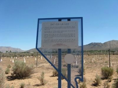
Dat-So-La-Lee Marker and Cemetery in Background
| Near Bigelow Drive near Snyder Avenue. |
| On West Fifth Street at Terrace Street, on the right when traveling west on West Fifth Street. |
| On Snyder Avenue near Clear Creek Drive, on the right when traveling south. |
| On North Plaza Street at East Washington Street on North Plaza Street. |
| On U.S. 50, 23 miles north of Nevada Route 722, on the right when traveling north. |
| Near U.S. 50 at milepost 30.7, on the left when traveling east. |
| Near U.S. 50 at milepost 30.7, on the left when traveling east. |
| On U.S. 50 at milepost 30.7, on the right when traveling west. |
| Near U.S. 50 at milepost 30.7, on the left when traveling east. |
| Near U.S. 50 at milepost 30.7, on the left when traveling east. |
| Near U.S. 50 at milepost 30.7, on the left when traveling east. |
| Near U.S. 50 at milepost 30.7, on the left when traveling east. |
| On Nevada Route 722 at milepost 4.7, on the right when traveling north. |
| On U.S. 50, on the right when traveling east. |
| Near U.S. 95 at Interstate 80, on the right when traveling south. |
| On Canyon Road, 0.6 miles north of Industrial Road, on the right when traveling north. |
| On U.S. 95 at Nevada Route 165, on the left when traveling south on U.S. 95. |
| On North Main Street at Paiute Drive, on the right when traveling south on North Main Street. |
| On North Las Vegas Boulevard at Foremaster Lane on North Las Vegas Boulevard. |
| On Tule Springs Road, on the right when traveling north. |
| On Avi Casino Drive, 1.8 miles west of Needles Highway, on the left when traveling north. |
| On Needles Highway (at milepost 5), 2 miles south of West Casino Drive, on the right when traveling south. |
| Near South Pioneer Road (State Highway 169), on the right when traveling north. |
| On Nevada Route 165, 12.9 miles east of U.S. 95, on the left when traveling east. |
| On Nevada Route 165, 12.9 miles east of U.S. 95, on the left when traveling east. |
| Near South Moapa Valley Boulevard. |
| On Nevada Route 169, 0.1 miles south of Simplot Road, on the left. Reported missing. |
| On U.S. 395, 0.9 miles south of Leviathan Mine Road, on the right when traveling north. |
| On Highway 395, on the right when traveling south. |
| Near Jacks Valley Road/Main Street (Nevada Route 206) near Genoa Lane. |
| On Railroad Street at 7th Street, on the right when traveling north on Railroad Street. |
| On Idaho Street, 0.1 miles north of 14th Street, on the left when traveling north. |
| Near Interstate 80 at milepost 292, on the right when traveling west. |
| On U.S. 95 at S Road, on the right when traveling north on U.S. 95. |
| On North Road, 5 miles east of U.S. 95, on the left when traveling east. |
| On the rest area at Exit 216 (Interstate 80), on the right when traveling east. |
| On Museum Avenue near Maple Avenue, on the left when traveling west. |
| On Highway 50, on the right when traveling east. |
| On Highway 50, on the right when traveling east. |
| On Nevada Route 376, 0.4 miles south of U.S. 50, on the left when traveling south. |
| On U.S. 50 near Main Street, on the right when traveling north. |
| On Main Street just west of Lincoln Highway (U.S. 50), on the right when traveling west. |
| On N Main Street, on the right when traveling south. |
| On Nevada Route 208 just north of Copperbelt Drive. |
| On U.S. 95 at Cottonwood Lane, on the left on U.S. 95. |
| Near Point of Rocks Road, 1.5 miles east of Spring/Ash Meadows Road. |
| Near Cedar Street, 0.1 miles west of Main Street (Nevada Route 82), on the left when traveling west. Reported missing. |
| On U.S. 95, on the right when traveling west. |
| Near 3rd Street east of East Street, on the left when traveling east. |
| On Sutcliffe Highway (Nevada Route 446) near Pyramid Lake Road (Nevada Route 445), on the left when traveling north. |
| On Pyramid Lake Road (Nevada Route 445) near Sutcliffe Highway (Nevada Route 445), on the right when traveling north. |
| On Henness Pass Road, on the left when traveling west. |
| On Interstate 80, on the right when traveling east. Reported missing. |
| Near U.S. 93 at White Pine County Road 18 (Nevada Route 893), on the right when traveling north. |