After filtering for New Hampshire, 49 entries match your criteria.
Waterways & Vessels Topic
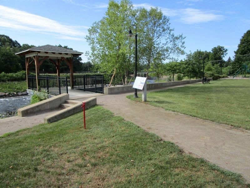
By Anton Schwarzmueller, August 18, 2016
The Winnipesaukee River Marker at Riverfront Park
| 1 ► New Hampshire, Belknap County, Tilton, Tilton-Northfield — The Winnipesaukee River — Tilton Riverfront Park — |
| Near West Main Street (U.S. 3) at Winter Street, on the left when traveling west. | |||
| 2 ► New Hampshire, Cheshire County, Hinsdale — Hinsdale and the Power of the Ashuelot — |
| On Canal Street (New Hampshire Route 119) 0.5 miles east of Chesterfield Road (New Hampshire Route 63), on the left when traveling east. | |||
| 3 ► New Hampshire, Cheshire County, Hinsdale — The Story of Anadromous Fish — From Freshwater to the Ocean and Back Again — |
| On Canal Street (New Hampshire Route 119) 0.5 miles east of Chesterfield Road (New Hampshire Route 63), on the left when traveling east. | |||
| 4 ► New Hampshire, Coos County, Groveton — Connecticut River to Umbagog Lake — Northern Forest Canoe Trail — |
| On Main Street (U.S. 3) 0.1 miles north of Berlin-Groveton Highway (New Hampshire Route 110), on the right when traveling north. | |||
| 5 ► New Hampshire, Coos County, Lancaster — 173 — Lake Coos and the Presidential Range — |
| On Portland Street (U.S. 2) 1.8 miles east of Prospect Street (U.S. 3), on the right when traveling west. | |||
| 6 ► New Hampshire, Coos County, Stratford — 034 — Log Drives — |
| On U.S. 3, 0.3 miles south of Washburn Road, on the right when traveling south. | |||
| 7 ► New Hampshire, Grafton County, Franconia — Early Franconia — |
| On Main Street (New Hampshire Route 116) 0.1 miles south of Sugar Hill Road (New Hampshire Route 117), on the left when traveling north. | |||
| 8 ► New Hampshire, Grafton County, Lebanon — Colburn Park — |
| Near S. Park Street at Bank Street, on the left when traveling east. | |||
| 9 ► New Hampshire, Grafton County, Orford — The Samuel Morey Memorial Bridge — Erected 1937 — |
| On Bridge Street (New Hampshire Route 25A) east of Main Street (U.S. 5), on the left when traveling east. | |||
| 10 ► New Hampshire, Grafton County, Plymouth — 189 — Stream Gaging in New Hampshire — |
| On Green Street. | |||
| 11 ► New Hampshire, Grafton County, Rumney — 55 — Baker River — |
| On Mount Moosilauke Highway (New Hampshire Route 25) 1 mile west of Halls Brook Road, on the right when traveling west. | |||
| 12 ► New Hampshire, Hillsborough County, Manchester, Downtown — 124 — Amoskeag Mills — |
| On Canal Street at West Pentacook Street, on the right when traveling north on Canal Street. | |||
| 13 ► New Hampshire, Hillsborough County, Nashua — Nashua River - Jackson Falls Dam — |
| Near Pearson Avenue, 0.1 miles east of Main Street, on the left when traveling east. | |||
| 14 ► New Hampshire, Hillsborough County, Weare — Pine Tree Riot — |
| On South Stark Highway (New Hampshire Route 114) 0.1 miles south of Orchard Hill Road, on the right when traveling south. | |||
| 15 ► New Hampshire, Merrimack County, Concord — George Hamilton Perkins — |
| On North State Street at Park Street on North State Street. | |||
| 16 ► New Hampshire, Merrimack County, Concord — Site of First Ferry — |
| On Eastman Street, on the right when traveling north. | |||
| 17 ► New Hampshire, Merrimack County, Concord — 0238 — The Pennacook — |
| On College Drive, on the right when traveling north. | |||
| 18 ► New Hampshire, Merrimack County, Concord — U.S.S. Maine Memorial — |
| 19 ► New Hampshire, Merrimack County, Hill — 0162 — New Hill Village — |
| On Commerce Street (New Hampshire Route 3A), on the right when traveling north. | |||
| 20 ► New Hampshire, Merrimack County, Pembroke — 187 — Suncook Village — |
| On Main Street at Union Street, on the left when traveling north on Main Street. | |||
| 21 ► New Hampshire, Rockingham County, New Castle — Mines Building — |
| Near Sullivan Lane, 0.2 miles east of Wentworth Road. | |||
| 22 ► New Hampshire, Rockingham County, New Castle — Walbach Tower — |
| On Sullivan Lane east of Wentworth Road, on the right when traveling east. | |||
| 23 ► New Hampshire, Rockingham County, New Castle — Walbach Tower — |
| On Sullivan Lane east of Wentworth Road, on the right when traveling east. | |||
| 24 ► New Hampshire, Rockingham County, Newington — Bloody Point Ferry — |
| On Shattuck Way north of Bloody Point Road, on the right when traveling north. | |||
| 25 ► New Hampshire, Rockingham County, Portsmouth — CMoMM (SS) Arthur L. Stanton Chief of the Boat (COB) — Albacore — Portsmouth Submarine Memorial Association — |
| Near Submarine Way north of Bypass U.S. 1, on the left when traveling west. | |||
| 26 ► New Hampshire, Rockingham County, Portsmouth — Dedicated to the men of the USS Thresher (SSN 593) — |
| On Route 1 Bypass near Submarine Way, on the right when traveling north. | |||
| 27 ► New Hampshire, Rockingham County, Portsmouth — In This House Admiral (John) Paul Jones Resided — |
| On Middle Street (U.S. 1) north of State Street, on the right when traveling north. | |||
| 28 ► New Hampshire, Rockingham County, Portsmouth — James Baxter Sergeant — Born February 10, 1946 in Trenton, NJ, son of Neil and Katherine (Keby) Sergeant — Died March 23, 2014 in Winter Park, FL — |
| Near Submarine Way north of Bypass U.S. 1, on the left when traveling west. | |||
| 29 ► New Hampshire, Rockingham County, Portsmouth — Memorial Bridge 1923-2012 — |
| On Daniel Street, on the right when traveling west. | |||
| 30 ► New Hampshire, Rockingham County, Portsmouth — New Hampshire's Lost Boat — USS Capelin SS 289 — |
| Near Submarine Way north of Bypass U.S. 1, on the left when traveling west. | |||
| 31 ► New Hampshire, Rockingham County, Portsmouth — North Pier — |
| Near State Street north of Marcy Street, on the right when traveling north. | |||
| 32 ► New Hampshire, Rockingham County, Portsmouth — Pleasant Street — |
| On Pleasant Street at Washington Street, on the left when traveling west on Pleasant Street. | |||
| 33 ► New Hampshire, Rockingham County, Portsmouth — Portsmouth Naval Shipyard Memorial — |
| Near Submarine Way north of Business U.S. 1, on the left when traveling west. | |||
| 34 ► New Hampshire, Rockingham County, Portsmouth — Portsmouth Navy Yard — |
| Near Marcy Street north of Puddle Lane, on the right when traveling north. | |||
| 35 ► New Hampshire, Rockingham County, Portsmouth — Portsmouth NH Marine Railway — |
| Near Marcy Street. | |||
| 36 ► New Hampshire, Rockingham County, Portsmouth — Portsmouth Pier & Wharves — |
| Near State Street north of Marcy Street, on the right when traveling north. | |||
| 37 ► New Hampshire, Rockingham County, Portsmouth — Spring Hill Waterfront — |
| Near Ceres Street north of Bow Street, on the right when traveling north. | |||
| 38 ► New Hampshire, Rockingham County, Portsmouth — Still On Patrol — |
| On Bypass U.S. 1 near Submarine Way, on the right when traveling north. | |||
| 39 ► New Hampshire, Rockingham County, Portsmouth — The Continental Frigate "Raleigh" — |
| On Middle Street (U.S. 1) north of State Street, on the right when traveling north. | |||
| 40 ► New Hampshire, Rockingham County, Portsmouth — U.S.S. Albacore — |
| Near Route 1 Bypass near Submarine Way when traveling north. | |||
| 41 ► New Hampshire, Rockingham County, Portsmouth — U.S.S. O9 SS-70 — |
| On Route 1 Bypass near Submarine Way., on the right when traveling north. | |||
| 42 ► New Hampshire, Rockingham County, Portsmouth — U.S.S. Squalus SS-192 — |
| On Route 1 Bypass near Submarine Way, on the right when traveling north. | |||
| 43 ► New Hampshire, Rockingham County, Portsmouth — Union Cemetery — |
| On Maplewood Avenue north of Vaughn Street, on the left when traveling north. | |||
| 44 ► New Hampshire, Rockingham County, Portsmouth — 234 — US Route 1 Bypass of Portsmouth, NH (1940) — |
| On Woodbury Avenue (New Hampshire Route 1) at US 1 Bypass on Woodbury Avenue. | |||
| 45 ► New Hampshire, Rockingham County, Portsmouth — USS Albacore SS 218 Memorial — |
| Near Submarine Way north of Bypass U.S. 1, on the left when traveling west. | |||
| 46 ► New Hampshire, Rockingham County, Rye — 018 — Isles Of Shoals — |
| Near Ocean Boulevard (Route 1A). | |||
| 47 ► New Hampshire, Rockingham County, Salem — Native American Dugout Canoe |
| Near Haverhill Road just north of Christine Lane, on the left when traveling north. Reported unreadable. | |||
| 48 ► New Hampshire, Strafford County, Dover — Dover NH Spanish American War Memorial/USS Maine Memorial — |
| On Central Avenue, on the right. | |||
| 49 ► New Hampshire, Sullivan County, Cornish — The Farragut Monument — Saint-Gaudens National Historic Site — |
| On St Gaudens Road. | |||