By Barry Swackhamer, May 3, 2018
Fort Boise Marker
| On State Highway 21 at East Lake Forest Drive, on the right when traveling east on State Highway 21. |
| On West Main Street, 0.1 miles east of South 2nd Street, on the right when traveling east. |
| On South 5th Avenue at South 4th Avenue, on the left when traveling north on South 5th Avenue. |
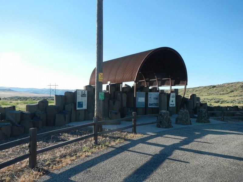
| On U.S. 20 at milepost 148 near Washington/Wheat Ranch Road, on the left when traveling west. |
| On Lincoln Road, 0.2 miles east of Middleton Road, on the left when traveling east. |
| On South 3rd Street West near West 3rd Street South. |
| On South 3rd Street West near West 3rd Street South, on the right when traveling south. |
| On Elba-Almo Road at 3000 South, on the right when traveling south on Elba-Almo Road. |
| On A-2 Clark County Road (Main Street) near Old Highway 22, on the right when traveling east. |
| On A-2 Clark County Road (Main Street) near Interstate 15, on the left when traveling east. |
| On Custer Street (U.S. 93) near Capital Avenue, on the right when traveling north. |
| Near U.S. 91 near Hot Springs Road, on the right when traveling north. |
| On U.S. 91 near Hot Springs Road. |
| On U.S. 91 just south of Hot Spring Road, on the right when traveling north. |
| On Highway 91 (State Highway 91) just south of Hot Spring Road, on the right when traveling north. |
| Near U.S. 91 near Hot Springs Road, on the right when traveling north. |
| Near U.S. 91 near Hot Springs Road, on the right when traveling north. |
| Near U.S. 91 near Hot Springs Road, on the right when traveling north. |
| On Highway 91 (State Highway 91) just south of Hot Spring Road, on the right when traveling north. |
| Near U.S. 91 near Hot Springs Road, on the right when traveling north. |
| Near U.S. 91 near Hot Springs Road, on the left when traveling north. |
| On Kilgore-Yale Road near U.S. 20, on the left when traveling west. |
| On U.S. 95 at Airport Road, on the right when traveling north on U.S. 95. |
| On U.S. 95 at Airport Road, on the right when traveling north on U.S. 95. |
| On U.S. 95 at Airport Road, on the right when traveling north on U.S. 95. |
| On Lolo Motorway (Forest Road 500) near Weites Butte Lookout Road, on the left when traveling west. |
| On U.S. 95 near Lake Road, on the left when traveling north. |
| Near Lake Road near Tolo Lake Road, on the left when traveling south. |
| On U.S. 95 at milepost 227, on the right when traveling north. |
| On Pine Street near U.S. 95. |
| On U.S. 12 at State Highway 13, on the left when traveling east on U.S. 12. |
| On U.S. 12, 0.5 miles east of State Highway 13, on the right when traveling east. |
| Near U.S. 12 at Elk Meadows Road, on the left when traveling east. |
| On U.S. 12 at milepost 158 near Forest Road 1684, on the left when traveling west. |
| On State Highway 13 at milepost 21 near Stites Grade Road, on the left when traveling north. |
| On Lolo Motorway (Forest Road 500) near Liz Butte Road, on the left when traveling west. |
| On Lolo Motorway (Forest Road 500) near Horseshoe Lake Lookout Road, on the left when traveling south. |
| Near Old Highway 95 near Two Moon Trail, on the left when traveling north. |
| Near Old Highway 95 near Two Moon Trail, on the left when traveling north. |
| On U.S. 95 near Trueblood Lane, on the right when traveling north. |
| Near State Highway 29 at milepost 13.6, on the left when traveling north. Reported missing. |
| Near State Highway 28, on the left when traveling north. |
| Near Idaho Route 28, on the right when traveling north. |
| Near Highway 28 near Haynes Creek/17 Mile Road, on the right when traveling north. |
| On U.S. 12, 0.5 miles west of Dyche Road, on the left when traveling west. |
| On U.S. 12, 0.3 miles north of Corbett Lane, on the left when traveling west. |
| On Highway 78 near Bailey Street, on the left when traveling west. |
| On Murphy Grandview Road (State Highway 78) at Wees Road, on the left when traveling west on Murphy Grandview Road. |
| On Wees Road near Nettleton Road, on the left when traveling north. |
| Near Park Lane near Register Road, on the left when traveling west. |
| Near Park Lane near Register Road, on the left when traveling west. |
| On Interstate 86 at milepost 30 near Register Road, on the right when traveling west. |
| On State Highway 33 near Creekside Meadows Avenue, on the right when traveling south. |
| On State Highway 55 at milepost 115 at Old State Highway, on the left when traveling south on State Highway 55. |
| On North Superior Street (U.S. 95) near West Hopper Avenue, on the left when traveling north. |