By J. J. Prats, June 9, 2017
Robert L. Doughton Marker
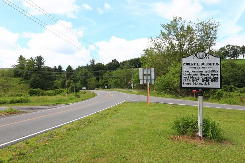
| On State Highway 18 at State Highway 88, on the right when traveling south on State Highway 18. |
| On Blue Ridge Parkway (at milepost 241). |
| On North Main Street (U.S. 21) at East Whitehead Street (State Highway 18), on the right when traveling north on North Main Street. |
| On Andrew Jackson Highway (U.S. 74) at Clark Mountain Road (County Route 1744), on the right when traveling west on Andrew Jackson Highway. |
| On Bridge Street (U.S. 17), on the right when traveling north. |
| On West Main Street near South Respess Street, on the right when traveling south. |
| On Cypress Road at Governor Eden House Road, on the left when traveling east on Cypress Road. |
| On Sterlingworth Street (State Highway 308) at Bazemore Street, on the right when traveling north on Sterlingworth Street. |
| On Governors Road (State Highway 308) at Republican Road, on the left when traveling north on Governors Road. Reported missing. |
| On South King Street (State Highway 308) at East Gray Street, on the right when traveling south on South King Street. |
| On Owen Hill Road at North Carolina Route 41/87, on the left when traveling north on Owen Hill Road. |
| On Ocean Highway East (U.S. 17) 0.2 miles west of West Gate Drive, on the right when traveling east. |
| On Ocean Highway (U.S. 17) at Ocean Isles Beach Road, on the right when traveling north on Ocean Highway. |
| On Ocean Highway (Local Route 17) at Governors Road SE (Route 1521), on the right when traveling north on Ocean Highway. |
| On Market Street at Collage Street on Market Street. |
| On Hilliard Avenue at S French Broad Avenue, on the right when traveling west on Hilliard Avenue. Reported missing. |
| On College Street (State Highway 74) at South Charlotte Street on College Street. |
| On Riverside Drive (State Highway 251) south of Pearson Bridge Road, on the right when traveling south. |
| On Broadway Street at Ocala Street, on the left when traveling north on Broadway Street. |
| On Sterling Street south of Union Street. |
| On Green Street south of Union Street, on the left when traveling north. |
| Near McConnaughey Lane, 5 miles south of Swan Pond Drive (County Road 1297), on the left when traveling south. |
| On Green Street on Green Street. |
| On North Green Street (State Highway 181) at Bost Road on North Green Street. |
| On Main Street East (U.S. 70). |
| On Union Street South just south of Means Avenue Southeast, on the right when traveling north. |
| On Union Street South just south of Means Avenue Southeast, on the right when traveling south. |
| On Union Street S just north of Means Avenue Southeast, on the right when traveling south. |
| On Davidson Highway (State Highway 73) at Odell School Road, on the right when traveling east on Davidson Highway. |
| On Union Street South at Corban Avenue Southeast, on the right when traveling north on Union Street South. |
| On Union Street South at Means Avenue Southeast, on the left when traveling north on Union Street South. |
| On State Highway 343 at NC Highway 34 North (U.S. 158), on the left on State Highway 343. |
| On U.S. 158 at 343, on the right when traveling east on U.S. 158. |
| On State Highway 343, 0.1 miles south of U.S. 158, on the right when traveling south. |
| On Highway 158 just east of Havenwood Drive (County Road 1257), on the right when traveling west. |
| On State Highway 343 at Palmer Road (County Road 1121), on the right when traveling south on State Highway 343. |
| On Front Street at Orange Street, on the right when traveling west on Front Street. |
| On U.S. 158 at Olive Hill Church Road (County Route 1701), on the left when traveling east on U.S. 158. |
| On Fairview Drive, 0.1 miles north of Broad Street (State Highway 57), on the right when traveling west. |
| On North Carolina 62 (State Highway 62), on the right when traveling north. |
| On Fairview Drive, 0.1 miles north of Broad Street (State Highway 62), on the left when traveling north. |
| On U.S. 158 east of North Carolina Highway 150, on the right when traveling east. |
| On U.S. 158, 0.3 miles east of Hatchett Road, on the left when traveling west. |
| On Court Square at West Main Street, on the right when traveling east on Court Square. |
| On Main Avenue Northeast at North Center Street, on the right when traveling east on Main Avenue Northeast. |
| On 3rd Avenue Northwest (State Road 1314) at 4th Street Northwest, on the right when traveling west on 3rd Avenue Northwest. |
| On 6th Street Northwest at 4th Avenue Northwest, on the right when traveling south on 6th Street Northwest. |
| On 6th Street Northwest north of 3rd Avenue Northwest (State Road 1314), on the left when traveling north. |
| On 3rd Avenue Northwest (State Road 1314) at 5th Street Northwest, on the left when traveling west on 3rd Avenue Northwest. |
| On South College Avenue, 0.1 miles north of East Herman Street, on the left when traveling north. |
| On State Highway 16 at W A Street, on the right when traveling south on State Highway 16. |
| On North Masonic Street (Business U.S. 64), on the left when traveling east on North Masonic Street. |
| On East Church Street east of North Broad Street, on the left when traveling east. |
| On South Broad Street (Business U.S. 17) at East Queen Street, on the right when traveling north on South Broad Street. |
| On South Broad Street (Business U.S. 17) at East Queen Street, on the right when traveling north on South Broad Street. |
| On N Broad St. at Queen Street on N Broad St.. |
| On N. Broad St. Reported missing. |
| On W. Church Street at N. Broad St, on the right when traveling south on W. Church Street. |
| On East Church Street (State Highway 32) at Court Street, on the right when traveling west on East Church Street. |
| On West Marion Street at North Martin Sreet, on the right when traveling west on West Marion Street. |
| On East Warren Street at South Washington Street, on the right when traveling east on East Warren Street. |
| On State Highway 55 near Belltown & Biddle Roads, on the right when traveling east. |
| On Broad Street (Business U.S. 17) at Middle Street, on the right when traveling west on Broad Street. |
| On Broad Street (Business U.S. 17) at Middle Street, on the right when traveling west on Broad Street. |
| On East Front Street just south of New Street. |
| On Broad Street (Business U.S. 70) near Craven Street, on the right when traveling west. |
| On Broad Street (Business U.S. 17) at Middle Street, on the right when traveling east on Broad Street. |
| On Broad Street (Business U.S. 70) at Metcalf Street, on the left when traveling east on Broad Street. |
| On Cypress Street at Smith Street, on the right when traveling west on Cypress Street. |
| On George Street just north of Pollock Street, on the right when traveling south. |
| On Johnson Street east of Hancock Street, on the right when traveling east. |
| On Brices Creek Road, 0.2 miles south of State Road 1004, on the right when traveling west. |
| On Broad Street (U.S. 17) near Craven Street. |
| On Broad Street (U.S. 17) at Craven Street, on the left when traveling east on Broad Street. |
| On Broad Street (Business U.S. 17) at George Street, on the right when traveling east on Broad Street. |
| On Pollock Street at Eden Street, on the right when traveling west on Pollock Street. |
| On Broad Street (Business U.S. 17) at Craven Street, on the right on Broad Street. |
| On Green Street at Market Square, on the right when traveling north on Green Street. |
| On Cool Spring Street at Meeting Street, on the right when traveling south on Cool Spring Street. |
| On Randolph Street at Armistead Street, in the median on Randolph Street. |
| On Old Bluff Church Road, 1.2 miles west of Sisk Culbreth Road when traveling west. |
| On Courthouse Road (State Highway 1242) near Caratoke Highway (State Highway 168), on the right when traveling north. |
| On Caratoke Highway (U.S. 158), on the right when traveling east. |
| On Kohler Road, 0 miles east of North Carolina Highway 12, on the right when traveling east. |
| On Veterans Drive near Town Hall Drive. |
| On South Main Street at W Center Street, on the right when traveling south on South Main Street. |
| On Cedar Lodge Road at Cedar Drive, on the right when traveling east on Cedar Lodge Road. |
| On Wilkesboro Street (U.S. 64), on the left when traveling east. |
| On Turkey Highway (Route 24), on the right when traveling west. |
| On North Roxboro Street (U.S. 501) at Bahama Road (County Route 1616), on the right when traveling north on North Roxboro Street. |
| On West Main Street west of Market Street. |
| On East Parrish Street at East Parrish Street, on the right when traveling west on East Parrish Street. |
| On East Main Street east of North Church Street, on the right when traveling east. |
| On West Forest Hills Boulevard north of Westwood Drive, on the right when traveling north. |
| On Dacian Avenue east of Watts Street, on the right when traveling east. |
| On East Raleigh Boulevard (Business U.S. 64) at Wake Street, on the right when traveling west on East Raleigh Boulevard. |
| On Alternate U.S. 64 near Kingsboro Road (State Highway 1225), on the left when traveling east. |
319 entries matched your criteria. The first 100 are listed above.
Next 100 ⊳