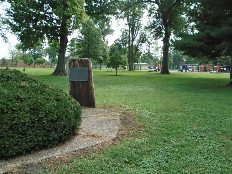
On 24th Street (Illinois Route 96) south of Maine Street, on the left when traveling south.
Distinguished naturalist and educator, friend of birds and young people, a lifelong resident of Quincy, "T. E." was loved by all those who shared his knowledge, enthusiasm and concern for wildlife.
He founded the "Bluebird Trails" to erect and . . . — — Map (db m156860) HM
On Maine Street just east of 8th Street, on the right when traveling east.
On this corner, in 1859, the Franciscan Fathers founded St. Francis Solanus College. In September of 1860, the College was relocated on Allstynes Prairie (the present site) at 19th and College Avenue. The charter was granted by the State of Illinois . . . — — Map (db m150020) HM
On 4th Street (Illinois Route 57) at Maine Street (U.S. 24) on 4th Street.
12th & Maine
Romanesque Revival Style
Harvey Chatten, Arthitect
———————————
Pilasters
Students entered the school through
a monumental arched entrance facing
on Maine . . . — — Map (db m156773) HM
On Washington Avenue (U.S. 51) south of 17th Street, on the right when traveling south.
President William Jefferson Clinton, 42nd President of The United States accompanied by his wife, Hillary and Vice President and Mrs. Albert Gore, Jr. spoke to a crowd of over 6000 in Cairo, Illinois at The Cairo Public Library on Friday, August 30, . . . — — Map (db m161195) HM
On Miller City Road just south of Island Road, on the left when traveling south.
This memorial recognizes the 109 year legacy of Rev. Nathan London, born a slave in 1830. Known then as "Nate Lundy", he distinguished himself, attaining the rank of sergeant and assistant paymaster in the Union army during the Civil War. His . . . — — Map (db m40405) HM
On North 4th Street at West Main Street, on the right when traveling south on North 4th Street.
Imagine a world without books--a frontier where print is a luxury, often out of reach. It's the world you would have known in 1815, when George Davidson settled the bluff overlooking Little Shoal Creek, just a short walk from where you stand. . . . — — Map (db m144131) HM
On 3rd Street (Illinois Route 127) at College Avenue (Illinois Route 127), on the left when traveling north on 3rd Street.
The earliest records show Samuel Colcord's Sorghum Mill once stood here. In 1870 Charles R. Bennett opened his new drugstore. Four drugstores were operating on the square during this time. It was Kate Benneett, Charles' wife, who prevailed on her . . . — — Map (db m34176) HM
On West Main Street just west of North 3rd Street (Illinois Route 127), on the right when traveling west.
Constructed as a two story house, this is thought to be the oldest building still standing in Greenville. It as built by Kendall Morse, younger brother of Stephen Morse, who co-founded Almira College. The brothers were some of the most prosperous . . . — — Map (db m144598) HM
On Unnamed campus entrance road, 0 miles east of South Clay Street (Illinois Route 78), on the right when traveling east.
Mount Carroll Seminary was founded as a coeducational institution in 1853 by Frances Ann Wood (later Mrs. Shimer). After the Civil War, enrollment was limited to women. Rechartered in 1896 as the Frances Shimer Academy of the University of Chicago, . . . — — Map (db m34479) HM
On Third Street at Madison Street, on the right when traveling north on Third Street.
Helen Scott Hay, famous Red Cross nurse, was born near Lanark in this county. She was a graduate of Savanna High School, Northwestern University in Evanston, and the Illinois Training School for Nurses in Chicago, where she was later Superintendent. . . . — — Map (db m55838) HM
Nathan C. Ricker, the first person to graduate in architecture in the United States, established an architectural program here at his alma mater in 1873. Ricker emphasized the application of science and technology to design. He strove to create an . . . — — Map (db m225558) HM
On East Peabody Drive, 0.1 miles east of South 4th Street, on the left when traveling east.
Allen S. Weller led the Urbana campus
to a period of great artistic growth
and innovation from 1954 to 1971. His
imagination and efforts were the
force behind experimentation in the
visual arts, dance, and music, and
the development of . . . — — Map (db m225525) HM
Near East Armory Avenue at South Wright Street, on the right when traveling east.
In the early 20th century, Clarence W. Alvord gathered sources for Illinois history, directed the Illinois Historical Survey, edited the collections of the Illinois State Historical Library, wrote histories of colonial Illinois and the Mississippi . . . — — Map (db m225556) HM
On South Mathews Avenue, 0.1 miles north of West Green Street, on the left when traveling north.
In 1961, Don L. Bitzer, co-inventor of the plasma display panel, and Chalmers W. Sherwin introduced PLATO, the first computer-based education system, the first time-shared education system, and the home of the first on-line community. By the early . . . — — Map (db m225545) HM
Near West Gregory Drive, 0.1 miles east of South 6th Street, on the left when traveling east.
Under the administrations of Phineas L. Windsor (1909-1940) and Robert B. Downs (1943-1971), the library grew from fewer than a million volumes to nearly five million volumes and became one of the world's great libraries. Windsor aggressively built . . . — — Map (db m225557) HM
On South Mathews Avenue, 0.1 miles south of West Green Street, on the left when traveling south.
The University of Illinois College of Medicine at Urbana-Champaign
(1971-2022) educated over 4500 physicians, including many
from underrepresented groups in the urban health and
rural medicine programs, who went on to practice in . . . — — Map (db m225538) HM
On West Gregory Drive, 0.2 miles east of South 6th Street, on the left when traveling east.
Started in 1876, the Morrow Plots are the oldest field experiment in the United States. First known as “Rotation Experiment No. 23” and modeled after trials at Rothamsted, England, the plots were established to study the long-term effects of crop . . . — — Map (db m225531) HM
On South Matthews Avenue at West Green Street, on the right when traveling south on South Matthews Avenue.
This facility originally known as the
Natural History Building
constructed in 1892
has been placed on the
National Register of Historic Places
by the United States
Department of the Interior — — Map (db m225572) HM
On West Nevada Street at South Gregory Street, on the left when traveling west on West Nevada Street.
Joseph M. Hunt was a pioneer in the
study of child development. He provided
experimental evidence for the powerful
and lasting effects of early experience
on the development of intelligence
and personality. Hunt helped to convince
the Kennedy . . . — — Map (db m225580) HM
On West Nevada Street east of South Goodwin Avenue, on the left when traveling east.
Paul Rolland was the first to use science-based research to consider the role of movement in the acquisition of stringed-instrument performance technique. His movement-centered approach has had world-wide influence in the teaching of children to . . . — — Map (db m225576) HM
Near Lorado Taft Drive, 0.1 miles east of South 6th Street.
This facility originally known as the
Farm House
constructed in 1870
has been placed on the
National Register of Historic Places
by the United States
Department of the Interior — — Map (db m225529) HM
On Illinois Route 1 just south of Plum Street, on the left when traveling north.
From Here to Eternity author James Jones co-founded The Handy Writers’ Colony (1949-1964) at the West edge of Marshall with his mentor Lowney Turner Handy and her husband, Harry. Jones wrote Some Came Running here before moving to New . . . — — Map (db m23336) HM
On West Lincoln Street (County Route 31) at South Fulton Street, on the right when traveling west on West Lincoln Street.
For more than fifty years Westfield College was located on this site. It was founded as a seminary in 1861 by the United Brethren in Christ and incorporated as a college in 1865. The school was coeducational from the beginning and in some years . . . — — Map (db m184588) HM
On West Lincoln Street at South Madison Street, on the right when traveling west on West Lincoln Street.
This marks the site of Westfield College 1865 - 1917 Presented by the
High School Class of 1932
2nd Plaque
Westfield Township High School 1921-1994 Class of 1932 — — Map (db m184589) HM
To summon the people of Bellwood to worship God and to strive for education
1908
St. John Lutheran Church and School
Placed here in honor of the nation's bicentennial
1976 — — Map (db m245033) HM
On Foster Avenue (U.S. 41) at Clark Street on Foster Avenue.
On this site stood the Andersonville School in the northeastern corner of the sub-division called Andersonville. Here in 1857 arrangements were made for the township's first election.
Erected by
Chicago's Charter Jubilee . . . — — Map (db m235664) HM
On Langley Avenue at East 37th Place on Langley Avenue.
Ida Bell Wells was born into slavery in Holly Springs, Mississippi. Orphaned at 16, she became a teacher to support her five younger siblings. She later moved to Memphis where she became a pioneering data Journalist, newspaper . . . — — Map (db m235179) HM
On N. State Parkway at Goethe Street on N. State Parkway.
A crossroads in the development of Oekology (Ecology) at the turn of the century.
Named for Dr. Frank Spooner Churchill an early pediatrician, medical inspector of Chicago's Board of Health who pioneered reforms in pure food, water, air and . . . — — Map (db m229292) HM
On South Vincennes Avenue north of East 41st Street, on the right when traveling north.
Nat "King" Cole
Musician
1919 - 1965
Nat "King" Cole's warm, relaxed, velvety
voice made him a best-selling recording
star. His 1949 hit "Mona Lisa" sold more
than three million copies, and in 1956 he
became the first . . . — — Map (db m180615) HM
On South Ellis Avenue at East 49th Street, on the right when traveling north on South Ellis Avenue.
Julius Rosenwald
Businessman and philanthropist
1862 - 1932
Sears, Roebuck & Company became a household
name because of the energy and vision of Julius
Rosenwald. He developed Sears’ mail-order
business when much of the nation . . . — — Map (db m188774) HM
On North Ashland Road at West Irving Park Road on North Ashland Road.
Here in 1874, was built Lake View High School, one of the first township schools in Illinois. Erected in accordance with legislation enacted by General Assembly of 1872
Erected by Chicago’s Charter Jubilee
Authenticated by Chicago Historical . . . — — Map (db m47456) HM
On North Halsted Street south of Waveland Avenue, on the right when traveling north.
Dra. Antonia Pantoja
(Lesbian Puerto Rican Educator and Activist)
(1922 - 2002)
Antonia Pantoja overcame the poverty and circumstances of her childhood to become a schoolteacher who focused on the educational needs of disadvantaged . . . — — Map (db m181518) HM
On North Lakeview Avenue, on the right when traveling south.
László Moholy-Nagy came to Chicago in 1937 to
direct the New Bauhaus, an experimental art and
design school. One of the most creative
personalities of his time, Moholy-Nagy was a
writer, painter, photographer, filmmaker,
teacher, . . . — — Map (db m188068) HM
On North Wells Street at West Evergreen Street, on the right when traveling south on North Wells Street.
The Benjamin Franklin School, located at
225 West Evergreen, is the fifth oldest school
in Chicago. The school, which today is known
as The Franklin Fine Arts Center,
originally opened in 1837 on Canal Street.
In 1856 the school was moved to . . . — — Map (db m188291) HM
On East McFetridge Drive east of South Lake Shore Drive, on the right when traveling east.
Our understanding of people with intellectual disabilities evolved and changed during the post-war years of the 1950s and 1960s. Research studies in Europe and North America demonstrated how physical activity could aid and assist people with . . . — — Map (db m234309) HM
Near East Grand Avenue, 0.5 miles east of Park Drive, on the right when traveling east.
Navy Pier honors and salutes the members of the U.S. armed forces whose lives were lost while conducting training exercises at the Pier during World War ll. We commemorate their brave efforts and recognize their sacrifice while serving our country. — — Map (db m229721) WM
On East Jackson Blvd. (U.S. 66) at South State Street, on the right when traveling east on East Jackson Blvd..
Built in 1912 as the Rothschild Building
Holabird and Roche – architect
Renamed the Goldblatt Building in 1936
Placed on the Nation Register of Historic Places in 1989
Rededicated by DePaul University September 14, 1993
Richard . . . — — Map (db m134433) HM
On this site, Sept. 23, 1846, the
Sisters of Mercy
who provided Chicago with its first hospital, began their charitable, educational and civic services to this city — — Map (db m99817) HM
On West Monroe Street at South Sangamon Street, on the right when traveling east on West Monroe Street.
This park is named for Mary Bartelme (1866-1954), a pioneering Illinois Lawyer. Bartelme became the first female judge in Illinois (1923) and the second female judge in the United States. Born at Fulton and Halsted Streets in Chicago, she became a . . . — — Map (db m132021) HM
On East 61st Street, on the right when traveling west.
John Dewey
Philosopher and educator
1859 - 1952
John Dewey was one of the foremost philosophers of the twentieth
century and a founder of the Laboratory School at the University of
Chicago. He played a role in public life that few . . . — — Map (db m188254) HM
On West 22nd Place at 57th Avenue, on the left when traveling west on West 22nd Place.
Named to honor the first President of an independent Czechoslovakia, the Thomas G. Masaryk Czech School opened at this site amidst elaborate ceremonies on September 4, 1921. It was established by the Freethinkers Bohemian School Association, a group . . . — — Map (db m245073) HM
On 57th Avenue south of 22nd Place, on the right when traveling south.
Named to honor the first President of an independent Czechoslovakia, the Thomas G. Masaryk Czech School opened at this site amidst elaborate ceremonies on September 4, 1921. It was established by the Freethinkers Bohemian School Association, a group . . . — — Map (db m245074) HM
On North Wolf Road at Armitage Avenue on North Wolf Road.
This is the former site of the Northlake Library. The brick structure was once part of the property housing the grounds keeper of the Westward Ho Country Club, a golf course developed from farmland around this site in 1923. The first Northlake . . . — — Map (db m189973) HM
We acknowledge that Mann Elementary and the entire Oak Park community are on the traditional territory of the Bodéwadmiakiwen (Potawatomi), Kiikaapoi (Kickapoo), Miami, Oeti Šakówi (Sioux), and Peoria peoples. We honor the ongoing contributions of . . . — — Map (db m233238) HM
In Memoriam
1917 - 1918
To the boys of this school who gave their lives for freedom's cause.
Howard Watson Andrews, died in France, February 6, 1919. • Edwards Hall Berry, 1st Lieutenant, died en route to France, October 29, 1918. • Earl . . . — — Map (db m246653) WM
On Ontario Street at North Cuyler Avenue, on the right when traveling west on Ontario Street.
Also known as Ontario Street School and renamed Beye School in 1896 to honor school board member William Beye, who was instrumental in getting the first school built to serve this neighborhood — — Map (db m229021) HM
The Alumni Bell Tower
erected in praise of the Triune God
and in memory of
Robert Erfourth and David Hammes
—
June 1975
The bell in this tower, cast in the year 1881,
is the original bell from the first site of
Concordia Teachers . . . — — Map (db m233144) HM
Near Illinois Route 171 north of Palos Trail System - Orange Single Trak Trail, on the right when traveling north.
On December 2, 1942, scientists at the University of Chicago produced the first controlled nuclear chain reaction in human history. Soon after, the reactor was relocated to “Site A” in the Palos Park Forest Preserve where scientists performed . . . — — Map (db m208231) HM
Near Palos Trail System - Brown Unpaved Trail (West) north of Pipeline Trail, on the right when traveling north.
Built at the University of Chicago and called Chicago Pile–1 (CP-1), the world’s first nuclear reactor was moved to Site A in the Red gate Woods in 1943 and renamed CP-2. The site Boasted 10 tons of uranium metal, 42 tons of uranium oxide, and . . . — — Map (db m208229) HM
Near Palos Trail System - Brown Unpaved Trail (West) north of Pipeline Trail, on the right when traveling north.
The world’s first nuclear reactor was rebuilt at this site in 1943 after initial operation at the University of Chicago. This rector (CP-2) and the first heavy water moderated reactor (CP-3) were major facilities which around which developed the . . . — — Map (db m208225) HM
On West Lincoln Highway (Illinois Route 38) east of Castle Drive, on the right when traveling west.
On May 22, 1895, Governor John Peter Altgeld signed an act establishing the Northern Illinois State Normal School. The first building, "The Castle on the Hill", was constructed here on what was once the site of the DeKalb County Fairgrounds. . . . — — Map (db m213756) HM
On West Roosevelt Street just west of Hickory Street, on the left when traveling west.
In the early 20th century William George Eckhardt (1879-1959) was a pioneer in DeKalb County's leading role in agricultural innovation. Eckhardt, an agronomy professor at the University of Illinois, was an expert in the blossoming field of soil . . . — — Map (db m198012) HM
Near East Woodlawn Street east of North Monroe Street, on the left when traveling east.
During the twenty years Abraham Lincoln attended the DeWitt County Court on the Eighth Judicial Circuit, he and Clifton H. Moore, Clinton’s first resident attorney, developed a deep friendship as well as a mutual law practice.
The two men . . . — — Map (db m24298) HM
On West Johnson Street west of North Center Street, on the left when traveling west.
Warner's Memories
Top Section
Lincoln traveled the Eighth Judicial Circuit six months a year, becoming close friends with his fellow lawyers, with whom he shared, not only courtroom, but also meals, an easy camaraderie, and often a . . . — — Map (db m24325) HM
Even after thirty years of marriage to Bob Moomaw, I was always surprised by his ideas--and this event is another surprise. Bob said there have been sculptures built on more ridiculous concepts than my life--this is not ridiculous--this is my life: . . . — — Map (db m135930) HM
This memorial was constructed using the cornerstone, bricks, doorframe, and windowsills from the former Kinderheim building.
Originally, the building served as a Lutheran foster home for children, from the time it was built in 1925, until 1960. . . . — — Map (db m47431) HM
This monument, made from window sills and steps from the seminary, was erected in 1974 by grateful alumni.
The seminary was relocated in 1913 to River Forest, Illinois, and is now named Concordia College.
Matt 28:19 – Go ye and teach all . . . — — Map (db m47436) HM
On May Street at West Army Trail Boulevard on May Street.
Site of the first building of St. Paul Lutheran School which served as school and teacherage, home, and youth center (1849-1974). Henry Bartling, first teacher (1849-1891) also served as Addison postmaster for over 50 years. — — Map (db m47429) HM
On South Brainard Street near East Chicago Avenue, on the right when traveling south.
North Central's award-winning radio station was launched in 1946 by World War II student veterans, many of whom had served as service radio technicians. Granted a license in 1968 to operate as WONC-FM 89.1 the station and its student broadcasters . . . — — Map (db m246562) HM
Near Oak Brook Road (County Route 34) east of Jorie Boulevard, on the right when traveling west.
This merry-go-round is from Butler School's original playground that was located about 100 yards to the northeast of the school. The merry-go-round saw service from 1921 until 1961 when a new Butler School was built.
School Board member Joseph . . . — — Map (db m246245) HM
On North 700E Road at E 900N Road, on the right when traveling north on North 700E Road.
One-room schoolhouses in Illinois date from the 1855 free school law, which gave local townships the incentive to create school districts with elected boards that could levy taxes to support the schools and pay teachers. It is estimated Illinois . . . — — Map (db m176682) HM
On South State Street just south of West Pearl Street, on the right when traveling south.
The Geneseo Collegiate Institute was founded in 1884 by the
Presbyterian church of the United States and the citizens of
Geneseo "for the promotion of higher Christian education"
the academic building was on the corner to the east the . . . — — Map (db m160070) HM
On West Pearl Street just west of South State Street, on the left when traveling west.
Founded May, 1990, to complement, enhance, and enrich educational opportunities and experiences for students in School District #228. — — Map (db m160105) HM
On West North Street just east of South Center Street, on the right when traveling east.
This park is established on the site of the former Geneseo Township High School. Built in 1910-11, the sturdy brick structure was Geneseo's senior high school from 1911 to 1964.
From 1964 to 1998 it served as Geneseo's junior high school. The . . . — — Map (db m160096) HM
On North 900th Avenue, 0.1 miles west of County Road 00 East, on the right when traveling west.
This was the home of Fred Francis, inventor and innovator, artist and poet. Born near Kewanee in 1856, he graduated from the Illinois Industrial University, Urbana, in 1878. While there, he was one of the designers and builders of the 'Class of 78' . . . — — Map (db m213643) HM
On South Washington Street at East College Street, on the right when traveling north on South Washington Street.
The evolution of Southern Illinois University began here in 1856 when Presbyterians founded Carbondale College. Suffering hardships during the Civil War, the college was sold to the First Christian Church in the mid 1860s and renamed Southern . . . — — Map (db m161077) HM
Near South Washington Street south of East Main Street (Illinois Route 13).
In 1869, Carbondale was chosen as the location for Southern Illinois College. By the early 1870s, several new commercial brick buildings were planned for the Town Square, reflecting growth and optimism.
The Newell House Hotel at 101 South . . . — — Map (db m161969) HM
On Washington Street at Walnut Street, on the right when traveling west on Washington Street.
Erected A.D. 1920
B.B. Easterly Pres'd't. • F.A. Richards, Clerk • Thos. G. Dunn • Samuel Smith • Munroe Lunceford • S. L. Porter — — Map (db m191123) HM
Near North State Street (U.S. 67) 0.1 miles south of Snedeker Street, on the left when traveling south.
The Lone Star School is one of more than 70 one-room schools once located throughout Jersey County. The school was built in 1877 roughly 13 miles west of Jerseyville, near the intersection of Routes 16 and 100.
For more than 70 years, children . . . — — Map (db m142795) HM
In 1834 Dr. Silas Hamilton, physician and humanitarian, bequeathed $4,000 for construction and operation of a building for educational and religious purposes. A stone schoolhouse was opened in 1836, and the tuition-free education for local . . . — — Map (db m142751) HM
On Park Street at College Street, on the left when traveling east on Park Street.
Among Elginites who served in the Civil War, there were 153 students, teachers, administrators and trustees from Elgin Academy.
•Academy student Leverett Kelley was awarded the Congressional Medal of Honor for heroic action in combat at Missionary . . . — — Map (db m63437) HM WM
On Straford Drive East just west of Main Street NW (Illinois Route 102), on the left.
Dedicated to the memory of Gurdon Saltonstall Hubbard, Noel Le Vasseur, Francois Bourbonnais—early pioneers in the employ of The American Fur Company who had a post near this site. Father de Pontavisse, first priest and religious . . . — — Map (db m105636) HM
On Illinois Route 41 at Cherry Grove Cemetery Road, on the right when traveling south on State Route 41.
A Cumberland Presbyterian School, stood on the knoll west of this spot. It was founded by George Latimer, a grandson of Col. Jonathan Latimer and served the community as church and school for thirty years, when it was united with the school at . . . — — Map (db m155971) HM
Near South Cherry Street, 0.1 miles south of East South Street, on the left when traveling north.
This tablet commemorates the one hundredth anniversary of the fifth debate between Abraham Lincoln & Stephen A. Douglas held on this site October seventh 1858. — — Map (db m229137) HM
On East Ferris Street at North Broad Street, on the right when traveling west on East Ferris Street.
Ferris Street
named for
Silvanus Ferris
member of the committee
which purchased the site
of Galesburg in 1835
financial agent and
trustee of Knox College — — Map (db m150555) HM
On Public Square at West Main Street (U.S. 150) on Public Square.
Founded in 1837 by George Washington Gale, who led a group from upper New York State here to establish a Christian manual labor college and a community.
Knox College and the City of Galesburg stand as testimony to the efforts of these . . . — — Map (db m150559) HM
Near East South Street, 0.1 miles west of South Cherry Street, on the right when traveling east.
Scene of the fifth debate between
Abraham Lincoln and Stephen A. Douglas held on the East side of this building October 7, 1858. Restored and rededicated during the Knox College centenary, 1937.
Near South Cherry Street, 0.1 miles south of East South Street, on the left when traveling north.
This table commemorates the one hundredth anniversary of the fifth debate between Abraham Lincoln and Stephen A. Douglas held on this site October seventh 1858 — — Map (db m229139) HM
On South Cherry Street just south of East South Street, on the right when traveling south.
[Left panel]
Lincoln and Douglas
debated here on October 7, 1858.
Their joint meeting was one of seven across Illinois as they
contested Stephen A. Douglas's seat in the Senate that summer and fall. Here in . . . — — Map (db m150565) HM
On Farragut Avenue near Sampson Road, on the right when traveling east.
On many occasions during its history, Great Lakes Naval Training Center has fought to remain an important training location for the Navy. The Base Realignment and Closure (BRAC) decision of 1993 finally seems to have put an end to that fight. This . . . — — Map (db m37879) HM
On Farragut Avenue near Sampson Road, on the left when traveling east.
In the early months of World War II, the Navy Department designated Great Lakes as the only site for training African-American recruits. Since recruit training camps were named after naval heroes, it was thought fitting to do the same for the camp . . . — — Map (db m38002) HM
On Dewey Avenue near Sampson Road, on the right when traveling west.
The original Drill Hall, now a gymnasium, was designed with battered walls to give the massive building a military, fort-like appearance. Above the main entrance, the architects provided a large ornamentation of the bow of an ancient sailing ship, . . . — — Map (db m38182) HM
On Farragut Avenue near Sampson Road, on the right when traveling east.
During World War I, the Public Works Department at Great Lakes was tasked with the original construction of new facilities. Originally, Public Works was to use local civilian contractors. The problem, however, was that patriotic tradesmen joined . . . — — Map (db m37870) HM
On Farragut Avenue near Sampson Road, on the right when traveling east.
The Great Lakes History Trail has been established on base to teach about the past and promote a healthy future. As you walk the 2 mile trail, you will learn more about the fascinating history of our great base at the actual locations where it . . . — — Map (db m37876) HM
On Farragut Avenue near Sampson Road, on the left when traveling east.
(Left Side): Origins of the Base During the 1898 Spanish-American War, the Navy recognized that over half of the American sailors in that war had come from the Midwest. Congressman Foss of Illinois suggested that in the future, it might . . . — — Map (db m219216) HM
On Farragut Avenue near Sampson Road, on the left when traveling east.
The First Recruit17-year old Joseph Gregg of Terre Haute, Indiana arrived at Great Lakes Naval Center on July 1, 1911, the day of the first commissioning of the Station. Later that year on October 8, President William Howard Taft officially . . . — — Map (db m37970) HM
264 entries matched your criteria. The first 100 are listed above. Next 100 ⊳