On South High Street at Chambersburg Street, on the right when traveling south on South High Street.
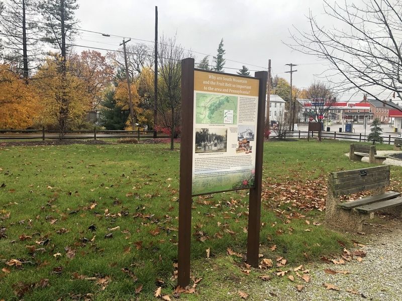
The Historic South Mountain Fruit Belt encompasses about 20,000 acres and forms a fertile crescent (half moon shape) covering the southeastern slopes of South Mountain in the western half of Adams County. The soils are deep, well drained and . . . — — Map (db m159877) HM
On South University Drive, 0.4 miles north of West York Street (Pennsylvania Route 234), on the right when traveling north.
Founded in 1918, FREC was established in response to management challenges faced by Pennsylvania fruit growers. Originally located in Arendtsville, the center moved here in 1971. Groundbreaking research has been conducted at . . . — — Map (db m192372) HM
On North Washington Street at Delap Alley, on the right when traveling south on North Washington Street.
"We will close...you know nothing about the lesson anyhow." With those words, Pennsylvania College Professor Michael Jacobs reluctantly gave in to the distraction of mounting cannon and musketry fire on the morning of July 1, 1863, and dismissed his . . . — — Map (db m32375) HM
On West High Street at South Washington Street, on the right when traveling east on West High Street.
The students of Rebecca Eyster's Young Ladies Seminary were studying in this "old Academy Building" on June 26, 1863. One of those students, Tillie Pierce, described the arrival of the Confederate troops from Seminary Ridge in her book, At . . . — — Map (db m12003) HM
On West Middle Street (State Highway 116) at South Washington Street, on the right when traveling west on West Middle Street.
This building was the Professor Michael Jacobs residence which remained in the family from 1834 until 1901. One of the town's leading citizens, Professor Jacobs was a member of the Gettysburg College faculty from its foundation in 1832 until his . . . — — Map (db m168189) HM
Near Penn Hall Drive north of West Water Street, on the right when traveling west.
This tablet commemorates the founding of the College Alumni Association, September 16, 1835, and honors its eleven founders,
Bacon — Barnitz — Smith — Bittle
Dale — Keller — Ruthrauff — Shuman
Stevenson . . . — — Map (db m130280) HM
On West Lincoln Avenue, on the right when traveling west.
"There was no one among us who had the smallest comprehension of all that an invasion of our soil could mean." - Henry Eyster Jacobs, Class of 1862
When the Confederate army advanced into Pennsylvania in June 1863, no person or place went . . . — — Map (db m76071) HM WM
On Carlisle Street (Alternate U.S. 15) just north of East Water Street, on the left when traveling north.
In memory of
Captain James A. Thompson '40
former Consul of Theta Chapter
Died in India Nov. 9, 1944
in the service of his country — — Map (db m147276) WM
On Lincoln Highway (U.S. 30) at Reynolds Street, on the right when traveling west on Lincoln Highway.
The above photo of Chambersburg Pike (Courtesy of Special Collections/Musselman Library, Gettysburg College) was taken in 1863 near where you are standing (white star), looking west. On July 1, 1863, soldiers from the Army of . . . — — Map (db m130273) HM
Curious townspeople gathered near the Seminary on the morning of July 1, "all eager to witness a brush with the Confederates and not dreaming of the terrible conflict that was to occur on that day." As soon as the fighting began in earnest, . . . — — Map (db m66722) HM WM
Originally the Seminary's main building (1832), Schmucker Hall now serves as the Seminary Ridge Museum presenting Civil War exhibits on the first day of the battle, care of the wounded, the religious conflict over slavery, and the experience of . . . — — Map (db m66681) HM WM
On North Washington Street, 0.1 miles south of West Stevens Street.
Born a free African-American. He taught the Colored people at this college, 1837, while a student at the Lutheran Seminary. A historian, he was elected bishop of the A.M.E. Church, 1852, and was president of Wilberforce University, 1863-76. — — Map (db m40951) HM
On Seminary Ridge Avenue, 0.2 miles south of Buford Avenue (U.S. 30), on the left when traveling south.
Daniel A. Payne was born a free person of color in Charleston, South Carolina and came to Gettysburg Seminary in 1835 to study theology after a law prohibiting the education of slaves forced him to close his school and abandon teaching. With his . . . — — Map (db m66679) HM
On Steinwehr Avenue (Business U.S. 15) 0.1 miles north of King Street, on the left when traveling north.
Dedicated to the
Memory of
James A. Getty
For his untiring
efforts to inculcate
the youth of America
by his portrayal
of Abraham Lincoln
And for his service
as a member of
the Confederation
of Union Generals.
Robert E. . . . — — Map (db m241988) HM
On Steinwehr Avenue (Business U.S. 15), on the right when traveling south.
Built in 1776 by the Rev. Alexander Dobbin. In use for some 25 years as one of the first classical schools west of the Susquehanna River. It is now a museum refurnished in keeping with the early period. — — Map (db m122380) HM
After leaving the White House in 1961, former President and Commanding General Dwight David Eisenhower retired to his permanent Gettysburg home. The adjacent building, located on the campus of Gettysburg College at 300 Carlisle Street, was used by . . . — — Map (db m87973) HM
On West High Street at South Washington Street, on the right when traveling east on West High Street.
Built 1813-1814 For Gettysburg Academy Lutheran Theological Seminary 1826-1832 Gettysburg College 1832-1837 Plaque erected 1982 by Gettysburg College — — Map (db m12004) HM
Near Penn Hall Drive north of West Water Street, on the right when traveling north.
"Some eighteen wounded of the 1st Corps were carried to the splendid mansion of the Professor [Baugher]. Day and night the family were unremitting in their attention to the wants of the sufferers." — David Weaver, 90th . . . — — Map (db m130279) HM
On W High Street at S Franklin Street, on the right when traveling west on W High Street.
On this corner stood the only building built for the sole purpose of educating the Colored children of the Borough of Gettysburg. In 1834 Pennsylvania mandated public education. On September 19, 1934, citizens of Gettysburg met and chose six . . . — — Map (db m75467) HM
On Carlisle Street (Business U.S. 15) south of West Railroad Street, on the right when traveling north.
Top 50 among liberal arts colleges for return on investment within 10 years of enrollment
No. 20 in salary potential by payscale.com*
32,000+ active and global alumni network
Gettysburg College is a . . . — — Map (db m217043) HM
On West Lincoln Avenue at Carlisle Street (Pennsylvania Highway 34), on the right when traveling east on West Lincoln Avenue.
Founded in 1832 by leaders including the Rev Samuel Simon Schmucker and Thaddeus Stevens, abolitionist and drafter of the 14th Amendment. Gettysburg Office stood in the path of the Union retreat on July 1, 1863, and Pennsylvania Hall served as a . . . — — Map (db m11049) HM
On Carlisle Street (Business U.S. 15) just south of West Railroad Street, on the right when traveling north.
50+ annual live performances by nationally-known artists and Sunderman Conservatory of Music students
$20.7 million in community support since 2005
40,000+ annual visitors
The Majestic Theater has . . . — — Map (db m217046) HM
On North Hay Street, on the right when traveling south.
The Lutheran Theological Seminary is the oldest continuing graduate and professional school of the Lutheran tradition in the Americas. Its campus has long been a crossroads of history. We invite you to walk the steps of the soldiers who fought . . . — — Map (db m91301) HM
On Seminary Ridge, 0.1 miles south of Lincoln Highway (U.S. 30), on the right when traveling south.
The Lutheran Theological Seminary is the oldest continuing graduate and professional school of the Lutheran tradition in the Americas. Its campus has long been a crossroads of history. We invite you to walk the steps of the soldiers who fought . . . — — Map (db m192368) HM
Constructed in 1832 under the leadership of the Reverend Samuel Simon Schmucker, the brick federal-style building was an impressive home for the Lutheran Theological Seminary at Gettysburg. In July 1863, as war engulfed Gettysburg, the building . . . — — Map (db m66762) HM WM
There is a beautiful and diverse natural habitat on Seminary Ridge. At 560 feet above sea level, the ridge is a threshold to the Blue Ridge and Appalachian Mountains to the west. The high ground that was of strategic importance in the Battle of . . . — — Map (db m66708) HM
On North Washington Street at Chambersburg Street (U.S. 30), on the right when traveling south on North Washington Street.
A gift to Gettysburg College in 1990 from George W. Olinger and Mac E. Olinger, life long residents of Gettysburg, zestful supporters of local history, common sense preservationists and quiet, humanitarians. Their gift of these historic buildings . . . — — Map (db m29799) HM
The Lutheran Theological Seminary at Gettysburg held its inaugural session in 1826 with one professor, eight students, a small collection of books, and less than $1700. Seminarians adhered to a rigid schedule. The day started with a 5:00 a.m. . . . — — Map (db m66663) HM
Near Penn Hall Drive north of West Water Street, on the right when traveling north.
Miller Hall
1882
The First Chapter House
erected by the
Phi Kappa Psi Fraternity,
and the first college fraternity house
in the
State of Pennsylvania — — Map (db m130281) HM
Founder of the Lutheran Theological Seminary and nearby Gettysburg College, Samuel Simon Schmucker (1799-1873) guided the school through its early years and the tumultuous Civil War period. Intelligent, energetic, well educated, and deeply pious, . . . — — Map (db m66668) HM
On Seminary Avenue, on the left when traveling south.
1832 Oldest standing building in America for Lutheran Theological Education 1863 Civil War hospital & lookout station 1961 Home of Adams County Historical Society — — Map (db m15304) HM
On Carlisle Street (Pennsylvania Route 34), on the left when traveling north.
The residence hall straight ahead of you is named after Thaddeus Stevens, a trustee of Pennsylvania College (now Gettysburg College) from 1834 to 1868. During the Civil War, Stevens was a powerful abolitionist Congressman. He led efforts to pass the . . . — — Map (db m88727) HM
On Baltimore Street at W Middle Street, on the right when traveling south on Baltimore Street.
Gettysburg College - As a state representative, Stevens got $18,000 from the state for the college’s first building, Pennsylvania Hall
Savior of Public Education – Speech in 1835 turned back repeal effort of public education. Also left . . . — — Map (db m199082) HM
On South Washington Street south of West High Street, on the right when traveling south.
This house (#219) belonged to John Hopkins, an African American citizen, from 1851 until his death at age 62 in 1868. His wife Julia continued to live here until she passed away in 1891.
John Hopkins enjoyed a distinguished career of janitor at . . . — — Map (db m130260) HM
Near North Washington Street at West Stevens Street, on the left when traveling north.
The U.S. Signal Corps, soon after came into the College… This created considerable noise and aroused suspicions." - Horatio Watkins, Class of 1864
When completed in the fall of 1837, the Edifice, known today as Pennsylvania Hall, became the . . . — — Map (db m88728) HM
On Baltimore Street (Business U.S. 15) at Lefever Street, on the right when traveling north on Baltimore Street.
In 1834 Gettysburg established a "common school" to provide its children with a free elementary education, which over the years evolved into the current Gettysburg Area School System. Following 23 years of classes being held in multiple private . . . — — Map (db m13266) HM
On West Stevens Street at Mummasburg Street, on the left when traveling east on West Stevens Street.
"The College at that day, was but a large family." - Reverend William F. Eyster, Class of 1839
In 1832, Lutheran theologian Samuel Simon Schmucker founded Pennsylvania College (now Gettysburg College). Chartered to provide instruction . . . — — Map (db m87976) HM
Near West Broadway, 0.2 miles west of College Avenue, on the left when traveling west.
"No one can come to Gettysburg unstirred by thoughts of those who fought here, and of him who spoke here." - President Dwight D. Eisenhower, Gettyburg College Trustee (1961-1969)
Founded in 1832, Gettysburg College (originally . . . — — Map (db m90671) HM
On West Stevens Street at Carlisle Street (Business U.S. 15), on the right when traveling west on West Stevens Street.
After leaving office in 1961, President Dwight D. Eisenhower retired to his Gettysburg farm and became a Gettysburg College trustee. He wrote his memoirs in an office in the house that stands before you. Gettysburg College founded 1832 (Lower . . . — — Map (db m32422) HM
On Springs Avenue just east of Seminary Ridge Avenue, on the right when traveling west.
Erected in 1833, the President's House served as the home of Professor Samuel S. Schmucker during his long tenure at the Seminary. Runaway slaves reportedly received aid and temporary shelter in a nearby barn before they continued on their . . . — — Map (db m66669) HM
On North Hay Street at Elm Street, on the right when traveling south on North Hay Street.
Beginning in the late 17th century, large waves of European settlers flooded into William Penn's colony in pursuit of opportunity and religious freedom. By the early 19th century, American Lutheran leaders realized that an institution dedicated . . . — — Map (db m66662) HM
The Seminary constructed this large Romanesque Revival building in 1894-95 as the Seminary's "Recitation Hall." Architect John Dempwolf designed the structure and its counterpart on the Gettysburg College campus which can be seen to the . . . — — Map (db m66667) HM
On York Road (U.S. 30), on the right when traveling east.
Army of the Potomac Medical Department Location of the Field Hospitals During the Battle of Gettysburg 1st Corps - July 1st at the Lutheran Theological Seminary and in Gettysburg July 2nd near White Church on Baltimore Pike 2nd Corps - July 2nd . . . — — Map (db m13265) HM
On Baltimore Pike (Pennsylvania Route 97) just west of Mud College Road.
Pleasant Grove School
"Mud College"
circa 1869
has been placed on the
National Register of
Historic Places
by the
United States Department
of the Interior — — Map (db m147274) HM
On Library Street at Maple Way when traveling south on Library Street.
Braddock Carnegie
Library
has been designated a
National Historic Landmark
This site possesses national significance
In commemorating the history of the
United States of America
Built in 1888-1889 and dedicated March 30, . . . — — Map (db m99024) HM
On Beaver Grade Road, 0.1 miles east of Lozer Drive, on the right when traveling east.
A militia captain during the American Revolution and civic leader in the early republic, Meeks was a petitioner to create Allegheny County in 1787. While making his living as a farmer, he took up arms to defend western Pa. during conflict and war. . . . — — Map (db m40221) HM
Inspired by the good turn of an English Scout, he brought the Scouting movement to the United States. His efforts led to the incorporation of Boy Scouts of America in Washington, D.C., on February 8, 1910, and to its chartering by Congress on June . . . — — Map (db m40917) HM
On Bell Avenue east of Jones Avenue, on the right when traveling east.
This original entrance way stone is a lasting tribute and
memorial to every student, faculty member and
administrator who lingered "within thy walls" of
North Braddock Scott High School
On this site stands the former residence of . . . — — Map (db m224788) HM
Near Frew Street, 0.2 miles west of Tech Street, on the right when traveling west.
This Tau Beta Pi Bent is dedicated to the memory of
Judith A. Resnik
Carnegie Mellon Alumna E'70 and Tau Beta Pi member
An astronaut on the tragic flight of the Space Shuttle Challenger on January 28, 1986.
She was an . . . — — Map (db m235994) HM
Near Forbes Avenue east of Morewood Avenue, on the right when traveling east.
Scotty, 2021
Made possible through the generosity of
Kathy Sabec Dax (CFA 1975) and F. Robert Dax (ENG 1972, 1977)
- - -
Sculptor Raymond Kaskey (CFA 1967) — — Map (db m236044) HM
Near Frew Street, 0.2 miles east of Tech Street, on the right when traveling east.
Mao Yi-Sheng (Thomas Mao), born in Zhenjiang, Jiangsu Province, China, received his Bachelor's degree in civil engineering from Tangshan Engineering Institute (1916), his Master's from Cornell (1917) and his Ph.D. from Carnegie Institute of . . . — — Map (db m236030) HM
On Sixth Avenue, 0.1 miles south of Wood Street, on the right when traveling south.
Dr. Nathaniel Bedford
Died March 21, 1818 Aged 63
Surgeon at Fort Pitt
Trustee under Penn Grant to Trinity Church, 1787
Incorporator of Pittsburgh Academy now University of Pittsburgh, 1806
Burgess of Pittsburgh, 1806 . . . — — Map (db m236153) HM
A.B. Miami University
Oxford Ohio 1857
Western Theological Seminary
of the Presbyterian Church 1859
Ordained 1859
D.D. Miami University 1914
A founder of the
Sigma Chi Fraternity
at Miami University
Oxford Ohio
June the . . . — — Map (db m225110) HM
On First Avenue at Smithfield Street, on the right when traveling west on First Avenue.
Founded 1808 & known as the African Church. Chartered in 1818. Located nearby in early years, church was site of area's first school for colored children, 1831, and statewide civil rights convention, 1841. Congregation moved to Wylie Avenue, 1872; . . . — — Map (db m42023) HM
On Fifth Avenue at Wood Street, on the right when traveling west on Fifth Avenue.
James E. Rohr
rose from the position of management trainee to become
Chairman, President and Chief Executive Officer of PNC Financial Services Group, Inc.
Under his leadership, PNC became . . . — — Map (db m156260) HM
On Boulevard of the Allies at Smithfield Street, on the right when traveling west on Boulevard of the Allies.
On this site in 1787 stood a log schoolhouse
The first home of the
University of Pittsburgh
This plaque erected by the General Alumni Association of the University of Pittsburgh
June 10, 1957
And rededicated on the year of the University's . . . — — Map (db m74981) HM
On East Ohio Street at Nash Street, on the right when traveling east on East Ohio Street.
To the south, at Nash and Avery Streets, stood Avery College. Founded in 1849 by Charles Avery (1784-1858), Methodist lay preacher, philanthropist, abolitionist, to provide a classical education for Negroes. — — Map (db m41046) HM
A poor Scottish immigrant, Carnegie became a millionaire steel magnate and proponent of the "Gospel of Wealth." Seeking to benefit society with his fortune, he built over 2,500 libraries and endowed institutions advancing education and peace. — — Map (db m40875) HM
On 5th Avenue, 0.1 miles south of Lytton Avenue, on the right when traveling east.
This property has been placed on the National Register of Historic Places by the United States Department of the Interior
Historic Landmark
Cathedral of Learning 1926-1937 — — Map (db m214313) HM
On Bayard Street at North Bellefield Street, on the right when traveling west on Bayard Street.
A distinguished philanthropist and humanitarian, she created and funded numerous social service agencies, including the Western Pennsylvania School for Blind Children, here. Her pioneering efforts in charitable giving have served those in need, . . . — — Map (db m46526) HM
On Fifth Avenue at Bigelow Boulevard, on the right when traveling east on Fifth Avenue.
First institution of higher education west of the Alleghenies and north of the Ohio River. Founded in 1787 as the Pittsburgh Academy, it became the Western University of Pennsylvania in 1819. Present name was adopted in 1908. — — Map (db m40914) HM
United States Army officer; he rose to the rank of general, 1951. In World War II, commanded the 82nd Airborne Division (famed for its invasion of Sicily), 1942-44; and 18th Airborne Corps, 1944-45. Supreme commander, United Nations forces in Korea, . . . — — Map (db m47552) WM
On Brighton Road at California Avenue, on the right when traveling south on Brighton Road.
Born near here, dancer, choreographer, and teacher Martha Graham created a modern and unique movement style. In 1927, she founded her School of Contemporary Dance, revolutionizing the art of modern dance with innovative works such as . . . — — Map (db m42222) HM
On Riverview Avenue, 0.2 miles west of Perrysville Avenue (U.S. 19).
Part of the University of Pittsburgh. Chartered 1860; located here since 1912. At the original site nearby, Professor Samuel P. Langley conducted experiments that would lead to the first sustained, mechanically powered flight in 1896. — — Map (db m42219) HM
On Forbes Avenue at Margaret Morrison Street, on the right when traveling south on Forbes Avenue.
This is the original site of the baseball diamond
dedicated by
J.P. "Pat" Crecine
in recognition of his commitment to the life of the students of Carnegie Mellon University
Dr. Crecine received his Bachelor's, Master's and Doctoral . . . — — Map (db m156200) HM
On Fifth Avenue west of Devonshire Street, on the right when traveling east.
Television station, located here, opened April 1954, as first community-sponsored educational television station in America. In 1955 it was the first to telecast classes to elementary schools. — — Map (db m40913) HM
On McAnulty Dr. at Bluff St., on the left when traveling north on McAnulty Dr..
Founded by Holy Ghost Fathers from Germany in 1878. Incorporated 1882 as the Pittsburgh Catholic College. Named Duquesne University in 1911, this Catholic institution has served students of many faiths in liberal arts and professional studies. — — Map (db m35486) HM
On Locust Street, on the right when traveling east.
Founded in 1847 by the Sisters of Mercy as Pittsburgh's first hospital. Medical internships began in 1848, and the nursing school in 1893. This was the first Mercy hospital worldwide, caring for all patients, especially the community's poor. — — Map (db m42223) HM
On McKnight Road (U.S. 19) at West View Avenue, on the right when traveling south on McKnight Road.
On the hill just west of here, the first known astronomical observatory with an aluminum dome was erected in 1930. Designed & built by Pittsburgh amateur astronomers led by Leo J. Scanlon, the Valley View Observatory stood beside his Van Buren St. . . . — — Map (db m35633) HM
On Park Road at Grove Drive, on the left when traveling north on Park Road.
In continuous service as a schoolhouse from 1844-1950. During its 106 years it exemplified the basic element of the American public school system of the 19th century, a one room school in which one teacher taught eight different grades. — — Map (db m50886) HM
On College Avenue (Pennsylvania Route 18) at 32nd Street (Pennsylvania Route 18), on the right when traveling north on College Avenue.
A Christian liberal arts college which was founded by the Reformed Presbyterian Church of North America in Northwood Ohio in 1848. Was moved to Beaver Falls in 1880 to a site provided by the Harmony Society. Old Main built 1880 with native stone. — — Map (db m136) HM
On Seventh Avenue (Pennsylvania Route 18) at 13th Street on Seventh Avenue.
Constructed in 1903 as the County's first library building. The building funds were furnished by an Andrew Carnegie grant and the site and maintenance by the citizens of Beaver Falls and the Big Beaver Falls School District. — — Map (db m135) HM
On 37th Street Extension at McKinley Road, on the right when traveling west on 37th Street Extension.
Built 1872 on land owned by John McKinley. Pupils in grades one to eight attended here 1873-1929. Purchased by McKinley School Historical Society of Chippewa in 1992. School house now serves as a museum. — — Map (db m50884) HM
On Market Street (Pennsylvania Route 551) 0 miles north of Old Darlington Road.
Established with funds collected by Reverend Thomas E. Hughes erected 1802 chartered 1806 by the Pennsylvania State Legislature as Greersburg Academy ratifying it the first academy west of the Allegheny Mountains. — — Map (db m48136) HM
Near Market Street (Pennsylvania Route 551) 0 miles north of Old Darlington Road.
Reverend Thomas E Hughes recognizing the need for a school for the frontier obtained approval and full support from the Erie Presbytery April 13, 1802 to construct a building and form a seminary. He proceeded to build the so called stone pile and . . . — — Map (db m122308) HM
On Midland Avenue (Pennsylvania Route 68/168) at 9th Street, on the right when traveling west on Midland Avenue.
In 1865 Neel School District was formed. Many years later in 1908 7th St in 1914 1st St and 1917 4th St schools were built. In 1926 Lincoln High School opened. In 2000 PA Cyber Charter School and 2006 Lincoln Park Performing Arts were created. — — Map (db m44178) HM
On 4th Street, 0 miles north of Pennsylvania Avenue (Pennsylvania Route 18), on the right when traveling north.
Endowed by A Louis Thiel and founded in 1866 as Thiel Hall by Reverend William A. Passavant. Chartered in 1870 as Thiel College of the Evangelical Lutheran Church with Reverend Henry W. Roth as first president. Moved to Greenville, Pennsylvania in . . . — — Map (db m45783) HM
On Midland Road (Pennsylvania Route 68/168) at Smiths Ferry Road, on the right when traveling east on Midland Road.
Oil boom town in 1860s-1870s. Oil shipped here on trains and river boats from wells in the Upper Dry Run and Island Run oilfields. Town had a hotel store post office and train station. All gone today. Rockport School remains. Neaby Glasgow had oil . . . — — Map (db m44179) HM
Near Delaware Avenue, 0.1 miles north of West Madison Street (Pennsylvania Route 18).
Home of Joseph H. Bausman D.D. 1854-1924 author of best known and most used history of Beaver County 2-volume Published 1904
Pastor of United Presbyterian and congregational churches Rochester 1882-1907
Professor English Literature Washington . . . — — Map (db m50284) HM
999 entries matched your criteria. The first 100 are listed above. Next 100 ⊳