After filtering for Pennsylvania, 1001 entries match your criteria. The first 100 are listed. ⊳
Education Topic
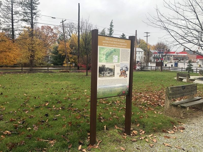
By Devry Becker Jones (CC0), November 11, 2020
Why are South Mountain and the Fruit Belt so important to the area and Pennsylvania? Marker
| 1 ► Pennsylvania, Adams County, Arendtsville — Why are South Mountain and the Fruit Belt so important to the area and Pennsylvania? — |
| On South High Street at Chambersburg Street, on the right when traveling south on South High Street. | |||
| 2 ► Pennsylvania, Adams County, Biglerville, Butler Township — Penn State Fruit Research and Extension Center — |
| On South University Drive, 0.4 miles north of West York Street (Pennsylvania Route 234), on the right when traveling north. | |||
| 3 ► Pennsylvania, Adams County, Gettysburg — "… you know nothing about the lesson anyhow." — |
| On North Washington Street at Delap Alley, on the right when traveling south on North Washington Street. | |||
| 4 ► Pennsylvania, Adams County, Gettysburg — "…run home as quickly as you can." — |
| On West High Street at South Washington Street, on the right when traveling east on West High Street. | |||
| 5 ► Pennsylvania, Adams County, Gettysburg — "…what in your life you will never see again." — |
| On West Middle Street (State Highway 116) at South Washington Street, on the right when traveling west on West Middle Street. | |||
| 6 ► Pennsylvania, Adams County, Gettysburg — "United to Serve" — 1835 - 1935 — |
| Near Penn Hall Drive north of West Water Street, on the right when traveling west. | |||
| 7 ► Pennsylvania, Adams County, Gettysburg — A Historic Year — Gettysburg College in 1863 — |
| On West Lincoln Avenue, on the right when traveling west. | |||
| 8 ► Pennsylvania, Adams County, Gettysburg — Captain James A. Thompson '40 — |
| On Carlisle Street (Alternate U.S. 15) just north of East Water Street, on the left when traveling north. | |||
| 9 ► Pennsylvania, Adams County, Gettysburg — Chambersburg Pike to the Lincoln Highway — |
| On Lincoln Highway (U.S. 30) at Reynolds Street, on the right when traveling west on Lincoln Highway. | |||
| 10 ► Pennsylvania, Adams County, Gettysburg — 16 — Civilians on Seminary Ridge — |
| On Buford Avenue. | |||
| 11 ► Pennsylvania, Adams County, Gettysburg — 8 — Crisis Comes to the Seminary's Back Door — |
| 12 ► Pennsylvania, Adams County, Gettysburg — Daniel Alexander Payne — (1811-1893) — |
| On North Washington Street, 0.1 miles south of West Stevens Street. | |||
| 13 ► Pennsylvania, Adams County, Gettysburg — 7 — Daniel Alexander Payne — |
| On Seminary Ridge Avenue, 0.2 miles south of Buford Avenue (U.S. 30), on the left when traveling south. | |||
| 14 ► Pennsylvania, Adams County, Gettysburg — Dedicated to the memory of James A. Getty — |
| On Steinwehr Avenue (Business U.S. 15) 0.1 miles north of King Street, on the left when traveling north. | |||
| 15 ► Pennsylvania, Adams County, Gettysburg — 226 — Dobbin House — |
| On Steinwehr Avenue (Business U.S. 15), on the right when traveling south. | |||
| 16 ► Pennsylvania, Adams County, Gettysburg — Dwight D. Eisenhower — 1890-1969 — |
| Near Carlisle Street at West Stevens Street. | |||
| 17 ► Pennsylvania, Adams County, Gettysburg — First Home of Seminary and College — |
| On West High Street at South Washington Street, on the right when traveling east on West High Street. | |||
| 18 ► Pennsylvania, Adams County, Gettysburg — For the Union Cause — The Norris-Wachob Alumni House — |
| Near Penn Hall Drive north of West Water Street, on the right when traveling north. | |||
| 19 ► Pennsylvania, Adams County, Gettysburg — Franklin Street “Colored” School 1884-1932 — |
| On W High Street at S Franklin Street, on the right when traveling west on W High Street. | |||
| 20 ► Pennsylvania, Adams County, Gettysburg — Gettysburg College — A Consequential Education Inspired By A Consequential Place — |
| On Carlisle Street (Business U.S. 15) south of West Railroad Street, on the right when traveling north. | |||
| 21 ► Pennsylvania, Adams County, Gettysburg — Gettysburg College Rooted in History — |
| On West Lincoln Avenue at Carlisle Street (Pennsylvania Highway 34), on the right when traveling east on West Lincoln Avenue. | |||
| 22 ► Pennsylvania, Adams County, Gettysburg — Gettysburg College's Majestic Theater — The Grandest Small-Town Theater in America — |
| On Carlisle Street (Business U.S. 15) just south of West Railroad Street, on the right when traveling north. | |||
| 23 ► Pennsylvania, Adams County, Gettysburg — Gettysburg Seminary — |
| On North Hay Street, on the right when traveling south. | |||
| 24 ► Pennsylvania, Adams County, Gettysburg — Gettysburg Seminary — |
| On Seminary Ridge, 0.1 miles south of Lincoln Highway (U.S. 30), on the right when traveling south. | |||
| 25 ► Pennsylvania, Adams County, Gettysburg — 2 — Gettysburg Seminary Ridge Museum — |
| 26 ► Pennsylvania, Adams County, Gettysburg — 13 — Habitat of Seminary Ridge — |
| Near Seminary Ridge Avenue. | |||
| 27 ► Pennsylvania, Adams County, Gettysburg — Ice House Complex — |
| On North Washington Street at Chambersburg Street (U.S. 30), on the right when traveling south on North Washington Street. | |||
| 28 ► Pennsylvania, Adams County, Gettysburg — Lee's Headquarters at Gettysburg — Restoring Seminary Ridge — |
| On Chambersburg Pike (U.S. 30) west of Seminary Ridge, on the right when traveling west. | |||
| 29 ► Pennsylvania, Adams County, Gettysburg — 3 — Life as a Seminary Student — |
| Near North Hays Street at Elm Street. | |||
| 30 ► Pennsylvania, Adams County, Gettysburg — Miller Hall — |
| Near Penn Hall Drive north of West Water Street, on the right when traveling north. | |||
| 31 ► Pennsylvania, Adams County, Gettysburg — Public School — Civil War Hospital — |
| On E High Street west of S Stratton Street, on the right when traveling west. | |||
| 32 ► Pennsylvania, Adams County, Gettysburg — 5 — Samuel Simon Schmucker — |
| Near Springs Avenue. | |||
| 33 ► Pennsylvania, Adams County, Gettysburg — Samuel Simon Schmucker Hall — |
| On Seminary Avenue, on the left when traveling south. | |||
| 34 ► Pennsylvania, Adams County, Gettysburg — Stevens Hall — |
| On Carlisle Street (Pennsylvania Route 34), on the left when traveling north. | |||
| 35 ► Pennsylvania, Adams County, Gettysburg — Thaddeus Stevens, the Great Commoner, 1792 - 1868 — |
| On Baltimore Street at W Middle Street, on the right when traveling south on Baltimore Street. | |||
| 36 ► Pennsylvania, Adams County, Gettysburg — The "Jack" Hopkins House — |
| On South Washington Street south of West High Street, on the right when traveling south. | |||
| 37 ► Pennsylvania, Adams County, Gettysburg — The Battle Arrives — Pennsylvania Hall — |
| Near North Washington Street at West Stevens Street, on the left when traveling north. | |||
| 38 ► Pennsylvania, Adams County, Gettysburg — The Evolution of Gettysburg's "Common School" — |
| On Baltimore Street (Business U.S. 15) at Lefever Street, on the right when traveling north on Baltimore Street. | |||
| 39 ► Pennsylvania, Adams County, Gettysburg — The Founding of Gettysburg College — |
| On West Stevens Street at Mummasburg Street, on the left when traveling east on West Stevens Street. | |||
| 40 ► Pennsylvania, Adams County, Gettysburg — The History of Gettysburg College — |
| Near West Broadway, 0.2 miles west of College Avenue, on the left when traveling west. | |||
| 41 ► Pennsylvania, Adams County, Gettysburg — The Office of a President — Dwight D. Eisenhower — |
| On West Stevens Street at Carlisle Street (Business U.S. 15), on the right when traveling west on West Stevens Street. | |||
| 42 ► Pennsylvania, Adams County, Gettysburg — 6 — The Samuel Simon Schmucker House — |
| On Springs Avenue just east of Seminary Ridge Avenue, on the right when traveling west. | |||
| 43 ► Pennsylvania, Adams County, Gettysburg — 1 — The Seminary Comes to Gettysburg — |
| On North Hay Street at Elm Street, on the right when traveling south on North Hay Street. | |||
| 44 ► Pennsylvania, Adams County, Gettysburg — 4 — Valentine Hall — |
| Near Seminary Ridge Avenue. | |||
| 45 ► Pennsylvania, Adams County, Gettysburg, Cumberland Township — Adam Butt Farm & Schoolhouse — Civil War Hospital — |
| On Fairfield Road (Pennsylvania Route 116) at Fairplay Avenue, on the right when traveling west on Fairfield Road. | |||
| 46 ► Pennsylvania, Adams County, Gettysburg, Straban Township — Location of Field Hospitals — During the Battle of Gettysburg — Army of the Potomac — |
| On York Road (U.S. 30), on the right when traveling east. | |||
| 47 ► Pennsylvania, Adams County, Littlestown, Mount Joy Township — Pleasant Grove School — "Mud College" — 4084 Baltimore Pike — |
| On Baltimore Pike (Pennsylvania Route 97) just west of Mud College Road. | |||
| 48 ► Pennsylvania, Allegheny County, Bellevue, Ross Township — Mount Assisi — Historical Landmark — |
| Near Forest Avenue. | |||
| 49 ► Pennsylvania, Allegheny County, Braddock — Braddock Carnegie Library — Historic Landmark — |
| On Library Street at Maple Way when traveling south on Library Street. | |||
| 50 ► Pennsylvania, Allegheny County, Bridgeville — Bridgeville Public Library Founders 1962 — |
| On Station Street, on the right when traveling north. | |||
| 51 ► Pennsylvania, Allegheny County, Carnot-Moon, Moon Township — Joshua Meeks — (1731-1818) — |
| On Beaver Grade Road, 0.1 miles east of Lozer Drive, on the right when traveling east. | |||
| 52 ► Pennsylvania, Allegheny County, Monroeville — William D. Boyce — (1858-1929) — |
| Near Beatty Road at Cooper Road. | |||
| 53 ► Pennsylvania, Allegheny County, Munhall — Carnegie Library of Homestead — Historic Landmark — |
| Near 10th Avenue, 0.1 miles west of Andrew Street. | |||
| 54 ► Pennsylvania, Allegheny County, North Braddock — Alexander M. Scott High School — 1928 — |
| On Bell Avenue east of Jones Avenue, on the right when traveling east. | |||
| 55 ► Pennsylvania, Allegheny County, Oakmont, Lower Oakmont — Oakmont Carnegie Library — Historic Landmark — |
| Near Allegheny River Boulevard at Pennsylvania Avenue, on the right when traveling north. | |||
| 56 ► Pennsylvania, Allegheny County, Pittsburgh — Baker Hall — Historic Landmark — |
| Near Frew Street, 0.1 miles west of Tech Street, on the right when traveling west. | |||
| 57 ► Pennsylvania, Allegheny County, Pittsburgh — College of Fine Arts — Historic Landmark — |
| Near Frew Street west of Tech Street, on the right when traveling west. | |||
| 58 ► Pennsylvania, Allegheny County, Pittsburgh — Hamerschlag Hall — Historic Landmark — |
| Near Hamerschlag Drive north of Frew Street, on the right when traveling north. | |||
| 59 ► Pennsylvania, Allegheny County, Pittsburgh — Judith A. Resnik — |
| Near Frew Street, 0.2 miles west of Tech Street, on the right when traveling west. | |||
| 60 ► Pennsylvania, Allegheny County, Pittsburgh — Porter Hall — Historic Landmark — |
| On Frew Street, 0.2 miles west of Tech Street, on the right when traveling west. | |||
| 61 ► Pennsylvania, Allegheny County, Pittsburgh — Scotty Dog Statue — |
| Near Forbes Avenue east of Morewood Avenue, on the right when traveling east. | |||
| 62 ► Pennsylvania, Allegheny County, Pittsburgh — Yi-Sheng Mao — (1896 - 1989) — |
| Near Frew Street, 0.2 miles east of Tech Street, on the right when traveling east. | |||
| 63 ► Pennsylvania, Allegheny County, Pittsburgh, Allegheny Center — Allegheny High School — Historic Landmark — |
| Near West Commons, 0.1 miles north of Children's Way. | |||
| 64 ► Pennsylvania, Allegheny County, Pittsburgh, Allegheny Center — Allegheny Post Office — Historic Landmark — |
| Near Children's Way, 0.1 miles east of West Commons. | |||
| 65 ► Pennsylvania, Allegheny County, Pittsburgh, Allegheny Center — First Free Public Library Building in the United States — |
| Near Allegheny Square East west of East Ohio Street. | |||
| 66 ► Pennsylvania, Allegheny County, Pittsburgh, Allegheny-West — West Hall — Historic Landmark — |
| Near Ridge Avenue at Rope Way, on the right when traveling west. | |||
| 67 ► Pennsylvania, Allegheny County, Pittsburgh, Central Downtown Historic District — Dr. Nathaniel Bedford — |
| On Sixth Avenue, 0.1 miles south of Wood Street, on the right when traveling south. | |||
| 68 ► Pennsylvania, Allegheny County, Pittsburgh, Central Lawrenceville — Daniel William Cooper — September 2 1830 · December 11 1920 — An Apostle of Jesus Christ — |
| 69 ► Pennsylvania, Allegheny County, Pittsburgh, Downtown — Bethel A.M.E. Church — |
| On First Avenue at Smithfield Street, on the right when traveling west on First Avenue. | |||
| 70 ► Pennsylvania, Allegheny County, Pittsburgh, Downtown — James E. Rohr — |
| On Fifth Avenue at Wood Street, on the right when traveling west on Fifth Avenue. | |||
| 71 ► Pennsylvania, Allegheny County, Pittsburgh, Downtown — University of Pittsburgh Log Schoolhouse — |
| On Boulevard of the Allies at Smithfield Street, on the right when traveling west on Boulevard of the Allies. | |||
| 72 ► Pennsylvania, Allegheny County, Pittsburgh, East Allegheny — Avery College — |
| On East Ohio Street at Nash Street, on the right when traveling east on East Ohio Street. | |||
| 73 ► Pennsylvania, Allegheny County, Pittsburgh, Lincoln-Lemington-Belmar — Lemington School — |
| On Lemington Avenue north of Lincoln Avenue, on the right when traveling north. | |||
| 74 ► Pennsylvania, Allegheny County, Pittsburgh, North Oakland — Andrew Carnegie — (1835-1919) — |
| Near Schenley Drive Extension. | |||
| 75 ► Pennsylvania, Allegheny County, Pittsburgh, North Oakland — Cathedral of Learning — 4200 5th Avenue — |
| On 5th Avenue, 0.1 miles south of Lytton Avenue, on the right when traveling east. | |||
| 76 ► Pennsylvania, Allegheny County, Pittsburgh, North Oakland — Jane Holmes — (1805-1885) — |
| On Bayard Street at North Bellefield Street, on the right when traveling west on Bayard Street. | |||
| 77 ► Pennsylvania, Allegheny County, Pittsburgh, North Oakland — University of Pittsburgh — |
| On Fifth Avenue at Bigelow Boulevard, on the right when traveling east on Fifth Avenue. | |||
| 78 ► Pennsylvania, Allegheny County, Pittsburgh, O'Hara Township — General Matthew B. Ridgway — (1895-1993) — |
| Near Field Club Road. | |||
| 79 ► Pennsylvania, Allegheny County, Pittsburgh, Old Allegheny Rows Historic District — Martha Graham — (1894-1991) — |
| On Brighton Road at California Avenue, on the right when traveling south on Brighton Road. | |||
| 80 ► Pennsylvania, Allegheny County, Pittsburgh, Perry North — Allegheny Observatory — |
| On Riverview Avenue, 0.2 miles west of Perrysville Avenue (U.S. 19). | |||
| 81 ► Pennsylvania, Allegheny County, Pittsburgh, South Shore — Rev. John McMillan — |
| On West Station Square Drive, on the right when traveling west. | |||
| 82 ► Pennsylvania, Allegheny County, Pittsburgh, Squirrel Hill North — Doherty Hall — Historic Landmark — |
| Near Frew Street west of Tech Street, on the right when traveling west. | |||
| 83 ► Pennsylvania, Allegheny County, Pittsburgh, Squirrel Hill North — Original Site of the Baseball Diamond — |
| On Forbes Avenue at Margaret Morrison Street, on the right when traveling south on Forbes Avenue. | |||
| 84 ► Pennsylvania, Allegheny County, Pittsburgh, Squirrel Hill North — Station WQED — |
| On Fifth Avenue west of Devonshire Street, on the right when traveling east. | |||
| 85 ► Pennsylvania, Allegheny County, Pittsburgh, Uptown — Duquesne University — |
| On McAnulty Dr. at Bluff St., on the left when traveling north on McAnulty Dr.. | |||
| 86 ► Pennsylvania, Allegheny County, Pittsburgh, Uptown — Mercy Hospital — |
| On Locust Street, on the right when traveling east. | |||
| 87 ► Pennsylvania, Allegheny County, Ross Township, McKnight — First Aluminum Observatory Dome — |
| On McKnight Road (U.S. 19) at West View Avenue, on the right when traveling south on McKnight Road. | |||
| 88 ► Pennsylvania, Allegheny County, Sewickley — Sewickley Public Library — Historic Landmark — |
| 89 ► Pennsylvania, Allegheny County, Turtle Creek — St Colman School — Historic Landmark — |
| Near Hunter Street at Thompson Street. | |||
| 90 ► Pennsylvania, Beaver County, Beaver — Richmond Little Red Schoolhouse — |
| On Park Road at Grove Drive, on the left when traveling north on Park Road. | |||
| 91 ► Pennsylvania, Beaver County, Beaver Falls — Geneva College — |
| On College Avenue (Pennsylvania Route 18) at 32nd Street (Pennsylvania Route 18), on the right when traveling north on College Avenue. | |||
| 92 ► Pennsylvania, Beaver County, Beaver Falls — The Carnegie Library — |
| On Seventh Avenue (Pennsylvania Route 18) at 13th Street on Seventh Avenue. | |||
| 93 ► Pennsylvania, Beaver County, Chippewa — McKinley School No. 3 — |
| On 37th Street Extension at McKinley Road, on the right when traveling west on 37th Street Extension. | |||
| 94 ► Pennsylvania, Beaver County, Darlington — Greersburg Academy — |
| On Market Street (Pennsylvania Route 551) 0 miles north of Old Darlington Road. | |||
| 95 ► Pennsylvania, Beaver County, Darlington — 47 — Greersburg Academy — American Presbyterian and Reformed Historical Site — |
| Near Market Street (Pennsylvania Route 551) 0 miles north of Old Darlington Road. | |||
| 96 ► Pennsylvania, Beaver County, Darlington — Sandstone Walk — |
| On Market Street at 3rd Street, on the left when traveling north on Market Street. | |||
| 97 ► Pennsylvania, Beaver County, Midland — Midland Education — |
| On Midland Avenue (Pennsylvania Route 68/168) at 9th Street, on the right when traveling west on Midland Avenue. | |||
| 98 ► Pennsylvania, Beaver County, Monaca — Site of Thiel College — |
| On 4th Street, 0 miles north of Pennsylvania Avenue (Pennsylvania Route 18), on the right when traveling north. | |||
| 99 ► Pennsylvania, Beaver County, Ohioville — Smiths Ferry — |
| On Midland Road (Pennsylvania Route 68/168) at Smiths Ferry Road, on the right when traveling east on Midland Road. | |||
| 100 ► Pennsylvania, Beaver County, Rochester — Joseph H. Bausman D.D. — |
| Near Delaware Avenue, 0.1 miles north of West Madison Street (Pennsylvania Route 18). | |||
1001 entries matched your criteria. The first 100 are listed above. Next 100 ⊳