After filtering for Massachusetts, 406 entries match your criteria. The first 100 are listed. ⊳
Industry & Commerce Topic
By Brandon D Cross, September 21, 2019
Abraham Blish Marker
| 1 ► Massachusetts, Barnstable County, Barnstable — Abraham Blish — |
| On Main St (Local Route 6A) 0.1 miles east of Hyannis - Barnstable Rd, on the right when traveling east. | |||
| 2 ► Massachusetts, Barnstable County, Brewster — The Brewster Store — 1852 — |
| On Main Street at Harwich Road, on the left on Main Street. | |||
| 3 ► Massachusetts, Barnstable County, Buzzards Bay — The Cape Cod Canal — |
| Near Valeri Road (U.S. 6) south of Deerpath Trail. | |||
| 4 ► Massachusetts, Barnstable County, Chatham — Captain David F. Ryder — |
| Near Shore Road east of Barcliff Avenue, on the right when traveling north. | |||
| 5 ► Massachusetts, Barnstable County, Chatham — Chatham Commercial Fishing — |
| On Barcliff Avenue at Shore Road (Massachusetts Route 28), on the right when traveling west on Barcliff Avenue. | |||
| 6 ► Massachusetts, Barnstable County, Chatham — Chatham Packet Wharf — |
| Near Water Street, 0.1 miles east of Main Street. | |||
| 7 ► Massachusetts, Barnstable County, Chatham — Chatham Railroad Depot — |
| On Depot Road, 0.1 miles west of Old Harbor Road (Massachusetts Route 28), on the left when traveling east. | |||
| 8 ► Massachusetts, Barnstable County, Chatham — Chatham's Fishing Fleet — |
| Near Shore Road east of Barcliff Avenue, on the right when traveling north. | |||
| 9 ► Massachusetts, Barnstable County, Chatham — The Godfrey Windmill — |
| Near 125 Shattuck Place at Cross Street. | |||
| 10 ► Massachusetts, Barnstable County, Eastham — A Whale Bone Welcome — |
| On Fort Hill Road, on the right when traveling east. | |||
| 11 ► Massachusetts, Barnstable County, Eastham — Eastham Windmill — Cape Cod's Oldest — |
| On Samoset Road just west of Mid Cape Highway (U.S. 6), on the right when traveling west. | |||
| 12 ► Massachusetts, Barnstable County, Eastham — There’s No Place Like Home — |
| On Fort Hill Road, on the right when traveling east. | |||
| 13 ► Massachusetts, Barnstable County, Falmouth, Teaticket — Teaticket History — |
| On Teaticket Highway (Massachusetts Route 28) at Figuerodo Way, on the right when traveling north on Teaticket Highway. | |||
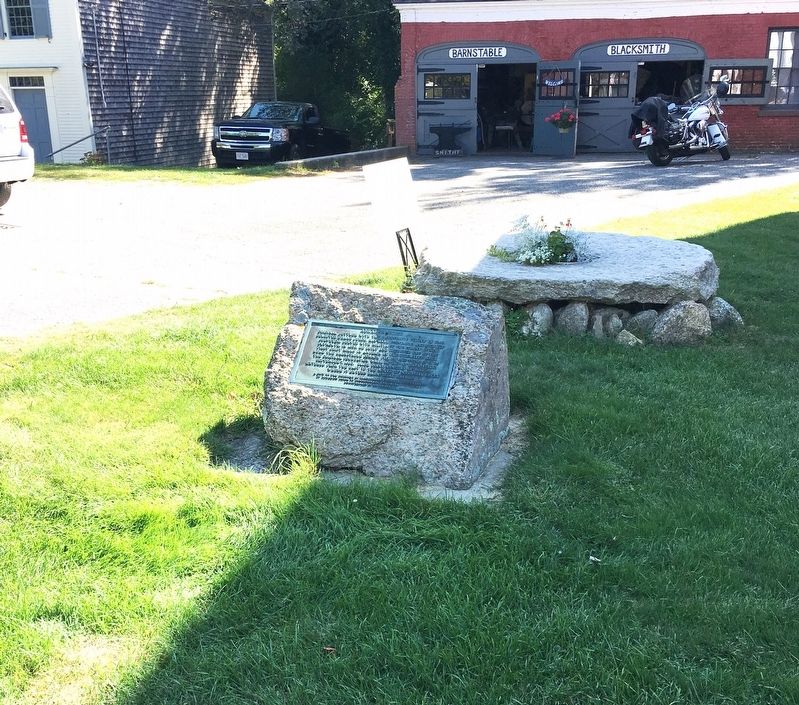
| 14 ► Massachusetts, Barnstable County, Harwich — Brooks Grinding Stone — |
| Near Sisson Road (Massachusetts Route 39) at Parallel Street, on the left when traveling north. | |||
| 15 ► Massachusetts, Barnstable County, Hyannis — Hyannis Main Street — |
| On Main Street at Center Street, on the left when traveling south on Main Street. | |||
| 16 ► Massachusetts, Barnstable County, Hyannis — Hyannis Town Center — |
| On Main Street, 0.1 miles north of Pearl Street, on the left when traveling south. | |||
| 17 ► Massachusetts, Barnstable County, Hyannis — HyArts Artist Shanties — Bismore Park — |
| On Ocean Street at Bay Street, on the right when traveling north on Ocean Street. | |||
| 18 ► Massachusetts, Barnstable County, Hyannis — 2 — Main St. Hyannis — Hyannis Kennedy Legacy Trail — |
| On Main St at Pearl St, on the left when traveling south on Main St. | |||
| 19 ► Massachusetts, Barnstable County, Hyannis — The Public Service Building — 1928 — |
| On Main Street, 0.1 miles north of Pearl Street, on the right when traveling south. | |||
| 20 ► Massachusetts, Barnstable County, Orleans — Benjamin Sparrow — Lifesaving Heritage of Orleans — |
| On Beach Road at Surf Path, on the left when traveling east on Beach Road. | |||
| 21 ► Massachusetts, Barnstable County, Orleans — East Orleans Country Store — |
| On Main St at Beach Road, on the right when traveling east on Main St. | |||
| 22 ► Massachusetts, Barnstable County, Orleans — French–Atlantic Cable Company — |
| On S Orleans Rd, on the right when traveling north. | |||
| 23 ► Massachusetts, Barnstable County, Orleans — Jonathan Young Mill — |
| On Cranberry Highway (Route 28 &6A). | |||
| 24 ► Massachusetts, Barnstable County, Orleans — Keeping the Light for 114 Years — Nauset Lighthouse — |
| On Nauset Light Beach Rd, 0.2 miles north of Cable Rd, on the right when traveling south. | |||
| 25 ► Massachusetts, Barnstable County, Orleans — The Birth of the Coast Guard — Lifesaving Heritage of Orleans — |
| On Beach Road at Surf Path on Beach Road. | |||
| 26 ► Massachusetts, Barnstable County, Orleans — The French Transatlantic Telegraph Cable, 1898 — IEEE Milestone — |
| On S Orleans Rd at Cove Rd, on the left when traveling south on S Orleans Rd. | |||
| 27 ► Massachusetts, Barnstable County, Orleans — The Legacy Begins — Lifesaving Heritage of Orleans — |
| On Beach Road at Surf Path on Beach Road. | |||
| 28 ► Massachusetts, Barnstable County, Orleans — The Legacy Endures — Lifesaving Heritage of Orleans — |
| On Beach Road at Surf Path, on the left when traveling east on Beach Road. | |||
| 29 ► Massachusetts, Barnstable County, Orleans — The Schooner Montclair — |
| Near River Rd at Main St, on the left when traveling north. | |||
| 30 ► Massachusetts, Barnstable County, Orleans — The United States Lifesaving Service — Lifesaving Heritage of Orleans — |
| On Beach Road at Surf Path, on the left when traveling east on Beach Road. | |||
| 31 ► Massachusetts, Barnstable County, Orleans — The Whale of Orleans — |
| On Cove Rd, 0.1 miles east of Route 6A, on the left when traveling east. | |||
| 32 ► Massachusetts, Barnstable County, Sandwich — Dexter’s Grist Mill — |
| On Water St at Main St, on the left when traveling east on Water St. | |||
| 33 ► Massachusetts, Barnstable County, Sandwich — First Church of Christ / The Dexter Grist Mill — |
| On Main Street (Massachusetts Route 130) at Water Street (Massachusetts Route 130), on the right when traveling west on Main Street. | |||
| 34 ► Massachusetts, Barnstable County, Sandwich — Sandwich Town Hall/Mill Creek — |
| On Main Street at Water Street, on the right when traveling north on Main Street. | |||
| 35 ► Massachusetts, Barnstable County, Wellfleet — Marconi Wireless Station |
| Near Marconi Station Road. Reported missing. | |||
| 36 ► Massachusetts, Barnstable County, Wellfleet — Transatlantic Triumph |
| On Marconi Station Road. Reported missing. | |||
| 37 ► Massachusetts, Berkshire County, Adams — Big Business of Cotton Cloth / Working in the Berkshires — Explore Adams History — |
| On Hoosac Street east of Depot Street, on the right when traveling east. | |||
| 38 ► Massachusetts, Berkshire County, Adams — Prosperity! — Explore Adams History — |
| On Park Street (Massachusetts Route 8) 0.1 miles south of School Street, on the right when traveling south. | |||
| 39 ► Massachusetts, Berkshire County, Adams — Renfrew Manufacturing Company World War Honor Roll — |
| On Columbia Street (Massachusetts Route 8) at Upton Street, on the right when traveling south on Columbia Street. | |||
| 40 ► Massachusetts, Berkshire County, Adams — Susan Brownell Anthony — February 15, 1820 - March 13, 1906 — Born Adams, Massachusetts — |
| On Park Street (Massachusetts Route 8) north of the Moosic River, on the left when traveling north. | |||
| 41 ► Massachusetts, Berkshire County, Adams — The Railroad Solved A Problem / The Railroad Changed Everything — Explore Adams History — |
| On Hoosac Street east of Columbia Street (Massachusetts Route 8), on the right when traveling west. | |||
| 42 ► Massachusetts, Berkshire County, Adams — Why McKinley? / A Library & Civil War Veterans — Explore Adams History — |
| On Park Street (Massachusetts Route 8) at East Maple Street, on the right when traveling south on Park Street. | |||
| 43 ► Massachusetts, Berkshire County, Becket — Monroe E. Ballou — |
| On Main Street (Massachusetts Route 8) at Prentice Place, on the right when traveling north on Main Street. | |||
| 44 ► Massachusetts, Berkshire County, Cheshire — Ashuwillticook Rail Trail — Pond for Power — |
| Near Hoosac Drive, 0.6 miles north of Mallard Drive. | |||
| 45 ► Massachusetts, Berkshire County, Cheshire — Cheshire’s Mammoth Cheese — |
| On Main Street at Railroad Street, on the right when traveling west on Main Street. | |||
| 46 ► Massachusetts, Berkshire County, Great Barrington — Alternating Current Electrification, 1886 — IEEE Milestone in Electrical Engineering and Computing — |
| On Main Street (U.S. 7) at Cottage Street, on the right when traveling north on Main Street. | |||
| 47 ► Massachusetts, Berkshire County, Great Barrington — Memorial Street Light — |
| On Main Street (U.S. 7) at Cottage Street, on the right when traveling north on Main Street. | |||
| 48 ► Massachusetts, Berkshire County, Great Barrington — William Stanley — |
| On Main Street at Cottage Street, on the right when traveling north on Main Street. | |||
| 49 ► Massachusetts, Berkshire County, Great Barrington — William Stanley Overlook — Housatonic River Walk — |
| Near near Dresser Avenue at River Street. | |||
| 50 ► Massachusetts, Berkshire County, Lee — Lee — A Mill Town — |
| On Housatonic Street (U.S. 20) at Fuller Street, on the right when traveling north on Housatonic Street. | |||
| 51 ► Massachusetts, Berkshire County, New Marlborough — Elihu Burritt — "The Learned Blacksmith" — 1810-1879 — |
| On New Marlborough-Monterey Road north of Hartsville-New Marlborough Road (Massachusetts Route 57), on the right when traveling north. | |||
| 52 ► Massachusetts, Berkshire County, New Marlborough — Historic Town Meeting — |
| On New Marlborough-Monterey Road north of Hartsville-New Marlborough Road (Massachusetts Route 57), on the left when traveling north. | |||
| 53 ► Massachusetts, Berkshire County, New Marlborough — New Marlborough: The Stagecoach Era — |
| On Hartsville-New Marlboro Road (Massachusetts Route 57) east of New Marlborough-Monterey Road, on the left when traveling east. | |||
| 54 ► Massachusetts, Berkshire County, Pittsfield — Hancock Shaker Village — |
| 55 ► Massachusetts, Berkshire County, Pittsfield — Shaker Color — |
| 56 ► Massachusetts, Berkshire County, South Williamstown — South Williamstown Five Corners — |
| On Cold Spring Road/New Ashford Road (U.S. 7) at Green River Road/Hancock Road (Massachusetts Route 43), on the left when traveling south on Cold Spring Road/New Ashford Road. | |||
| 57 ► Massachusetts, Berkshire County, Williamstown — Nehemiah Smedley House — |
| On Main Street (Massachusetts Route 2) at Colonial Avenue, on the right when traveling west on Main Street. | |||
| 58 ► Massachusetts, Bristol County, Acushnet — White's Factory — (1831) — |
| On Hamlin Street. | |||
| 59 ► Massachusetts, Bristol County, Attleboro — Last Wooden Bridge — |
| On South Main St. (Massachusetts Route 152), on the left when traveling south. | |||
| 60 ► Massachusetts, Bristol County, Attleboro — The Old Shuttle Shop — |
| On North Main St. | |||
| 61 ► Massachusetts, Bristol County, Mansfield — Lowney Common — |
| On Crocker Street, 0.1 miles east of North Main Street, on the right when traveling west. | |||
| 62 ► Massachusetts, Bristol County, New Bedford — Ernestina's Many Lives — |
| On MacArthur Drive south of Elm Street, on the left when traveling south. | |||
| 63 ► Massachusetts, Bristol County, New Bedford — A Tribute of Respect to Enterprising Whalemen — |
| On Johnny Cake Hill south of Williams Street, on the right when traveling south. | |||
| 64 ► Massachusetts, Bristol County, New Bedford — Bourne Warehouse — 1887 — "Building the Future on the Best of the Past" — |
| On N 2nd Street, on the left when traveling north. | |||
| 65 ► Massachusetts, Bristol County, New Bedford — Cape Verde to New Bedford — |
| On MacArthur Drive south of Elm Street (Route 104), on the left when traveling south. | |||
| 66 ► Massachusetts, Bristol County, New Bedford — Captain Paul Cuffe — |
| On Union Street near 1st Street, on the right when traveling west. | |||
| 67 ► Massachusetts, Bristol County, New Bedford — Captain Paul Cuffe's Atlantic World — |
| On Pleasant Street south of Union Street, on the left when traveling north. | |||
| 68 ► Massachusetts, Bristol County, New Bedford — Centre Street — Utility over Elegance — |
| On North Water Street, on the right when traveling south. | |||
| 69 ► Massachusetts, Bristol County, New Bedford — Colonel George Claghorn — |
| On MacArthur Drive south of Elm Street, on the left when traveling south. | |||
| 70 ► Massachusetts, Bristol County, New Bedford — Commonwealth of Toil — Longshoremen’s Union — |
| On Front Street near Union Street, on the right when traveling north. | |||
| 71 ► Massachusetts, Bristol County, New Bedford — Dedicated as a Tribute — |
| On Lieutenant Walter E. Fuller Memorial Parkway at Buttonwood Street, in the median on Lieutenant Walter E. Fuller Memorial Parkway. | |||
| 72 ► Massachusetts, Bristol County, New Bedford — Double Bank — |
| On Williams Street, on the right when traveling east. | |||
| 73 ► Massachusetts, Bristol County, New Bedford — From Whales to Bales — |
| On MacArthur Drive south of Elm Street, on the left when traveling south. | |||
| 74 ► Massachusetts, Bristol County, New Bedford — From Whales to Flatfish and Scallops — |
| On MacArthur Drive south of Elm Street, on the left when traveling south. | |||
| 75 ► Massachusetts, Bristol County, New Bedford — Lewis Temple — Blacksmith — Inventor of the Iron Toggle Harpoon Tip — |
| On Pleasant Street, on the left when traveling north. | |||
| 76 ► Massachusetts, Bristol County, New Bedford — Merrill's Wharf — |
| On MacArthur Drive south of Elm Street, on the left when traveling south. | |||
| 77 ► Massachusetts, Bristol County, New Bedford — New Bedford Historic District — |
| On Williams Street, on the left when traveling east. | |||
| 78 ► Massachusetts, Bristol County, New Bedford — Preserving Whaling's Legacy — The New Bedford Whaling Museum — |
| On Johnny Cake Hill south of Williams Street, on the left when traveling south. | |||
| 79 ► Massachusetts, Bristol County, New Bedford — Signs of the Time — New Bedford Whaling National Historic Park — National Park Service, U.S. Department of the Interior — |
| On Williams Street. | |||
| 80 ► Massachusetts, Bristol County, New Bedford — The Andrew Robeson House — |
| On Williams Street, on the right when traveling east. | |||
| 81 ► Massachusetts, Bristol County, New Bedford — The Benjamin Rodman House — |
| On North Second Street, on the right when traveling north. | |||
| 82 ► Massachusetts, Bristol County, New Bedford — The Mariner's Home — |
| On 1st Street just south of Williams Street, on the right when traveling south. | |||
| 83 ► Massachusetts, Bristol County, New Bedford — Twentieth-Century Whaling — New Bedford Whaling National Historic Park — National Park Service, U.S. Department of the Interior — |
| On Union Street. | |||
| 84 ► Massachusetts, Bristol County, New Bedford — Whaleman’s Memorial — |
| On Pleasant Street. | |||
| 85 ► Massachusetts, Bristol County, New Bedford — Whaling Capital — New Bedford Whaling National Historic Park — National Park Service, U.S. Department of the Interior — |
| On MacArthur Drive-Pier 3. | |||
| 86 ► Massachusetts, Bristol County, New Bedford — Whaling's Final Days — |
| On MacArthur Drive south of Elm Street, on the left when traveling south. | |||
| 87 ► Massachusetts, Bristol County, Norton — Stony Brook — Chartley Pond Area — |
| On West Main Street (Massachusetts Route 123), on the right when traveling west. | |||
| 88 ► Massachusetts, Bristol County, Raynham — Site of the First Successful Iron Works in the Old Colony — 1656-1876 — |
| On South Main Street (Massachusetts Route 104) 0.1 miles north of King Philip Street, on the right when traveling north. | |||
| 89 ► Massachusetts, Bristol County, Rehoboth — Anawan House — |
| On Anawan St, on the right when traveling south. | |||
| 90 ► Massachusetts, Bristol County, Rehoboth — Anawan House-Inn — |
| On Anawan Street near Massachusetts Route 44, on the right when traveling south. | |||
| 91 ► Massachusetts, Bristol County, Rehoboth — Bliss-Carpenter Saw & Shingle Mill — 1729-1870 — |
| On Williams Street, on the left when traveling east. | |||
| 92 ► Massachusetts, Bristol County, Rehoboth — Cole-Perry Turning Mill — 1780-1830 — |
| On Ash Street, on the right when traveling west. | |||
| 93 ► Massachusetts, Bristol County, Rehoboth — Leonard Iron Mine — 1696 - 1802 — |
| On Tremont St, on the right when traveling west. | |||
| 94 ► Massachusetts, Bristol County, Rehoboth — Orleans Manufacturing Co. — 1810-1884 — Also known as Shad Factory — |
| On Reed Street. | |||
| 95 ► Massachusetts, Bristol County, Rehoboth — Perryville Dam — 1740 - 1935 — |
| On Danforth st near Perryville Rd. | |||
| 96 ► Massachusetts, Bristol County, Rehoboth — Sabin Sawmill — |
| On Pond St., on the right when traveling north. | |||
| 97 ► Massachusetts, Bristol County, Rehoboth — Samual Baker Grist & Sawmill Site — 1810-1870 — |
| On Brook Street north of Pleasant Street, on the left when traveling south. | |||
| 98 ► Massachusetts, Bristol County, Swansea — Site of Jonathan Barney - Mason Barney Shipyard — 1782-1861 — |
| On Old Providence Road at Barneyville Road, on the right when traveling east on Old Providence Road. | |||
| 99 ► Massachusetts, Dukes County, Edgartown, Martha's Vineyard — 24 South Water Street — |
| On South Water Street south of Main Street, on the right when traveling south. | |||
| 100 ► Massachusetts, Dukes County, Edgartown, Martha's Vineyard — Giant Pagoda Tree — |
| On South Water Street south of Main Street, on the left when traveling south. | |||
406 entries matched your criteria. The first 100 are listed above. Next 100 ⊳