State Of Ohio. Named for the river, called by the Iroquois the "Beautiful River Visited by La Salle in 1669-1670. Once part of the Northwest Territory. Settled at Marietta, 1788. Admitted to the Union, 1803 Home of eight United States . . . — — Map (db m288602) HM
United States of America
Congressional Medal of Honor Recipients
State of Ohio, Hancock County
Civil War
Bensinger, William Captain Georgia 1862
Porter, John R. 1st Lt. Georgia 1862
Scott, John M. Sergeant Georgia 1862
Vance, . . . — — Map (db m29178) HM
Side A: The Ohio Oil Company-Marathon Oil Company
Site of the first Findlay Field Office for what was to become a world-wide oil company, formerly locally owned and operated.
1887: The Ohio Oil Company was incorporated by five independent . . . — — Map (db m29180) HM
Indian Green. This area of western Hancock County is a part of the Maumee River Watershed known as "Indian Green." Wyandot Indians chose this area for hunting and ceremonial grounds along the Blanchard River in the 1700s because it was next to . . . — — Map (db m93378) HM
The Underground Railroad ran most actively in Hancock County from 1856-1860, following Route 68 north, with the first stop on John A. Woods' property in Williamstown, just south of Arlington. From there, David Adams, a free black man and local . . . — — Map (db m245410) HM
The Fugitive Slave Act of 1850 prompted an expansion of the "Underground Railroad," and as the state spanning the shortest distance between the Ohio River and Canada, Ohio saw heavy traffic in escaping slaves in the decades before the Civil War. . . . — — Map (db m29176) HM
[Marker Front]:
Early in the War of 1812, Gen. Wm. Hull, commander of Ohio troops, ordered Col.. James Findlay to open a road from Ft. McArthur on the Scioto River to Blanchard’s Fork. Under Findlay, a stockade 50 yards square, with a . . . — — Map (db m21576) HM
Village of Arcadia
Settled in 1833, Arcadia was one of the last permanent villages to be established in eastern Hancock County. Pioneers Ambrose, David, and Ephriam Peters laid out the farming village on the south edge of "Wild Cat Thicket." . . . — — Map (db m94706) HM
Village of Arlington
First a farming community, later a railroad
crossroads in southern Hancock County, Arlington
was one of the county's earliest settlements.
Gen. William Hull opened a trail into the area
during the War of 1812 as he . . . — — Map (db m176403) HM
Findlay College was a joint venture of the Churches of God, General Conference, and the Village of Findlay. It was chartered on January 28, 1882, to provide a liberal arts education within a Christian context for all -- regardless of race or . . . — — Map (db m29182) HM
Side A:
In spite of small numbers and being welcomed by the mostly white congregation of First Methodist Episcopal Church, African Americans in Findlay in the 1880s wanted to express their faith in ways that best reflected their freedoms and . . . — — Map (db m29179) HM
[West Side of Marker] : "Riverside Park"
One of the earliest and largest amusement parks in Northwest Ohio dedicated in 1906 on site of old waterworks. Trains brought visitors from as far away as Cleveland. 1907: Dance Pavilion and . . . — — Map (db m29569) HM
In 1884, the first natural gas well was successfully drilled in Findlay, and when The Great Karg Well, then the largest in the world, was drilled in 1886, the boom was on. Many industries, especially glass, were attracted to Findlay, lured by free . . . — — Map (db m29174) HM
William Ellsworth "Dummy" Hoy was born in Houcktown on May 23, 1862. Although spinal meningitis as a toddler left him deaf and mute, Hoy became one of the great 19th century professional baseball players. He played centerfield for such teams as the . . . — — Map (db m184256) HM
Organization of the congregation began in 1848 under the Rev. George Van Eman, and a charter was granted in 1854. The oldest Presbyterian church building in continuous use in Hancock County, the sanctuary was constructed in 1855-56. Members of . . . — — Map (db m157030) HM
This frame church, architecturally typical of the rural churches built throughout Ohio in the latter nineteenth century, was constructed in 1885 during the pastorate of E.L.T. Engers. The first pastors were from the German Reformed tradition and . . . — — Map (db m93657) HM
Side A
The village was laid out on August 18, 1847, by Benjamin Todd, and consisted of 18 lots in Section 26 of Pleasant Township. Originally named Pleasantville, it was incorporated in 1858 and the name was changed in honor of Maj. Gen. . . . — — Map (db m93655) HM
Mt. Blanchard. This village was founded in 1830 on the banks
of the Blanchard River by Asa M. Lake, son of
Asa Lake, veteran of the Revolution and War
of 1812 and first settler of Delaware Township.
The town and river are named for an . . . — — Map (db m93927) HM
The Village of Van Buren was laid out December 28, 1833, by John Trout and George Ensminger on the boundary of Portage and Cass Townships. It was comprised of 53 lots surrounding a public square, and was named in honor of Martin Van Buren, a . . . — — Map (db m29187) HM
7/8 mile west – site of
Fort Necessity
Erected in 1812 by Hull’s
army on its march north-
ward from Fort McArthur,
when incessant rains and
mud made further advance
impossible. — — Map (db m136824) HM
In 1907, Laurel Hollow Park was created for the benefit of the residents of the then newly formed town, Newell, West Virginia. Unfortunately, it only lasted about six years and would eventually be taken over by wild growth.
George Washington . . . — — Map (db m269354) HM
The Underground Railroad in Champaign County
The inhumanity of slavery and the Fugitive Slave Acts of 1793 and 1850 motivated anti-slavery activists to operate a covert network, the "Underground Railroad," which helped fugitive slaves . . . — — Map (db m78141) HM
In 1895, at the request of the Hancock County Commissioners, a one lane, pre-engineered Pratt through-truss Bridge made of wrought iron was fabricated, shipped by rail and wagon, and erected by the Canton (Ohio) Bridge Company to connect the . . . — — Map (db m262697) HM
Woman's Club Of New Cumberland. Organized in 1933, the Woman's Club of New Cumberland's objective was to promote mental, moral, civic, and social improvement in the The home and community. Their motto is "Unity in Diversity." original 44 . . . — — Map (db m269278) HM
This historic barn is a proud symbol of Hancock County's rich agricultural heritage. Originally built around the 1850's, probably by the McKinnis family who settled the farmstead, this English style, three bay barn has been reconstructed using . . . — — Map (db m198621) HM
Front Side: Rawson and the Railroads
The original town plat of Rawson was filed on February 3, 1855, consisting of fifty-five lots in sections 13 and 14 of Union Township, Hancock County on the Frederick Keller and George J. Kelly . . . — — Map (db m67548) HM
For John Hancock, 1737-93. Patriot, statesman and soldier. President of Continental Congress, 1775-77, and bold first signer of the Declaration of Independence. Mayor-general of Mass. militia in Revolutionary War, member of the Mass. Constitutional . . . — — Map (db m119794) HM
It was far days after the firing on Fort Sumter when the village of Findlay began preparations for war. Flags uld be seen flying, and large banners were hung across Main Street. A cannon led a procession of several hundred citizens to the river . . . — — Map (db m245409) HM
These markers were funded with a grant from Federal Highway Administration through the National Scenic Byways Program.
The Hoosier National Forest - Then and Now
This area has been inhabited continuously by humans for 12,000 years. . . . — — Map (db m178232) HM
In the fall of 1821 Robert McKinnis and his sons, Charles, James,
Phillip, John, and his son-in-law Jacob Poe, traveled to Hancock County
to establish the first settlement in the spring of 1822. Being amongst the
first white settlers to arrive . . . — — Map (db m198619) HM
Side A
(colored flag)
In
honor
of all who
served
(5 bronze service medallions)
Side B
major donors
Hancock County Veterans Assistance Center
Jack Harden & Sons Contracting Inc.
K & L Ready Mix
Ed Harden Excavating . . . — — Map (db m93663) WM
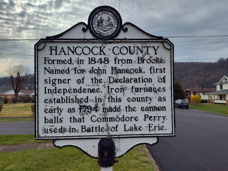
Side A:Hancock CountyFormed in 1848 from Brooke. Named for John Hancock, first signer of the Declaration of Independence. Iron furnaces established in this county as early as 1794 made the cannon balls that Commodore Perry used in . . . — — Map (db m44127) HM
(side 1)
Rails of Louisville, St. Louis, and Texas Railroad laid here June 9, 1888. First passenger train ran between Owensboro and Stephensport Oct. 7, 1888. Service between Evansville and Louisville began in April 1889. Rail line . . . — — Map (db m119799) HM
It was believed that the supply of natural gas beneath Findlay was inexhaustible, and that one day, Toledo would be a suburb of Findlay. But, by 1900, most of the gas had run out. Without free gas, many of the factories left town, and Findlay . . . — — Map (db m245407) HM
The 1960s in Findlay celebrated the old as it welcomed the new!
In 1962, a weeklong Sesquicentennial celebration in July included four parades, a historical pageant, a beard growing competition, fireworks, burying a time capsule, and . . . — — Map (db m245370) HM
The Township Road 241 Bridge (TR 241 Bridge) is a wrought iron Pratt through-truss that spanned the Blanchard River for 114 years. It was originally located on Township Road 241, which now forms the western boundary of Riverbend Recreation Area. . . . — — Map (db m262712) HM
Land, timber, and commercial opportunities drew settlers here to the banks of the Holston River. As the Civil War approached, the river's importance in the Tennessee Valley made it a contested transportation route. Hawkins County residents mostly . . . — — Map (db m97667) HM
In 1816, the Lincoln family moved from present-day Larue County, Kentucky, to present-day Spencer County, Indiana. Abraham Lincoln, future president of the United States, recounted the reason for this move north of the Ohio River in a short . . . — — Map (db m249381) HM
Thin black lines indicate changes in relevance. Between each pair of lines entries are ordered geographically but all have the same relevance.
* Inflectional forms of words are their plurals, singulars, and possessives as well as gramatical tenses and similar variations.