By James Hulse, February 13, 2026
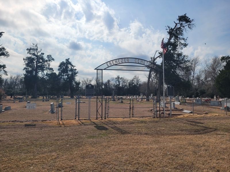
James Alfred Head Marker
RANKED BY RELEVANCE
| On Ebenezer Cemetery Rd (County Road 714) 1 mile south of State Highway 7, on the right when traveling south. |
| On West State Street at Ellis Street, on the right when traveling east on West State Street. |
| Near Ragle Road north of Arrow Point Dr. |
| On South Micheaux Street, on the right when traveling north. |
| On State Highway 14 0.5 miles north of County Highway 662, on the right when traveling north. |
| Near Creek Drive west of Route 792, on the left when traveling west. |
| On Ebenezer Cemetery Rd (County Road 714) 1 mile south of State Road 7, on the right when traveling south. |
| On State Highway 7 0.1 miles east of Ebenezer Church Road (County Highway 462), on the right when traveling east. |
| On LCR Comanche A 0.1 miles south of Farm to Market Road 3437, on the right when traveling south. |
| On Farm to Market Road 2339 0.5 miles west of Farm to Market Road 4712, on the right when traveling west. |
| On Faulkenberry Road 0.1 miles south of E Yeagua Street, on the left when traveling south. |
| On East Palestine Avenue (State Highway 19) at North Laura Street, on the right when traveling east on East Palestine Avenue. |
| On County Road 666 2 miles north of County Road 668, on the right when traveling west. |
| On Allyn Avenue (Farm to Market Road 339) at North Fourth Street West, on the left when traveling west on Allyn Avenue. |
| On East Washington Street (State Highway 7) at S Narcissus Street, on the left when traveling west on East Washington Street. |
| On County Road 740 0.1 miles west of County Road 741. |
| On North Ellis Street (State Highway 14) at West Sabine Street, on the right when traveling north on North Ellis Street. |
| On Ellis Street (State Highway 14) at West State Street, on the right when traveling north on Ellis Street. |
| On State Highway 7 at Ebenezer Church Road (County Highway 462), on the right when traveling east on State Highway 7. |
| Near Park Road 35 0.2 miles north of County Highway 401. |
| On West State Street at Ellis Street (State Highway 14), on the right when traveling north on West State Street. |
| On State Highway 14 at County Highway 456, on the right when traveling south on State Highway 14. |
| On Park Road 28 0.5 miles west of State Highway 14, on the left when traveling west. |
| On East Main Street at South McKinney State, on the left when traveling east on East Main Street. |
| Near Boonville Road 0.1 miles east of Austins Colony Parkway. |
| Near Landa Park Drive (California Blvd) at Monument Drive. |
| On County Highway 231 1.1 miles east of Highway 246, on the left when traveling east. |
| On County Road 1140 at County Road 1131, on the right when traveling north on County Road 1140. |
| Near Fort Park Memorial Cemetery Road 0.4 miles east of Farm to Market Road 1245. |
| Near LCR 102 0.2 miles west of LCR 106. |
| On Lentzville Road 0.7 miles south of Barker Road, on the right when traveling south. |
| On Parker Street at S 1st Street, on the right when traveling west on Parker Street. |
| On County Road 186 at County Road 185 on County Road 186. |
| On Fort Park Memorial Cemetery Road 0.4 miles east of Farm to Market Road 1245, on the right when traveling east. |
| On County Road 454 0.5 miles north of County Road 453, on the right when traveling north. |
| On Ebenezer Cemetery Rd (County Road 714) 1 mile south of State Highway 7, on the right when traveling south. |
| On Farm to Market Road 2705 at County Highway 477, on the left when traveling north on Highway 2705. |
| On LCR 141 0.1 miles east of Farm to Market Road 73, on the left when traveling east. |
| Near County Road 226 north of Westminser Street, on the right when traveling north. |
| On State Highway 171 0.3 miles east of Paris Road (County Route 178), on the right when traveling west. |
| Near Park Road 35 0.2 miles north of County Highway 401. |
| On State Highway 171 0.1 miles east of County Road 634, on the right when traveling west. |
| On Farm to Market Road 339 0.2 miles south of LCR 131, on the left when traveling north. |
| On County Road 4350 north of County Road 4336, on the right when traveling north. |
| On Farm to Market Road 1246 at County Road 758, on the left when traveling east on Road 1246. |
| On Trinity Circle north of Browns Ferry Street (County Road 29), on the left when traveling north. |
Thin black lines indicate changes in relevance. Between each pair of lines entries are ordered geographically but all have the same relevance.* Inflectional forms of words are their plurals, singulars, and possessives as well as gramatical tenses and similar variations.
Nov. 12, 2026
