Department of the Interior markers at sites possessing exceptional value illustrating the nation’s natural heritage and contributing to a better understanding of man’s environment.
Cathedral Caverns
has been designated a
Registered
Natural Landmark
under the provisions of the
Historic Sites Act of August 21, 1935
This site possesses exceptional value
in illustrating the natural
history of the . . . — — Map (db m76233) HM
has been designated a
National
Natural Landmark
This site possesses exceptional value
as an illustration of the nation's natural
heritage and contributes to a better
understanding of the environment
1972
National Park Service . . . — — Map (db m185282) HM
Has been designated a
National Natural Landmark
This site possesses exceptional value as an illustration of the Nation's natural heritage and contributes to a better understanding of the environment. — — Map (db m94912)
Mammoth Spring has been designated a National Natural Landmark This site possesses exceptional value as an illustration of the Nation's natural heritage and contributes to a better understanding of man’s environment 1990 National Park . . . — — Map (db m192000) HM
Amboy Crater, formed of ash and cinders, is 250 feet high and 1500 feet in diameter. The crater is in one of the youngest volcanic fields in the United States. Six distinct periods of eruptions created the resulting nested group of volcanic cinder . . . — — Map (db m78561) HM
Rising from the bottom of what was once an ancient lakebed, the Trona Pinnacles represent one of the most unique geologic landscapes in the California Desert. Over 500 of these tufa or calcium carbonate spires are spread out over a 14 square mile . . . — — Map (db m50221) HM
Burney Falls
has been dedicated a
National Natural Landmark.
This site possesses exceptional value as an illustration of the nation's natural heritage and contributes to a better understanding of man's environment. — — Map (db m546) HM
Administered by the Forest Service, United States Department of Agriculture has been designated a
Registered Natural Landmark
This site possesses exceptional value as an illustration of the nation's natural heritage and contributes to a . . . — — Map (db m89118) HM
In 1879, General William Jackson Palmer, founder of Colorado Springs, convinced his friend Charles Elliot Perkins to purchase land in Garden of the Gods. Perkins eventually bought a total of 480 spectacular acres surrounding the Gateway Rocks, . . . — — Map (db m135646) HM
The beauty of Garden of the Gods Park, with its dramatic red rock formations framing Pikes Peak, serves as a magnificent eastern gateway to Colorado’s Rocky Mountains. The park’s towering red sandstone rocks have long been recognized as a landmark. . . . — — Map (db m45983) HM
This rock formation, called Sentinel Rock, is a geologic treasure. It is composed of two types of rock - a fine sandstone and a gravelly conglomerate. The various layers in this rock were deposited 275 million years ago. During that time, ancient . . . — — Map (db m135022) HM
Morrison Fossil Area has been designated a National Natural Landmark This site possesses exceptional value as an illustration of the Nation's natural heritage and contributes to a better understanding of the environment 1973 National . . . — — Map (db m155600) HM
Devil’s Millhopper
has been designated a
Registered Natural Landmark
This site possesses exceptional value
as an illustration of the Nation’s natural
heritage and contributes to a better
understanding of man’s environment
. . . — — Map (db m125200) HM
Bald cypress, the swamp and wood storks make this National Audubon Society sanctuary unique. The source of storks Wood storks come to Corkscrew Swamp during the dry months of winter and early spring. Here, in greater numbers than anywhere . . . — — Map (db m164800) HM
This location is significant as it represents relationships between human culture and natural resources from the settlement systems of the Paleoindian period to the recent historic past, a period of nearly 15,000 years. There are 55 recorded . . . — — Map (db m101862) HM
A vast display of towering granite rocks (16 miles southeast of here) attracted emigrants who were on their way to California. A gold rush visitor, July 14, 1849, reported that "you can imagine among these massive piles, church domes, spires, . . . — — Map (db m31637) HM
Fults Hill Prairie Nature Preserve has been formally dedicated as a sanctuary for native plants and animals. It is maintained in its natural condition so that present and future generations can see the Illinois landscape as it appeared in the . . . — — Map (db m241611) HM
Discovered September 6, 1883 by Blanche & Orris Hiestand who descended into the first room. The following Sunday, Mitch Stewart and friends explored the main passageways. The next day, local residents descended in mass on the cave. Owner Samuel . . . — — Map (db m70554) HM
has been designated a
National Natural Landmark
This site possesses exceptional value as an illustration of the nation's natural heritage and contributes to a better understanding of the environment — — Map (db m10093) HM
Over 11 square miles of marshes, savannas, oak forests, and other landscapes drain into Lake Michigan
at this point.
You are standing in the Dunes Creek watershed which drains into Lake Michigan and
encompasses all of the Indiana Dunes . . . — — Map (db m161460) HM
The Legend of Hanging Rock
Wy-nu-sa was a beautiful Miami Indian maiden who thought she was in love with two handsome, strong, stalwart Indian braves. Both of the young men were deeply in love with the maiden, too, but she was not able . . . — — Map (db m71305) HM
Rock City rocks are magnificent examples of sandstone concretions which have formed in the millions of years since Kansas was covered by an inland sea. This is the only place in the world where so many concretions of such giant size are found in . . . — — Map (db m79957) HM
Grand Gulf
has been designated a
National
Natural Landmark
This site possesses exceptional value
as an illustration of the Nation's natural
heritage and contributes to a better
understanding of man’s environment . . . — — Map (db m207737) HM
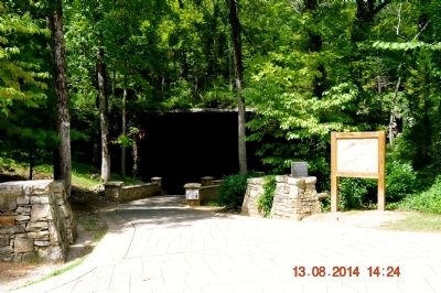
Marvel Cave
has been designated a
Registered
Natural Landmark
under the provisions of the Historic Sites Act of August 21, 1935. This site possesses exceptional value in illustrating the natural history of the United States
US. . . . — — Map (db m209709) HM
Nebraska Sand Hills has been designated a National Natural Landmark This site possesses exceptional value as an illustration of the Nation's natural heritage and contributes to a better understanding of Man’s environment . . . — — Map (db m178499) HM
has been designated a National Natural Landmark
This site possesses exceptional value as an illustration of the Nation's Natural heritage and contributes to a better understanding of the environment.
1968
National Park Service . . . — — Map (db m3433) HM
William L. Hutcheson Memorial Forest has been designated a National Natural Landmark. This site possesses exceptional value as an illustration of the nation's natural heritage and contributes to a better understanding of the environment. 1976. . . . — — Map (db m99139) HM
In 2014, the Albany Pine Bush was designated
a National Natural Landmark by the U.S.
Department of the Interior in recognition of
outstanding geological and biological features
including the largest area of inland sand dunes
in the eastern . . . — — Map (db m191105) HM
Has been designated a
National Natural Landmark
This site possesses exceptional value as an illustration of the nation's natural heritage and contributes to a better understanding of the environment — — Map (db m57738) HM
Clear Fork Gorge was formed when glacial meltwater cut through the sandstone bedrock that forms its steep walls fourteen to twenty-four thousand years ago. The gorge is one thousand feet wide and over three hundred feet deep. Its seclusion has . . . — — Map (db m24285) HM
Cedar Bog…
• is a nature preserve with several different wetlands.
• has a mile-plus long boardwalk providing a pathway through the wetlands that is easy, dry, and handicapped-accessible.
• is a paradise for naturalists and . . . — — Map (db m198691) HM
In 1942 Cedar Bog became the first nature preserve in Ohio purchased
with state funds. Efforts to set this wetland aside began in the
1920s through the efforts of Florence Murdock and her daughter.
Efforts intensified in the mid 1930s with help . . . — — Map (db m90503)
Tinker's Creek is named after Joseph Tinker, a member of Moses Cleveland's survey crew. The creek has been carving this gorge from the surrounding rock for thousands of years. The creek begins its 28.2 mile journey in Portage County, flows . . . — — Map (db m228171) HM
A living memorial to the Goll Family whose love of trees preserved this natural sanctuary through five generations. The forest is part of a 320-acre farm purchased in 1837 from the U.S. Government by Peter Goll, Sr. and sold in 1966 to
the state . . . — — Map (db m172010) HM
Clifton Gorge
has been designed a
Registered
Natural Landmark
under the provisions of the
Historic Sites Act of August 21, 1935
this site possesses exceptional value
in illustrating the natural
history of the United States
U. S. Department . . . — — Map (db m77111) HM
Ten thousand years ago, Fort Rock was prime real estate for cave-dwelling families. Food was plentiful and there was a great lake where you stand. Walk the trail of this giant "tuff ring" and you'll discover dynamic strands of nature woven . . . — — Map (db m113569) HM
Founded in 1934 by Rosalie Edge, it is the world's first refuge for birds of prey. It had been a popular shooting site because of its location on a major hawk migration corridor and a 1929 bounty placed on northern goshawks. Through the work of its . . . — — Map (db m140170) HM
Presque Isle
has been designated a
Registered
Natural Landmark
under the provisions of the
Historic Sites Act of August 21, 1933
This site possesses exceptional value
in illustrating the natural
history of the United . . . — — Map (db m132341) HM
Cedar Creek Gorge, 21.8 miles north. Off the main trail in Cedar Creek Park, you will find waterfalls and wildflowers, as well as a suspension bridge over the gorge. photo by Betsy Mandarino.Great
Tufa Formation, 20.5 miles north. A living, . . . — — Map (db m76710) HM
A half-million years ago, North America entered one of several "ice ages." Thousands of years of relentless cold passed, and ice accumulated a mile thick across Canada. The ice eventually formed glaciers that slowly advanced southward into . . . — — Map (db m216285) HM
The inspiration for this garden is the Wissahickon Valley Park, a picturesque wooded gorge extending seven miles along Wissahickon Creek in the northwestern section of Philadelphia. The first to walk the rugged trails of the valley were the . . . — — Map (db m212730) HM
Welcome to Wissahickon Valley Park!
Designated a National Natural Landmark in 1964, the Wissahickon Creek gorge is one of the most unique places in the City of Philadelphia. Carved through the distinctive Wissahickon Schist bedrock, . . . — — Map (db m232064) HM
Welcome to Wissahickon Valley Park and Forbidden DriveMany rough mill roads once ran through this valley. But as traffic increased, people needed a better road. In the early 1850s, work began on a turnpike to ease travel between the mills and . . . — — Map (db m69097) HM
Welcome to Wissahickon Valley Park!
Designated a National Natural Landmark in 1964, the Wissahickon Creek gorge is one of the most unique places in the City of Philadelphia. Carved through the distinctive Wissahickon Schist bedrock, . . . — — Map (db m160457) HM
The Indians called Pine Creek “Tiadaghton,” which meant river of pines. These now-gone pines brought drastic changes to Pine Creek.
Logging began in the 1800s. Before the logging, the thick soil held rainwater like a sponge. It released it . . . — — Map (db m93076) HM
Lake Lacawac
has been classified a
Registered National Landmark
under the provisions of the Historic Sites Act of August 21, 1935
This site possesses exceptional value in illustrating the natural history of the United States
U.S. . . . — — Map (db m144861) HM
has been designated a
Registered Natural Landmark
Under the provisions of the
Historic Sites Act of August 21, 1935
this site possesses exceptional value
in illustrating the natural
history of the United States
U.S. . . . — — Map (db m234940) HM
Gigantic Mammoths, ancestors of the elephants of today, once roamed freely across the High Plains of North America. A repository of their remains, along with other prehistoric animals, lay undisturbed until their discovery over 26,000 years later, . . . — — Map (db m184458) HM
The Castles
Administered by the Forest Service
United States Department of Agriculture
has been designated a
Registered Natural Landmark
This site possesses exceptional value as an . . . — — Map (db m154916) HM
has been designated a
Registered
Natural Landmark
Under the provisions of the Historic Sites Act of August 21, 1935 this site possesses exceptional value in illustrating the natural history of the United States
U. S. Department of . . . — — Map (db m185215) HM
Has been designated a
Registered
Natural Landmark
Under the Provisions of the
Historic Sites Act of August 21, 1955
This site Possesses Exceptional Value
In illustrating the Natural
History of the United States
U.S. . . . — — Map (db m123355) HM
Mount Mansfield Natural Area has been designated a National Natural Landmark This site possesses exceptional value as an illustration of the Nation’s natural heritage and contributes to a better understanding of man’s environment. 1980 . . . — — Map (db m160995) HM
(front)
Near This Spot
Andrew Campbell, feeling the cool air of newly found natural wonder Luray Caverns, is shown here very shortly after this "discovery of the century" was made. Photo was most likely taken by co-discoverer Benton . . . — — Map (db m106463) HM
The Discovery of the Century
On August 13, 1878, town tinsmith Andrew Campbell, Campbell's 13-year-old nephew Quint, and three other men were exploring for a cave. With the help of a companion, photographer Benton Stebbins, they dug away . . . — — Map (db m159107) HM
This butte was first called Pyramid Peak. It was named “Steptoe” for a commander in the Indian wars at a battle in 1858 near the present town of Rosalia. In the 1880s James S. Davis built a resort and observatory on the Butte’s top. A . . . — — Map (db m129095) HM
Although saltpeter (potassium nitrate or nitre), an essential element in the manufacture of gunpowder, had been mined at Organ Cave since the eighteenth century, the need for the mineral increased dramatically during the Civil War. Several saltpeter . . . — — Map (db m59342) HM