By J. Makali Bruton, March 14, 2016
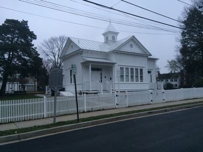
Carlin Community Hall Marker
GEOGRAPHIC SORT Title Sort Marker Number Sort Marker Number Sort N Marker Number Sort T Publication Order Sort Publication Order Sort A Erected Year Sort Most Viewed Sort Most Recent-Interest Sort Most Recently Changed Sort SEE FAQ #33 FOR DESCRIPTIONS
On South 4th Street west of South Kensington Street, on the left when traveling east.
On South Four Mile Run Drive just east of South Nelson Street, on the left when traveling west.
Near South Kenmore Street north of 24th Street South, on the right when traveling south.
On 24th Road South west of South Glebe Road (Virginia Route 120), on the right when traveling east.
On 22nd Street South at South Kenmore Street, on the right when traveling east on 22nd Street South.
On South Kenmore Street at South 19th Street, on the right when traveling south on South Kenmore Street.
Near South Kenmore Street just north of 24th Street South, on the right when traveling south.
On North Glebe Road (Virginia Route 120) at Old Glebe Road on North Glebe Road.
On Columbia Pike (Virginia Route 244) at South Scott Street on Columbia Pike.
On Marshall Drive at Richmond Highway on Marshall Drive. Reported permanently removed.
On Campbell Avenue at South Quincy Street, on the right when traveling west on Campbell Avenue.
On North 17th Street, on the right.
On North 16th Street at Glebe Road on North 16th Street.
On Tinkling Spring Road (County Route 805), on the right when traveling north.
On Old Stone Church Lane just west of Lee Highway (U.S. 11), on the right when traveling south.
Paid Advertisement
On Lee Highway (U.S. 11) just south of County Route 616, on the right when traveling south.
On Lee Highway (U.S. 11) just south of County Route 616, on the left when traveling south.
On Mt. Tabor Road (County Route 694) 0.1 miles north of Middlebrook Road (Virginia Route 252), on the left when traveling north.
On Salem Church Road (County Route 804) at Burke’s Mill Road, on the right when traveling north on Salem Church Road.
On Lee Highway (U.S. 11) 0.1 miles north of Tye River Turnpike (Virginia Route 56), on the right when traveling north.
On Lee Jackson Highway (U.S. 11) at Howardsville Road (Virginia Route 701), on the right when traveling south on Lee Jackson Highway.
On Lee Jackson Highway (U.S. 11) at Spottswood Road (Virginia Route 620), on the right when traveling south on Lee Jackson Highway.
On Glebe School Road (Virginia Route 876) south of Baylor Mill Road, on the right when traveling south.
On Lee Jackson Highway (U.S. 11) at Tye River Turnpike (Virginia Route 56), on the right when traveling north on Lee Jackson Highway. Reported permanently removed.
On Virginia Route 39 west of County Route 678, on the right when traveling east.
On U.S. 220 at Virginia Route 39, on the right when traveling north on U.S. 220.
Near Overlord Circle, 0.4 miles west of Burks Hill Road.
On Shingle Block Road (Virginia Route 24) at Wilson Church Road (County Route 722), on the right when traveling west on Shingle Block Road.
On Forest Road (U.S. 221) east of Venture Drive, on the right when traveling west.
On State Park Road (Road 888) 1.2 miles west of Smith Mountain Lake Parkway (State Route 626), on the right when traveling west.
On North Scenic Highway (U.S. 52) at Interstate 77, on the right when traveling south on North Scenic Highway.
Paid Advertisement
On Main Street at Bedford St, on the left when traveling north on Main Street.
On Main Street at Washington Street, on the left when traveling south on Main Street.
On Lee Highway at Washington St, on the right when traveling south on Lee Highway.
On Roanoke Road (U.S. 220), on the right when traveling south.
On Botetourt Road (Route 220) at Poor Farm Road (Route 681), in the median on Botetourt Road.
On Lee Street north of Cumberland Street (Virginia Route 113), on the left when traveling north.
On Pleasant Grove Road (County Road 681) 0.2 miles west of Governor Harrison Parkway (U.S. 58), on the right when traveling west.
On Christanna Highway (Virginia Route 46) 0.1 miles east of Walkers Wood Lane, on the right when traveling east.
On College Drive, 0.1 miles north of Windsor Avenue (Virginia Route 46), on the right when traveling north. Reported permanently removed.
On North Main Street (Business U.S. 58) at Athletic Field Road, on the right when traveling west on North Main Street.
On Christanna Highway (Virginia Route 46) 0.5 miles north of Gasburg Road (County Road 626), on the right when traveling north.
On Christanna Highway (Virginia Route 46) 0.1 miles south of Gasburg Road (County Road 626), on the left when traveling north.
On Boydton Plank Road (U.S. 1) 0.1 miles south of Flat Rock Road (County Route 643), on the right when traveling north.
On North James Madison Highway (U.S. 15) 0.1 miles south of Bell Road (Virginia Route 650), on the right when traveling north.
On Camden Street (Virginia Route 1001) 0.1 miles south of Hancock Street (Virginia Route 1001), on the right when traveling south.
On James Madison Highway (U.S. 15) 0.3 miles north of Trents Mill Road (County Route 622), on the right when traveling north.
Paid Advertisement
On James Madison Highway (U.S. 15) 0.3 miles north of Trents Mill Road (Virginia Route 622), on the right when traveling north.
On Swinging Bridge Road (County Route 605) at Wickliffe Road (Virginia Route 40), on the right when traveling west on Swinging Bridge Road.
On Courthouse Lane, on the right when traveling east.
On Jefferson Davis Highway (U.S. 1) south of Cedar Fork Road (Virginia Route 601), on the right when traveling south.
On Water Street west of Market Street, on the right when traveling west.
On Middle Street at Main Street (Route 301) on Middle Street.
On U.S. 17, on the right when traveling south.
On Jericho Road (Virginia Route 207) at Jefferson Davis Highway (U.S. 1), on the left when traveling south on Jericho Road.
On Roundabout Road, 0.1 miles south of Jericho Road (Virginia Route 658), on the left when traveling south.
On South River Road, on the right when traveling south.
Near Buffalo Road (County Road 628) at Childress Road (County Road 626), on the left when traveling north.
On Sturgeon Point Road at The Glebe Lane, on the right when traveling south on Sturgeon Point Road.
On John Tyler Memorial Highway (Virginia Route 5) at Kimages Road, on the right when traveling east on John Tyler Memorial Highway.
On Courthouse Road (Virginia Route 155) at Spoth Lott Cary road (Virginia Route 602) on Courthouse Road.
On Wilcox Neck Road (Virginia Route 623) 1.2 miles south of Eagles Nest Road (Virginia Route 621), on the right when traveling south.
On Lott Cary Road (Virginia Route 602) at Adkins Road (Virginia Route 618) on Lott Cary Road.
Paid Advertisement
On The Glebe Lane (Virginia Route 615) 0.1 miles west of Ruthville Road (Virginia Route 612), on the right when traveling west.
On John Tyler Memorial Highway (Virginia Route 5) at Barnetts Road (Virginia Route 609), on the right when traveling west on John Tyler Memorial Highway.
On John Tyler Memorial Highway (Virginia Route 5) at Wilcox Wharf Road (Virginia Route 618), on the right when traveling east on John Tyler Memorial Highway.
On John Tyler Memorial Highway (Virginia Route 5) 0.4 miles east of Barnetts Road (Route 609), on the right when traveling east.
On John Tyler Memorial Highway (Virginia Route 5) 1.4 miles east of Harrison Landing Road, on the right when traveling east.
On John Tyler Memorial Highway (Virginia Route 5) at Wayside Road (County Route 607), on the right when traveling east on John Tyler Memorial Highway.
On Farmville Highway (U.S. 15) at Cabbage Patch Road (County Route 654), on the right when traveling north on Farmville Highway.
On Patrick Henry Highway (Virginia Route 40) at Womacks Loop Road, on the right when traveling east on Patrick Henry Highway. Reported permanently removed.
On Patrick Henry Highway (Virginia Route 40) at Fearstown Road / Womacks Loop (County Road 649), on the left when traveling west on Patrick Henry Highway.
On Red House Road (Virginia Route 727) at Rough Creek Road, on the right when traveling south on Red House Road.
On Cargills Creek Road (County Route 632) at Salem School Road (County Route 608), on the right when traveling west on Cargills Creek Road. Reported permanently removed.
On Cargills Creek Road (County Road 632) just west of Tobacco Hill Road (County Road 608), on the right when traveling west.
On East Market Street (U.S. 250) at 2nd Street Northeast, on the right when traveling east on East Market Street.
On East Jefferson Street at 3rd Street Northeast, on the right when traveling east on East Jefferson Street.
On East Jefferson Street just west of 4th Street Northeast, on the right when traveling east.
On East Jefferson Street just east of 4th Street Northeast, on the right when traveling east.
Paid Advertisement
On West Main Street (Business U.S. 250) at 7th Street, on the right when traveling east on West Main Street.
On Ridge Street just south of West Main Street (Business U.S. 250), on the right when traveling south.
On West Main Street (Business U.S. 250) at 13th Street Northwest, on the right when traveling west on West Main Street.
On Luray Street, 0.3 miles north of George Washington Highway North (Business U.S. 17), on the right when traveling north.
On South Battlefield Boulevard (Virginia Route 168) at Cedar Road (Virginia Route 165), on the right when traveling south on South Battlefield Boulevard.
On North Battlefield Boulevard (Virginia Route 168) at Great Bridge Boulevard (Virginia Route 190), on the right when traveling south on North Battlefield Boulevard.
On Battlefield Blvd S at St. Brides Road West, on the right when traveling south on Battlefield Blvd S.
On Long Ridge Road at Cuffee Road, on the left when traveling north on Long Ridge Road.
Near Old Bermuda Hundred Road east of Ramblewood Drive, on the right when traveling east.
On North Enon Church Road (Virginia Route 618) at Bermuda Hundred Road, on the right when traveling north on North Enon Church Road.
On Centralia Road (Virginia Route 145) just west of Chester Road (Virginia Route 144).
Near Henricus Park Road, 1.3 miles east of Coxendale Road.
Near Iron Bridge Road at Wagners Way.
On River Road (Virginia Route 602) 0.2 miles east of Reedy Branch Road, on the left when traveling east.
On Hugenot Springs Road, 0.1 miles north of Midlothian Turnpike (U.S. 60), on the left when traveling north.
On Hull Street Road (U.S. 360) at North Bailey Bridge Road, on the right when traveling west on Hull Street Road.
Paid Advertisement
On Midlothian Turnpike (U.S. 60) at Grove Road, on the right when traveling east on Midlothian Turnpike.
On Westfield Road just west of Railroad Avenue, on the left when traveling west.
Near North Woolridge Road, 0.3 miles south of Walton Park Road.
Near North Woolridge Road, 0.3 miles south of Walton Park Road.
On Midlothian Turnpike (U.S. 60) at Coalfield Road (Virginia Route 754), on the right when traveling east on Midlothian Turnpike.
1091 entries matched your criteria. Entries 101 through 200 are listed above.
⊲ Previous 100 —
Next 100 ⊳