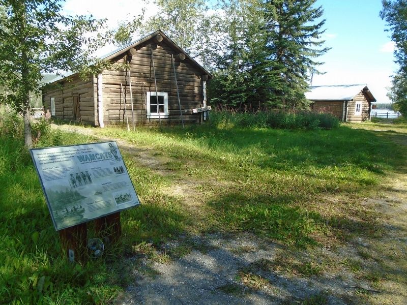
WAMCATS provided communication between the military posts in Alaska and headquarters at Washington, D.C. The soldiers who built, manned and maintained the line persevered through adversity.
Link in the Chain
The Signal Corps constructed . . . — — Map (db m255757) HM
On Richardson Highway (State Highway 4 at milepost 266) at the Alaska Highway (State Highway 2), on the right when traveling north on Richardson Highway.
The History of the Purple Heart
In 1783 during the American Revolution General George Washington first awarded a decoration of embroidered purple fabric in the shape of a heart called the Badge of Military Merit. The decoration was awarded . . . — — Map (db m255663) HM
On Alaska Highway (at milepost 1,422) at Richardson Highway, on the left when traveling north on Alaska Highway.
This highway was constructed during World War II as a military supply route for interior Alaska Military and Airfields in 1942. 7 Army regiments and 42 Contractors and Public Roads Administrators working from Delta Junction South and Dawson Creek . . . — — Map (db m59840) HM
On Alaska Highway (Alaska Route 2 at milepost 1,314) at 2nd Street, on the left when traveling east on Alaska Highway.
The History of the Purple Heart
In 1783 during the American Revolution General George Washington first awarded a decoration of embroidered purple fabric in the shape of a heart called the Badge of Military Merit. The decoration was awarded . . . — — Map (db m255533) HM WM
Near Parking Lot BIA 100 MP 0 (Route 100 Connector Road) 0.8 miles east of Route 12 N (Arizona Highway 263).
In Remembrance of Our Warriors
Who Made the Ultimate Sacrifice and/or
Missing in Action,
They will never be forgotten
and to us they will always be young in our thoughts.
Nelson Lewis • Walter Nelson • Willie A. Notah • Edie . . . — — Map (db m27911) HM
On Arizona Route 90 at milepost 314, on the right when traveling south.
Situated on the southern route to the Pacific Ocean, it brought law and order to the Arizona Territory, protecting settlers, miners, travelers and immigrants. Its troops won the surrender of Geronimo. Generals Pershing and Wood served here.
As . . . — — Map (db m27897) HM
On Hatfield Street at Irwin Street, on the right when traveling south on Hatfield Street.
The Crazyhorse system was fielded in 1985 to meet the need for a capability to locate unique electronic emissions in Central America. It consisted of three RC – 12G airframes converted from C – 12D aircraft by Sanders Associates, . . . — — Map (db m29587) HM
On Forest Service Road 100, on the right when traveling west.
In the summer of 1857 former Navy Lt. Edward F. Beale was chosen by the Buchanan Administration to develop a wagon road from Fort Defiance, New Mexico Territory (now Arizona) to the Colorado River along the 35th parallel. Secretary of War John B. . . . — — Map (db m48347) HM
On Inspiration Avenue at Sullivan Avenue, on the right when traveling south on Inspiration Avenue.
This wall is to honor the memory of all of the veterans who have served in the Armed Forces of this great nation, in war and in peace. They have placed themselves in harms way to serve a cause greater than themselves. Ensuring that the freedom we . . . — — Map (db m67472) WM
On Broadway Avenue (Arizona Route 72 at milepost 27) south of Main Street, on the right when traveling west.
Camp Bouse
September 1943 to March 1944
"The Kid Battalion"
From Normandy to the Elbe:
•Normandy
•Northern France
•Ardennes
•Rhineland
•Central Europe — — Map (db m78563) HM
On Broadway Avenue (Arizona Route 72 at milepost 27) south of Main Street, on the right when traveling west.
Dedicated to the men who gave time in their lives to serve honorably and courageously for our country. We take this moment in time to recognize their achievements which were done with pride and dignity.
* * *
Campaigns
Ardennes - Alsace - . . . — — Map (db m29160) HM
On Broadway Avenue (Arizona Route 72 at milepost 27) south of Main Street, on the right when traveling west.
Campaigns
Ardennes, Rhineland and Central Europe
The 739th Tank Battalion was activated in March 1943 at Fort Lewis, Washington. The officers were from various states, the enlisted personnel from Oklahoma, Texas and Louisiana.
The . . . — — Map (db m78558) HM
On Broadway Avenue (Arizona Route 72 at milepost 27) south of Main Street, on the right when traveling west.
The 740th tank battalion was activated at Fort Knox, Ky. on March 1, 1943. It trained at Fort Knox and at Camp Bouse, Az. as a canal defense light (CDL) unit and as a standard medium tank battalion from October 15, 1943 to April 24, 1944 then sailed . . . — — Map (db m78562) HM
On Broadway Avenue (Arizona Route 72 at milepost 27) south of Main Street, on the right when traveling west.
General George Patton established Camp Bouse in 1943 in the Butler Valley as the site for training over 5,500 carefully screened and qualified volunteers. These soldiers were trained to use a highly secret weapon called the Canal Defense Light. . . . — — Map (db m29165) HM
On Broadway Avenue (Arizona Route 72 at milepost 27) south of Main Street, on the right when traveling west.
Camp Bouse was established in Butler Valley 30 miles behind this monument in Sept. of 1943. It was one of twelve such camps built in the southwestern deserts to harden and train United States troops for service on the battlefields of World War II. . . . — — Map (db m78566) HM
On Broadway Avenue (Arizona Route 72 at milepost 27) south of Main Street, on the right when traveling west.
Campaigns
Central Europe Northern France Rhineland
The 701st tank battalion was activated 3/28/43 at Camp Campbell, KY. Here 553 young men and officers began their journey into history. These men began their basic training and for many saw . . . — — Map (db m78564) HM
On Broadway Avenue (Arizona Route 72 at milepost 27) south of Main Street, on the right when traveling west.
Activated 1 April, 1943 at Camp Perry, OH. Completed basic training and then sent to Ft. Knox, KY. Unit then assigned to Camp Bouse, AZ arriving there 9 November, 1943. Maintaining operation of special tanks named "Leaflets" was specific assignment. . . . — — Map (db m78557) HM
On Broad Street (Arizona Route 72 at milepost 27) south of Main Street, on the right when traveling west.
He was our drinking buddy
While on duty
He drank our beer
He was
Full of good cheer
And went to the nurses' quarters around the bend
And came to an untimely end,
Of the Colonel, he was unaware
That it would be the crime of all time . . . — — Map (db m78536) HM
On Broadway Avenue (Arizona Route 72 at milepost 27) south of Main Street, on the right when traveling west.
We bring to a close
We tried to find
We must now impose
Units not found
748th Tank Battalion
150th Station Hospital
538th Ordnance Company
166th Quartermaster
629th Quartermaster — — Map (db m29161) HM
On Broadway Avenue (Arizona Route 72 at milepost 27) south of Main Street, on the right when traveling west.
In honored memory of those soldiers of the battalion who trained here at Camp Bouse and gave their lives in combat to preserve the freedom of the United States and to set the Peoples of Europe free.
Headquarters Company
Donald D. . . . — — Map (db m78537) HM
Near Hi Jolly Road 0.2 miles north of Quartzsite Boulevard.
The famous camel herd with which the name of Hi Jolly is linked constitutes an interesting sidelight of Arizona history.
Jefferson Davis (afterward president of the Southern Confederacy), as Secretary of War, approved a plan to experiment . . . — — Map (db m70566) HM
On Beeline Highway (Arizona Route 87) near North Fort McDowell Road, on the right when traveling north.
This important military post protected central Arizona settlements from the Tonto Apaches during the Indian wars 1865-1886. Its function as a military post ended in 1890 and it became a reservation by executive order, September 15, 1909 as home of . . . — — Map (db m27681) HM
On N. Greenfield Road at E. McKellips Road, on the right when traveling north on N. Greenfield Road.
The 3-Inch Mark 33 is a twin dual-purpose drive mount on a carriage base ring structure used with selective remote or local control. The Gun is primarily designed for defense against enemy aircraft and was installed on combat ships. Each gun is . . . — — Map (db m102917) HM WM
On Innovation Way West at East Williams Field Road, on the right when traveling north on Innovation Way West.
Honor Roll Williams Field, Chandler, Arizona J. W. Allsbury 42-13 · C. V. S. Duncan Jr. 42-F · J.J. Colasuonno 42-E · P. G. Jameson 42-H · D. L.Burgess 42-E · R.C. Greybill 42-16 · C.W.Khidrup 42-G · W. H. Hamilton 42-G · S. M. Magill 42-16 · . . . — — Map (db m152472) WM
On North Gavilan Peak Parkway 0.2 miles south of West Anthem Way, on the left when traveling south.
Every year on Veterans Day, the five pillars of the Memorial will align perfectly to cast one, long shadow across the circle of pavers at precisely 11:11 a.m. At the exact same time, the sunlight projecting through the elliptical openings in the . . . — — Map (db m81043) WM
Dedicated on February 16, 2009 to our true heroes
Just as this wood has endured the passage of time, so do the veterans of the state of Arizona and throughout this great land. They symbolize the foundation of the freedom we enjoy each and every . . . — — Map (db m269086) WM
Near E. Pinnacle Peak Road at Cave Creek Road, on the left when traveling west.
Dedicated to The Memory of
All The Patriotic Men and Women
Who Answered Their Country’s Call To Service
George W. Bush
President of The United States
Anthony J. Principi
Secretary
U.S. Department of Veterans Affairs
Roger R. Rapp . . . — — Map (db m102949) HM
Near E. Pinnacle Peak Road at Cave Creek Road, on the left when traveling west.
"The markers in this memorial area honor veterans whose remains have not been recovered or identified, were buried at sea, donated to science or cremated and the ashes scattered." — — Map (db m102948) HM
On E. Pinnacle Peak Road at Cave Creek Road, on the left when traveling west on E. Pinnacle Peak Road.
Amvets National Service Foundation
In Partnership With
The Unified Arizona Veterans And
The Arizona Department Of Veterans Services
Dedicate This Carillon As A Living Memorial
To American Veterans Who Served Their Country
Honorably For . . . — — Map (db m102950) WM
In 1775, George Washington proclaimed chaplains, "As important as the cannon to the success of our endeavor." and placed chaplains throughout the Continental Army, carrying no weapons, with only their faith to protect them. The chaplain became the . . . — — Map (db m141338) HM WM
Near Andy Devine Road (Business Interstate 40) near Grandview Avenue.
Established Camp Beale's Springs about one mile north, March 25, 1871. For the protection of settlers and travelers on northern route. Served as Hualapais Indian Agency. Military Camp abandoned April 6, 1874. — — Map (db m29358) HM
On Center Street, on the right when traveling west.
Dedicated to those
who served in
The Armed Forces
Christopher Lavar Heaton ·
Derryll Leo Heaton ·
LaMont "Pete" Heaton ·
Royce W. Rogers ·
Carl Johnson ·
LaNard Johnson ·
Woodrow Johnson ·
Eldon Johnson ·
Sterling Johnson · . . . — — Map (db m269381) WM
On East 3rd Street at Transcon Lane, on the right when traveling west on East 3rd Street.
These two steel beams from the World Trade Center
entrusted to the citizens of Winslow
by the city of New York,
along with this flag that was flown at the Pentagon;
stand as the centerpiece of our Remembrance Garden.
The words "United We . . . — — Map (db m36325) WM
This disc marks the southeast corner of the old adobe wall that protected Tucson from the Indians in the early days - prior to 1845
Moved to this location in 1955 — — Map (db m26461) HM
On North Church Avenue at West Washington Street, on the right when traveling south on North Church Avenue.
This marker locates the northeast corner of the adobe wall which surrounded the Royal Spanish Presidio San Agustin del Tucson. It is thought that a bastion, used as a lookout and as a defensive position, stood here. The site was excavated in 1954 by . . . — — Map (db m83213) HM
On Alden Road north of Upton Road, on the right when traveling east.
At the outbreak of the Mexican War in 1846, President Polk directed Colonel Kearny to organize the so-called "Army of the West" and to lead it to Santa Fe and thence on to secure California. On August 18, 1846, Kearny claimed the area of Santa Fe . . . — — Map (db m232146) HM
On Sacaton Road (Arizona Route 87) at Sacaton-Casa Blanca Road, on the right when traveling east on Sacaton Road.
Dedicated to
Ira H. Hayes USMC
February 23rd 1992
by the Memorial Committee
Lance Lewis Director,
Shirley Lewis Coordinator
JR Currea Artist
In Country Vietnam Veterans
Post 2 Tempe Arizona
Ira H. Hayes American . . . — — Map (db m32845) WM
On Sacaton Road (Arizona Route 87) at Sacaton-Casa Blanca Road on Sacaton Road.
Military Order Purple Heart of the U.S.A.
1782 - 1932
Dedicated to
KIA-MIA-WIA
In memory of tribal members
by
Military Order of Purple Heart Sun Lakes, Arizona Chapter 1958
in the year 2000
[ Lower Plaque: ]
This . . . — — Map (db m40341) HM
On Arizona Route 82 at milepost 29.5, on the right when traveling west.
Established August 10, 1867. Named Camp Crittenden by Generals Orders No. 57 Department of California, September 30, 1867, in honor of Thomas S. Crittenden, Col. 32nd U.S. Infantry Major General U.S. Volunteers. Camp abandoned June 1, 1873. . . . — — Map (db m27114) HM
Near East Hollamon Street 0.3 miles North Montezuma Well Road ( Route 260).
The Crook Road begins at this point
with the first in a series of mile markers
across the Mogollon Rim segment of the
military supply trail connecting Forts
Whipple, Verde and Apache. Reconnoitered
in 1871 by General George Crook with a . . . — — Map (db m28561) HM
Near East Holloman Street 0.2 miles north of Route 260.
The following named individuals were assigned, either permanently or temporarily, to Camp Verde, Arizona Territory. While stationed here their personal action in combat was above and beyond the call of duty, earning them the nation's highest . . . — — Map (db m28593) HM
On Entrance to Bob Stump VA Medical Center, on the right.
Stone Marker:
14 Inf. N.Y.
John Towhey
Wounded
Here
1861
Plaque Attached to Stone:
-- January 1970 --
This stone with inscription of incident was originally located on the Yavapai Indian Reservation . . . — — Map (db m21966) HM
Near East Gurley Street east of North Arizona Avenue.
Prescott was one of the first towns in Arizona to have a National Guard Unit. Companies B and C of the First Territorial Rifles were organized in Prescott in 1865 and Company M of the First Arizona Infantry was organized in 1910. Company M of the . . . — — Map (db m33136) HM
On Ave 64E near Interstate 8, on the left when traveling south.
On the morning of March 23, 1950, an Air Force B-50 Bomber on a routine training mission, exploded and crashed north of the communities of Dateland and Hyder AZ. Two of the 14 crewman on board, Capt. John H. Lee and 1st. Lt. William T. Gentry, . . . — — Map (db m28936) HM
On East Imperial Dam Road 0.5 miles west of U.S. 95, on the right when traveling east.
Camp Laguna operated from April 1942 to April 1944. It was one of twelve such camps built in the southwestern deserts to train United States troops during World War II.
The Desert Training Center, a simulated theater of operations, included . . . — — Map (db m29061) HM
This adobe building was constructed in 1872 as an office for the Fort Yuma Quartermaster Depot. It replaced a room in a corner of the depot storehouses where, according to Captain J. G. C. Lee, Quartermaster, ". . .the noise of the arrivals and . . . — — Map (db m29000) HM
A steam pump located at the edge of the river propelled muddy Colorado River water through pipes to an elevated holding tank constructed of local rock and mortar with a wood shingle roof to decrease evaporation. Sediment fell to the bottom of the . . . — — Map (db m29001) HM
Near Veterans Parkway at Razorback Regional Greenway/Cold Cave Road.
The Distinguished Service Cross (Army), Navy Cross, and Air Force Cross are equivalent awards. They are given to any service person who, while serving, distinguishes himself or herself by extraordinary heroism not justifying the award of the Medal . . . — — Map (db m90867) HM WM
The Bronze Star Medal is awarded to any person who, while serving in any capacity in or with the military of the United States after 6 December 1941 distinguished himself or herself by heroic or meritorious service or achievement, not involving . . . — — Map (db m90855) HM
The Legion of Merit was the first American decoration awarded to citizens of Foreign Nations. There are four degrees of award. They are Chief Commander, Commander, Officer, and Legionaire/Legion of Merit. Only the Legion of Merit is awarded to . . . — — Map (db m90866) HM
The Medal of Honor is the highest Military decoration awarded by the United States. It is bestowed on a member of the American Armed Forces, who distinguishes himself or herself conspicuously by gallantry and intrepidity at the risk of his life . . . — — Map (db m90869) HM WM
In 1782 General George Washington created a new military badge for Enlisted Men and Non-Commissioned Officers called the Badge of Military Merit. This was the forerunner of the Purple Heart that we know today. The award fell into disuse until . . . — — Map (db m90776) HM WM
Criteria: The Silver Star Medal is awarded to any person who, while serving in any capacity with the Armed Forces of the United States is cited for gallantry in action while engaged in military operations involving conflict with an opposing armed . . . — — Map (db m90778) HM WM
Founder’s Statement
All Who Serve Sacrifice
Some Who Serve Sacrifice All
Welcome to the Veterans Wall of Honor, honoring all veterans of our Armed Forces who have served in peace and war since the Revolutionary War. In the spring of 2001 . . . — — Map (db m92585) WM
Near 6800 Southwest Minuteman Avenue, on the left when traveling north.
Headquarters & Headquarters Battery
1st Battalion
142nd Field Artillery
November 21, 1990 - September 17, 1991
In honor of those who served in Operation Desert Shield and Operation Desert Storm — — Map (db m242844) WM
On Arkansas Route 72 at North Curtis Avenue, on the right when traveling west on Arkansas Route 72.
To honor those who served
[Slab #1] SCPO Robert W. Mix Sr. - U.S. Navy - Korea/Vietnam • MSgt. Kently H. Easley - U.S. Army -Korea/Vietnam • AirLO A. “Gus” Flory - U.S. Army - WWII • Tech 4 Reginald C. Tyndall - U.S. Army - World War II . . . — — Map (db m225103) WM
On East Main Street west of South Maxwell Street, on the right when traveling east.
For God and Country Dedicated as a memorial to all that served in the Armed Forces of the United States of America Past · Present · Future
Sponsored by Disabled American Veterans, The American Legion, Veterans of Foreign Wars, Citizens of . . . — — Map (db m220471) WM
On Public Square south of West Church Street, on the left when traveling south.
That we not forget
the cost of freedom,
let us honor
those who served,
and give thanks
for their sacrifice.
World War I
Rex Eldridge • Robert K. Grogan • Rosco Jordon
Korean Conflict
Herman Binam
Vietnam
George . . . — — Map (db m225239) WM
On South Moose Street north of East Church Street, on the right when traveling north.
In honor of the men and
women of Conway County
who served in the armed
forces and sacrificed
unselfishly for the
freedom of the United
States of America — — Map (db m237019) WM
On S. Main Street at W. Washington St., on the left when traveling north on S. Main Street.
LTC Teddy W. Pylant
US Army - Retired
Founder/President CCVMF
LTC Ted Pylant, a Vietnam veteran, served 34
years in the Arkansas National Guard as a
member of the 875th Engineer Battalion.
He also served at the Arkansas National
Guard . . . — — Map (db m227423) HM WM
On Main Street at South 4th Street, on the left when traveling west on Main Street.
Remember those who served
and those who died
Killed in Action
Maj. Walter Hugh Moon
Capt. Jimmy Cartwright
LCpl. Roger Dale Cecil
LCpl. Billy Dale Livingston
SSgt. Samuel Ray Nixon
PFC. Jewel Lee Rainwater
GMG1 Arthur C. . . . — — Map (db m100703) WM
In memory of
Merle D. Hay
Thomas Enwright
James B. Gresham
They were the first members of
the Expeditionary Army of the
United States in France to die
that we might live
stricken on the field of glory,
November 3, . . . — — Map (db m96633) WM
On Main Street (Arkansas Route 59) west of North 11th Street, on the right when traveling west.
GFWC Women's League of Van Buren
Proudly Dedicates this Clock as a Symbol of our Appreciation to all Veterans.
May it Stand to Honor all the Men and Women of the Military who have Bravely Served
and their Families who have Sacrificed so . . . — — Map (db m244105) WM
On Main Street (Arkansas Route 59) east of Cane Hill Street, on the right when traveling east.
The military history of the United States spans a period of more than two centuries. During these years, the United States evolved from a new nation fighting Great Britain for independence (1775-1783), through the monumental American Civil War . . . — — Map (db m244110) HM WM
On Court Street near Cypress Drive, on the right when traveling north.
Dedicated to all veterans of Crittenden County
To the men and women who served their country in war and peace with honor
We shall not forget — — Map (db m234719) WM
On Locust Avenue at Main Street, on the left when traveling north on Locust Avenue.
In remembrance of those who made the ultimate sacrifice that we might be free
World War I
Alexander, Luther • Barr, Roscoe M. • Campbell, Theodore • Cartwright, Lester • Clark, Lee • Ford, John E. • Fulmer, William L. • Galyon, Daniel P. . . . — — Map (db m237072) WM
On Central Avenue (State Highway 7) at Spring Street, on the right when traveling north on Central Avenue.
Appointed 14th Sergeant Major of the U.S. Marine Corps June 28, 1999 • First Sergeant Major in history of NATO, Supreme Headquarters, Allied Powers Europe • Inducted into Boys and Girls Club Alumni Hall of Fame 2003 • Distinguished Service Medal, . . . — — Map (db m264667) HM
On Locust St. at W. Second St., on the left when traveling north on Locust St..
WW I.
James C. Bailey •
James H. Ledbetter •
Thurman Lindsey •
Dave Morrison •
Isaac Parker •
Dewey Pope •
William Presley •
Cleveland Haltom •
Doctor P. Harper
WW II.
Roy Abbott •
Charles Alsop •
Charles Austin •
Herman . . . — — Map (db m228491) WM
On Brandenberg Lane at Graceland Street, on the right when traveling east on Brandenberg Lane.
World War I
Alred, William M.- Birdsong, John- Chord, Alton L.- Cole, Elder M.- Davis, Henry - Feeback, Gilbert- Griffin, Neil - Hawthorne, Francis - Howell, Eldridge R. - Inman, Roe - Nash, William E. - Pruett, Jim - Smith, John C. - Ward, . . . — — Map (db m187950) WM
On North Beacon Road 0.1 miles north of Custom, on the left when traveling north.
Sons and grandsons of Sgt. Luther S. Clark and Aurora C. Clark of Black Rock, AR who served in the military.
Sons
Major Chester M Clark, Army Air Corps •
Cm-3 Millard M Clark, Navy •
TS/3 Lavelle Clark, Army •
S/Sgt. C Leroy Clark, . . . — — Map (db m174063) WM
On Ramp Road north of Douglas Road, on the left when traveling north.
CMSGT Gerald C Freligh Sr. USAF
WWII, Korea, Vietnam
November 13, 1941- July 1 1974
BSM, AFCM, MSM
Maj. Gerald C. Freligh Jr. USA
September 29 1978 - September 29 1995 Special Forces "Green Beret"
USA/Europe/Asia/Latin . . . — — Map (db m174048) WM
On Ramp Road north of Douglas Road, on the left when traveling north.
Master Sergeant Carter Holm, US Army 43rd Combat Engineer 1941-1945 •
LTC. Betty L Holm, US Army - Logistics, Daughter •
1Sgt. James Carter Holm, US Army - Combat Engineer, Grandson •
MSgt. Jacob Holm, US Air Force - Security Forces, . . . — — Map (db m174050) WM
On West Main Street (U.S. 412) at Northwest 4th Street (Business U.S. 67), on the left when traveling west on West Main Street.
In memory of our Lawrence Co Sons who made the supreme sacrifice in service for our country.
In memory of our Lawrence Co. Officers who gave their life in service for our community.
Gene Matthews •
John Biggers — — Map (db m170242) WM
On State Highway 14 0.1 miles north of Potter, on the right when traveling north.
A native of Baxter County, Arkansas, this young 17 year old was killed during the Korean War in April 1951, while serving as a member of the U.S. Army, Company I, 7th Infantry Regiment, 3rd Infantry Division. — — Map (db m160310) HM WM
On State Highway 140 east of State Route 136, on the left when traveling east.
Dedicated in loving memory to those brave and honorable veterans who unselfishly sacrificed for love of country and freedom.
May 29, 2000 — — Map (db m221254) WM
On Route 140 east of Route 136, on the left when traveling east.
In loving memory of my brother
Joseph Allen Sisco
Technical Sergeant
AF1412 1721
Nov. 11, 1922 – Aug. 20, 1948
Son of Brownie and Daisy (Swift) Sisco
Brother to Earl, Clara, Lee, Sue, Anna and Mary Lou
Joe was born and raised in . . . — — Map (db m221255) WM
On East Fleeman Street (State Highway 18) at Baltimore Avenue, on the left when traveling east on East Fleeman Street.
Enlisted March 14th 1918; Honorably discharged May 29th 1919
Cited for bravery for extraordinary heroism in action and decorated with:
U.S. Distinguished Service Cross: Oct. 10th 1918
French Croix de Guerre with Palm: Apr. 19th 1919
Gilt Star . . . — — Map (db m30388) HM
On West Cypress Street 0.2 miles east of North Main Street (U.S. 49), on the left when traveling east.
American Legion Memorial Claude Sims Post #69 Brinkley, Arkansas Dedicated 2005 Names not transcribed Sculptor: Roy W. Butler Models from U.S. 6th RCTG BDE, NV-CPT Van Kirk, SFC Tovar — — Map (db m172225) WM
On Stone Street (State Highway 7) at Church Street, on the right when traveling north on Stone Street.
In memoriam
Newton County veterans of all wars who gave
their lives in the service of their country
N.W. Armer • Frank Bickner • Caldin Bolen • C.H. Clark • Emory Collins • Albert Cooper • Quenton Criner • Loyd Dixon • Raymond Dollar • . . . — — Map (db m225349) WM
Near Pecan Street south of Perry Street, on the right when traveling south.
Quick to Volunteer
Between 1861 and 1865, several hundred men— one-third of
the able-bodied men in Phillips County — joined the
Confederate army. Most enlisted in the opening weeks of the
Civil War. The volunteers joined . . . — — Map (db m109136) HM