After filtering for Kansas, 312 entries match your criteria. Entries 101 through 200 are listed.⊲ Previous 100 — Next 100 ⊳
Roads & Vehicles Topic
By William Fischer, Jr., July 16, 2013
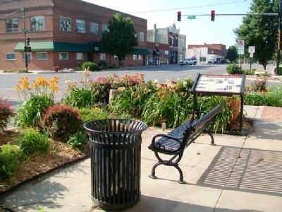
Main Street, 400 Block South Marker
| 101 ► Kansas, Franklin County, Ottawa — Main Street, 400 Block South — Historic Ottawa Tour Stop 6 — |
| On Main Street at 4th Street, on the right when traveling south on Main Street. | |||
| 102 ► Kansas, Geary County, Fort Riley — The Mormon Trail — (South Fork) — |
| Near Henry Drive at Interstate 70. | |||
| 103 ► Kansas, Geary County, Fort Riley, Main Post — M113 Armored Personnel Carrier — |
| 104 ► Kansas, Geary County, Fort Riley, Main Post — M16 Multiple Gun Motor Carriage — |
| 105 ► Kansas, Geary County, Fort Riley, Main Post — M24 Chaffee Light Tank — |
| 106 ► Kansas, Geary County, Fort Riley, Main Post — M3 Personnel Carrier Half-Track — |
| 107 ► Kansas, Geary County, Fort Riley, Main Post — M36 Tank Destroyer — |
| 108 ► Kansas, Geary County, Fort Riley, Main Post — M4A3 Sherman Medium Tank — |
| 109 ► Kansas, Geary County, Fort Riley, Main Post — M5 Stuart Light Tank — |
| 110 ► Kansas, Geary County, Junction City — Purple Heart Trail in Kansas — "Freedom Isn't Free" — Dedicated to the Soldiers, Sailors, Airmen, and Marines Wounded or Killed in Action — |
| Near Interstate 70, 4.5 miles west of Pillsbury Drive (State Route 177), on the right when traveling west. | |||
| 111 ► Kansas, Gove County, Gove City — BOD — 1865 — Butterfield Overland Despatch — |
| On County Road 16, 2.1 miles north of County Road E, on the right when traveling north. | |||
| 112 ► Kansas, Grant County, Hugoton — 83 — Wagon Bed Springs — |
| On State Highway 25, 14.4 miles north of U.S. 56, on the left when traveling north. | |||
| 113 ► Kansas, Gray County, Cimarron — Santa Fe Trail — |
| On Avenue A (U.S. 50/400) 0.7 miles west of Main Street (State Highway 23), on the right when traveling west. | |||
| 114 ► Kansas, Gray County, Cimarron — The Santa Fe Trail — |
| Near South Main Street (State Highway 23) 0.1 miles south of West Avenue E, on the right when traveling south. | |||
| 115 ► Kansas, Hamilton County, Coolidge — 83 — Santa Fe Trail — 1822-1872 — |
| On Coolidge Avenue (U.S. 50/400) just east of Main Street, on the right when traveling east. | |||
| 116 ► Kansas, Hamilton County, Syracuse — Santa Fe Trail — 1822-1872 — |
| On Avenue A (U.S. 50/400) just west of North Gates Street, on the right when traveling west. | |||
| 117 ► Kansas, Harvey County, Halstead — The Horse and Buggy Doctor — |
| On Hertzler Road (Horse and Buggy Doctor Highway) (State Highway 89) south of U.S. 50, on the left when traveling south. | |||
| 118 ► Kansas, Harvey County, Hesston — Chisholm Trail — |
| On Kansas Route 15, 0.8 miles north of NE 96th Street, on the left when traveling north. | |||
| 119 ► Kansas, Harvey County, Sedgwick — Purple Heart Trail in Kansas — "Freedom Isn't Free" — Dedicated to the Soldiers, Sailors, Airmen, and Marines Wounded or Killed in Action — |
| On Interstate 135, 1 mile north of 125th Street (I-135 Exit 22) (Interstate 135), on the right when traveling north. | |||
| 120 ► Kansas, Johnson County, Gardner — A Look Back in Time — The Santa Fe, Oregon, and California trails once passed this way — |
| Near U.S. 56 at West 183rd Street, on the right when traveling west. | |||
| 121 ► Kansas, Johnson County, Gardner — A Look Back in Time — The Oregon and California trails were pathways for the greatest mass migration in American history — |
| Near U.S. 56 at West 183rd Street, on the right when traveling west. | |||
| 122 ► Kansas, Johnson County, Gardner — A Look Back in Time — The Santa Fe Trail stirs the imagination as few other historic trails — |
| Near U.S. 56 at West 183rd Street, on the right when traveling west. | |||
| 123 ► Kansas, Johnson County, Gardner — Apprehension and Conflict — |
| Near U.S. 56 at West 183rd Street, on the right when traveling west. | |||
| 124 ► Kansas, Johnson County, Gardner — Eye of the Needle — |
| Near U.S. 56 at West 183rd Street, on the right when traveling west. | |||
| 125 ► Kansas, Johnson County, Gardner — Following Their Dreams — |
| Near U.S. 56 at West 183rd Street, on the right when traveling west. | |||
| 126 ► Kansas, Johnson County, Gardner — From Prairie Schooners to Locomotives — |
| Near U.S. 56 at West 183rd Street, on the right when traveling west. | |||
| 127 ► Kansas, Johnson County, Gardner — 6 — Overland Trails — |
| On Main Street, 0.1 miles North Oak Street, on the right when traveling west. | |||
| 128 ► Kansas, Johnson County, Gardner — Santa Fe Trail — |
| On Shawnee Street at Elm Street, on the right when traveling north on Shawnee Street. | |||
| 129 ► Kansas, Johnson County, Lenexa — 2 — Santa Fe Trail — 1822 - 1872 — |
| On Santa Fe Trail Drive west of Noland Road, on the left when traveling west. | |||
| 130 ► Kansas, Johnson County, Merriam — 03 — The Overland Trails — Merriam Historic Plaza Walking Path — |
| 131 ► Kansas, Johnson County, Olathe — "Indian Jim" and the Building of Kansas City Road — World's Champion Lays 46,664 Bricks in Under Eight Hours — |
| On East Poplar Street at North Kansas City Road, on the right when traveling west on East Poplar Street. | |||
| 132 ► Kansas, Johnson County, Olathe — A Most Desirable Spot For Camping — |
| 133 ► Kansas, Johnson County, Olathe — Children of the Trails — Artist: Kwan Wu — |
| On Kansas Avenue at Park Street, on the right when traveling north on Kansas Avenue. | |||
| 134 ► Kansas, Johnson County, Olathe — Elm Grove Campground — |
| On Old US-Highway 56, 0.1 miles east of West 151st Street, on the right when traveling west. | |||
| 135 ► Kansas, Johnson County, Olathe — Fast Food — |
| 136 ► Kansas, Johnson County, Olathe — Lone Elm Campground — |
| On Lone Elm Park Drive, on the right when traveling south. | |||
| 137 ► Kansas, Johnson County, Olathe — Lone Elm Park — |
| On Lone Elm Park Drive, on the right when traveling east. | |||
| 138 ► Kansas, Johnson County, Olathe — Pit Stop — |
| 139 ► Kansas, Johnson County, Olathe — Rest for the Weary — |
| 140 ► Kansas, Johnson County, Olathe — Roads To The West — |
| 141 ► Kansas, Johnson County, Olathe — Santa Fe Trail — |
| On North Santa Fe Street. | |||
| 142 ► Kansas, Johnson County, Olathe — 3 — Santa Fe Trail — 1822 - 1872 — |
| On Lone Elm Road at West 167th Street, on the left when traveling south on Lone Elm Road. | |||
| 143 ► Kansas, Johnson County, Olathe — Stagecoach Drivers — Don't Let Your Babies Grow Up To Be... — |
| 144 ► Kansas, Johnson County, Olathe — State Your Business... — |
| 145 ► Kansas, Johnson County, Olathe — The Travelers — |
| 146 ► Kansas, Johnson County, Olathe — Trail Campground..To Farm..To Park — |
| 147 ► Kansas, Johnson County, Olathe — Trails West — by Eldon Tefft — |
| On Lone Elm Park Drive, on the left when traveling south. | |||
| 148 ► Kansas, Johnson County, Olathe — Westward Ho! — |
| 149 ► Kansas, Johnson County, Olathe — Workin' For a Living — |
| 150 ► Kansas, Johnson County, Overland Park — "A Day on the Trail" — |
| On 80th Street at Santa Fe Drive, on the right when traveling west on 80th Street. | |||
| 151 ► Kansas, Johnson County, Overland Park — A Day on the Santa Fe Trail — 1822 - 1872 — |
| On 80th Street at Santa Fe Drive, on the right when traveling west on 80th Street. | |||
| 152 ► Kansas, Johnson County, Overland Park — Opening the Floodgates — |
| 153 ► Kansas, Johnson County, Overland Park — Santa Fe and Oregon Trails — |
| On 151st Street, on the right when traveling east. | |||
| 154 ► Kansas, Johnson County, Overland Park — 1 — Santa Fe Trail — 1822 - 1872 — |
| On 80th Street at Santa Fe Drive, on the right when traveling west on 80th Street. | |||
| 155 ► Kansas, Johnson County, Overland Park — Two Routes from Westport — |
| 156 ► Kansas, Johnson County, Overland Park — Two Ways West from Westport — |
| On 80th Street at Santa Fe Drive, on the right when traveling west on 80th Street. | |||
| 157 ► Kansas, Johnson County, Overland Park — Voices from the Trail — |
| 158 ► Kansas, Johnson County, Overland Park — Wagons and Coaches... ...to Trains and Planes — |
| 159 ► Kansas, Johnson County, Shawnee — California Road — |
| On Shawnee Mission Parkway near Melrose Lane, on the right when traveling east. | |||
| 160 ► Kansas, Johnson County, Shawnee — Fort Leavenworth Military Road — |
| On Shawnee Mission Parkway near Melrose Lane, on the right when traveling east. | |||
| 161 ► Kansas, Johnson County, Shawnee — Gum Springs — |
| On Shawnee Mission Parkway near Melrose Lane, on the right when traveling east. | |||
| 162 ► Kansas, Johnson County, Shawnee — The Development of the Kansas City area Frontier Trails Network — Trail Map — |
| On Shawnee Mission Parkway near Melrose Lane, on the right when traveling east. | |||
| 163 ► Kansas, Johnson County, Shawnee — Wagonmaster's House — Richard Williams — |
| On Shawnee Mission Parkway near Melrose Lane, on the right when traveling east. | |||
| 164 ► Kansas, Johnson County, Shawnee — Westport - Santa Fe Trail - Oregon / California Trail — |
| On Shawnee Mission Parkway near Melrose Lane, on the right when traveling east. | |||
| 165 ► Kansas, Johnson County, Stilwell — Quantrill's Raids and the Military Road — 1862 — |
| On 199th Street west of Lamar Avenue, on the right when traveling west. | |||
| 166 ► Kansas, Kearny County, Deerfield — Santa Fe Trail — 1822-1872 — |
| On Main Street at West 8th Street, on the right when traveling south on Main Street. | |||
| 167 ► Kansas, Kearny County, Lakin — 82 — Chouteau's Island — |
| On U.S. 50/400, 0.1 miles west of Country Heights Road, on the left when traveling west. | |||
| 168 ► Kansas, Kearny County, Lakin — 78 — Santa Fe Trail — 1822 - 1872 — |
| On Main Street (State Highway 25) north of Washington Avenue, on the right when traveling north. | |||
| 169 ► Kansas, Kearny County, Lakin — 79 — Santa Fe Trail — 1822 - 1872 — |
| On Campbell Street north of Wayne Avenue, on the left when traveling north. | |||
| 170 ► Kansas, Kearny County, Lakin — 72 — Santa Fe Trail Ruts — 1821 - 1872 — |
| On U.S. 50/400 east of Road W2, on the left when traveling east. | |||
| 171 ► Kansas, Kiowa County, Greensburg — 16 — Cannonball Stage Line Highway — |
| On U.S. 54/400 west of Ohio Avenue, on the left when traveling east. | |||
| 172 ► Kansas, Labette County, Oswego — Riverside Park — |
| On the park's north perimeter road west of Oregon Street, on the left when traveling west. | |||
| 173 ► Kansas, Leavenworth County, Fort Leavenworth — Santa Fe and Oregon Trails — |
| On Riverside Drive east of Scott Avenue, on the left when traveling east. | |||
| 174 ► Kansas, Leavenworth County, Fort Leavenworth — The Oregon and Santa Fe Trails — |
| On Riverside Drive, on the left when traveling east. | |||
| 175 ► Kansas, Leavenworth County, Leavenworth — Lincoln at Stockton Hall — |
| On 4th Street (U.S. 73) at Delaware Street, on the right when traveling south on 4th Street. | |||
| 176 ► Kansas, Leavenworth County, Leavenworth — Russell, Majors & Waddell — Historic Wayside Tour #6 — |
| On Delaware Street at 4th Street, on the left when traveling east on Delaware Street. | |||
| 177 ► Kansas, Leavenworth County, Leavenworth — Site of Offices of Russell, Majors, and Waddell — A Famous Freighting Firm — |
| On 4th Street (U.S. 73) at Delaware Street, on the left when traveling north on 4th Street. | |||
| 178 ► Kansas, Linn County, Centerville — [Potawatomi] Trail of Death — Indiana to Kansas — |
| 179 ► Kansas, Linn County, Centerville — [Potawatomi] Trail of Death — |
| 180 ► Kansas, Linn County, Centerville — Ft. Scott and California Road — |
| 181 ► Kansas, Linn County, Mound City — Mound City Bandwagon — |
| On Main Street (State Highway 52) west of 7th Street, on the right when traveling west. | |||
| 182 ► Kansas, Linn County, Pleasanton — Chaos at the Crossing — |
| 183 ► Kansas, Linn County, Pleasanton — Price's Raid — |
| 184 ► Kansas, Linn County, Pleasanton — The Fort Scott Road — |
| 185 ► Kansas, Linn County, Trading Post — Sounds along the byway...anxiety and anticipation in the creak of wagon wheels. — Frontier Military Historic Byway — |
| 186 ► Kansas, Linn County, Trading Post — Sounds along the byway...auto, trucks and buses. — Frontier Military Historic Byway — |
| 187 ► Kansas, Linn County, Trading Post — Sounds along the byway...fur traders bringing their goods. — Frontier Military Historic Byway — |
| 188 ► Kansas, Linn County, Trading Post — Sounds along the byway...saws, picks and axes. — Frontier Military Historic Byway — |
| 189 ► Kansas, Linn County, Trading Post — Sounds along the roadway...soldiers on the move. — Frontier Military Historic Byway — |
| 190 ► Kansas, Linn County, Trading Post — Sounds from the past...hoof beats and heartbeats. — Frontier Military Historic Byway — |
| 191 ► Kansas, Linn County, Trading Post — Sounds of the byway...moccasins and tears. — Frontier Military Historic Byway — |
| 192 ► Kansas, Lyon County, Admire — 21 — Santa Fe Trail — 1822 - 1872 — |
| On Road R (State Highway 99) north of Road 380, on the left when traveling north. | |||
| 193 ► Kansas, Lyon County, Emporia — Prairie Passages — |
| On Industrial Road at U.S. 50, on the left when traveling south on Industrial Road. | |||
| 194 ► Kansas, Marion County, Durham — 33 — Santa Fe Trail — 1822 - 1872 — |
| 195 ► Kansas, Marion County, Hillsboro — The Crossing of Historic American Trails — |
| On D Street at Ash Street, on the left when traveling west on D Street. | |||
| 196 ► Kansas, Marion County, Tampa — Old Santa Fe Trail — |
| On Limestone Road at 330th Road, on the right when traveling south on Limestone Road. | |||
| 197 ► Kansas, Marshall County, Axtell — David Smith's Pony Express and Stage Station Overland Trail — 1861 — |
| On 30th Road south of Granite Road, on the right when traveling north. | |||
| 198 ► Kansas, Marshall County, Beattie — Saddle Up at Guittard — Pony Express Trail — |
| On 21st Road, 0.8 miles north of Granite Road, on the right when traveling north. | |||
| 199 ► Kansas, Marshall County, Blue Rapids — A Quiet and Restful Place — |
| 200 ► Kansas, Marshall County, Blue Rapids — A Respite In The Wilderness — Alcove Spring — |
312 entries matched your criteria. Entries 101 through 200 are listed above. ⊲ Previous 100 — Next 100 ⊳