This is the site of the earliest documented river crossing, used both by Native American peoples as well as Euro-American pioneers traveling the Yankton Trail. Prior to 1926, below the 9th Street Parking Ramp to the Northwest, a small island divided . . . — — Map (db m184843) HM
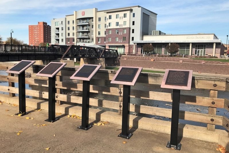
Early settlers embraced the Big Sioux River for its industrial potential, but the river was also an important recreational amenity
Bring your love to the bridge.
Initial, Attach & Kiss! #sflovelock
The Love Lock Wall
A love . . . — — Map (db m195025) HM
On May 13, 1912, during a flood of the Big Sioux River, four young Sioux Falls' men steered two crafts, a rowboat and a canoe, over the Cascade Mill dam. Guy Beck and Mat Yost successfully made the descent, but John Meehan and Will Dahl were thrown . . . — — Map (db m194702) HM
The combination of heavy snowfall and spring rains have been flooding the banks of the Big Sioux River for many years – these destructive events led to levee improvements and the reconstruction of downtown bridges & businesses. . . . — — Map (db m195034) HM
The realization of a grand vision to restore the natural beauty of our city’s most historic and important landmark
Falls Park is the city’s historic birthplace. The almost mystical allure of the falls has always been a powerful influence. . . . — — Map (db m124588) HM
While the Big Sioux River was primarily of industrial importance to the settlement of Sioux Falls, it also has an equally important history for recreation.
The First Public Report of the Board of Parks Supervisors of 1915-1920 called for . . . — — Map (db m124495) HM
The Dakota Land Company of St. Paul, Minnesota, arrived in Sioux falls in June of 1857 as part of a "town-planting party" which was progressing from Medary (near Brookings, SD) to Commerce City (Canton) along the Big Sioux River. Because the prime . . . — — Map (db m184841) HM
Urban renewal was a movement that provided for the development of aging and underutilized city neighborhoods. During the 1960s, light industry and warehouses had begun to move out of downtown Sioux Falls. The area near Seventh Street and the Big . . . — — Map (db m124496) HM
For as long as humans have inhabited this area, they have been attracted by the Falls. Rumors about these falls drew early American explorers. The sound of the Falls could once be heard for several miles around.
The sound, smell and sight of . . . — — Map (db m198704) HM
On this day, river stages on the Big Sioux River reached 17.8 feet, 3.6 feet higher than the previous record of 14.2 feet in June 1957. The winter's record snowfall in Eastern South Dakota began melting and pouring into the Big Sioux River. The . . . — — Map (db m208336) HM
One of the captives of the Spirit Lake Massacre, who was drowned while crossing the Big Sioux River, in April 1857, about 300 yards east of this point. — — Map (db m181285) HM
Construction of Pactola Dam began in 1952 and was completed in 1956. At times nearly 200 men worked on the dam. Unskilled workers earned $1.25 an hour and skilled workers $2.75 an hour. The men placed 2,163,251 cubic yards of impervious earthfill . . . — — Map (db m37064) HM
By the mid-20th century, water in the West did more than irrigate 160 acre patches of alfalfa. Water flowed as the life blood of cities, private industries, and military bases. Droughts during the 1930s illustrated that Rapid City could not depend . . . — — Map (db m37070) HM
His birthplace was Idaho. California first taught him art. Then France, who first gave him fame. England welcomed him. America called him home. His genius for the exquisite as for the colossal gave permanence on canvas, in bronze, in marble, to . . . — — Map (db m134568) HM
Castle Creek was named by General Custer when he and his troops traveled through its headwaters in 1874.
Gold was discovered in this valley to the west in 1875. A mining camp soon developed into the town named Castleton with a population of . . . — — Map (db m184801) HM
The adjacent graph reflects the water levels in height of feet of Rapid Creek under certain events — average winter stage flows, average summertime stage flows during the irrigation season, and the stage flow of June 9, 1972. It must be noted that . . . — — Map (db m184416) HM
Heavy thunderstorms on the afternoon and evening of June 9th, 1972, caused Rapid Creek to flood this area. The water reached the elevation of this flood benchmark. — — Map (db m184418) HM
a relief sculpture in concrete
Martin Wanserski, creator and designer
Fiorenzo Berardozzi and Nancy Losacker, artist assistants
Lost Cabin Constructors, Inc., fabricators and installers
Trout are not native to the Black Hills. They were . . . — — Map (db m184831) HM
South Dakota's rich western heritage has been remembered along the Interstate highway system at safety rest areas and tourist information centers.
The eight pillars which thrust skyward here merge in the framework of a tipi, the Plains Indian . . . — — Map (db m184631) HM
When the Oahe Dam was built, taming the
Mighty Missouri River, the resulting reservoir
backed up 231 miles. The dam was completed
in 1962 and was dedicated by President John
F. Kennedy. The body of water, named Lake
Oahe, boasts 2,250 miles of . . . — — Map (db m161878) HM
has been designated a
Registered
Natural Landmark
Under the provisions of the Historic Sites Act of August 21, 1935 this site possesses exceptional value in illustrating the natural history of the United States
U. S. Department of . . . — — Map (db m185215) HM
Archeologists can use stone points and pottery to help discover clues about who lived where and when. Paleoindian hunters used different styles of stone points at different times in the prehistoric era. The type of points hunters used depended on . . . — — Map (db m246425) HM
Bad Humored Island
"Four Indians, two chiefs and two principle men joined us. We proceeded on about one mile (up river from the mouth of the Teton (Bad) River) and anchored off the shore of a willow island. Placed a guard on shore to . . . — — Map (db m246412) HM
Here, you are halfway from the mouth of the source of the Missouri. Here was the centre of the Fur Trade for half a century, with eight different fur posts and two military posts within your vision. (See Map on reverse). This was, before white man . . . — — Map (db m190170) HM
This tablet marks the site and
commemorates the institution of
Fort Pierre Choteau Trading Post
chief landmark of fur-trading period, 1822 – 1864
on the Upper Missouri River between
the Platte and the Yellowstone.
Founded, 1832, . . . — — Map (db m177392) HM
Commissioned by Pierre Chouteau of the American Fur Company, the Yellow Stone was the first steamboat to ply the "upper" Missouri River above Council Bluffs, Iowa. Loaded with a variety of trade goods - including generous stocks of gunpowder, beads, . . . — — Map (db m170483) HM
Honored Guests
Lewis and Clark were taken to the Teton (Lakota) Sioux Encampment where they partook in a peace pipe ceremony with the grand Council.
Clark's journal entry states, "with Great Solemnity took up the pipe of Peace, & after . . . — — Map (db m246413) HM
The steamboats that plied the waters of the Missouri were known as Mountain Boats for their ability to travel close to the headwaters of the Missouri at the Rocky Mountains. Missouri River steamboats were built different then their counterparts on . . . — — Map (db m246418) HM
Completed in 1958, the Stilling Basin allowed the river to flow through Oahe Dam until the Powerhouse became operation in 1962.
The structure can release 748,000 gallons of water per second (110,000 CFS).
The intakes cannot be seen, they . . . — — Map (db m170491) HM
November 13, 1866, James C. Bunker and his survey crew reached Swan Lake and surveyed the lands adjacent thereto. The Yankton to Sioux Falls stage road then ran around the west side of the Lake.
In 1869, William W. Aurner and his . . . — — Map (db m183500) HM
Lewis & Clark reached a point in what is now Sioux City on August 20, 1804 near the mouth of Floyd River. Sergeant Charles Floyd, who had been taken sick with a "Biliose Chorlick" the day before, died near a bluff on the east side of the river. The . . . — — Map (db m190114) HM
Dakota's first flour mill was established in 1867, after the Legislature gave them a water right on the Big Sioux five miles northeast, by Preston Hotchkiss & Amos Dexter on Lot 3, Section 32, Township 91, Range 48. They sold to Crill & Sargent in . . . — — Map (db m190127) HM
The Missouri, the continent's longest river, figures prominently in the unfolding of America's saga. Flowing nearby in its 2,341 - mile course from the Rocky Mountains to the Mississippi, the Big Muddy is not only loaded with sediment but steeped in . . . — — Map (db m92825) HM
In 1906, one hundred years after the Lewis and Clark Expedition passed through this area, Milwaukee Railroad crews labored to build a bridge across the Missouri River. They carefully worked, balancing themselves on high metal beams as the . . . — — Map (db m112089) HM
A bit of history lies under the water behind Oahe Dam. Before the dam was built many islands and sandbars were commonly found along the Missouri River. When the Corps of Discovery traveled along this river on the way to the Pacific Ocean they . . . — — Map (db m112088) HM
Dedicated to the early settlers of the Mobridge area, Revheim Park is named for Mons J. Revheim who established a homestead on this site in 1881. During the Great Dakota Boom of 1878-1887, thousands of landseekers headed for western Dakota Territory . . . — — Map (db m154041) HM
This wide, low moving, Missouri River of today is quite different from when the Corps of Discovery navigated in then torrent waters in 1804. Lewis and Clark fought against the strong current, using ropes to pull the boat upstream. By the time . . . — — Map (db m112114) HM
The Missouri River creates a crossroads of cultures and creativity. The river has been an artery to the upper plains for thousands of years. The Missouri River was first explored in earnest by the Lewis and Clark Expedition in the early 19th . . . — — Map (db m177903) HM
Originally named Strahmsburg after Saby Strahm who platted the town in 1872, Green Island grew to an estimated population of 150 by 1881. The village had two churches, a school, post office, general store, hotel, and a blacksmith's shop. In spite of . . . — — Map (db m177901) HM
The Meridian Bridge has been an icon of Yankton and the Missouri River for many years. With its completion in 1924, the permanent structure spanning the river replaced unreliable ferries and seasonal pontoons. It derives its name from the Meridian . . . — — Map (db m177900) HM
The Missouri flows free for 59 miles below Gavins Point Dam and for 39 miles below Fort Randall Dam. These sections of the national recreational river provide glimpses of the once undammed, unchannelized river that played a major role in America's . . . — — Map (db m189403) HM
The Missouri, the continent's longest river, figures prominently in the unfolding of America's saga. Flowing nearby in its 2,341 - mile course from the Rocky Mountains to the Mississippi, the Big Muddy is not only loaded with sediment but steeped in . . . — — Map (db m232821) HM
Scorpion's first patrol was a hunting and mining mission near Honshu in April 1943. Scorpion fiercely assaulted enemy vessels in a series of submerged torpedo attacks and surface gun battles. She sank two freighters, four sampans and two patrol . . . — — Map (db m211681) HM WM
Smoke-belching steamboats plied the riverway here
from 1832 to 1900. Servicing forts, Indian agencies, and
frontier villages, Sioux City and other ports dominated
trade on the Upper Missouri because of their proximity
to railroads. With its new . . . — — Map (db m191177) HM
145 entries matched your criteria. Entries 101 through 145 are listed above. ⊲ Previous 100