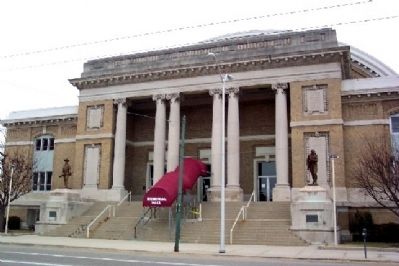
United States of America
Congressional Medal of Honor Recipients
State of Ohio, Montgomery County
Civil War
Downs, Henry W. Sgt. Winchester, Virginia 1864
James, Isaac, Pvt. Petersburg, Virginia 1865
James, John H. Capt. Mobile Bay, . . . — — Map (db m22239) HM
Side A:
A Shaker village called Watervliet, Ohio, was located here from 1806-1900. The Shakers, originally called the United Society of Believers in Christ's Second Appearing, were followers of Mother Ann Lee who came from Manchester, England . . . — — Map (db m26345) HM
On October 3, 1920 the first game matching two professional teams of the American Professional Football Association, a league that would become the National Football League (NFL), was held on this field within Triangle Park. In that game, the . . . — — Map (db m26339) HM
Edmund Munger was born in 1763 in Norfolk, Connecticut, and later moved to Vermont. In 1799, his wife Eunice Kellogg and five children traveled by wagon and flat-bottomed boat to claim land in Washington Township. A blacksmith by trade and a . . . — — Map (db m26218) HM
John W. Carey was born in 1805 in West Virginia [sic - Virginia] and came to Shelby County with his parents, Cephas and Jane Williamson Carey. Around 1833, J.W. Carey bought a thousand acres in Dinsmore Township, west of the present railroad in . . . — — Map (db m29873) HM
In the late 1700's the Greenville Treaty between the U.S. government and the local Ohio Indians was signed allowing the territory to be surveyed and later sold. The local area known as Dayton, Ohio was Chartered in 1803 the same year Ohio became . . . — — Map (db m285888) HM
A small grouping of houses and outbuildings near this spot became a kinship-based community known as Newmantown. There were numerous post Civil-War African American communities in Montgomery County similar to Newmantown. There were also several . . . — — Map (db m295953) HM
You Are At North Park 2005 U.S. 40, Vandalia
Latitude: 39.877099 Longitude: -84.169101
Welcome To Taylorsville Metropark
Taylorsville MetroPark opened to the public on April 1, 1967. One of the first of Five Rivers MetroParks . . . — — Map (db m261054) HM
A Poolesville landmark, the Old Bank was built in 1910. Its architectural style is referred to as “vaguely classical” and was typical of many of the town's structures. Most of the historic downtown was destroyed by fire in 1923.
The Building . . . — — Map (db m307483) HM
Built by the Thomas Family in the early 1800s,this property, formerly known as Woodlawn, has national significance. In 1816, Samuel and Anna Thomas established a Friends Boarding School here. Francis Scott Key frequently visited his daughters who . . . — — Map (db m67596) HM
Silver Spring's First Movie Theater, the 500-seat SECO (Suburban Electric Company), which opened on November 7, 1927 with the silent film "Fireman Save My Child," was located at 8242-8244 Georgia Avenue. The theater, renamed Roth's Silver . . . — — Map (db m125279) HM
Near here stood a fortified dwelling used for shelter during periods of warfare between European colonists and Native Americans. To this fort in 1756 came Mary Draper Ingles (Mrs. William Ingles) for protection following her escape from captivity by . . . — — Map (db m42851) HM
From 1946 to 2000, Tastee Diner's 24-hour service could be enjoyed three blocks south at 8516 Georgia Avenue. Designated a Montgomery County Master Plan Historic Preservation site in 1994, this classic Streamline Moderne-style diner was . . . — — Map (db m157692) HM
On June 25-27, 1863, the Federal Army of the Potomac used two temporary pontoon bridges to cross the Potomac River from Virginia back into Maryland at Edwards Ferry. On the evening and morning of June 27-28, Confederate Gen. J.E.B. Stuart led . . . — — Map (db m293881) HM
The Establishment of Silver Spring's first bank and Newspaper, traditional institutions required for a community to grow and prosper, occurred on this corner with the opening of the Silver Spring National Bank in 1910 and publication of The . . . — — Map (db m62165) HM
Original Plat of (Jacksonville) Versailles by Silas Atchison - August 28, 1819
The history of the village passed through several name changes; from Jacksonville (1819-1837) to Versailles (1837-1854); then added North Jacksonville (1842-1854) . . . — — Map (db m252785) HM
Katharine Kennedy Brown (1891-1986), born in
Dayton, was a leading figure in local, state, and
national Republican politics. Soon after the 19th
Amendment was passed In 1920, she earned a seat
on the Montgomery County Republican . . . — — Map (db m127225) HM
The Capital Crescent Trail follows the route of an old railroad line called the Georgetown Branch of the Baltimore and Ohio (B&O). It's all that remains of an unrealized attempt by the B&O to construct a major rail link between the . . . — — Map (db m83) HM
The Capital Crescent Trail follows the route of an old railroad line called the Georgetown Branch of the Baltimore and Ohio (B&O). It's all that remains of an unrealized attempt by the B&O to construct a major rail link between the . . . — — Map (db m295745) HM
You Are At Overlook Entrance
Welcome To Huffman Metropark
Huffman MetroPark connects cyclists to the Miami Valley's paved trail network. Nature enthusiasts will discover year-round bird watching. Red-tailed hawks and great horned owls make . . . — — Map (db m285880) HM
Born in New York City, John Marshall Wade left his home as a youth. On the advice of Sam Houston, he came to Texas in 1835 from the Western Creek Nation in present-day Oklahoma. He joined the Texas army during the War for Independence. At the Battle . . . — — Map (db m128624) HM
Before the arrival of the first European settlers, the area that is now the City of Gaithersburg was a land of dense forests and gently rolling hills. Frederick Avenue was a well-traveled path for the Piscataway and Tuscarora Indians, who hunted . . . — — Map (db m3346) HM
The red brick and sandstone courthouse on this site is believed to be the fourth location of courts since Rockville was selected as the county seat in 1776. Court was originally held at Hungerford Tavern. A frame courthouse existed in the late . . . — — Map (db m174765) HM
On June 24, 1863, Gen. J.E.B. Stuart, leaving 3,000 cavalrymen in Rectortown, Virginia, to monitor Federal activity, led three Confederate cavalry brigades to Haymarket. Encountering Union Gen. Winfield S. Hancock’s corps marching north, Stuart . . . — — Map (db m306043) HM
With a burst of new development in 1927, downtown Silver Spring's commercial center -- originally located around the Baltimore and Ohio Railroad station (8100 Georgia Avenue at Sligo Avenue) -- firmly re-established itself three blocks to the north. . . . — — Map (db m62161) HM
Designed in 1946 by New York City architect Walter Monroe Cory, the Canada Dry Bottling Plant is the most architecturally significant Streamline Moderne industrial structure in Montgomery County and a landmark in downtown Silver Spring. The . . . — — Map (db m75058) HM
We honor these Revolutionary War Soldiers and Patriots
Who are Buried in Unmarked Graves in Montgomery County, Ohio
Jonathan Martin Appell · John Bickel · Peter Bose · Jehu Burkhart · Peter Castor · Anthony Chevaller · Nicholas Coble · James . . . — — Map (db m241189) WM
Have you ever wondered?
In a city with nearly equal numbers of Black and white residents, why is Ward 3's population 70% white and 8% Black?
Since at least the 1700's, Black people have lived and thrived in the area, . . . — — Map (db m259716) HM
In April 1793, thirty-five Indians
attacked Morgan’s Station, a fort
in Montgomery County, and captured
nineteen residents. Pursued by
a group of settlers, the Indians
killed some captives at Murder
Branch in Menifee County. After
a skirmish . . . — — Map (db m146651) HM
Darnestown Road is one of the oldest roads in Montgomery County. Once an old trail, the route dates back to 1600 when it was used by the Seneca Indians. Native Americans established villages, planted maize, and fished along the Potomac Palisades. . . . — — Map (db m295915) HM
The Land
Francis Cassatt Clopper began assembling The Woodlands in 1812 by purchasing a patchwork of neighboring farms. An assessment of Montgomery County properties in 1783 listed a variety of framed houses, log cabins, and tobacco and corn . . . — — Map (db m305980) HM
Across Beach Drive, three hundred yards from this recreation building is a stone abutment, all that remains of a Bollman truss bridge, originally 450 feet long and 70 feet high, used by America's first railroad, the Baltimore and Ohio. Chartered . . . — — Map (db m184470) HM
PRESIDENT HARRY S. TRUMAN
wrote in his diary on January 3, 1952: “The Baltimore & Ohio [B&O] Station was new, on a double track. Great business houses were on both sides of the track, thick as they could be. When I came to Washington on . . . — — Map (db m304917) HM
Geology
This section of the Metropolitan Branch Trail is on the border of two physiographic provinces, the Coastal Plain and the Piedmont Region, displaying traces of two very different times on Earth.
The Coastal Plain stretches south . . . — — Map (db m174049) HM
Geology
This section of the trail is on the border of two physiographic provinces, the Coastal Plain and the Piedmont Region, display traces of two different times on Earth.
The Coastal Plain stretches south and east from where you are . . . — — Map (db m58425) HM
1775 1783
In honor of the Revolutionary War soldiers who
settled and lived in Montgomery County, Ohio
Alexander, George • Andrews, Capt. Hugh • Arnold, Jacob • Bacon, Richard • Bailey, John • Barnett, John • Bates, Issacher • Baum, Jacob • . . . — — Map (db m249121) WM
William Morris House
William Morris married his second wife, Patsy Hillian,
on October 5, 1831. The couple had a son
in 1835 when Morris was 74 years old.
William Morris, a Revolutionary War veteran, came to Montgomery County in
1806, He . . . — — Map (db m115957) HM
You Are At East Park 4361 W. National Rd., Vandalia
Latitude: 39.875653 Longitude: -84.277499
Welcome To Englewood Metropark
Englewood Metro Park became one of Five Rivers MetroPark's facilities in 1967. Englewood Dam is part of . . . — — Map (db m260970) HM
Schofield's Army of the Ohio, consisting of two divisions, one commanded by the Brig. Gen. Jacob D. Cox, the other by Brig. Gen. Henry M. Judah carried out one of two Union attacks on 14 May. Major Gen. John M. Palmer provided support for the right . . . — — Map (db m170999) HM
By the summer of 1861, the Union recognized Darnestown as an ideal location for establishing a major division headquarters. The town was strategically situated at the intersection of roads leading to the Chesapeake and Ohio Canal and to . . . — — Map (db m295676) HM
The serenity of the Maryland countryside was
shattered on September 4-6, 1862, as 35,000 Confederate soldiers of the Army of Northern Virginia
waded across the Potomac River. Gen. Robert E. Lee, hoping to rally support in the divided
state, . . . — — Map (db m173131) HM
Eliza Howard and Descendants
The third of Jack and Poly's original eight children was Eliza (b. 1821), who married William Henry Pratt. Sarah Griffith freed Eliza in 1849. William Henry Pratt was freed in 1846 by Ann Hayes of . . . — — Map (db m188262) HM
Mysteries of the Hopkins House
Set back from the main road at the end of a gravel driveway, stands the Hopkins House at 18465 Brooke Road. The oldest part of this house, of log construction, is a two-story, gable-roofed structure that runs . . . — — Map (db m188281) HM
Robert Patterson, grandfather of future NCR founder John Patterson,
owned several mills on his Dayton homestead. Stonemill and Sawmill
Roads between Main and Brown Streets were named for Patterson's mills.
In the 1800s, water-powered mills . . . — — Map (db m173717) HM
Clarksville, located along the banks of the Cumberland River, was established by John Montgomery and Martin Armstrong in 1784, before Tennessee became a state. It was governed by the Clarksville Compact of 1784 and named for General George Rogers . . . — — Map (db m169076) HM
Native Stewardship – Into the 1700s, the region known today as Appalachian Virginia was a hub for long-distance trade routes, a dynamic setting for shifting alliances between Native peoples of different languages and nations. For thousands of . . . — — Map (db m228237) HM
Arthur Briggs Farquhar, American Industrialist
Arthur Briggs Farquhar was born on September 28, 1838, in Montgomery County, Maryland. Arthur, known as A.B., was an ambitious young man who apired to a career in business. He had an early . . . — — Map (db m305357) HM
Lineage of Leatha Howard Holland Webster and the Canadian Connection
The Howard-Holland traces its roots to the Montgomery County plantations of the Gaithers, Howse and Griffith families. From census records and manumission . . . — — Map (db m188339) HM
Her Life | Marie Sturwold Aull | 1897-2002
Marie Aull played a major role in the creation of the Dayton-Montgomery County Park District, now called Five River MetroParks. In 1977, Marie donated her home, her thirty-acre garden and the . . . — — Map (db m173713) HM
2 miles S.E., along Battle Creek in Jan. 1780, settlers fleeing from Renfro's Station on Red River about 17 miles away, were caught by Indians and massacred. The sole survivor was a widow named Jones who made her way 4 days later into a Settlements . . . — — Map (db m123306) HM
Thin black lines indicate changes in relevance. Between each pair of lines entries are ordered geographically but all have the same relevance.
* Inflectional forms of words are their plurals, singulars, and possessives as well as gramatical tenses and similar variations.