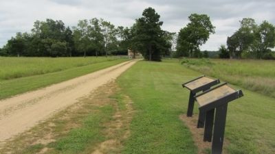
On Mount Calvert Road 0.3 miles east of McClure Road, on the right.
Colonial Settlement
It is hard to imagine, but Mount Calvert was once a busy port town of a frontier community. After the Colony of Maryland was created in 1634, colonists began seeking land grants along the Upper Patuxent River. In 1658 . . . — — Map (db m187418) HM
Near Warehouse Landing Road 0.2 miles west of Chapel Point Road, on the right when traveling south.
On this ground, two cultures — Indian and European — confronted one another. Here a commercial town and government center grew, declined, grew again, and declined again. Residents raised supplies for the Continental Army and, during the . . . — — Map (db m316272) HM
On Port Tobacco Road (County Route 6) at Port Tobacco Road & Howard Drive on Port Tobacco Road.
Born 1723 on "Coates Retirement" Plantation. Held the office of Charles County Justice, 1749-1764. Appointed 1760 to commission on Pennsylvania and Delaware boundary dispute, resulting in the Mason-Dixon boundary settlement. Moved to Annapolis by . . . — — Map (db m128614) HM
Near Wilson Landing Road 0.7 miles west of Riverside Rd.
Nearly 90 wooden skeletons of World War I cargo ships, discarded by the U.S. Shipping Board, sold for salvage, and then burned to their waterlines now host an amazing array of fishes, wildlflowers, painted turtles, bald eagles, river otters, and . . . — — Map (db m129251) HM
On Indian Head Rail Trail east of Mattingly Street.
The Naval Base, [then] known as “The Naval Proving Ground”, was established in the town of Indian Head in 1890. Its main purpose was to test guns, powder, fuses and other naval ordnances as well as producing smokeless powder. The Naval . . . — — Map (db m70905) HM
Near Friendship Landing Road 1.3 miles Ironsides Rd (County Route 425).
Following a dramatic decline caused by pesticides, our national bird, the bald eagle, has made a tremendous return in the region. In fact, Charles County has the second largest population of nesting eagle pairs in the State of Maryland. . . . — — Map (db m129282) HM
Near Riverside Road (Route 224) 1.1 miles Liverpool Point Road (Route 426).
Diverse Habitats
Groundwater seeps from the hillside here at Douglas Point, creating wetlands called "spring seeps." These boggy areas contain a distinct set of plant species, including bayberries, orchids, fringe trees and magnolias. Other . . . — — Map (db m129207) HM
Near Commerce St 0.1 miles west of Chapel Point Road.
During the 17th century, local Indians often traded corn and deerskins to colonists for knives, steel needles, kettles, cloth, and beads. By the early 18th century, while most colonists dispersed across the countryside to farm the land, a . . . — — Map (db m128936) HM
Near Long Drive 0.2 miles east of Camden Way, on the right when traveling east.
• March 30, 2008 - President George W. Bush throws ceremonial first pitch for stadium opener at Nationals Park
• Being located on a navy shipyard, a submarine dive horn is used after all Nationals' home runs and victories
• October . . . — — Map (db m254523) HM
Near Bel Alton Newtown Road 0.1 miles east of Rich Hill Farm Road, on the left when traveling east.
Rich Hill was the home of wealthy landowners, enslaved African Americans and tenant farmers. From the early 18th century through the 20th century, the land was used to produce tobacco, corn and dairy products and to raise sheep, pigs, chickens, . . . — — Map (db m186734) HM
On Bel Alton Newtown Road just east of Rich Hill Farm Road, on the left when traveling east.
Rich Hill Farm
In 1838, at the age of 18, Samuel Cox embarked on a farming career which lasted for about thirty-seven years. Following the death of his father, Hugh Cox, in 1849 he inherited the 400-acre farm at Rich Hill.
Both he and . . . — — Map (db m186737) HM
Near Bel Alton Newtown Road east of Rich Hill Farm Road, on the left when traveling east.
The Family
Thomas Adrian Garner, his wife Rosebelle, and their children lived on Rich Hill as tenant farmers during parts of the 20th century. Their yearly rent was paid with tobacco the family farmed on the property. . . . — — Map (db m186735) HM
The village of Pomonkey is an historic African-American enclave established in the late 19th century which included many successful businesses, churches, schools, and social halls that thrived during an era of Jim Crow and segregation. . . . — — Map (db m296760) HM
On Poseytown Road at Special Place, on the right when traveling east on Poseytown Road.
The Carroll Farmhouse and Cemetery is associated with a historic African American community in western Charles County known as Poseytown which was established in the 19th century. One of its original residents was Richard K. Posey who fathered . . . — — Map (db m296757) HM
On Bowie Road at Gilroy Road, on the right when traveling south on Bowie Road.
Established in 1867, Mount Hope Baptist Church is the site of the oldest Baptist African American congregation in Charles County. Rev. A. C. Watts served as its first pastor. Mt. Hope was the founding church for three other African American . . . — — Map (db m296752) HM
Near Commerce Street west of Chapel Point Road when traveling west.
Port Tobacco was the home and place of business of George Atzerodt. Although he failed to murder Vice President Andrew Johnson, he was convicted and executed for his role in the plot to assassinate President Abraham Lincoln.
Part . . . — — Map (db m128954) HM
On Hawthorne Road at Ropse Hill Road, on the right when traveling east on Hawthorne Road.
Signer of the Declaration of Independence. Member of Congress 1775-1784. One time its presiding officer. He lies buried at his home “Haber de Venture” one mile south. — — Map (db m1002) HM
On This Site (1773-1783) Lived
John Hanson
First President of United States
In Congress Assembled
(1781-1782)
Born Charles County, MD., April 13, 1715
Died Oxon Hill, MD., November 22, 1783
Placed by Historical Society of Frederick . . . — — Map (db m89065) HM
On Greenville Street (State Highway 20) at Central Shiloh / Milford Dairy Road (State Highway S-1-100), on the left when traveling south on Greenville Street.
Erected by the descendants of Abraham Bowie, born in Scotland and settled in Durham Parish, Charles County, Maryland, about 1700 A.D. The family of his grandson Rhody Bowie, moved to Abbeville County, South Carolina about 1800. Eli Bowie, son of . . . — — Map (db m9338) HM
Near Old Muirkirk Road. Reported permanently removed.
Iron Production: Maryland’s Industrial Past
Maryland’s early economy and identity were based on slave-based agriculture. However, slaves were also employed in manufacturing iron, one of the first non-agricultural industries. Seeing how other . . . — — Map (db m104641) HM
On Firehouse Alley 0.1 miles west of St. Mary's Avenue.
The La Plata Community Garden Club dedicates this garden to all those who restored and rebuilt our town following the devastating tornado on April 28, 2002.
The granite star in the center of the courtyard commemorates the star which stood on . . . — — Map (db m135552) HM
Near West Marlton Avenue west of Crain Highway (U.S. 301), on the right when traveling south.
This area of Rosaryville State Park is dedicated in honor and memory of
Frederick Lee Eskew
(April 22, 1938 - April 29, 1986)
A graduate of the University of Maryland, School of Recreation and Parks, Fred Eskew dedicated 25 years to . . . — — Map (db m299825) HM
Charles County was created by the Maryland General Assembly in 1658. In 1674 the first Charles County Courthouse was built near here. In the area known as Moore's Lodge, a prison, ordinary (tavern), and race track also were located there. In 1727 . . . — — Map (db m81196) HM
This building housed the first power plant in Charles County. It was operated by the Southern Maryland Tri-County Rural Electric Cooperative (today known as SMECO) from 1938 to 1953. Its founding was a result of the Rural Electrification Act of . . . — — Map (db m280331) HM
1000 acres in Chingamuxon Hundred, Charles County, Maryland patented 1 September 1659 to Thomas Allanson Gent, who was granted by Cecilius, Lord Baltimore, the Sovereignty of a Lordship with privileges of Court Baron and all things belonging . . . — — Map (db m98204) HM
This Stadium is Dedicated in Memory of John Thomas Parran, Jr.
1926—2006
Athlete, Legislator, Statesman, Mentor, and Friend
Citizen of Charles County and Southern Maryalnd
Pitcher for the Indian Head Indians
Charles—St. Mary's League . . . — — Map (db m129877) HM
Near Rich Hill Farm Road 0.1 miles north of Bel Alton Newtown Rd. Reported permanently removed.
(Right Banner)
After leaving Dr. Samuel A. Mudd's house on April 15, 1865, John Wilkes Booth, the assassin of President Abraham Lincoln, and his accomplice David E. Herold avoided Zekiah Swamp and made a wide arc around the village of . . . — — Map (db m129045) HM
Near Friendship Landing Road 1.3 miles Ironsides Rd (County Route 425).
Friendship House was built in the mid 1700s on a site overlooking Nanjemoy Creek in western Charles County by a member of the Dent family. The "Friendship" Dents were actively involved in their community, serving in prominent positions in . . . — — Map (db m129308) HM
On Oxon Hill Road (Maryland Route 414) west of Indian Head Highway ( Route 210).
[Panel 1:]
John Hanson
Honored Patriot of the American Revolution
[Picture of John Hanson and Seal of the "Sons of the American Revolution"]
[Panel 2:]
Born 3 April, 1721, Mullberry Grove, Charles Co., . . . — — Map (db m46045) HM WM
On James Madison Parkway (U.S. 301) at Roseland road, on the left when traveling north on James Madison Parkway.
John Wilkes Booth, the assassin of President Abraham Lincoln, and his accomplice David E. Herold, fled Washington, D.C. on April 14, 1865, for Southern Maryland, a hotbed of Confederate sympathizers skilled at evading Union surveillance. On April . . . — — Map (db m267329) HM
Near Teagues Point Road 0.1 miles south of Fairfax Court.
George Maxwell and Maxwell's Seat
George Maxwell, a Scottish immigrant, was present in Charles County, MD by 1745. He was a successful Chesapeake merchant with many business ventures and partnerships. Maxwell's Seat was purchased from Charles . . . — — Map (db m274119) HM
Near North Campus Drive west of Cross Campus Drive, on the left when traveling south.
The structure known as Friendship House was rescued in 1968 from the Nanjemoy Creek site by members of the Historical Society of Charles County.
[Captions:]
Disassembly of the house was meticulous, with each piece of . . . — — Map (db m131658) HM
On Brooke Road 0.1 miles west of Chandlee Mill Road, on the right when traveling west.
A former slave, Minister, Author, Abolitionist and Entrepreneur
Born a slave, a son of Charles County, Maryland; a historical figure trudging through the toils and injustices in life as a slave in Montgomery County, Maryland and Kentucky . . . — — Map (db m205932) HM
Near New Market Road (Maryland Route 6) 0.1 miles west of Three Notch Road ( Route 5), on the right when traveling west.
The Amish community in St. Mary’s is the largest of three Amish settlements in Maryland. The community is located primarily along MD Routes 6 and 236 in New Market, Charlotte Hall and neighboring Charles County. The Amish moved to the area in 1940 . . . — — Map (db m135330) HM
On Sotterley Lane north of Sotterley Wharf Road, on the right when traveling north.
When the war began in 1861, Sotterley Plantation still relied on slave labor as did other plantations in Southern Maryland. Sotterley's owner, Dr. Walter Hanson Stone Briscoe, served as the surgeon for the Smallwood Vigilantes, a local . . . — — Map (db m297759) HM
On Kapel Drive at Hope Hill Avenue, on the right when traveling south on Kapel Drive.
Allison Maddox (ca. 1760-1843), a veteran of the Revolutionary War from Charles County, Maryland, purchased this property in 1810 from James E. Heath. The Maddox family cemetery, situated well inside the tract, is typical for a small farmstead of . . . — — Map (db m237291) HM
On West Street (Route 450) near Munroe Court, on the right when traveling west.
"And for the support of this Declaration, with a firm Reliance on the Protection of divine Providence, we mutually pledge to each other our Lives, our Fortunes, and our sacred Honor."
With these ringing words of resolve, . . . — — Map (db m114543) HM
First President of the First United States Government,
The United States in Congress Assembled,
Which Existed From 1781 until 1788.
“As the first elected president of our independent nation,
President Hanson began the task of unifying . . . — — Map (db m89151) HM
Near National Harbor Boulevard south of Capital Beltway (Interstate 95), on the right when traveling south.
Durante Vita
From the day the colony was founded in 1634, enslaved Africans played an important role in the history and development of Maryland and Prince George's County. As skilled laborers, artisans, and farmhands, the . . . — — Map (db m202335) HM
Near National Harbor Boulevard south of Capital Beltway (Interstate 95), on the right when traveling south. Reported missing.
A Plantation Society
Settlers to the New World came in search of gold, but what they found was a rugged landscape whose humbler natural resources would prove to be the greatest source of wealth. Timber, furs, and metal ores that had . . . — — Map (db m229194) HM
Near Livingston Road south of Old St. Johns Way, on the right when traveling south.
Here is the final resting place of 40 members of the Col. John Addison family, some of Maryland's earliest colonial settlers. Their story began when Col. John Addison, the Emigrant (1634 – 1706) arrived on Maryland shores from England (1667). He . . . — — Map (db m272119) HM
Near Gunston Road (Virginia Route 242) south of Springfield Drive, on the left when traveling south.
George Mason and his first wife, Ann Eilbeck Mason, began this burial ground in 1772. At that time, wealthy Virginians preferred to be buried at home instead of the local parish church. Multiple generations of women, men, and children—both . . . — — Map (db m133740) HM
On Governor Stone Parkway at Benfield Boulevard, on the right when traveling north on Governor Stone Parkway.
Born in England about 1603, he emigrated to Virginia about 1628, and he came to Maryland about 1648. He brought with him nine settlers, and many others followed. He obtained about 5,000 acres located in St. Mary’s, Charles and Calvert counties.
. . . — — Map (db m2889) HM
On Rock Creek Park Road 0.5 miles north of Muncaster Mill Road, on the right when traveling north.
What was enslavement like for a young child of African descent? Only the men and women who endured slavery and lived to share their experiences either in published autobiographies or in recorded oral histories could answer that painful question. . . . — — Map (db m197907) HM
Robert Brooke
First Lord of the Manor
Born London 1602; died Brooke Place, 1655
Commander of Charles County, 1650. President Provincial Council and acting Governor of Maryland 1652. Council met at "De La Brooke" 1662. . . . — — Map (db m81178) HM
On East Wood Avenue west of Bunsen Street, on the right when traveling west.
John Thomas Chunn was born in Trinity Parish, Charles County, Maryland in 1780 to Zachariah and Deborah Turner Chunn. He settled in Clark County, Indiana in 1810 and served as Justice of the Peace. He came to Vincennes in 1811, enlisted in the . . . — — Map (db m289623) HM
On Brooke Road west of Chandlee Mill Road, on the right when traveling west.
A former slave, minister, abolitionist, author and entrepreneur. Born into slavery in Charles County, Maryland, he escaped to what is now known as Ontario, Canada in 1830.
He established a settlement and laborer's school for other fugitive . . . — — Map (db m197812) HM
On State Highway 87 at Anderson Avenue, on the right when traveling east on State Highway 87.
Born in Charles County, Maryland, Jane Herbert Wilkinson Long was a Texas pioneer. She married James Long in 1815, and joined him in Texas during his military invasion of the then-Spanish colony, settling in Nacogdoches. The occupation was . . . — — Map (db m184359) HM
On Lakeview Parkway near Shoosmith Road, on the left when traveling north.
During the first 18 months of the Civil War, President Abraham Lincoln chose not to act upon recommendations of Frederick Douglass, and others, to enlist Black men in the Union Army in the fight against the Confederacy. After the much-needed Union . . . — — Map (db m314862) HM
On West Barbour Street, on the left when traveling west.
Built between 1856 and 1860 by Edward Brown Young and his wife, Ann Fendall Beall, this was one of the first of the great Italianate style homes constructed in Eufaula. It later became the home of the builders’ daughter, Anna Beall Young, and her . . . — — Map (db m33759) HM
On Neale Sound Drive at Cobb Island Road on Neale Sound Drive.
On December 23, 1900, Reginald Fessenden made the first wireless transmission of human speech; that memorable event took place right here on Cobb Island, Maryland.
While Marconi is credited with the invention of the wireless telegraph, it was . . . — — Map (db m129054) HM
On Crain Highway (U.S. 301) south of Hawthorne Road, on the right when traveling south.
1917 - 1918
This memorial
is erected by a grateful people
to those who enlisted
from Charles County, Maryland,
in the World War.
May the valor of the men and women who then so loyally served their country, ever stand as a . . . — — Map (db m131661) WM
This town, established in 1823, grew up around a store owned by Matthew Young (1803-1876), who was also postmaster 1831-43. It was first called Pressly's Station, for the post office opened in 1823 with David Pressly (1764-1834) as postmaster. The . . . — — Map (db m9397) HM
On U.S. 92 just south of X Road, on the right when traveling south.
Colonel John Fairfax’s old plantation. He was aide to General Washington in the Revolution and at one time was superintendent of Mt. Vernon. The mansion was built in 1818. Federal homestead project here was model for others. — — Map (db m75117) HM
On Anacostia Drive Southeast north of Marion Barry Avenue Southeast, on the left when traveling north.
"He then turned and crossed the bridge; his horse was restive and he held him in and walked him across the bridge…I do not know with what speed he rode after that."
—Sergeant Silas T. Cobb
On Crain Highway (U.S. 301) south of Hawthorne Road, on the right when traveling north.
1917 - 1918
This memorial
is erected by a grateful people
to those who enlisted
from Charles County, Maryland,
in the World War.
★ These made the supreme sacrifice ★
Capt. Joseph Dent Hungerford ★ . . . — — Map (db m131662) WM
On Three Notch Road (Maryland Route 235) 0.1 miles north of Buse Road, on the left when traveling south.
During the Civil War, more than 700 African American men from St. Mary's County served as soldiers and sailors in the U.S. Army and Navy. Some enlisted to obtain their freedom; some were already free and joined from a sense of duty. Black men . . . — — Map (db m181789) HM
On Benedict Avenue at Potomac Avenue, on the left when traveling south on Benedict Avenue.
Residents along the Patuxent watched nervously as wave after wave of British warships approached the tiny town of Benedict. For months enemy raiders had terrorized Southern Maryland. Benedict felt their sting twice in June 1814. Now, August 19-20, . . . — — Map (db m68046) HM
Near Livingston Road (Maryland Route 224) 0.5 miles east of Hawthorne Road ( Route 225), on the left when traveling east.
Who would ever have imagined that a railroad track, once built with a focus on war, would one day be the source of such peace…
The Indian Head – White Plains Railroad was built during World War I in an effort to meet increased . . . — — Map (db m98546) HM
Dawson Family History
Thomas Dawson (1708-1800) left his family home in Charles County, Maryland, in 1750 and established Dawsonville in what was Frederick County, but later became Montgomery County. The Dawsons were a prominent Montgomery . . . — — Map (db m201500) HM
On Matthew Henson Trail south of Hewitt Avenue, on the right when traveling east.
August 8, 1866 - Born in Charles County, Maryland.
1877-1879 - At the age of 12, leaves home to live in Washington, DC and Baltimore, MD.
1879-1884 - Joins the crew of the ship "Katie Hines" as a cabin boy and explores the . . . — — Map (db m205930) HM
On Layhill Road (Maryland Route 182) north of Middlevale Lane, on the left when traveling north.
August 8, 1866 - Born in Charles County, Maryland.
1877-1879 - At the age of 12, leaves home to live in Washington, DC and Baltimore, MD.
1879-1884 - Joins the crew of the ship "Katie Hines" as a cabin boy and explores the . . . — — Map (db m114209) HM
Ideally Situated Close to Commerce Square and the Brazos River, these two lots were near the center of town. Like many San Felipe lots, the property changed hands several times. First developed by the Calvit family, its last owner was Almyra . . . — — Map (db m206287) HM
On Popes Creek Road 1 mile south of Crain Highway (U.S. 301), on the right when traveling south.
Home of Confederate Mail Agent, Thomas A. Jones, who helped to shelter, and aided the escape of John Wilkes Booth and David Herold in their flight, April 16th to 21st 1865. — — Map (db m129119) HM
Near Constitution Avenue Northwest (U.S. 50) east of 19th Street Northwest, on the right when traveling east.
In Congress, July 4, 1776.Unanimous Declaration of the thirteen united States of America.And for the support of this Declaration,
with a firm reliance on the protection of Divine Providence,
we . . . — — Map (db m137039) HM
Thin black lines indicate changes in relevance. Between each pair of lines entries are ordered geographically but all have the same relevance.
* Inflectional forms of words are their plurals, singulars, and possessives as well as gramatical tenses and similar variations.