On Pinckney Street west of Joy Street, on the left when traveling west.
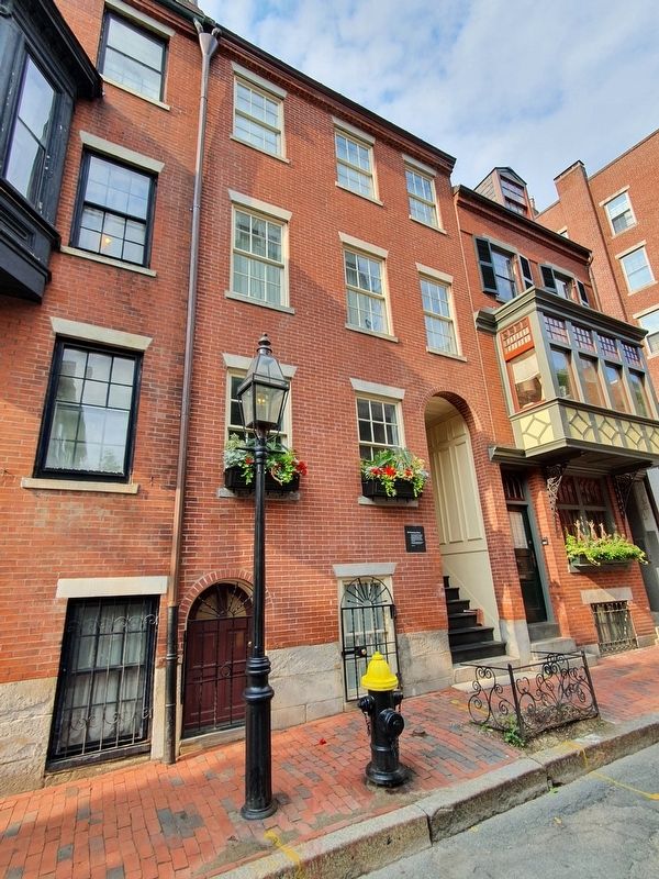
As a little girl Louisa May Alcott lived in rented rooms at 20 Pinckney Street. The Alcott home was part of the Boston literary scene during
the decades before the Civil War. Louisa's father, Bronson Alcott, was an innovative
educator whose . . . — — Map (db m175946) HM
On Chestnut Street just east of Willow Street, on the right when traveling west.
29A Chestnut Street, built about 1800, is thought to be the first house of the Mt. Vernon Proprietors, a development syndicate. It has features typical of the earliest building period: side entrance dating from the time when houses had . . . — — Map (db m215127) HM
On Mt. Vernon Street at Walnut Street, on the left when traveling west on Mt. Vernon Street.
The large brownstone houses at 40-42 Mt. Vernon were the newest fashion on the south slope of Beacon Hill in 1850. They are more than 50 years younger than most of the brick houses here. When new, these brownstones seemed very large. Improved . . . — — Map (db m175934) HM
On Beacon Street east of Spruce Street, on the right when traveling west.
This was Harrison Gray Otis' third house, built in 1806. Like his other two houses, it was designed by Charles Bulfinch. His three mansion, all built within ten years, leave a remarkable architectural record of their times. The first, at 141 . . . — — Map (db m215098) HM
On Mt. Vernon Street west of Walnut Street, on the left when traveling west.
Although we associate the name Charles Bulfinch with much of the architecture on Beacon Hill, he did not design most of the houses here.
Styles similar to his were copied by master
builders and independent housewrights in their
own vernacular, . . . — — Map (db m175940) HM
On Mt. Vernon Street west of Walnut Street, on the right when traveling west.
Charles Bulfinch, the foremost architect of his
time, designed this house in 1805 for Stephen
Higginson, Jr. Like No. 85, which Bulfinch built
in 1800 for Harrison Gray Otis, it is not part of
a continuous block. That more economical
pattern . . . — — Map (db m175943) HM
On Willow Street just south of Acorn Street, on the right when traveling south.
In the early 19th century, many well-to-do families built row houses between and on the sites of once spacious estates. Servants and tradesmen, who found jobs within the wealthy houses, lived conveniently nearby, often, according to local . . . — — Map (db m215112) HM
On Mount Vernon Street west of Willow Street, on the left when traveling west.
Boston sculptor who maintained a studio for nearly two decades at 92 Mt. Vernon St
See her statues of Samuel Adams in Faneuil Hall Park and "Leif Ericson" on Commonwealth Ave. — — Map (db m175993) HM
On Beacon Street, on the left when traveling east.
To commemorate the arrival on June 12, 1630 of the Frigate Arbella, bringing Governor Winthrop and the Charter of the Massachusetts Bay Colony, This tablet placed by the Massachusetts Daughters of the American Revolution — — Map (db m37664) HM
On Beacon Street at Park Street, on the left when traveling east on Beacon Street.
The Walk to the Sea encompasses four centuries
of Boston history. Beginning at the State House on
Beacon Hill, overlooking Boston's ancient Common,
the Walk passes among historic landmarks and
skyscrapers. The Walk crosses ground that, . . . — — Map (db m176177) HM
On Tremont Street at Park Street, on the left when traveling north on Tremont Street.
In or about the year of our Lord One thousand six hundred thirty and four the then present inhabitants of said Town of Boston of whom the Honble John Winthrop Esqr Govnr of the Colony was chiefe did treate and agree with Mr William Blackstone for . . . — — Map (db m18505) HM
On Beacon Street at Spruce Street, on the right when traveling east on Beacon Street.
For wee must consider that wee shall be as a citty vppon a hill the eies of all people are vppon vs soe that if wee shall deale falseley with our God in this worke we haue vundertaken… wee shall be made a story and a by-word through the world - . . . — — Map (db m215096) HM
Near Beacon Street at Brimmer Street, on the right when traveling west.
Previously known as the Bull & Finch
Pub, Cheers Beacon Hill's rise to stardom
is a classic "Hollywood” story... only it
happened in Boston!
Three producers were looking to create
a sitcom about a neighborhood bar. One
producer suggested . . . — — Map (db m176876) HM
On Chestnut Street just east of Wadsworth Place, on the right when traveling west.
Master builders and housewrights built many of the houses on Chestnut Street. These vernacular builders, including Cornelius Coolidge, Jesse Shaw and Hezekiah Stoddard, are hardly well-known. But their work gives Chestnut Street its composed 19th . . . — — Map (db m215128) HM
On Boylston Street west of Tremont Street, on the right when traveling east.
The Colonial Theatre opened in 1900 and is considered one of America's most elegant theatres. Designed by architect Clarence Blackhall, its rich history includes many memorable performances and world premieres, among them George Gershwin's "Porgy & . . . — — Map (db m215194) HM
On Tremont Street, on the right when traveling south.
Born in Wexford Ireland 1745 Died in Philadelphia 1803 Received first commission from the Continental Congress to command the Lexington 1775 Sailed from Boston on the Raleigh 1778 Acclaimed in Boston in 1780 for victories on the Alliance Appointed . . . — — Map (db m41561) HM
On Chestnut Street just west of Willow Street, on the left when traveling west.
[Top plaque:]
Francis Parkman House
has been designated a
Registered National
Historic Landmark
under the provisions of the Historic Sites Act of August 21, 1935. This site possesses exceptional value in commemorating and . . . — — Map (db m215124) HM
On Beacon Street at Joy Street, on the right when traveling west on Beacon Street.
Here lived and died George Francis Parkman 1823-1908 Remembered with enduring gratitude by the City of Boston for his bequest of a fund that secures forever the maintenance and improvement of the Common and other Public Parks — — Map (db m176182) HM
On Beacon Street west of Bowdoin Street, on the left when traveling east.
To commemorate the beginning of the Grand Army of the Republic in Massachusetts by the organization of William Logan Rodman Post No. 1, October 4, 1866, and the Department of Massachusetts Grand Army of the Republic May 17, 1867, this tablet is . . . — — Map (db m215134) HM
On Mt. Vernon Street west of Willow Street, on the right when traveling west.
Louisburg (pronounced Lewisberg) Square is
a private residential park. It was laid out in 1826 by the Mount Vernon Proprietors on pasture land purchased from John Singleton Copley. The homes were built from 1833 to 1847, and the statues of . . . — — Map (db m176192) HM
On Mt. Vernon Street west of Walnut Street, on the left when traveling west.
Margaret Deland 1857-1945 Author who lived at 76 Mt. Vernon St., and wrote the best selling novel, John Ward, Preacher. She was elected to the National Institute of Arts and Letters in 1926. — — Map (db m175944) HM
Witness for religious freedom. Hanged on Boston Common - 1660. "My life not availeth me in comparison to the liberty of the truth."
Erected by the Art Commission of the Commonwealth of Massachusetts from the legacy of Zenas Ellis of Fair . . . — — Map (db m20925) HM
On Beacon Street at Park Street, on the right when traveling east on Beacon Street.
[On the front of the monument, part of the relief itself]:
Omnia Relinqvit / Servare Rempvblicam
[Underneath the relief]:
Robert Gould Shaw Colonel of the Fifty Fourth Regiment of Massachusetts Infantry
born in Boston 10 . . . — — Map (db m20209) HM
Near Beacon Street east of Charles Street, on the right when traveling east.
A type of the 56,571 mines laid and swept in the mine barrier placed in the North Sea by the United States Navy during the World War, 1917-1919, the greatest achievement of its nature recorded in all naval history and placed here as a tribute to . . . — — Map (db m148926) HM
Near Tremont Street south of Temple Place, on the right when traveling south.
This is the home of the Nova Scotia Tree for Boston. Each year, Nova Scotia gives a tree to thank the people of Boston for their help in the aftermath of the Halifax Explosion on December 6, 1917. Nova Scotians will never forget this act of . . . — — Map (db m215818) HM
On Beacon Street, on the right when traveling west.
On this site stood the home of John Singleton Copley Distinguished historical and portrait painter Born in Boston 1737
Died in London 1815 — — Map (db m81965) HM
Near Beacon Street south of Spruce Street, on the right when traveling east.
On this field the Oneida Football Club of Boston, the first organized football club in the United States played against all comers from 1862 to 1865 The Oneida goal was never crossed This monument is placed on Boston Common November 1925 by . . . — — Map (db m176302) HM
On Tremont Street at Hamilton Place, on the right when traveling south on Tremont Street.
Organized February 27, 1809, edifice dedicated January 10, 1810
Handel & Haydn Society of Boston founded 1815
Sandwich Islands (Hawaii) church founded 1819
American Missionary Society founded 1826
William Lloyd Garrison's . . . — — Map (db m186284) HM
On Tremont Street at Park Street, on the right when traveling south on Tremont Street.
The first subway in America was designed to solve the center-city problem of traffic jams caused by streetcars. The new subway opened September 1, 1897. It had only two stops: Park Street and Boylston-Public Garden. To the surprise of critics, the . . . — — Map (db m215817) HM
On Charles Street north of Boylston Street, on the right when traveling north.
Pope John Paul II In commemoration of the first mass offered in the United States by His Holiness on his first pastoral visit to this country 1 October 1979 Here on Boston Common during the 350th year of the founding of Boston “May God’s . . . — — Map (db m176934) HM
On Tremont Street at Park Street, on the right when traveling south on Tremont Street.
Boston was the first city to build electric traction for a large-scale rapid transit system. The engineering challenge to design and construct safe, economically viable, and reliable electric power
for Boston’s rapid transit was met by the West . . . — — Map (db m154429) HM
On Beacon Street at Spruce Street, on the right when traveling west on Beacon Street.
Born Horncastle Parish Lincolnshire England 5 March 1596
Graduate of Emanuel College England 1621
First settler of Shawmut 1625
Near here stood his dwelling
He removed to Rhode Island 1635
Where he died May 26 - 1675
"The place of his . . . — — Map (db m215097) HM
On Mt. Vernon Street at Willow Street, on the left when traveling west on Mt. Vernon Street.
Robert Lee Frost 1874-1963 America’s “Poet Laureate” and four-time Pulitzer Prize winner lived at 88 Mt. Vernon Street from 1938-1941 while teaching poetry at Harvard University. “The figure a poem makes. It begins in delight and ends in . . . — — Map (db m175991) HM
This sculpture has been placed here as a tribute to Robert McCloskey whose story Make Way for Ducklings' has made the Boston Public Garden familiar to children throughout the world 1987 — — Map (db m76654) HM
Near Tremont Street at West Street, on the right when traveling south.
Here the Sons of Liberty assembled here Jesse Lee, Methodist pioneer, preached in 1790.
The landmark of the Common the Elm blew down in 1876. — — Map (db m215820) HM
Near Beacon Street east of Charles Street, on the right when traveling east.
To the men of Boston who died for their country on land and sea in the War which kept the Union whole, destroyed slavery and maintained the Constitution. The grateful City has built this Monument that their example may speak to coming generations. . . . — — Map (db m37560) HM
On Bowdoin Street at Ashburton Place, on the right when traveling north on Bowdoin Street.
This corner of the City of Boston is dedicated to
William "Billy" Sutton
a fixture in Boston's political landscape. A confidant to politicians both young and old, including a young Congressman named John F. Kennedy, Billy ruled the corridors . . . — — Map (db m215100) HM
On Tremont Street south of Winter Street, on the left when traveling south.
The Cathedral of St. Paul was established as St. Paul's Church in 1818. St. Paul's was the first example of Greek Revival architecture in Boston.
In 1846, Alexander Crummel was ordained a deacon here, making him the third African American . . . — — Map (db m215172) HM
On Beacon Street at Charles Street, on the left when traveling west on Beacon Street.
The Common an Historic Overview In 1634, only four years after John Winthrop and the Puritans of the Massachusetts Bay Colony settled the Shawmut Peninsula and created the town of Boston, these colonists bought a 48-acre tract of land on the . . . — — Map (db m176868) HM
On Tremont Street at Park Street, on the left when traveling north on Tremont Street.
The Common an Historic Overview In 1634, only four years after John Winthrop and the Puritans of the Massachusetts Bay Colony settled the Shawmut Peninsula and created the town of Boston, these colonists bought a 48-acre tract of land on the . . . — — Map (db m191834) HM
On Mt. Vernon Street west of Joy Street, on the right when traveling west.
The Historic Beacon Hill District has been designated a Registered National Historic Landmark
under the provisions of the Historic Sites Act of August 21, 1935 This site possesses exceptional value in commemorating or illustrating
the . . . — — Map (db m176189) HM
On Tremont Street, on the right when traveling south.
This mall is named in honor of Marquis de Lafayette
distinguished French soldier
Major-General in the War of American Independence
and illustrious patriot of the French Revolution
who nobly served the cause of liberty on two . . . — — Map (db m73212) HM
On Mt. Vernon Street at Walnut Street, on the right when traveling west on Mt. Vernon Street.
Soon after 1800, freestanding mansions surrounded by gardens became a luxury even the rich could scarcely afford on Beacon Hill. One of the few who could was Jonathan Mason. About 1800, he built a mansion and gardens (both demolished now) just . . . — — Map (db m176190) HM
On Beacon Street west of Park Street, on the right when traveling east.
The Shaw - 54th Regiment Memorial honors Colonel Robert Gould Shaw and members of the Massachusetts 54th Regiment who died in the assault on Fort Wagner, South Carolina, July 18, 1863. The 54th was the first regiment of Black volunteers from the . . . — — Map (db m75619) HM
On Beacon Street west of Park Street, on the right when traveling east.
The Shaw - 54th Regiment Memorial, the outstanding tribute to soldiers of the Civil War, was created by one of America's foremost sculptors, Augustus Saint Gaudens (1848 - 1907). Born in Dublin, of a French father and an Irish mother, he grew up in . . . — — Map (db m84002) HM
On Tremont Street at Park Street, on the right when traveling south on Tremont Street.
Tremont Street Subway Boston, Massachusetts Has been designated a Registered National Historic Landmark under the provisions of the Historic Sites Act of August 21, 1935 this site possesses exceptional value in commemorating and illustrating . . . — — Map (db m177230) HM
On Tremont Street at Bromfield Street, on the left when traveling north on Tremont Street. Reported missing.
From 1769-1776 Boston was the flashpoint for events leading up to the American Revolution. On February 22, 1770, a crowd gathered around the house and shop of a Tory sympathizer and customs agent, Ebenezer Richardson. When they started pelting the . . . — — Map (db m18766) HM
On School Street, on the left when traveling east.
Front of Monument: Born in Boston, 17 January, 1706. Died in Philadelphia, 17 April, 1790. Right Side of Monument: Treaty of Peace and Independence 3 September, 1783 Rear of Monument: Eripuit Colo Tulmen Sceptrumque Tyrannis. Left . . . — — Map (db m18506) HM
On Beacon Street east of Bowdoin Street, on the right when traveling east.
Boston Athenaeum has been designated a Registered National Historic Landmark
under the provisions of the Historic Sites Act of August 21, 1935 This site possesses exceptional value in commemorating or illustrating
the history of the United . . . — — Map (db m176131) HM
On Bowdoin Street north of Beacon Street, on the right when traveling north.
A large cathedral, mother church of other local Swedenborgian Societies, stood on this present site from 1845-1963. The present complex was dedicated as a place of worship in
1966.
The Christianity of this church is guided by . . . — — Map (db m176881) HM
On School Street, on the left when traveling east.
On this spot stood the First House erected for the use of the Boston Public Latin School. This School has been constantly Maintained since it was Established by the following Vote of the town: At a General meeting upon Public Notice it was agreed . . . — — Map (db m18509) HM
On School Street west of Chapman Place, on the left when traveling east.
At the corner of this site stood the first public school in America. Built in 1635, the school gave the street its name. In 1636, a subscription service was raised for a free schoolmaster. In 1645 the town also stipulated that 'Indians are to be . . . — — Map (db m215148) HM
On Hanover Street at John F. Fitzgerald Surface Road, on the left when traveling east on Hanover Street.
1600
Native Americans
Native Americans inhabited this area for at least 10,000 years before the arrival of Europeans. Although contact with European explorers and fishermen in the early 1600s resulted in heavy loss of life from European . . . — — Map (db m215646) HM
On Washington Street, on the right when traveling north.
Born in Windsor England 1595 Member of the Honourable Artillery Company of London 1623 Devoted citizen of Boston from 1635 to death in 1656 Liberal contributor for a town library for the maintenance of a free schoolmaster, for introducing pure . . . — — Map (db m18514) HM
On Beacon Street at Bowdoin Street, on the right when traveling east on Beacon Street.
Chester Harding House has been designated a Registered National Historic Landmark
under the provisions of the Historic Sites Act of August 21, 1935 This site possesses exceptional value in commemorating or illustrating
the history of the . . . — — Map (db m176134) HM
Near Tremont Street, on the left when traveling north. Reported missing.
Until a few decades before the American Revolution, Boston was the largest port in the British colonies. It thrived on maritime trade, shipbuilding, and the work of hundreds of craftspeople. While the tombs of the rich merchants and politicians ring . . . — — Map (db m18795) HM
On Beacon Street east of Bowdoin Street, on the right when traveling east.
The primary purpose of this building, the property of
the American Congregational Association is to provide
housing for Congregational Societies and other religious
and charitable organizations: it is the fifth home of the
Congregational . . . — — Map (db m176175) HM
On April 28, 1852, in Johnson Hall formerly on this site, the first municipal electric fire alarm system using call boxes with automatic signaling to indicate the location of a fire was placed into service. Invented by William Channing and Moses . . . — — Map (db m76634) HM
Near Tremont Street, on the left when traveling north. Reported missing.
Benjamin Franklin was born in Boston in 1707, son of Josiah Franklin (1657-1745), tallow chandler, and his second wife, Abiah (Folger) (1667-1752). After his parent’s deaths, Franklin created a modest memorial to them with an inscription . . . — — Map (db m18780) HM
On Tremont Street at Bromfield Street, on the left when traveling north on Tremont Street.
Within this ground are buried John Hancock, Samuel Adams and Robert Treat Paine, signers of the Declaration of Independence; Governors Richard Bellingham, William Dummer, James Bowdoin, Increase Sumner, James Sullivan and Christopher Gore; Lieut. . . . — — Map (db m18711) HM
Near Tremont Street, on the left when traveling north. Reported missing.
In early Boston when someone died, their family or friends indicated their burial site with a marker for remembrance. Often the deceased had already ordered their gravestone before their death. Gravestones were carved by masons, stonecutters, . . . — — Map (db m18783) HM
Near Tremont Street, on the left when traveling north. Reported missing.
In the 17th century, religious persecution led to the immigration of large numbers of French Protestants (known as Huguenots) to Massachusetts. Gravestones of the Cazneau, Johonnat, Revere, and Sigourney families can be found throughout . . . — — Map (db m231829) HM
On Tremont Street south of Court Street, on the left when traveling south.
In 1789 President George Washington stayed at Joseph Ingersoll's inn at this site while visiting Boston. Massachusetts Governor John Hancock's visit to meet Washington here is regarded as an early acceptance of Federal sovereignty over that of . . . — — Map (db m215167) HM
Near Tremont Street north of Bosworth Street, on the right when traveling south.
First Master of U.S. Revenue Cutter Massachusetts
The Revenue Cutter Service is the forerunner of the United States Coast Guard. Captain Williams was the commander of the first authorized ship. — — Map (db m215171) HM
Near Tremont Street, on the left when traveling north.
Josiah Franklin and Abiah his wife lie here interred. They lived lovingly together in wedlock fifty-five years, and without an estate, or any gainful employment, by constant labor and honest industry, maintained a large family comfortably, and . . . — — Map (db m19280) HM
On Tremont Street, on the right when traveling north.
Here were buried Governors of Massachusetts John Winthrop 1649, John Endicott 1665, John Leverett 1679, William Shirley 1771, Lieut. Governors of Massachusetts William Phillips 1827, Thomas Lindall Winthrop 1841; Governors of . . . — — Map (db m18713) HM
On Tremont Street at School Street, on the left when traveling south on Tremont Street.
Its first building was the first Church of England in Boston.
The corner stone of the present building was laid August 11, 1749.
After the Revolution it became the first Unitarian church in the United States. — — Map (db m18083) HM
On School Street just east of Tremont Street, on the left when traveling east.
First permanent established Anglican church in New England
First Unitarian church in America
Oldest American pulpit in continuous use on its original site — — Map (db m186286) HM
On Beacon Street at Tremont Street on Beacon Street.
The Walk to the Sea encompasses four centuries
of Boston history. Beginning at the State House on
Beacon Hill, overlooking Boston's ancient Common,
the Walk passes among historic landmarks and
skyscrapers. The Walk crosses ground that, . . . — — Map (db m144148) HM
On School Street west of Chapman Place, on the right when traveling west.
School Street Boston • Site of the oldest public school in the United States founded 1635.
"Agreed w Mr. John Barnerd as followeth, he to build a new school house of forty foot long, twenty five foot wide & eleven foot stud, . . . — — Map (db m215152) HM
On Tremont Street, on the right when traveling north.
Along the second row parallel to the front path are the stones of the three “Rebeccas”: Rebecca (Baker) Gerrish (d. 1743), Rebecca Smith Sanders (d. 1745/6), and Rebecca (Smith) Alexander Deal Sprague (ca. 1704-1746), who were . . . — — Map (db m18984) HM
On Tremont Street at Beacon Street, on the right when traveling south on Tremont Street.
Friend–
Look up and see the North Church Tower where were shown two lantern lights on the night of April 18, 1775, to send Paul Revere on his famous ride and begin the American Revolution. This view preserved for all future generations by . . . — — Map (db m186290) HM
On Washington Street at Milk Street, on the right when traveling north on Washington Street.
has been designated a Registered National Historic Landmark Under the provisions of the Historic Sites Act of August 21, 1935 this site possesses exceptional value in commemorating or illustrating the history of the United States U.S. Department . . . — — Map (db m18087) HM
On Milk Street east of Washington Street, on the left when traveling east.
This building was built in 1729 as a Puritan meeting house. Benjamin Franklin was baptized here. Phillis Wheatley, the first African American author, worshipped here.
In the years leading up to the American Revolution, colonists gathered . . . — — Map (db m176110) HM
On Tremont Street at Park Street, on the right when traveling south on Tremont Street.
The English architect Peter Banner designed Park Street Church. It was built in 1809 on the site of the old Granary for which the adjoining burying ground, much older than the church, was named. On July 4, 1829, William Lloyd Garrison delivered . . . — — Map (db m18081) HM
On Tremont Street at Bromfield Street, on the left when traveling north on Tremont Street.
This tablet as a memorial to Paul Revere is erected by the Paul Revere Memorial Association to commemorate the opening to the public on April 19, 1908 of his old house at No. 19 North Square in this city. May the youth of today when they visit . . . — — Map (db m18709) HM
Near Tremont Street, on the right when traveling north.
When the Puritans landed in Boston in 1630, the Separatist settlement at Plymouth Colony was ten years old. Puritans and Separatists were two Protestant sects that developed in the late 16th century in England. Puritans were critical of, but . . . — — Map (db m19003) HM
On Tremont Street just north of School Street, on the right when traveling north.
Robert Keayne
The founder of the Ancient & Honorable Artillery Company of Massachusetts in 1638 and its first Captain, died 23d March 1655. This stone was the doorstep at his farmhouse Rumney Marsh.
Col. Nicholas Paige
Captain of . . . — — Map (db m215135) HM
Near School Street west of City Hall Avenue, on the right when traveling west.
This site was the location of two Boston City Halls. Here, in 1810, the Suffolk County Court House was erected. In 1841, that courthouse was converted to Boston's second city hall. In 1865, it was replaced by Boston's third city hall, the . . . — — Map (db m215157) HM
Near Tremont Street, on the left when traveling north. Reported missing.
Around you are some of the earliest burials at Granary Burial Ground. “The Oldest Stone” dated 1667 marked the burial of John Wakefield (ca. 1615-1667). Apparently a frugal relative 36 years later had the back of the stone carved for Ann Child . . . — — Map (db m191829) HM
On Washington Street at School Street, on the right when traveling north on Washington Street.
The excellent spring water on the Shawmut
Peninsula drew the Puritans to settle here. The
site of the spring is marked on Spring Lane.
Nearby the colonists built their compact town.
The first church, first market, first prison, first
burying . . . — — Map (db m176000) HM
On Tremont Street at Beacon Street, on the left when traveling south on Tremont Street.
In Memory of The Chevalier de Saint Sauveur
first Chamberlain of his Royal Highness, Count d'Artois, brother of his Majesty
the King of France
“Cet officier, aide-major de l'escadre française et lieutenant de vaisseau . . . — — Map (db m176938) HM WM
Near School Street just west of City Hall Avenue, on the right when traveling west.
When, in 1828, Andrew Jackson established the Democratic party and ran for president using the populist slogan, "Let the people rule", his opponents thought him silly and labeled him a "jackass". Jackson, however, picked up on their name calling . . . — — Map (db m215155) HM
Near Tremont Street, on the right when traveling north.
Buried in the Winthrop family tomb are 11 members of the Winthrop family. Puritan leader John Winthrop the Elder (1588-1649) was the first governor of the Massachusetts Bay Colony and the founder of Boston. In 1629 he was elected governor by the . . . — — Map (db m18999) HM
Near Tremont Street, on the right when traveling north.
Located against the back fence of the burying ground is the Tudor family tomb, marked by a gravestone for John Tudor, Esquire (1709-1795),. The Tudor family legacy began with John Tudor, a baker and deacon of Second Church, who chronicled over . . . — — Map (db m19009) HM
On School Street at Washington Street, on the left when traveling east on School Street.
Thomas Crease built this structure as his apothecary and residence shortly after the great fire of 1711 destroyed Anne Hutchinson’s house on this site. Timothy Carter opened the Old Corner Bookstore here in 1829. Between 1845 and 1865, the . . . — — Map (db m18085) HM
On State Street at Congress Street, on the right when traveling west on State Street.
The Old State House, Boston’s oldest public building, was built in 1713 as the seat of British colonial government. Here the Royal Governor and the Massachusetts Assembly debated the Stamp Acts and the Writs of Assistance. The Declaration of . . . — — Map (db m18096) HM
135 entries matched your criteria. The first 100 are listed above. The final 35 ⊳