Launched 24 July 1943
USS Parche
P Π E
Par Excellence
Commissioned 20 November 1943
SS-384
These men served aboard during her six war patrols
[LEGEND: Name · Patrols · Role] •
Allard, C. J. · 3 · CMOMM • . . . — — Map (db m292238) WM
Near Arizona Memorial Road, on the left when traveling north.
Teamwork and practice were needed to load, sight, and fire this 3"/50 caliber gun while other crew members carried shells up from below deck.
As an anti-ship weapon, it proved less than ideal. Many were replaced with longer range, more . . . — — Map (db m292256) HM
On Arizona Memorial Drive. Reported permanently removed.
This gun assembly consists of four recoil-operated, heavy machine guns, designed primarily for anti-aircraft fire. Each gun had a firing rate of 120 rounds per minute and fired a two lb. projectile. It had a maximum horizontal range of about 33,000 . . . — — Map (db m292215) HM
Near Arizona Memorial Road west of Kamehameha Highway (Hawaii Highway 99), on the left when traveling north.
By 1944, Imperial Japan faced defeat. Military
leaders believed Kaiten would "turn the
heavens" to win the war for the Imperial Navy.
A Japanese submarine could carry four to six Kaiten to
the vicinity of their targets, but this limited the . . . — — Map (db m292210) HM
Near Arizona Memorial Road west of Kamehameha Highway (Hawaii Route 99), on the left when traveling north.
Bowfin's career in the U.S. Navy continued
long after WWII. She served during the
Korean War, and later on as a Naval Reserve
training submarine.
Bowfin returned to Pearl Harbor in 1972, and eventually
became a museum ship. One of few . . . — — Map (db m292319) HM
Near Arizona Memorial Road west of Kamehameha Highway (Hawaii Route 99), on the left when traveling north.
In a daring night time attack, Commander L. P. 'Red'
Ramage led USS Parche (SS-384) on a rampage.
rapidly firing torpedoes at an enemy convoy. One
enemy vessel turned and attempted to ram.
"Captain, we are going to be rammed!"
-Lieutenant . . . — — Map (db m292318) HM
Near Arizona Memorial Road west of Kamehameha Highway (Hawaii Highway 99), on the left when traveling north.
Introduced in 1942, the Bofors was the standard
intermediate range gun on U.S. Navy destroyer
escorts and other surface ships until the 1950s.
It had a firing rate of 120 rounds per minute, and
fired a two pound projectile with a . . . — — Map (db m292212) HM
The Japanese raided Pearl Harbor and other military targets on Oahu with carrier-launched aircraft which included fighters, horizontal bombers, torpedo planes, and dive bombers. The planes struck here in two waves, beginning at 7:55 a.m., with a 15 . . . — — Map (db m226784) WM
More than two thousand Americans were killed on December 7, 1941, almost half of them aboard USS Arizona. Military installations around the island were attacked and nineteen ships were sunk, beached, or badly damaged. Hundreds of Navy and Army . . . — — Map (db m104804) HM
Near Arizona Memorial Road, on the left when traveling north.
This capsule enables submerged launch
of the Harpoon missile through a
submarine's torpedo tube. When the
capsule breaks the surface, the front
and end caps eject so the missile can
blast out.
Weight: 1,385 pounds
Length: 15 feet . . . — — Map (db m292255) HM
Near Arizona Memorial Road, on the left when traveling north.
The Harpoon missile is one of few weapons
carried on U.S. Navy attack submarines. It was
originally carried from 1984 to 1997 and returned
to service in 2021 with upgraded capabilities.
Improvements include GPS guidance for
autonomous, . . . — — Map (db m292247) HM
Near Arizona Memorial Road west of Kamehameha Highway (Hawaii Route 99), on the left when traveling north.
The pilot entered the kaiten through the lower hatch and sat in a canvas chair with a periscope and controls close at hand. the pilot could not unlock the hatch from inside. The warhead at the front was packed with approximately 1.5 tons of . . . — — Map (db m292233) HM
At dawn on 7 December 1941 more than half of the United States Pacific Fleet, approximately 150 vessels and service craft, lay at anchor on alongside piers in Pearl Harbor. All but one of the Pacific fleet’s battleships were in port that morning, . . . — — Map (db m71610) WM
He goes a great voyage that goes to the bottom of the sea, George Herbert, Jacula Prudentum, 1651
Throughout the history of submarine development, men have fought enemies just as lethal as any human foe. Those who brave the deep in . . . — — Map (db m81389) HM WM
On Arizona Memorial Drive. Reported permanently removed.
This was the U.S. Navy's primary torpedo in WWII. When fired, compressed air, alcohol and water were mixed and ignited in the combustion chamber to produce the steam that powered the turbines.
Weight-3,200 lbs.; Length-20.5 feet; Diameter-21 . . . — — Map (db m292240) HM
Near Arizona Memorial Road, on the left when traveling north.
The steam-driven Mark 14 torpedo was the
primary weapon of fleet submarines during
World War II. Small surface ships were usually
sunk by the submarine's deck guns. Each
fleet submarine had 10 torpedo tubes and
carried 24 torpedoes. The torpedo . . . — — Map (db m292259) HM
Near Arizona Memorial Road, on the left when traveling north.
Defective torpedoes early in WWII resulted in many
unsuccessful attacks and frustrated submarine crews.
The Mk 14 had multiple design problems.
One notable attack by Commander L.R. Daspit onboard
USS Tinosa (SS-283) observed at least . . . — — Map (db m292260) HM
Near Arizona Memorial Road, on the left when traveling north.
The Mark 27 "Cutie" torpedo was a modified
version of the Mark 24 aerial homing torpedo,
with wooden guidance rails that allowed it to
be launched from standard 21 inch submarine
torpedo tubes. It was intended as a defensive
weapon against . . . — — Map (db m292209) HM
Near Arizona Memorial Road, on the left when traveling north.
The Mk 37 was an early submarine-launched,
acoustic homing, anti-submarine torpedo. With
electric propulsion, it swam quietly and smoothly
out of the torpedo tube.
The Mk 37 is still used as a submarine-launched
mobile mine.
Weight: . . . — — Map (db m292208) HM
On Arizona Memorial Drive. Reported permanently removed.
This high-performance, submarine-launched weapon is considered to be the first successful torpedo developed for use against other submarines. The Mark 37 was designed to swim out of a 21-inch torpedo tube, to which it remained attached by a length . . . — — Map (db m292328) HM
Near Arizona Memorial Road, on the left when traveling north.
The Mk 45 introduced a nuclear warhead to
the submarine-launched torpedo arsenal. It
was designed for attack against high-speed,
deep-diving submarines. Innovations include a
seawater-activated battery to power an electric
motor and an advanced . . . — — Map (db m292207) HM
Near Arizona Memorial Road, on the left when traveling north.
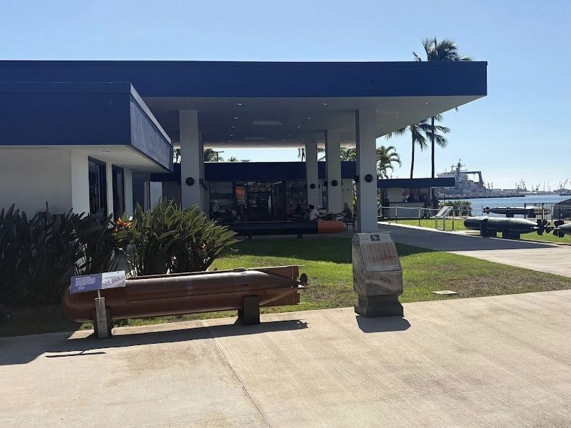
For testing and training, the explosive warhead was replaced with a liquid-filled head. At the end of a run, the liquid was expelled by pressurized air so the torpedo would surface. The head was painted orange to make it more
visible during . . . — — Map (db m292322) HM
Near Arizona Memorial Road, on the left when traveling north.
After the Cold War, the U. S. Navy planned to
decommission the first four Ohio-class SSBNs
early, unless alternatives for their continued use
were identified.
In response to this challenge, Northrop Grumman
developed the MAC.
This is the . . . — — Map (db m292204) HM
From this viewpoint along the eastern shore of Pearl Harbor you can see many features associated with the 1941 Japanese attack. The photo was taken in 1991, fifty years after the bombing.
1. Attack Signal-From the cockpit of his bomber over the . . . — — Map (db m71620) WM
From this viewpoint along the eastern shore of Pearl Harbor you can see many features associated with the 1941 Japanese attack. The photo was taken in 1991, fifty years after the bombing.
1. Naval Station Signal Tower-From the top of this water . . . — — Map (db m71619) WM
From 1959 through 1964
Regulus was the submarine
launched retaliatory
missile in the Pacific
The Regulus missile
deterrent strike force
operated from submarine
base, Pearl Harbor, under
the operational control of
Commander Submarine . . . — — Map (db m111762) WM
Near Arizona Memorial Drive, on the left when traveling north.
After WWII, the U.S. Navy adapted technology
from Japanese I-400 class submarines and
the German V-1 "buzz bomb" to develop the
Regulus Cruise Missile.
The Navy's first operational nuclear-capable missile, Regulus
featured folding wings and . . . — — Map (db m292326) HM
Near Arizona Memorial Road, on the left when traveling north.
This bronze propeller is from the Tang-class
submarine Darter, commissioned 20 October
1956. Diesel engines generated electricity for
the submarine's motors, which in turn drove
the propeller shafts.
Material: Bronze
Weight: 2,060 pounds . . . — — Map (db m292248) HM
Near Arizona Memorial Road, on the left when traveling north.
On 23 May 1939, USS Squalus (SS-192) flooded and
sank 240 feet to the floor of the Atlantic Ocean off the
coast of New Hampshire. Twenty-six men drowned,
but 33 took refuge in the forward compartment and
banged out Morse code on the . . . — — Map (db m292213) HM
Near Arizona Memorial Road, on the left when traveling north.
SUBROC was designed for long-range underwater attack by one submarine against another
submarine. Once ejected from the torpedo tube, the rocket ignites and propels the missile
at supersonic speed to its target. A nuclear or conventional warhead is . . . — — Map (db m292205) HM
December 7, 1941, at Pearl Harbor began routinely. Sailors and marines turned out for church services, morning colors, and chow. They looked forward to off-duty time for recreation, letter-writing, or sleep. It was Sunday in the peacetime Navy. . . . — — Map (db m71617) WM
The base of
this statue
contains steel
from the USS Arizona
with appreciation to the following supporters
(list of 16 donors)
Stanley Bleifield, sculptor
The Lone Sailor® is the iconic image of
The United States Navy . . . — — Map (db m111210) WM
Near Arizona Memorial Road, on the left when traveling north.
The Tomahawk is designed to fly at low altitudes
and subsonic speed for long-range attacks against
land targets. Tomahawk missiles can be carried
by attack submarines (SSN) and guided missile
submarines (SSGN).
Introduced in 1983, the . . . — — Map (db m292251) HM
Near Arizona Memorial Road west of Kamehameha Highway (Hawaii Highway 99), on the left when traveling north.
The Kaiten combined Japan's "Long Lance"
torpedo with a control compartment for a pilot.
The weapon had a range of up to 42 miles, far
beyond that of most torpedoes. This Type 4
Kaiten had a 4,000-pound warhead.
Kaiten were designed to be . . . — — Map (db m292211) HM
Step aboard and dive into submarine history onboard USS Bowfin (SS-287). A restored World War II submarine nick-named the "Pearl Harbor Avenger". Launched December 7, 1942, she made 9 successful war patrols in the Pacific, sinking 44 enemy ships. — — Map (db m81377) HM
United States Marines
Pearl Harbor
dedicated 10 November 2005
to Lt Colonel D R Fox
and the eighty seven men of the
Marine Detachment onboard
the USS Arizona
7 December 1941 at 0755
Born 10 July 1898
Died 7 December 1941
KIA . . . — — Map (db m111672) HM WM
This anchor was recovered from the Arizona
The ship had three anchors. The crew used one
in calm seas, two during foul weather, and the
third as a spare. Each weighs nearly ten tons.
Notice the size of the anchors compared to
the . . . — — Map (db m111209) WM
Near Arizona Memorial Road west of Kamehameha Highway (Hawaii Route 99), on the left when traveling north.
USS Bowfin played a significant role
in defeating Imperial Japan.
Named after a voracious predatory fish and nicknamed the
"Pearl Harbor Avenger," Bowfin completed nine war patrols
from 1945 1945 and navigated 100,000 nautical . . . — — Map (db m292323) HM
Near Arizona Memorial Drive, on the left when traveling north.
Launched 20 July 1942
Cdr. J.C. Hollingsworth, USN Commanding Officer
Lost at Sea, November 1944
Fearlessly stalking and attacking enemy convoys, Scamp oroved to be a bold undersea raider. In less than two years of service, Scamp sank . . . — — Map (db m292342) HM WM
LCDR A.M. Bontier, USN, Commanding Officer; Launched 15 August 1939; Lost at Sea, 3 October 1944.
Beginning with her first patrol just hours after the Japanese attack on Pearl Harbor, a daring submarine embarked on a career that made the name . . . — — Map (db m81417) WM
CDR K.E. Montross, USN, Commanding Officer; Launched 1 April 1939; Lost at sea, January 1945.
Less than two weeks after the Japanese attack on Pearl Harbor, Swordfish sank her first ship. So began the career of a submarine that not only sank . . . — — Map (db m81419) HM WM
CDR R.H. Kane, USN, Commanding Officer; Launched 17 August 1943; Lost at sea, 24 October 1944.
The exploits of Tang are legendary in submarine history. Under the bold leadership of Commander Richard H. O’Kane, Tang executed five brilliant . . . — — Map (db m81473) HM WM
CDR D.W. Morton, USN Commanding Officer; Launched 14 February 1942; Lost at sea 11 October 1943.
If one submarine could be said to embody the spirit and pride of the U.S. Submarine Force, it would probably be Wahoo. Certainly the enemy . . . — — Map (db m81474) WM
Near Arizona Memorial Drive west of Kamehameha Highway (Hawaii Highway 99), on the left when traveling north.
More than 4,000 submariners have
lost their lives while serving in the
U.S. submarine force.
Nine American submarines were lost prior to WWII.
Fifty-two American submarines and more than 3,600
submariners were lost during WWII.
Four . . . — — Map (db m292356) HM WM
Near Russell Avenue 0.1 miles west of Central Avenue, on the right when traveling west.
In the early months following the surprise attack on Pearl Harbor (December 7, 1941), a group of dedicated men in the Combat Intelligence Unit labored in this basement of the 14th Naval District Headquarters to decipher the Japanese naval code. . . . — — Map (db m302235) HM
On Cowpens Street, on the left when traveling north.
He was aggressive in war without hate; he never forgot that he was dealing with human beings, on both sides of the conflict. (E.R. Potter, 1976)
Born to Frederickburg, Texas in 1885, Chester W. Nimitz was accepted into the United States naval . . . — — Map (db m73127) HM
The Navy’s Retention Excellence Award, or “Golden Anchor” is
traditionally awarded to active-service Naval vessels for meeting or exceeding crew retention goals.
On June 11, 2005, Battleship Missouri became the first non-active ship
to be . . . — — Map (db m112231) HM
This memorial honors the fallen crew of USS Arizona and all those who died in the attack on December 7, 1941. The remains of over 900 Arizona crewman rest beneath you within the sunken battleship. Just ahead is an open area where you . . . — — Map (db m73230) HM WM
U.S. Naval Base, Pearl Harbor
has been designated a
Registered National
Historic Landmark
Under the provisions of the
Historic Sites Act of August 21, 1935
this site possesses exceptional value
in commemorating and . . . — — Map (db m4526) HM
On Langley Avenue, on the right when traveling north.
At 0755, 7 December 1941,
near this spot at Berth Fox 7
The USS Arizona
was hit by one torpedo and approximately
seven bombs. One bomb went down the stack and another penetrated the black powder magazines. The sunken ship remains the tomb . . . — — Map (db m143290) HM WM
“…In honor, and in commemoration of the
members of the armed forces of the United
States who gave their lives to their
country during the attack on Pearl
Harbor, Hawaii on December 7, 1941.”
Public Law 87-201
Construction authorized
by . . . — — Map (db m111524) HM WM
Near Kamehameha Highway (Hawaii Route 99) 0.8 miles south of Ford Island Boulevard.
The Instrument of Surrender terminating the Second World War was signed on this ship, 2 September 1945 east longitude date while she lay at anchor in Tokyo Bay.
The Allied representatives were:
General of the Army Douglas MacArthur, The . . . — — Map (db m49677) HM
Near Cowpens Street east of Franklin Avenue, on the left when traveling east.
Over this spot on 2 September 1945 the instrument of formal surrender of Japan to the Allied powers was signed thus bringing to a close the second world war. The ship at that time was at anchor in Tokyo Bay. — — Map (db m291259) HM
On Langley Avenue, on the right when traveling north.
In reverent recognition of divine guidance
and - to the eternal memory of those who
gave their last full measure of devotion
to their country this monument is
dedicated - humbly to their sacrifice in
defending our freedom.
Erected by the . . . — — Map (db m60157) HM
On Saratoga Boulevard north of Yorktown Boulevard, on the right when traveling east.
Near this spot, at Berth Fox 11
on the morning of 7 December 1941,
the USS Utah was struck on the portside
with what is believed to have been
three aerial torpedoes and was sunk.
She was subsequently rolled over
to clear the channel but . . . — — Map (db m60044) HM
On Saratoga Boulevard, on the right when traveling west.
This memorial was officially authorized by the 91st Congress of the United States of America on 14 October 1970. Its construction was made possible by Congressional appropriation and by the generous contributions of many individuals and . . . — — Map (db m60071) HM
In the waters ahead lie the mostly submerged remains of USS Utah, a former battleship used for target and gunnery training. Two torpedoes struck the Utah as the Pearl Harbor attack began on December 7, 1941. The ship capsized, trapping . . . — — Map (db m60161) HM
At 0758, 7 December 1941,
near this spot at Bert Fox 6
the USS West Virginia
moored outboard the USS Tennessee
was damaged and sunk by enemy bombs and torpedoes.
As the West Virginia settled to the bottom
she forced the Tennessee against the . . . — — Map (db m60158) HM