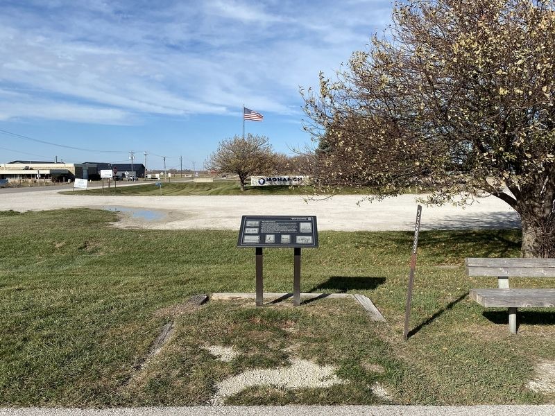
On R Avenue north of Highway 6 (U.S. 6), on the right when traveling north.
At one time the community of Ortonville included a cafe and grocery store, gasoline station, elevator, post office, stockyard and two telephone companies. Ortonville was named after the Orton family, who moved to this area in 1866.
Hiram Orton, . . . — — Map (db m236585) HM
On J Avenue (County Route P58) at 240th Street (Iowa Highway 44), on the right when traveling south on J Avenue.
The community of Panther was located where you are currently standing. In the late 1800s, three buildings stood on this site: a blacksmith shop, a tin shop, and a general store. As Panther continued to grow, a creamery and post office also served . . . — — Map (db m30809) HM
Near Old Highway 6 0.5 miles east of Panther Creek Road, on the right when traveling east.
Panther Creek Cemetery has a long and notable place in history dating back to the early settlement of Dallas County. The first recorded burial was that of Benjamin Van Cleave in 1854. Records show the land for the cemetery was purchased from the . . . — — Map (db m237718) HM
On Estates Way at Homestead Drive, in the median on Estates Way.
Dedicated to the original homestead families and their descendants. Brought to fruition through the efforts of the U.S. Government, the Franklin Roosevelt, MGSR. Luigi Ligutti and the Grace of God. In commemoration of the 50th anniversary of the . . . — — Map (db m83950) HM
On First Street north of Omaha Street, on the right when traveling north.
John Brown's Last Iowa Trip 1859
On February 16, 1859 John Brown, with twelve men, women, and children escaping slavery from Missouri, plus his own men, stopped near here at the farm of Jonathan M. Murray.
Murray, a fifty-five . . . — — Map (db m236587) HM
Near Interstate 80 at milepost 119, 1.9 miles east of Ute Avenue (County Road R22), on the right when traveling east. Reported permanently removed.
The fork of the Des Moines and Raccoon Rivers was recognized as an ideal site a military post as early 1834. Fort Des Moines was established in 1843, but was abandoned in 1846 following the treaty whereby the Sauk and Mesquakie Indians relinquished . . . — — Map (db m33004) HM
Near North 10th Street north of Hickman Road (U.S. 6), on the right when traveling north.
Waukee History
Adapted from "The Road to Waukee's Future" By Deborah Mikelson (Originally published in the July 2014 issue of myWaukee Magazine)
Looking Back-The Very Beginning
The first people to lay the cornerstone for . . . — — Map (db m236582) HM
Near 68th Street at Beechtree Drive, on the right when traveling south.
The son of a Kentucky frontiersman, Lincoln had to struggle for a living and for learning. Five months before receiving his party's nomination for President, he sketched his life:
"I was born February 12, 1809, in Hardin County, Kentucky. My . . . — — Map (db m292004) HM
Near 68th Street at Beechtree Drive, on the right when traveling south.
On April 30, 1789, George Washington, standing on the balcony of Federal Hall on Wall Street in New York, took his oath of office as the first President of the United States.
Born in 1732, into a Virginia planter family, he learned the morals, . . . — — Map (db m292002) HM
Near 68th Street at Beechtree Drive, on the right when traveling south.
On February 6, 1911, Ronald Wilson Reagan was born to Nelle and John Reagan in Tampico, Illinois. He attended high school in nearby Dixon and then worked his way through Eureka College. There, he studied economics and sociology, played on the . . . — — Map (db m292005) HM
Near 68th Street at Beechtree Drive, on the right when traveling south.
Author of the Declaration of Independence and the Statute of Virginia for Religious Freedom, third president of the United States, and founder of the University of Virginia — voiced the aspirations of a new America as no other individual of his era. . . . — — Map (db m292003) HM
On Railroad Street near High Street, on the left when traveling east.
Kellogg Garden Club established in 1945 commemorated Iowa’s 150th Anniversary of statehood with the planting of the common Chokecherry (Prunus Virginiana) a native Iowa tree. — — Map (db m44830) HM
On County Hwy F48 (County Route F48) at West 2nd Street North, on the right when traveling west on County Hwy F48.
The Plaque was mounted on 1928 WW I Monument. This monument is dedicated to the Veterans of the United States of America, July 4, 1994. Honoring Jasper County Men who served in the World War. — — Map (db m44831) HM
On John Wayne Drive at Jefferson Street, on the right when traveling north on John Wayne Drive.
The Winterset Savings Bank was established in 1902 and moved into this building in 1914. Sam C. Smith's law office was also in this building, and he served as the bank president for a period dating from 1926.
This building served as City Hall . . . — — Map (db m72518) HM
On John Wayne Drive at Court Avenue, on the right when traveling north on John Wayne Drive.
In the early 1850's this was the site of Winterset's first hotel. Berger's Hotel was a story-and-a-half log cabin that soon became a stagecoach stop.
Later known as the Bare Block, this building has had many businesses: several grocery stores, . . . — — Map (db m72680) HM
On 1st Avenue at Court Avenue, on the left when traveling north on 1st Avenue.
Before the current building was erected, boots and shoes were sold in a wood frame building on this site. Later, it became a harness shop. This brick building, built by C.D. Bevington, was originally known as the Bevington Block. It initially . . . — — Map (db m72773) HM
On Court Avenue at 1st Avenue, on the left when traveling west on Court Avenue.
This is the sole pre-Civil War commercial building that remains on the square. This building illustrates the art of the stone cutter as practiced in the 1850's and 1860's using native limestone.
Originally, this building was a tannery. Hides . . . — — Map (db m72771) HM
On John Wayne Drive near Court Avenue, on the right when traveling north.
This is one of the few one-story buildings around the square. Uses of this building include a grocery store, a confectionary, restaurants, including the Club Cafe, a health food and gift shop. For many years there was a bus stop on this end of . . . — — Map (db m72676) HM
On John Wayne Drive north of Court Avenue, on the right when traveling north.
Businesses in this building have included dry goods, boots and shoes, millinery, appliances, and health foods.
At one time the U.S. Department of Agriculture Soil Conservation Service had offices upstairs.
A Sears Catalog Store operated . . . — — Map (db m72674) HM
On John Wayne Drive at Jefferson Street, on the right when traveling north on John Wayne Drive.
Prior to the construction of this brick building Kerr and Boyd operated a grocery store here. They advertised "Staple and Fancy Groceries" as early as 1874. When Mr. Boyd retired, and Kerr's son joined him, the letter "d" in Boyd was painted over . . . — — Map (db m72519) HM
On 1st Avenue north of Court Avenue, on the left when traveling north.
In 1886, groceries and boots and shoes were sold in this building. In the 1890's, the first floor was a dry goods store with a printing shop on the second floor. The Graham's Store expanded into this building in 1918. After Graham's closed, the . . . — — Map (db m72774) HM
On John Wayne Drive north of Court Avenue, on the right when traveling north.
In the early 1870s the City Bakery operated here in a wooden structure. This brick building was used by farm implement dealers in the late 1800s. In 1907 it was a grocery/meat market, and motion pictures were shown here in 1916.
By the 1930s . . . — — Map (db m72671) HM
On 1st Avenue north of Court Avenue, on the left when traveling north.
From the 1870's through 1890's, groceries were sold on the main floor. In 1874, S.B. Wheelock advertised among other things, oranges, lemons, cigars, parlor brooms, boneless cod fish and candy. That year, Wheelock received a new delivery wagon . . . — — Map (db m72775) HM
On John Wayne Drive north of Court Avenue, on the right when traveling north.
1n 1886 there was a restaurant in the north side of the original building and a harness shop in the south side. A dry goods store in the north side and a jewelry store in the south side occupied the double store building in 1899. The Evening Star . . . — — Map (db m72533) HM
On 1st Avenue north of Court Avenue, on the left when traveling north.
The original use of this building was a bank on the main floor and law offices on the second level. It also housed dry goods and groceries, several bakeries, a women's clothing store, a decorating business, a print shop, a consulting firm, and a . . . — — Map (db m72776) HM
On 1st Avenue north of Court Avenue, on the left when traveling north.
T.S. Mardis constructed this building and most of the brick structures facing the square. Dry goods and boots and shoes were sold here in the 1880's. By the 1890's the first floor was a hardware store with a tin shop in the back. For the next 60 . . . — — Map (db m72803) HM
On John Wayne Drive south of Jefferson Street, on the right when traveling north.
Uses of this building include a bakery*, a harness shop, a grocery, a pool hall, a Coast to Coast store, and a law office.
The double store front was replaced after this building suffered fire damage in 1968.
*As with many bakeries of the . . . — — Map (db m72532) HM
On 1st Avenue north of Court Avenue, on the left when traveling north.
Over the years, this building has housed several businesses including "furnishing goods," a tailor shop, a piano store, a jewelry store, a bank, and an abstract office.
In 1864, the post office was in a wooden structure on this lot.
For . . . — — Map (db m72804) HM
On John Wayne Drive south of Jefferson Street, on the right when traveling north.
This building's uses have included a boot and shoe shop, a meat market, a second hand furniture store, a dry cleaner, a Coast to Coast store, restaurants, a fitness center, and a quilt supply mail-order business.
In 1886 a shoemaker had a shop . . . — — Map (db m72531) HM
On 1st Avenue north of Court Avenue, on the left when traveling north.
Clothing stores were operated from this building for over 100 years. Most of the merchants sold only men's clothing except Oliver's which sold women's clothing. Names of the business owners were Hadley, McMillan, Garrett, Rowe, Wright, and Oliver. . . . — — Map (db m72806) HM
On John Wayne Drive south of Jefferson Street, on the right when traveling north.
Under various owners, this building was used for furniture & undertaking, which was a popular business combination in the late 1800's and early 1900's. In 1963 this became the Iowa State University Extension Service office.
On this site circa . . . — — Map (db m72530) HM
On 1st Avenue north of Court Avenue, on the left when traveling north.
Before the present brick building was built, Atkison & Hutchings Real Estate Agents, the Amazon Refreshment Stand, a market, and a U.S. Express office were tenants in a small wood frame building that stood on this lot. The current building housed a . . . — — Map (db m72807) HM
On John Wayne Drive south of Jefferson Street, on the right when traveling north.
Businesses in this building have included: a barber shop, a confectionary, a general store, a meat market, a hardware store, an appliance store, a carpet store, and a bakery.
Rows of nails were hammered into the wood floor and used to measure . . . — — Map (db m72529) HM
On 1st Avenue north of Court Avenue, on the left when traveling north.
South building -
A pharmacy has been in this brick building since it was built. Lloyd Montross purchased the pharmacy and the building in 1921. His son, George, bought into the business in 1940 and was responsible for the additions to the . . . — — Map (db m72808) HM
On John Wayne Drive south of Jefferson Street, on the right when traveling north.
This building was originally one story. It served as a meat market and then the Ideal Restaurant for a few years. Upon completion of the second story, the building became a theater and live vaudeville performances were held on stage.
In 1916, . . . — — Map (db m72528) HM
On 1st Avenue at Jefferson Street, on the left when traveling north on 1st Avenue.
In 1869, a wood frame building stood on this lot, serving as a book store and the post office. The current brick building has housed a general store, a men's clothing store, and a chiropractic office in the front section of the main floor. From . . . — — Map (db m72811) HM
On Jefferson Street at 1st Avenue, on the right when traveling west on Jefferson Street.
In the Civil War days, the county jail stood here. It was a two story log cabin and was entered on the second floor, by an exterior stairway. Two banks occupied the first floor of the current building; Citizens National Bank, and later First . . . — — Map (db m72467) HM
On Court Avenue at 1st Avenue, on the left when traveling west on Court Avenue.
This building is made of native limestone. Some of the businesses that have been in the building include a hardware and a tin shop, a bank, a travel agency, and an advertising circular.
During World War II, the Selective Service office was in . . . — — Map (db m72770) HM
On Jefferson Street west of John Wayne Drive, on the right when traveling west.
Grocery stores operated here in the late 1800's. By 1907, a bakery with an oven in the basement had been added, as well as a jewelry store. It later became a hardware store with a tin shop in the rear. A pool hall, a farm and auto parts store, . . . — — Map (db m72470) HM
On Court Avenue west of John Wayne Drive, on the left when traveling west.
Entrepreneur Edward Jones ran a general store on this property for several years in the mid-1800s. By 1871, he took on a partner, M. R. Tidrick, and then moved on to other ventures.
The Tidrick-Terrill Company owned and operated several . . . — — Map (db m72758) HM
On Jefferson Street west of John Wayne Drive, on the right when traveling west.
This lot, including the land west to the corner, was purchased for $22 dollars in 1849. From the mid-1880's until the early 1900's, O.D. Ames, then Joeckel Bros. Clothing stores were located in this building. Later, the John Catterlin Harness & . . . — — Map (db m72471) HM
On Court Avenue west of John Wayne Drive, on the left when traveling west.
This building and the structure to the west were owned and operated by the Tidrick-Terrill Company in the late 1800s. Their furniture store occupied this building for many years. An elevator in the back of the building was shared by the company's . . . — — Map (db m72757) HM
On Jefferson Street west of John Wayne Drive, on the right when traveling west.
In its early days, this building housed businesses selling jewelry, stationery and then drugs. A Gambels Store conducted business here from the 1930's until 1971 when Alexander Fabrics acquired the building and operated until 1996. It has also . . . — — Map (db m72472) HM
On Court Avenue west of John Wayne Drive, on the left when traveling west.
In 1857 a single story wood frame structure was built on this property. The building was divided into two 12' wide stores, each with its own front door. For 30 years a jewelry business, which also sold organs, clocks, silverware and spectacles, . . . — — Map (db m72756) HM
On Jefferson Street west of John Wayne Drive, on the right when traveling west.
Drugs and Jewelry were sold from the wood frame building that originally stood here. The current building housed a succession of shoe stores for more than 100 years. Proprietors were Aikens, Allen, Stevens, and Hendricks.
In the early 1900's, . . . — — Map (db m72473) HM
On Court Avenue west of John Wayne Drive, on the left when traveling west.
Although this building appears to be one storefront, there are actually two separate buildings, and their histories intertwine. C. W. Eastman's Big Store first occupied this double storefront where dry goods were sold.
The Knights of Pythias . . . — — Map (db m72755) HM
On Jefferson Street west of John Wayne Drive, on the right when traveling west.
Eli Cox, builder of several local covered bridges, had the contract to build this structure. During the construction, gas pipes were incorporated in anticipation of soon having a source for lighting. The Opera House was originally on the second . . . — — Map (db m72475) HM
On Jefferson Street west of John Wayne Drive, on the right when traveling west.
Local covered bridge builder Eli Cox was the contractor for this building. Businesses have included dry goods, a harness shop, a bootery, a millinery, and an electric shop. The North Side Barber Shop has served Winterset's men since the 1930's. . . . — — Map (db m72509) HM
On Court Avenue west of John Wayne Drive, on the left when traveling west.
This building housed a general store in 1886, a clothing shop in 1893, and boots and shoes were sold here in 1907. By 1916 it was a grocery store.
The Western Auto Store was located here from the 1920s until the early 1960s when, in need of . . . — — Map (db m72741) HM
On Jefferson Street west of John Wayne Drive, on the right when traveling west.
In the 1800's, agricultural implements were sold here. The Marsh Harvester advertised that "it saves the house-wife the unpleasant drudgery of providing for extra help, during the hottest season of the year" implying that extra farm hands would . . . — — Map (db m72510) HM
On Court Avenue west of John Wayne Drive, on the left when traveling west.
John Wayne's father, Clyde Morrison, worked for Smith Drug Store in this building around 1905-1910. Earlier records indicate the building housed a harness shop, a hardware store and a tin shop as well.
In 1916, a jewelry store occupied this . . . — — Map (db m72740) HM
On Jefferson Street west of John Wayne Drive, on the right when traveling west.
In 1874, in a wood frame building on this lot, Ho Cheung, a Chinese immigrant, ran A.R. Shong & Co., importers and dealers of tea and coffee. They also manufactured cigars and sold tobacco. The City Bakery was here in 1875. From 1885 through the . . . — — Map (db m72511) HM
On Court Avenue west of John Wayne Drive, on the left when traveling west.
This building was a hardware store in 1886. In the early 1900s H. N. Shaw moved his dry goods store from the west side of the square to this site.
From 1931 to 1997 the J. C. Penney department store was in business here. An advertisement that . . . — — Map (db m72738) HM
On John Wayne Drive at Court Avenue, on the right when traveling south on John Wayne Drive.
This building is constructed of locally made soft bricks and originally housed three separate businesses. The east section was home to a variety of grocery stores, a jewelry store, a Skelgas appliance store, and a plumbing and heating business. . . . — — Map (db m72730) HM
On Jefferson Street at John Wayne Drive, on the right when traveling west on Jefferson Street.
This middle section of the building has been occupied by a bakery, drug stores, a pool hall, a dry cleaner, an engineering firm, and restaurants, including the Black and White Restaurant and the China Cafe.
In earlier years, the second floor . . . — — Map (db m72516) HM
On John Wayne Drive at Jefferson Street, on the left when traveling north on John Wayne Drive.
In 1864 this was the site of Irish immigrant Andrew Crawford's wood-frame grocery store.
This building was erected with one main facade for three stores. Notice the matching second-story windows.
Some of the businesses housed in the east . . . — — Map (db m72517) HM
On Court Avenue at 2nd Avenue, on the left when traveling west on Court Avenue.
Built in 1903 and used as the Public Library from 1905 to 2001
Renovated in 2002 and reopened as City Hall in 2003
In Memoriam
Dr. Charles D. Bevington
Born January 13, 1826 Died November 13, 1903
Resident of Winterset since 1853 . . . — — Map (db m72688) HM
On Cedar Bridge Road 1.8 miles north of Iowa Highway 92, on the left when traveling north.
Original Built: 1883
By: H.P. Jones
Replica Built: 2004
By: Herberger Construction Company
Type: Covered Timber Town Lattice Truss
Overlaid by a Queenpost Frame
Size: 130 feet (66 ft truss with an 42.5 ft approach to the south
and a . . . — — Map (db m78220) HM
On South 9th Street, on the right when traveling south.
Designed and built by Eli Cox.
Length: 79 feet Weight: 40 ton.
Covered timber superstructure, towne lattice truss with overlay queenpost frame, fastened with round wooden pins and iron bolts.
Originally located 18 miles N.E. of Winterset, . . . — — Map (db m23170) HM
On West Washington Street at South 1st Avenue, on the left when traveling west on West Washington Street.
Born Oct. 5th 1897 Died July 1st 1978 Lt. Commander US Navy Res.
Legendary art conservationist George Stout was born in Winterset, Iowa and graduated from Winterset High School in 1915. After 2 years at Grinnell College, he served overseas for 2 . . . — — Map (db m193900) HM
On Hogback Bridge Road, on the left when traveling north.
Built: 1884
By: Benton Jones
Type: Covered Timber Town Lattice Truss
overlaid by a Queenpost Frame
Size: 160 feet (98 ft truss with two 62 ft
approaches) x 15 feet wide
Jones was responsible for the last all-timber truss built in the . . . — — Map (db m72410) HM
On East Washington Street at South 2nd Street, on the right when traveling east on East Washington Street.
The Madison County Freedom Rock, located here in Winterset, was dedicated on Saturday, August 26, 2017, by American Legion Winterset Green Rogers Post 184 and VFW Winterset Post 8142. Ray "Bubba" Sorensen of Greenfield, Iowa, is painting a Freedom . . . — — Map (db m177142) HM WM
On Holliwell Bridge Road, on the right when traveling east.
[Historical excerpts from marker]
The Middle River has its origin in south-central Guthrie County. However, the navigable section of Middle River begins in east-central Adair County near Middle River Forest County Park. Middle River is a . . . — — Map (db m72408) HM
On Elderberry Avenue south of Roseman Bridge Road, on the right when traveling south.
[Historical excerpts from marker]
The Middle River has its origin in south-central Guthrie County. However, the navigable section of Middle River begins in east-central Adair County near Middle River Forest County Park. Middle River is a . . . — — Map (db m72439) HM
On North River School Street west of Knoll Lane, on the right when traveling west.
Restored by
Madison County Historical Society, Inc.
1962 - 1973
Placed on
National Register of Historic Places
by the U.S. Dept. of Interior
April 22, 1977 — — Map (db m72411) HM
On Elderberry Avenue south of Roseman Bridge Road, on the right when traveling south.
Built: 1883
By: Benton Jones & G.K. Foster
Type: Covered Timber Town Lattice Truss overlaid by a Queenpost Frame
Size: 225 feet (104 ft truss with an 88 ft approach to the south and a 33 ft approach to the north) x 15.4 feet . . . — — Map (db m286882) HM
To
commemorate
the discovery in
Madison County, Iowa
of a variety of apple
by
Jesse Hiatt A.D. 1872
and
called by him
The Hawkeye
Sole right to propagate
acquired by
C.M. Stark A.D. 1894
and by him . . . — — Map (db m78219) HM
On East Court Avenue 0.1 miles north of North Second Street, on the right when traveling west.
The grateful public dedicate this marble column to the Patriotic Dead who fell during the Great Rebellion this monument is gratefully erected to the soldiers of Madison County who gave their lives for their Country — — Map (db m23107) WM
On East Summit Street south of South 4th Street, on the right when traveling east.
Dedicated to the memory of the
following men who gave the supreme
sacrifice in the defence of their country
World War II
Dale E. Bell • Harold Bloomquist • Edward Briggie • Edward Butcher • Ross Chickering • George Clark • Scott . . . — — Map (db m23148) WM
On East Summit Street 0.1 miles south of South Fourth Street, on the right when traveling east.
[Main Memorial:]
Erected by the people of Madison County, Iowa, as a grateful tribute to the memory of its soldiers and sailors.
[Red Granite Cemetery Assocation marker]:
This plot of ground was donated by the Cemetery . . . — — Map (db m23157) HM
On Northwest 86th Street at Clark Street, on the right when traveling north on Northwest 86th Street.
Prairie Engine recalls the early days of the railroad and its importance in the development of Clive. The sculpture conveys the power and movement of a by-gone era and historically connects Clive's past to its present.
The deep brown . . . — — Map (db m236237) HM
Near Northwest 86th Street 0.2 miles south of Swanson Boulevard, on the right when traveling south.
On this day, Walnut Creek rose out of its banks reaching a record crest of 13.41 feet (flood stage is 12 feet). The flooding followed two storms that moved through portions of Iowa sending several river systems above flood stage and 5 inches of rain . . . — — Map (db m236235) HM
The Owen's Covered Bridge was built around 1875 to span the North River, a tributary of the Des Moines River. This Howe Truss style bridge originally sat about 2.5 miles northeast of Carlisle where it formed part of a road from Martins Ferry to . . . — — Map (db m236539) HM
On 2nd Avenue at Grand Avenue, on the right when traveling north on 2nd Avenue.
Initiated by the Iowa National Bar Association, the public art project A Monumental Journey honors the courage and legacy of African-American lawyers who founded the National Bar Association (NBA) in Des Moines in 1925. Black American attorneys . . . — — Map (db m256536) HM
On SW 1st Street at West Martin Luther King Parkway, on the left when traveling north on SW 1st Street.
Fort Des Moines No. 2
Established May 1843 — Evacuated March 1846
This cabin is a memorial to the military outpost, Fort Des Moines No. 2, occupied by Company I, First Regiment U. S. Dragoons and Company F First U. S. Infantry. The . . . — — Map (db m84100) HM
On Locust Street at 7th Street, on the right when traveling east on Locust Street.
At this site where Katz Drug Store once stood, on July 7, 1948, at 3:45 p.m., Edna Griffin, her infant daughter Phyllis, John Bibbs, and Leonard Hudson entered the store and ordered ice cream at the lunch counter. The manager refused to serve . . . — — Map (db m292945) HM
For a time in 1955, the Bruins were managed by Pepper Martin. Pepper Martin was a colorful ball player who was called the "Wild Horse of the Osage". He played for the "Gashouse Gang", as the 1930's St. Louis Cardinals were called. He was the hero of . . . — — Map (db m256343) HM
In 1906, the Des Moines team renamed themselves the Champions, in honor of their 1905 crown. The club lived up to the difficulties inherent with such a choice by winning the pennant with ease. The team sported a 97-50, .660 record, a full 23 games . . . — — Map (db m256437) HM
The Demons were the league champions in both 1925 and 1926. In 1926 they just beat out the Oklahoma City Indians who claimed that other league teams "threw " their games with the Demons. League President Mike Sexton eventually cleared all parties. . . . — — Map (db m256414) HM
The Oaks became the Cubs in 1981. With the same name and logo, the Cubs are affiliated with the Chicago Cubs. The Chicago Cubs came about their name in 1902. Chicago newspapers gave them that nickname because of all the young players on the team. . . . — — Map (db m256374) HM
Cy Young Award and MVP winner Vida Blue pitched for the Oaks in 1970 and still owns the season strikeout record here at 165. With the Oakland A's he played on three World Series winning
teams, 1972-74. Vida Blue went on to be named a six time . . . — — Map (db m256382) HM
On Court Avenue at 4th Street, on the right when traveling west on Court Avenue.
Ronald W. Reagan was the 40th president of the United States. He held the office from January 1981 to January 1989. Born February 6, 1911 in Tampico, Illinois, Reagan grew up in nearby Dixon. Upon graduation from Eureka College in 1932, friends . . . — — Map (db m295046) HM
On Southwest Water Street south of West Martin Luther King Jr Parkway, on the right when traveling north.
Established in 1843
Evacuated in 1846
Erected by Abigail Adams Chapter of the Daughters of the American Revolution
Assisted by park commissioners and early settlers of Des Moines
Dedicated June 14, 1908 — — Map (db m236114) HM
On Pleasant Street at 9th Street, on the right when traveling east on Pleasant Street.
Project Partners
St. Paul's is grateful to many partners for their support of the Cathedral Rain Garden and Labyrinth. Special thank-yous go to the Iowa Department of Natural Resources, The Episcopal Diocese of Iowa, Trees Forever, . . . — — Map (db m289429) HM
On Pleasant Street west of 12th Street, on the right when traveling west.
Blank Children's Hospital stands here today because of the generosity of A.H. and Anna Blank. The Blanks were steadfast in their philanthropic mission to build a children's hospital in memory of their son, Raymond Blank. At the time, Iowa had the . . . — — Map (db m237713) HM
On Pleasant Street west of 12th Street, on the right when traveling west.
People lived and worked here. They shopped and prayed here. They gathered here to celebrate life. Welcome to what was Iowa's most vibrant Black community — the historic Center Street neighborhood, stretching from 15th Street to Keosauqua Way. . . . — — Map (db m235901) HM
The Iowa Commission for the Blind Building has been listed in the National Register of Historic Places by the United States Department of the Interior for the work of Dr. Kenneth Jernigan,
director of the commission from 1959-1978, who made . . . — — Map (db m256459) HM
On 4th Street north of Locust Street, on the left when traveling north.
The Savery Hotel has been placed on the National Register of Historic Places by the United States Department of the Interior - 1919 — — Map (db m256464) HM
Near University Avenue just west of 28th Street, on the right when traveling west.
The iconic Painted Street tradition has been associated with the Drake Relays since 1975. The event gathers hundreds of students and involves student organizations painting themed squares and ends with a festive paint fight. In the fall of 2018, . . . — — Map (db m193850) HM
180 entries matched your criteria. The first 100 are listed above. The final 80 ⊳