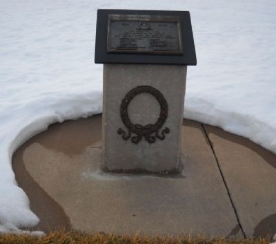
Near West 87th Street 0.2 miles west of Penner Road.
1941 - 1945
(picture of star, wreath, and ribbon)
The people of De Soto
pays homage to the memory
of these Valiants who gave the last
full measure of devotion to their Country
Lawrence W. Cauldwell • Wm. G. Land • Earl . . . — — Map (db m26568) WM
Near U.S. 56 at West 183rd Street, on the right when traveling west.
Heavy freight wagons lumbering to and from New Mexico, and emigrant families and gold seekers heading west to Oregon and California all shared this route from Independence and Kansas City. The trails split here at Gardner Junction.
Preserving . . . — — Map (db m131353) HM
Near U.S. 56 at West 183rd Street, on the right when traveling west.
From the late 1820s to the 1870s, an estimated 300,000 fur traders, missionaries, settlers, and gold seekers followed these trails. In the 1840s and 1850s, emigrants from the eastern and central United States walked 2,000 miles from the Missouri . . . — — Map (db m131376) HM
Near U.S. 56 at West 183rd Street, on the right when traveling west.
Spanning 900 miles of the Great Plains between the United States (Missouri) and Mexico (Santa Fe), this great trail of commerce between two countries was also a route for the frontier military and emigration to the West. For 60 years, the trail was . . . — — Map (db m131377) HM
Near U.S. 56 at West 183rd Street, on the right when traveling west.
The Indian Removal Act of 1830 required that many American Indian Tribes in the eastern part of the United States be moved to the Great Plains Region west of the Missouri River — lands identified as the “Permanent Indian Frontier.” . . . — — Map (db m131313) HM
On Main Street (U.S. 56) west of Elm Street, on the right when traveling west.
A variety of shops have been located in this building: grocery store and warehouse, bakery, jewelry store, café, doctor's office, beauty shop, Miller's Barber Shop, a piano and furniture store, and the Dodge Sisters' Millinery Shop. — — Map (db m92569) HM
Near U.S. 56 at West 183rd Street, on the right when traveling west.
"This morning we passed the road to Oregon that leaves, about eight miles from Round Grove, the Santa Fe Road, and turns to the right towards the Kansas. A way post had been put there, marked "Road to Oregon." —Dr. Frederick A. . . . — — Map (db m131352) HM
Near U.S. 56 at West 183rd Street, on the right when traveling west.
"We took the Oregon road, instead of that to Santa Fe and went twelve miles before we discovered our error. In returning two of our wagons broke down, by which we were detained two days until July 4th. We at last got fairly on the Santa Fe . . . — — Map (db m131312) HM
Near U.S. 56 at West 183rd Street, on the right when traveling west.
Travel along the Oregon and California trails increased in the 1840s with the cry of “Westward Ho.” When the 1848 discovery of gold was made at Sutter’s Mill in California, the desire to reach the gold fields ahead of others intensified . . . — — Map (db m131310) HM
On Main Street 0.1 miles North Oak Street, on the right when traveling west.
Here US-56 lies directly on the route of the Oregon-California and Santa Fe trails. Nearby, the trails branched. On a rough sign pointing northwest were the words, "Road to Oregon." Another marker directed travelers southwest along the road to Santa . . . — — Map (db m21669) HM
On Elm Street south of Main Street (U.S. 56), on the right when traveling south.
Site of First Newspaper—The Gardner Gazette, Founded in 1889, First Drug Store—Est. 1867 and the Original location of Gardner State Bank 1906 — — Map (db m92570) HM
On Santa Fe Trail Drive west of Noland Road, on the left when traveling west.
Bradshaw Park honors the memory of the pioneer Bradshaw family headed by Charles A. and Sarah Bradshaw.
On May 25, 1869 they gave land to the Missouri River, Fort Scott, and Gulf Railroad for the establishment and maintenance of a railroad . . . — — Map (db m83099) HM
If not for Bob and Dorothy Rose, Lenexa might never have established the city's beloved and most-used Sar-Ko-Par Trails Park.
The Roses - originally hailing from Madison, Wisconsin - bought a 50-acre farm at 87th Street and Lackman Road . . . — — Map (db m312504) HM
Section Crews
Section crews were responsible for maintaining the railways. These crews replaced ties and installed new tracks and spikes to keep the route smooth and usable. The crews were responsible for 10-15 miles of track.
These . . . — — Map (db m312506) HM
Near West 87th Street Parkway east of Lackman Road.
Adam Legler: An Immigrant Journey
Adam Legler and his family came from Switzerland in 1845. They landed at the Port of New Orleans and settled in St. Louis County, MO. Adam became a citizen and served in the U.S. Army. In 1861, they moved . . . — — Map (db m312501) HM
Establishing the Foundation
Depots connected small communities to larger markets, which created growth in rural Johnson County in the late 1800s. Squire Charles A. Bradshaw and his wife Sarah knew that a depot in Lenexa would promote . . . — — Map (db m312347) HM
A two-person crew watched the movements and operations of the train from the caboose. One was a brakeman and the other a conductor. The caboose also served as the living space for the workers. It had a small kitchen with a stove, restroom, heater . . . — — Map (db m312340) HM
Near West 87th Street Parkway east of Lackman Road.
The wait station was located on the John Wiedenmann farm in the Morrison Ridge area (present day 53rd and Lamar Avenue in Overland Park, KS). The wait station was part of the Strang Line Interurban Railway. The station was moved to the Piercy farm . . . — — Map (db m312335) HM
In the early 1900s, David Legler sold his land at the southwest corner of Haskins and Walnut streets to the City. The bandstand was built in this first city park, so residents could have a central gathering place. Residents enjoyed coming . . . — — Map (db m312334) HM
Near West 87th Street Parkway east of Lackman Road.
Gardens were important to early settlers because of limited places to purchase produce and other goods. Settlers needed to grow their own food to survive. Each generation taught the next how to garden and prepare food for storage. This garden . . . — — Map (db m312493) HM
History of Lenexa's Skate Park
The original city skate park located here opened in 2002. It was built after a local group of teens came together to ask the governing body to build a skate park. Community input was gathered on this request . . . — — Map (db m312491) HM
On Johnson County 0.1 miles west of Campbell Street, on the left.
In 1864 David Gee Campbell finally found his safe haven at this site, after dodging threats from the Missourians and danger from Quantrill's raiders in Shawnee.
This valley reminded Campbell of his Tennessee home and his Scottish roots. . . . — — Map (db m51344) HM
A pioneer and leader in the development of the Johnson County area, Merriam has recorded several "firsts."
Prior to the incorporation of Overland Park in 1950, Merriam was home to the county's first high school, then known as Shawnee Mission . . . — — Map (db m50603) HM
Today, Merriam is a vibrant community boasting a mix of commercial, industrial, and residential districts. Merriam residents enjoy established neighborhoods, diverse cultures, a full range of municipal services, plentiful parks, and strong . . . — — Map (db m50608) HM
From 1837 to 1869 the Quaker Mission educated the children from area Indian settlements. The early settlers of Campbellton sent their children to the Hickory Grove School, which was located near present day Shawnee Mission North High School.
As . . . — — Map (db m50579) HM
On West 51st Street 0.1 miles west of Grandview Avenue, on the left when traveling west.
Esther E. Brown organized citizen support in South Park for litigation leading to the 1949 Kansas Supreme Court order admitting black children to the South Park School and to nearby high schools. Her actions encouraged similar litigation resulting . . . — — Map (db m20606) HM
Although Merriam is one of the oldest communities in the area, it was unincorporated for much of its history. When the county was created, it was divided into several smaller segments called townships. Merriam is placed on the boundary of Shawnee . . . — — Map (db m50587) HM
On Kessler Lane near West 57th Street, on the left when traveling north.
The original limestone building, was built in 1911. The two brick additions were added in 1938 and 1951. Merriam School housed elementary and high school students until 1922, when the high school students began attending Shawnee Mission Rural High . . . — — Map (db m46863) HM
On East Frontage Road (Interstate 35 Frontage Road) at Eby Avenue, on the right when traveling west on East Frontage Road.
President Ulysses S. Grant dedicated a spectacular park on this site on July 1, 1880. Built by the Ft. Scott & Gulf Railroad and designed by the famed landscape architect George Kessler, the park covered 40 acres from Shawnee Mission Parkway to . . . — — Map (db m20599) HM
With Kansas City becoming a focal point of trade and transportation, the Fort Scott and Gulf Railroad company saw the need for an amusement park to entertain the booming population in the area. The company purchased forty acres to establish Merriam . . . — — Map (db m46898) HM
Religious missionaries of nearly all denominations were present throughout Indian settlements as early as the 1680’s. Missionaries were intent on converting the Native Americans to Christianity. Quakers (The Society of Friends) had worked among the . . . — — Map (db m46855) HM
On 63rd Terrace 0.1 miles west of Carter Avenue, on the right when traveling west.
In 1825 the Federal government began moving Eastern Indians to new lands west of the Mississippi. This sign is on a 2,500 square mile tract assigned to the Shawnees.
With this tribe came Methodist, Baptist and Quaker missionaries. One mile . . . — — Map (db m20906) HM
The Bear Pit Bronze sculpture by artist Kwan Wu. Dedicated and installed 2006.
This sculpture by artist Kwan Wu represents the City of Merriam's first public sculpture installation. The mother bear and cubs celebrate one of the most popular . . . — — Map (db m46906) HM
With the opening of the Kansas Territory in 1854, people from everywhere began to converge on Kansas. The fertile and inexpensive land available in the territory attracted David Gee Campbell, a Tennessee native. Campbell loaded his wife and their . . . — — Map (db m46857) HM
Historic Frontier Trails cut through the territory now known as Merriam. Hundreds of thousands of people emigrated [sic – immigrated] to the western frontiers along the Oregon and California Trails. The Santa Fe, Oregon and California Trails . . . — — Map (db m46856) HM
From the late 1600’s until the early 1800’s, the Kansa (or Kaw) Indians lived in northeast Kansas. The Indian word Kansa means “People of the South Wind,” and both the state of Kansas and the Kansas River take their name from this . . . — — Map (db m46854) HM
The community of South Park, Kansas was founded in 1887 as an integrated community. By 1900, four black families had settled in the town of 250 residents. South Park continued to grow and became a part of Merriam when it incorporated in 1950.
In . . . — — Map (db m50583) HM
A few years after the closure of Merriam Park, Richard Weaver Hocker developed the second largest amusement park in Merriam. Named Hocker Grove after its founder, the park was established in 1907 and remained in existence until 1919.
Again, . . . — — Map (db m46902) HM
On East Poplar Street at North Kansas City Road, on the right when traveling west on East Poplar Street.
Founded in 1857, Olathe was strategically located on the Santa Fe Trail. In the era of horsepower, the new town was a day's journey from Independence, Missouri. As time passed, Olathe's population and commerce grew, and a faster connection with . . . — — Map (db m20270) HM
Conceptualized by Heart of America's own Craig Shannon and Mike Whalen, "Wheels of Progress" represents the evolution of transportation depicted by 4 giant wheels. One in stone to symbolize the prehistoric era, one in wood to symbolize the middle . . . — — Map (db m99462) HM
The Lone Elm Campground
The land here at Lone Elm met the three requirements for a stopover for travelers on the trail...wood, water, and grass. Wood for campfires and wagon repairs, water for the support of people and animals, and grass for . . . — — Map (db m34342) HM
This barn is thought to be the oldest structure standing on the Mahaffie farm. While the siding was replaced at least twice, the frame underneath probably dates to about 1860, when the Mahaffies established the farm and their first home. In 2009, . . . — — Map (db m34542) HM
On Kansas Avenue north of Park Avenue, on the right when traveling north.
Beneath this stone is buried a capsule containing papers and items used in celebrating the American Revolution Bicentennial in Johnson County, Kansas. Placed on this Thanksgiving Eve November 24, 1976 A.D. by the Johnson County Bicentennial . . . — — Map (db m69376) HM
According to the agricultural census of that year, Beatty Mahaffie produced 2000 bushels of corn on this farm in 1865. The average Johnson County farm produced 667 bushels. This small field is slightly less than one acre in size. With forty bushels . . . — — Map (db m34460) HM
On Kansas Avenue at Park Street, on the right when traveling north on Kansas Avenue.
Perhaps the greatest test of the pioneers' spirit was the loss of children like Asa Smith to the harsh and unforgiving elements of the frontier. His tiny marker stands today at the intersection of K-19 and K-7 Highways. It is joined by this . . . — — Map (db m69377) HM
On Old U.S. 56 0.1 miles east of West 151st Street, on the right when traveling west.
For over three decades starting in 1827, Elm Grove Campground, one mile east of near the bridge on Cedar Creek, was an important frontier camp site. Thousands of Santa Fe traders, Oregon and California emigrants, missionaries, mountain men, . . . — — Map (db m20093) HM
Stagecoaches carrying passengers of the Barlow and Sanderson stagecoach line pulled into the side yard of the house. This outside door led to the cellar of the house where Lucinda Mahaffie, her daughters, and hired help served meals to hungry . . . — — Map (db m34496) HM
Near South Harrison Street at East Old 56 Highway (Kansas Route 7).
Plaque on ground:
This monument honors, recognizes and serves Gold Star Families and the legacy of their Loved Ones who have paid the ultimate sacrifice while serving in the Armed Forces of the United States of America.
The Homeland . . . — — Map (db m312560) WM
On Santa Fe Drive at Cherry Street, on the right when traveling west on Santa Fe Drive.
Olathe captured the attention of the nation, and of the world, in 1970, 1971 and 1972, with four fund-raising drives to provide holiday furloughs for 28 Olathe servicemen then stationed in the Vietnam war zone.
Olathe was the first community . . . — — Map (db m69378) HM WM
J.B. Mahaffie is building, on his farm just east of town a large two story dwelling house.
Olathe Mirror - July 20, 1865
In 1857, James B. (Beatty) and Lucinda Mahaffie moved to Olathe from northern Indiana with four children. In . . . — — Map (db m34503) HM
On Lone Elm Park Drive, on the right when traveling south.
Lone Elm is one of the most historic and important frontier trail camp sites in America and was used as a campground and rendezvous point for all three of our nation's great western roads to the frontier.....the Santa Fe, Oregon, and California . . . — — Map (db m34334) HM
On Lone Elm Park Drive, on the right when traveling east.
"Travelers came to look upon it as an old friend - they felt an attachment for the tree that had so often sheltered and shaded them from storm and sun..."
W.W.H. Davis (1853)
Lone Elm Park was purchased by the City of Olathe in 2000 to . . . — — Map (db m34339) HM
On North Sunset Drive at East Kansas City Road, on the left when traveling north on North Sunset Drive.
James and Lucinda Mahaffie served stagecoach passengers and other travelers at this farm starting in 1858. The stone farmhouse was built in 1865. Today, Mahaffie Stagecoach & Farm Historic Site is the only stop left on the Santa Fe Trail that is . . . — — Map (db m312507) HM
The agricultural censuses for 1860, 1865, and 1870 make it clear that J.B. Mahaffie had one of the most valuable farming operations in the township.
In 1865, J.B. owned 570 acres of land, with 240 of them enclosed by fence. The total cash value . . . — — Map (db m34529) HM
Why does a race car driver pull into the pits, or a truck driver leave the highway to visit a truck stop? The Mahaffie stagecoach stop offered similar services.
Need repairs or new tires? The federal census for 1865 lists a "R. Vickard" - . . . — — Map (db m34546) HM
On Santa Fe Street 0.1 miles west of Kansas Avenue, on the right when traveling west.
"I am glad to get into Kansas again..."
President Franklin Delano Roosevelt ("FDR") told the audience in Syracuse, Kansas in 1936. The president was returning to Washington, D.C. after a campaign trip by train to Colorado. When he reached Olathe . . . — — Map (db m21671) HM
On Santa Fe Drive at Cherry Street, on the right when traveling west on Santa Fe Drive.
Robert R. Osborne - Olathe banker, businessman, and philanthropist, 1904-2001. His longstanding community leadership and unfailing support for those in need helped shape Olathe and its institutions. The art works in this plaza are intended to . . . — — Map (db m69380) HM
On East Kansas City Road, on the right when traveling west.
"These is a romance about the stage coach that will never die. Its jolly driver with his six-in-hand, the merry passenger with his jokes ans stories, and the stations along the road where we used to stretch our tired limbs will long linger like a . . . — — Map (db m20096) HM
Near South Harrison Street at East Old 56 Highway (Kansas Route 7).
This marker commemorates the men and women who achieved American independence. These Patriots, each believing in the noble cause of liberty, valiantly strove to found a new nation.
1775-1783 — — Map (db m312513) WM
The Santa Fe Trail
The Santa Fe Trail began in 1821 when William Becknell led a small group of men on a trading expedition from frontier Missouri to colonial Santa Fe. Mexico had recently declared its independence from Spain and abolished . . . — — Map (db m34340) HM
Stagecoach drivers were an interesting group by many accounts. Good drivers were sought by stagecoach companies for their skills in driving. They exercised authority similar to ship captains over their coaches and the passengers traveling with . . . — — Map (db m34507) HM
Near South Harrison Street at East Old 56 Highway (Kansas Route 7).
Plaque on top:
Memorial to Stanley T. Adams
B. May 2, 1922 D. April 19, 1999
Medal of Honor Recipient- Korean
Olathe, Kansas is proud to honor one of their own
Marker on ground
Citation: M/Sgt. Adams, Company A, . . . — — Map (db m312546) HM WM
Friends or business associates coming to call on the Mahaffie family used the front door of the house. Stagecoach passengers and other travelers used the side door to reach the dining hall in the cellar, and had no need to enter the private, family . . . — — Map (db m34504) HM
Near South Harrison Street at East Old 56 Highway (Kansas Route 7).
Front, top of base:
To all chaplains who ministered to those men and women who stood in harms way as sentinels of our freedom
Front, on base:
George L. Fox
George Fox was the oldest. Up in Vermont they called him "the . . . — — Map (db m312565) HM WM
The Travelers
For more than four decades, tens of thousands of travelers camped here. The Lone Elm campground was one or two nights out from the frontier "jumping off" points on the Missouri River. The great lone elm tree that gave this . . . — — Map (db m34355) HM
Our reproduction chicken coop is based on an original coop built in Missouri in the mid-1800s. The sloped gabled-ends provide a perfect place for the chickens to roost, and the doors underneath make it easy to clean out the building.
The . . . — — Map (db m34472) HM
In 1857, Newton Ainsworth claimed this land and allowed the trail travelers to continue camping here. A decade later, the railroads began to make their way west and the great overland trails became a part of history. The need for camping at Lone . . . — — Map (db m34357) HM
On Lone Elm Park Drive, on the left when traveling south.
The oxen and Conestoga wagon sculpture was originally commissioned in 1994 for use at the Kansas Visitors Center at 119th & Strang Line Road. When the Center closed in 2002 the sculpture was awarded to the City of Olathe. The sculpture has been . . . — — Map (db m34337) HM
Thanks to archaeological digs carried out in the early 1980s, we know that the Mahaffies' original smokehouse stood about 15 feet behind you, closer to the ice house.
Smokehouses, like ice houses, offered a way to preserve food. In the . . . — — Map (db m34549) HM
You are traveling in the path of countless men, women, and children who passed this very home in the 1860s! When you turned into the parking lot, you pulled off the Westport Route of the Santa Fe, Oregon, and California Trails. And now, you're . . . — — Map (db m34470) HM
Buck and Tip, the Mahaffie oxen, are four years old. They are accurately called "oxen" now that they have reached maturity. Until they reach four years of age, young oxen-in-training are properly referred to as working steers. Weighing in about . . . — — Map (db m34514) HM
On 80th Street at Santa Fe Drive, on the right when traveling west on 80th Street.
Images Art Gallery has proudly designed and painted this mural depicting "A Day on the Trail." The Santa Fe Trail was a two-way trail of commerce and cultural exchange between the United States and Mexico from 1821 to the 1870's. Oxen or mules . . . — — Map (db m99304) HM
On 80th Street at Santa Fe Drive, on the right when traveling west on 80th Street.
The Trip Ahead
The Santa Fe, Oregon, and California trails proved to be both challenging and exhilarating for the travelers in the caravans passing near here. Letters and diaries are filled with the adventures, excitement, and hardships . . . — — Map (db m99328) HM
On West 119th Street at Lowell Avenue, on the left when traveling west on West 119th Street.
Kansas honors her uniformed
sons and daughters
who answered their
country's call to
defend a country
they did not know
and a people they
had never met
Over a million and a half U.S. Soldiers
served in the Korean War, 1950-53. . . . — — Map (db m36725) WM
[Inset]
"from 'Sappling Grove' where there is an excellent fountain spring & a very good place to camp.. The road runs a little round on the high ridge."
The Santa Fe Trail began in 1821 when William Becknell and a small . . . — — Map (db m100228) HM
On Johnson Drive east of Newton Street, on the right when traveling east.
With the faith and courage of
their forefathers who made
possible the freedom of these
United States
The Boy Scouts of America
dedicate this replica of the
Statue of Liberty as a pledge
of everlasting fidelity and
loyalty . . . — — Map (db m93455) HM
On 151st Street, on the right when traveling east.
Both the Santa Fe and Oregon Trails crossed here, northeast to southwest, beginning 1821. The trails took separate courses farther west. A route through Kansas Territory was opened north of here in the 1830's after the founding of Westport, Mo. Long . . . — — Map (db m20213) HM
While S.R.H.S. was being built, classes were held in the Christian and Methodist churches - Grange Hall.
Charter Roll
SCHOOL BOARD TEACHERS
J.L. Chaney, R.H. Holmes, P.L. Kellogg - J.L. Stark, Principal; Amy Kincaid . . . — — Map (db m20786) HM
1095 entries matched your criteria. The first 100 are listed above. Next 100 ⊳