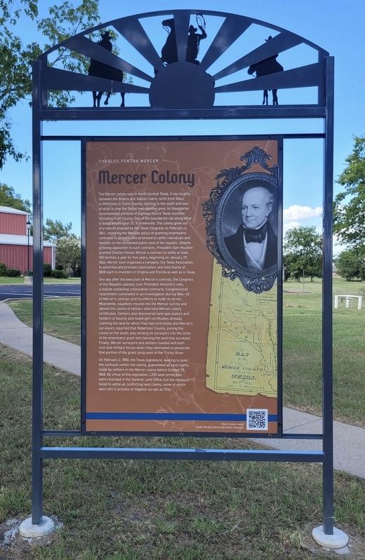
On Interstate 30 Frontage Road 0.2 miles west of Division Street, on the right when traveling west.
"Gone to Texas" was the popular slogan for settlers during the 1830s who immigrated from numerous countries and states to the newly formed Republic of Texas (1836-1846). Although the Republic of Texas struggled, the desire for vast amounts of cheap . . . — — Map (db m285487) HM
On Farm to Market Road 513 at County Road 1624, on the left when traveling north on Road 513. Reported missing.
Prominent Hunt County pioneer (1807-1865) Came to Texas 1840. Granted a 640-acre headright by Republic of Texas. Served as commissioner to organize county and locate county seat. First postmaster of Hooker's Mill settlement where he owned area's . . . — — Map (db m280289) HM
Near Moulton Street north of Marshall Street, on the left when traveling north.
Came to Texas from Virginia and settled in Hunt County in 1850s. In Confederate army, organized Texas Sharpshooters, called "Ben Martin's Company." First mayor of Greenville (present regime), 1873; helped draft Texas Constitution, 1875; state . . . — — Map (db m163994) HM
Near Marshall Street at Pine Street, on the right when traveling west.
First woman in Texas to hold an elective public office. Upon death of her first husband, E. W. Briscoe, she was appointed, April 17, 1902, by the Commissioners' Court to complete his term as clerk of Hunt County. At that time women could not vote . . . — — Map (db m201909) HM
On Interstate 30 Frontage Road 0.2 miles west of Division Street, on the right when traveling west.
In the nineteenth century, alcohol consumption in Hunt County was part of normal life. This practice came into question with the rise of the movement to ban the consumption of alcohol (the Temperance Movement). This, coupled with the growing . . . — — Map (db m282773) HM
On Interstate 30 Frontage Road 0.2 miles west of Division Street, on the right when traveling west.
In the aftermath of the Civil War, plans were enacted for the Reconstruction of the Union with the creation of the Freedmen's Bureau in 1865, and the passages of the Civil Rights Act of 1866 and the Reconstruction Act of 1867. Texas would not . . . — — Map (db m282770) HM
On Interstate 30 Frontage Road 0.2 miles west of Division Street, on the right when traveling west.
Before the railroad arrived in Hunt County, farmers and merchants drove their products to railheads or steamboat ports by ox-drawn wagons. Roads were mostly unpaved and would often turn muddy and impassable when wet. Cotton was too costly and too . . . — — Map (db m285485) HM
On Mill Street east of Bois d'Arc Street, on the right when traveling west.
Born near Atlanta, Georgia, in 1876, Mary Jim Morris moved to Greenville, Texas, in 1899 with her family. That summer, Mary received her teaching certificate from the hunt county normal school, locally known as the county teachers institute for . . . — — Map (db m164062) HM
On Washington Street at Oak Street, on the right when traveling east on Washington Street.
In 1846, the Texas legislature created Hunt County and specified that Greenville would be the name of the county seat, honoring Texas War for Independence veteran Thomas J. Green. Voters ultimately selected this location, on land donated by . . . — — Map (db m119714) HM
On South Patterson south of East Oak Street, on the left when traveling south.
Prominent early institutions. Henry College, founded in 1892 by educators Henry Bridges and Henry Eastman was reestablished and renamed in 1903 for writer Ralph Waldo Emerson. Closed 1907.
Other early colleges in Hunt County were Calhoun . . . — — Map (db m279983) HM
On Interstate 30 Frontage Road 0.2 miles west of Division Street, on the right when traveling west.
Secession was an issue that Hunt County residents did not agree on. The county vote on secession was close, 416 to 339, but ultimately secession won. Once the war started, hundreds of county men joined and fought in the war effort. Greenville raised . . . — — Map (db m282760) HM
On State Highway 90 at County Highway 106, on the left when traveling south on State Highway 90.
Alabama native Calvin Cullen Bullard (1824-1882) brought his family to this area from Hunt County, Texas, in 1867 and settled on 160 acres of land between Bedias Creek and Caney Creek. In their new home, he and his second wife, Zillah (Woodbury), . . . — — Map (db m157880) HM
On Interstate 30 Frontage Road 0.2 miles west of Division Street, on the right when traveling west.
William Rosenthal came to the U.S. from Poland in 1873. He eventually made his way to Greenville, where he opened a furniture store in the early 1920's.
William Rosenberg, born in Germany, owned a wholesale liquor business in Greenville but . . . — — Map (db m282812) HM
On U.S. 69 just east of County Road 3524, on the right when traveling north.
Four hundred years ago, the valleys and tributaries of the Ouachita, Red, Sabine, and Neches rivers in what is today northeast Texas, northwest Louisiana, southwest Arkansas, and southeast Oklahoma were home to ancestors of the people known . . . — — Map (db m201966) HM
On Interstate 30 Frontage Road 0.2 miles west of Division Street, on the right when traveling west.
While a county record-breaking 66,000 cotton bales were sold in 1950, by 1959 cotton farming had significantly decreased. The industrialization that occurred during the WWII years brought manufacturing jobs to the county, replacing many of the lost . . . — — Map (db m285488) HM
On Interstate 30 Frontage Road 0.2 miles west of Division Street, on the right when traveling west.
As baseball developed into "America's pastime"," Greenville residents participated in numerous short-lived small Texas league teams. From 1923-1926, Greenville fielded a segregated team in the East Texas baseball league known as the “Greenville . . . — — Map (db m284996) HM
The 1870 U. S. Census lists most area settlers as farmers from the upland south. One such family was that of Dr. Alexander Murchiso, who arrived from Polk county, Georgia. Through his efforts the Methodist church organized in Apr. 1871. In the . . . — — Map (db m164263) HM
On Farm to Market Road 513 at County Road 1624, on the left when traveling north on Road 513.
The Footstone below is in memory of Sgt. Christopher Columbus Neal, Co. E, 1st Battalion, Texas Sharpshooters. He enlisted as a Private in Hunt County, Tx. with Captain Benjamin Martin's 1st Texas Sharpshooters at the age of 30 on April 30, 1862. . . . — — Map (db m280291) HM WM
On Waul's Legion Road (County Road 51) 2 miles west of State Highway 36, on the right when traveling west.
In the spring of 1862 Thomas N. Waul (1813-1903) recruited men from Washington and the surrounding counties to form a legion for Confederate service. Composed of twelve infantry companies, six cavalry companies, and two artillery companies, the . . . — — Map (db m28314) HM
On Interstate 30 Frontage Road 0.2 miles west of Division Street, on the right when traveling west.
In the late 1850s, "Big" Jim Brigham bought his and his family's freedom from Robert Neyland, a planter who owned land in northeastern Hunt County. Brigham founded Neylandville, the first all-Black community in the county and the only known . . . — — Map (db m282811) HM
On McKinney Street (Business State Highway 78) at S Washington Street on McKinney Street.
Educator Gussie Nell Davis was a role model to many young girls and women through her creation of the first girls’ drill team in America. Born to Robert Augustus Davis and Mattie Lavinia (Callaway) Davis on November 4, 1906, she and her family . . . — — Map (db m309848) HM
On County Road 214 0.2 miles east of Highway 2481, on the right when traveling east.
A minister in the Primitive Baptist Church, the Rev. Henry Hurley came to Texas in 1844. His years in the state were spent organizing frontier churches and helping pioneers settle in new communities. He established churches in Hunt, Fannin and . . . — — Map (db m248536) HM
On U.S. 380 at County Road 2146, on the right when traveling east on U.S. 380.
Early travel artery. Followed the north boundary line of the Chas. F. Mercer colony, a 6,500-square-mile tract granted to Mercer in 1844 by Sam Houston (President of the Republic of Texas) for purpose of bringing colonists into Texas. Southern half . . . — — Map (db m119549) HM
On Lee Street at Wesley Street, on the right when traveling west on Lee Street.
As Civil War approached, north Texas was split over the idea of secession. While Hunt County narrowly endorsed seceding from the Union, a majority of voters in several nearby counties did not.
Greenville attorney and State Senator Martin D. . . . — — Map (db m280364) HM
On Lee Street at Johnson Street (State Road 34), on the right when traveling west on Lee Street.
The Hunt County Courthouse was built in 1929. The opening celebration on April 11, 1929 included the unveiling of the "living statuary' shown in this picture. Five Hunt County citizens, covered with flour to resemble stone statues, posed on the 3rd . . . — — Map (db m280322) HM
Near Bethel Road (County Route 3316) 0.4 miles east of Texas Highway 34, on the right when traveling east.
First Anglo-American born in Hunt County, then in Republic of Texas. Birthplace: on South Sulphur, near present Wolfe City. Son of John W. Lane, one of commissioners organizing county.
During Civil War, served in Confederate army. Later moved . . . — — Map (db m164065) HM
On U.S. 69 0.1 miles north of Farm to Market Road 3427, on the right when traveling north.
The Shields Brothers, known as the "Texas Giants," were featured attractions of the Barnum & Bailey Circus in the 1880s, travelling throughout the northeast U.S. and Canada. Noted for their unusual heights, Guss stood 7'10", Frank, 7'11 ¾'', Jack, . . . — — Map (db m281790) HM
On Farm to Market Road 513 at County Road 1624, on the left when traveling north on Road 513.
James and Elizabeth Kitching Hooker migrated from Tennessee to Missouri to Texas. By 1842 James had claimed a headright grant for 640 acres located in the extreme Northwest corner of then Nacogdoches County. In 1846 he helped organize Hunt County as . . . — — Map (db m280286) HM
The Hunt County Baptist Association decided to establish a school in Greenville in 1895, a common trend at the end of the 19th century for Christian denominations to support colleges. Burleson College was one of these schools that was established . . . — — Map (db m288393) HM
On Lee Street at Wright Street, on the right when traveling south on Lee Street.
Missouri, Kansas & Texas (Katy) Railway, whose first train from Denison reached here Oct. 1, 1880. A $5,000 cash bonus and right of way across Hunt County were guaranteed by Greenville men: F. P. Alexander, M. M. Arnold, A. Cameron, J. J. Cooper, J. . . . — — Map (db m119384) HM
On Highway 2101 at Majors Road, on the right when traveling north on Highway 2101.
In 1941 the Civil Aeronautics Administration (CAA) informed Greenville officials that the city would receive Federal assistance to build a civilian airport as part of the country's preparation for possible entry into World War II. In April 1941 U. . . . — — Map (db m164064) HM
On Highway 499 west of Highway 24, on the left when traveling west.
Republic of Texas President Sam Houston granted two tracts of land to Charles F. Mercer on which to settle families in January 1844. Included in Mercer's colony were 6,500 square miles of land around this site. Among the earliest settlers here . . . — — Map (db m165683) HM
On Farm to Market Road 121 at Pilot Grove Road, on the left when traveling west on Road 121.
Founded in early 1850's. On Bonham-McKinney stage line. Called Lick Skillet; renamed, 1858 for J.P. Dumas Ranch. Site of Lee-Peacock feud, 1865-1871, between ex-Confederate Capt. Bob Lee with his gold and Union supporter Lewis Peacock. Although Lee . . . — — Map (db m256940) HM
On Farm to Market Road 118 south of County Road 4303, on the left when traveling south.
Oldest institution in Hunt County. Organized 1844 by Rev. Ben Watson under a tree near Shady Grove.
First building erected near that spot. Several moves later, congregation settled on this site, 1885.
Concord helped organize Texas Baptist . . . — — Map (db m279957) HM
On Interstate 30 Frontage Road 0.2 miles west of Division Street, on the right when traveling west.
Some of the first industries in Hunt County were agriculture and business related. Greenville had a wagon factory that was south of downtown where local blacksmiths worked with wood-workers to construct wagons, instead of ordering them from Northern . . . — — Map (db m282816) HM
On Lee Street (State Highway 302 Spur) at Oak Street, on the left when traveling east on Lee Street.
This financial institution was chartered by the state of Texas on December 17, 1886, as the Greenville Building and Loan Association. The formation of the association came as a second railroad line was constructed to Greenville, signaling the . . . — — Map (db m119710) HM
On Stonewall Street (State Highway 34) at Lee Street, on the left when traveling west on Stonewall Street.
The first bank in Greenville was the private Hunt County Bank organized in 1879 by Holt, Bivens, and Corley of Terrell, Texas. After reorganization under the Federal Banking Act, the Greenville National Exchange Bank was chartered on February 14, . . . — — Map (db m280359) HM
Thin black lines indicate changes in relevance. Between each pair of lines entries are ordered geographically but all have the same relevance.
* Inflectional forms of words are their plurals, singulars, and possessives as well as gramatical tenses and similar variations.