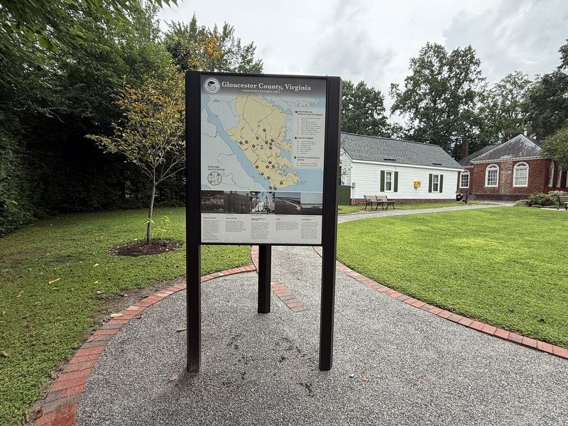
On Main Street (Business U.S. 17) west of John Lemon Lane, on the right when traveling west.
⚫ Historical Points of Interest
1. Abingdon Episcopal Church
2. Rosewell
3. Bethel Baptist Church
4. Walter Reed's Birthplace
5. Woodville Rosenwald School
6. Zion Poplars Baptist Church
7. Ware Episcopal Church . . . — — Map (db m309531) HM
On John Tyler Memorial Highway (State Highway 5) 0.2 miles west of The Crossover Road, on the right when traveling east.
John Tyler, tenth president of the United States, was born just north of here at Greenway on 29 March 1790. The frame plantation house was built ca. 1776 for his father, John Tyler, a noted jurist and governor of Virginia (1808-1811), who is buried . . . — — Map (db m200104) HM
On Main Street (Business U.S. 17) just west of John Lemon Lane, on the right when traveling west.
Native to parts of Europe and Northern Africa, daffodils were introduced to Britain by the Romans after they invaded and captured the country in AD 43. Daffodils (also known as "Lent Lilies") spread naturally and eventually became the favorite . . . — — Map (db m175990) HM
On Main Street (Business U.S. 17) just west of John Lemon Lane, on the right when traveling west.
In 1938 the Garden Club of Gloucester held the first annual Daffodil Show, sponsored by the American Daffodil Society. Growers competed for awards. The show continues to this day.
The same year, the first local daffodil tour was proposed by . . . — — Map (db m175988) HM
On George Washington Memorial Highway (U.S. 17) south of Chesapeake Road, on the right when traveling south.
Petsworth Parish, one of the four parishes of colonial Gloucester County, was established in the middle of the 17th century. The first parish church was located some four miles southwest near Purtan Bay on the York River. Across Route 17 were built . . . — — Map (db m52645) HM
On Main Street (Business U.S. 17) just west of John Lemon Lane, on the right when traveling west.
In 1890 Eleanor Linthicum Smith, of Toddsbury, decided there might be an opportunity to turn the abundant local naturalized daffodils into a money-making proposition. She started buying up cut daffodils from local property owners and sending them . . . — — Map (db m175985) HM
Near Water Street at Buckner Street, on the right when traveling west.
Across the York River in Gloucester County is the Virginia Institute of Marine Science (VIMS), one of the nation’s leading centers for the interdisciplinary research in coastal oceans and estuarine science. Chartered in 1940 as the Virginia . . . — — Map (db m64628) HM
On Virginia Route 39 at T. C. Walker Road (County Route 635), on the left when traveling west on Virginia Route 39.
T.C. Walker School, which opened in 1930, was named for Thomas Calhoun Walker a former slave from Gloucester County who became the first African American attorney in Virginia. It cost $4,600, and was underwritten with $500 from the Julius Rosenwald . . . — — Map (db m69471) HM
On Church Street (Virginia Route 611) at Court Street ( Route 1002), on the right when traveling east on Church Street.
Mathews County was formed in 1790 from Gloucester County and named for Thomas Mathews, of Norfolk, a soldier of the Revolution who was then Speaker of the Virginia House of Delegates. A local builder, Richard Billups, constructed the courthouse . . . — — Map (db m30124) HM
“Seeking knowledge and solutions through coastal marine science.” Mission of the Virginia Institute of Marine Science
When Robert Tyndall sailed past Gloucester Point in 1608, the York River and the Chesapeake Bay were . . . — — Map (db m18746) HM
On Main Street (Business U.S. 17) just east of Justice Drive, on the right when traveling west.
Gloucester County was formed from York County in 1651. Its first brick courthouse, one of Virginia's earliest, was erected by 1685. The county built a new courthouse in 1766, and the Virginia General Assembly established Botetourt Town around it in . . . — — Map (db m175983) HM
On Main Street (Business U.S. 17) west of John Lemon Lane, on the right when traveling west.
Virginia Indians and English Colonists
Native Americans lived in Virginia for thousands of years prior to the arrival of English colonists at Jamestown in 1607. The stronghold of Chief Wahunsenacawh was located nearby along the York River . . . — — Map (db m309527) HM
Near Blackberry Circle east of Timberneck Farm Road ( Route 1324), on the right when traveling east.
Near this spot was located the early burial ground of the Mann and Page families. Three marble tombs removed from the site in 1980 bore these inscriptions:
Here lyeth ye body of John Mann, gentleman of Gloucester County in Virginia aged 63 . . . — — Map (db m192179) HM
Near Windsor Road (Virginia Route 3) 0.2 miles north of John Clayton Memorial Highway ( Route 14), on the right when traveling north.
These earthworks are the remains of Fort Nonsense, first called the Smart's Mill or North End Mill fortification. Enslaved black laborers under the supervision of 2nd Lt. William Henry Clarke, an engineer who graduated from Virginia . . . — — Map (db m74687) HM
On George Washington Memorial Highway (U.S. 17) north of Mid County Lane, on the right.
Three miles east is Warner Hall. The estate was patented about 1650 by Augustine Warner, who built the first house in 1674. Bacon, the rebel, was here for a time in 1676. The later house, built about 1740 and burned in 1849, has been beautifully . . . — — Map (db m2963) HM
On Powhatan Drive west of Pigeon Hill Road, on the right when traveling west.
The War of Independence comes to Gloucester County
A large British force commanded by Lord Cornwallis marched from North Carolina and reached Virginia in May of 1781. After a summer of skirmishes with American forces under the . . . — — Map (db m302381) HM
On Buena Vista Road (Virginia Route 14) 0.5 miles east of Poropotank Drive, on the right when traveling east.
During the summer of 1663, indentured servants (held for several years of service) in the Poropotank River and Purtan Bay region plotted an insurrection against their masters to occur on 13 Sept. 1663. It was prevented when John Berkenhead, servant . . . — — Map (db m129028) HM
On Windsor Road (Virginia Route 3) 0.1 miles north of John Clayton Memorial Highway ( Route 14), on the right when traveling north.
One and a half miles north is the site of his home "Windsor" where he developed an excellent botanical garden. He was first president, Virginia Society for the Promotion of Useful Knowledge, and clerk of Gloucester County from 1722 until his death . . . — — Map (db m30123) HM
Near Windsor Road (Virginia Route 3) 0.2 miles north of John Clayton Memorial Highway ( Route 14), on the right when traveling north.
Mathews County has numerous historic sites that reflect a rich history dating to the first English settlement early in the 1640s. Formed in 1791 from the Kingston Parish section of Gloucester County, Mathews County is named for Gen. . . . — — Map (db m74686) HM
On Linden Street at Heritage Lane, on the right when traveling north on Linden Street.
The 1831 Southampton Insurrection is considered the most consequential slave revolt in North American history. It was, however, preceded by many others. Slaveholders lived in fear of such uprisings as enslaved people of African descent often . . . — — Map (db m276512) HM
Near Blackberry Circle east of Timberneck Farm Road ( Route 1324), on the right when traveling east.
The Fairfield Foundation is renovating the Timberneck House (c. 1800) as a place for learning, lodging, and exploring Virginia’s Middle Peninsula. As a not-for-profit organization we are dedicated to promoting and involving the public in hands-on . . . — — Map (db m192503) HM
On North Point Road (Maryland Route 20) 0.3 miles south of McComas Road, on the left when traveling south.
Thomas Todd settled here from Gloucester County, Virginia, in 1664. Homestead has remained in Todd Family for more than three centuries. Farm once contained 1,700 acres. 17th Century brick house was burned by British Soldiers September 14, 1814, . . . — — Map (db m2123) HM
On George Washington Memorial Highway (U.S. 17) at Bacons Lane, on the right when traveling west on George Washington Memorial Highway.
Near here stood Gloucester Hall (built ca. 1660s), where Bacon’s Rebellion effectively ended with the fatal illness of its leader, Nathaniel Bacon, in 1676. In 1684, this house served as the first Virginia residence of Royal Governor Francis Howard, . . . — — Map (db m74702) HM
On T C Walker Road (Virginia Route 629) 0.2 miles east of Enfield Road ( Route 671), on the right when traveling east.
Zion Poplars Baptist Church houses one of the oldest independent African-American congregations in Gloucester County. It is named for seven united poplar trees under which the founding members first met for worship in 1866. The church was erected . . . — — Map (db m34013) HM
On George Washington Memorial Highway (U.S. 17) 0.8 miles south of Belroi Road ( Route 616), on the right when traveling south.
Zion Poplars Baptist Church houses one of the oldest independent African-American congregations in Gloucester County. It is named for seven united poplar trees under which the founding members first met for worship in 1866. The church was erected . . . — — Map (db m30107) HM
Near Water Street west of Ballard Street ( Route 1020), on the right when traveling west.
Native North Americans called the York River Pamunkee, combining two words meaning upland and sloping to describe its high banks. English colonists renamed the river Charles, in 1634, and later York, in 1643.
The river’s . . . — — Map (db m64617) HM
On George Washington Memorial Highway (U.S. 17) south of Hickory Fork Road, on the right when traveling north. Reported missing.
Several miles west is Rosewell, built about 1750, home of the Page family, and the largest of Colonial Virginia houses. On York River, probably at Puritan Bay some miles west of Rosewell, was Werowocomoco, Chief town of the Indian ruler Powhatan in . . . — — Map (db m248780) HM
On Williams Wharf Road (Virginia Route 614) 0.4 miles west of Bertschy Lane, on the left when traveling west.
Williams Wharf Landing and the Making of America: 1600's
Mathews County maritime history began in the 1600's, when the early colonists discovered deep water in the East River and plenty of natural resources along its shores.
The rapidly . . . — — Map (db m315303) HM
On George Washington Memorial Highway (U.S. 17) at T C Walker Road (Route 629), on the right when traveling south on George Washington Memorial Highway. Reported missing.
John Page, planter, scholar, and Revolutionary patriot, was born in 1743 at Rosewell, three miles west of here. He attended the College of William and Mary with Thomas Jefferson. The two men developed a lifelong friendship and shared an interest . . . — — Map (db m297641) HM
On Vernon Street near Riverview Street, on the right when traveling south.
You are standing at the entrance to Tyndall’s Point Park. These protected remains of a Civil War fort survive to help take us back into the history of Gloucester Point. Nearby, you will find signs and brochures explaining events that occurred here . . . — — Map (db m18698) HM
On Main Street (Business U.S. 17) at John Clayton Memorial Highway ( Route 3/14), on the right when traveling west on Main Street.
The land on which the Edge Hill Service Station now stands was onced in the early 1900s by Thomas Calhoun Walker, a prominent African American in the community. He was the first African-American lawyer in Gloucester County and in 1888 founded the . . . — — Map (db m176009) HM
Near Church Street north of Main Street, on the right when traveling north.
Born c. 1650 England | Died 1703 Yorktown
Owner of the Richard Pate Plantation est. 1650, Gloucester County, 1672 - 1703
Vestryman and Warden, Petsworth Parish, Gloucester Co., c. 1675 - c. 1684
Nathaniel Bacon, leader of Bacon's . . . — — Map (db m293847) HM
On Kings Court west of Moore Avenue, on the left when traveling west.
Peter Mott was a free Black man, a 19th century preacher, and Sunday School superintendent in Snow Hill, New Jersey, the former name for Lawnside. He was a farmer, a landowner, a laborer, and a plasterer. The Snow Hill community's population grew . . . — — Map (db m304289) HM
On 1st Street east of Main Street, on the left when traveling east.
Named for his "barrel chest," and having a bulldog face and gruff voice, West Point's native son remains the most decorated United States Marine in American history, known as "the Marine's Marine." He received five Navy Crosses for Valor, and was a . . . — — Map (db m218260) HM
Near Powhatan Drive west of Pigeon Hill Road, on the right when traveling west.
The Volontaires-étrangers de Lauzun
The Foreign Volunteers of Lauzun
Lauzun's Legion was created on March 5, 1780, expressly for him, and numbered around 600 men during the American Campaign. It was considered part of the French . . . — — Map (db m310614) HM
On Brickbat Road (Virginia Route 1001) at Court Street, on the left when traveling west on Brickbat Road.
The Tompkins Cottage, a weatherboard-clad structure, is one of the oldest standing buildings in the Mathews Downtown Historic District. Architectural historians surmise it was erected in two building campaigns. The oldest portion, which has been . . . — — Map (db m251484) HM
Thin black lines indicate changes in relevance. Between each pair of lines entries are ordered geographically but all have the same relevance.
* Inflectional forms of words are their plurals, singulars, and possessives as well as gramatical tenses and similar variations.