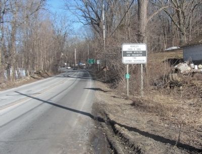
On New York State Route 94 at Barrett Rd, on the right when traveling east on New York State Route 94.
One of original counties of the Province of New York, established 1683 by Gov. Thomas Dongan, named for William, Prince of Orange. — — Map (db m81838) HM
On Winkler Place near Howland Street & Greycourt Avenue.
When the first train entered Chester, New York on September 23, 1841, few realized exactly what kind of an impact the railroad would have on the town. Before the New York & Erie Railroad (later reorganized as the Erie Railroad) entered town, Chester . . . — — Map (db m60383) HM
On Main Street (New York State Route 207) at Erie Street on Main Street.
Not far from this location, which in 1862 was part of the Wickham Farm that stretched from here to what is now the C. J. Hooker School, lays the site of the first encampment of the celebrated 124th New York Volunteers known as the "Orange Blossoms." . . . — — Map (db m43410) HM
Near New York State Route 17A 0.4 miles Gibson Rd (County Route 100), on the right when traveling south.
Built in the 1700’s and used continuously as a school until 1936 when purchased by Minisink Chapter, NSDAR.
N.Y. State and National Register of Historic Places — — Map (db m29728) HM
On Main Street (U.S. 5) 0.1 miles north of Oxbow Road, on the left when traveling north.
The old court house with jail connected for Gloucester County New York, which became Orange County Vermont. It was used for a meeting house until 1788. The Legislature of 1787 met in this building. A few rods northerly stood the log fort of . . . — — Map (db m48618) HM
On South Main Street (U.S. 34) at West Central Avenue, on the right when traveling south on South Main Street.
World-renowned organist, master teacher, recording artist, innovative arranger, and concert star.
Son of Miles S. and Birdie Nichols Fox. Native of Princeton, IL. and graduate of Princeton High School. First organ lessons at Hampshire Colony . . . — — Map (db m253142) HM
On South Main Street at Church Street (Dvorak Memorial Highway) (County Highway B16), on the left when traveling north on South Main Street.
United States Army Retired July 31, 1969 Native son of Spillville, IA. Born Aug, 17, 1910, son of Carl R. and Louise Fisher Haug. Early education — Spillville, Decorah, U of I, US Military Academy 1935 graduate. Married Carolyn Meyers, . . . — — Map (db m239184) HM
On Orange Heritage Trail 0.1 miles east of Greycourt Avenue.
The origins of a railroad in this area date back to 1836, when the Hudson & Delaware Railroad was chartered to build a rail line from Newburgh, New York to Chesterville, New York (now known as Greycourt) with the intention of extending the line to . . . — — Map (db m60266) HM
Before the railroad came to town, Monroe had been an isolated community, composed mainly of farmers. When the New York & Erie Railroad (later reorganized as the Erie Railroad) rolled into town in 1841, an entirely new way of life was introduced. . . . — — Map (db m60267) HM
On Paramount Boulevard 0.5 miles north of California Route 91, on the left when traveling north.
The towns of Hynes and Clearwater, later incorporated as Paramount, were the center of the hay and dairy industry in Los Angeles and Orange Counties from the 1920s through the 1960s. Considered the “Milk Shed of Los Angeles”, Paramount . . . — — Map (db m128218) HM
Near North Forest Avenue at Corrine Drive, on the left when traveling north.
(side 1)
In 1858, the David W. Mizell family homesteaded this property, and in 1862, built their first home. The Mizells farmed the land, growing cotton, corn, and sugar cane. David W. Mizell was appointed sheriff of Orange County in 1868. . . . — — Map (db m241095) HM
On Green Street 0.1 miles west of South Street, on the right when traveling west.
Situated in the center of Orange County, Goshen has a long and storied history as a major focal point of the nation's railroad infrastructure. When the builders of the New York & Erie Railroad began construction, they envisioned a railroad that . . . — — Map (db m60384) HM
Near Interstate 4 at milepost 96, 2.5 miles east of State Road 434, on the right when traveling east.
The importance of Seminole County in the history of the area lies in its location at the navigable headwaters of the St. Johns River and the elevated forest land south of the three large lakes within its boundaries: Monroe, Harney, and Jesup. . . . — — Map (db m52360) HM
Near Interstate 4 at milepost 95 east of State Road 434, on the right when traveling west.
The importance of Seminole County in the history of the area lies in its location at the navigable headwaters of the St. Johns River and the elevated forest land south of the three large lakes within its boundaries: Monroe, Harney, and Jesup. . . . — — Map (db m54051) HM
On Washington Street south of West 3rd Street, on the right when traveling south.
William Sidney Emay was placed in the Orange County Poor Farm in Goshen, New York as young child. Will's life changed the day after his eighth birthday in 1861 when he, along with several other boys from the Poor Farm, were taken to the Children's . . . — — Map (db m185977) HM
On Goshen Turnpike (Route 101) at Midland Lake Road, on the right when traveling north on Goshen Turnpike.
Stagecoaches stopped here to find food and lodging for weary turnpike travelers. The stepping stone used by passengers still stands. Listed on the National Register of Historic Places. — — Map (db m136700) HM
On Dutch Hill Road north of Orangeburg Road, on the right when traveling south.
Town of Orangetown Rockland County, N.Y. Settled 1639 by David De Vries; County seat of Orange County 1683-1764; Established by New York State 1788 from parts of Lockhart (1685), Tappan (1686) and Kakiat (1696) Patents: Home of the Orangetown . . . — — Map (db m138662) WM
On Sickles Avenue, on the right when traveling north.
(Front):124th New York Infantry. 2nd Brigade 1st Division 3rd Corps July 2nd 1863. (Back):The Orange Blossoms went into action on this spot with 18 officers and 220 men. Lost in killed and wounded 7 officers and 85 men. . . . — — Map (db m15089) HM WM
On Main Street (U.S. 5) south of Chapel Street, on the right when traveling south.
{East side} Patriot A pioneer of strong unselfish purpose A patriot of uncompromising fidelity A soldier unstained by personal ambition A citizen ever devoted to the public good {South side} Soldier French and Indian war . . . — — Map (db m88114) HM
On Main Street (New York State Route 207) at Park Place, on the right when traveling north on Main Street.
(eastern upper plaque)
124th Regiment
New York Infantry Volunteers
"Orange Blossoms"
Third Army Corps, 1862, 1863.
Second Army Corps, 1864, 1865.
Army of the Potomac
Mustered into the United States service, Goshen, Sept. . . . — — Map (db m179163) WM
On W Central Boulevard 0.1 miles N. Court Street, on the left.
These flags fly in honor and memory of those who lost their lives and loved ones in the attacks on our cherished American freedoms that took place in New York City, Washington, D.C. and Southwestern Pennsylvania on 9/11/2001
Dedicated . . . — — Map (db m138803) WM
On North Central Avenue (State Road 419/434) at Railroad Street, on the left when traveling north on North Central Avenue.
In the late 1860's Confederate veterans and freed slaves from the war-devastated South began to move into the settlement called "the Lake Jesup Community," to be joined later by others from Northern states and from Sweden. One of the Swedish . . . — — Map (db m93011) HM
On Red Cleveland Boulevard 0.3 miles west of East Airport Blvd, on the left when traveling south.
The importance of Seminole County in the history of the area lies in its location at the navigable headwaters of the St. Johns River and the elevated forest land south of the three large lakes within its boundaries: Monroe, Harney, and Jesup. . . . — — Map (db m157790) HM
On River Road at County Road 69, on the right when traveling north on River Road.
Historic New Windsor
Nearby stood the Thomas Ellison house, used as headquarters by General George Washington at various times during the years of 1779-1781.
Also quartered here was Alexander Hamilton and here was planned the attack on Stony . . . — — Map (db m37137) HM
On Park Avenue (New York State Route 42) north of W Main Street, on the left when traveling north.
The Upper Delaware Scenic Byway (New York State Route 97) follows the Upper Delaware River through the western parts of Delaware, Sullivan, and Orange Counties. This unique highway connects the rafting and bluestone village of Hancock to the . . . — — Map (db m194146) HM
On New York State Route 284 at State Line Road, on the left when traveling north on New York State Route 284.
Orange County
One of original counties
of province of New York.
Established 1683, by Gov.
Thomas Dongan, named for
William, Prince of Orange
State Education
Department 1936 — — Map (db m81841) HM
"...He] has endeavored to bring on the Inhabitants of our Frontiers, the merciless Indian Savages, whose known Rule of Warfare, is an undistinguished Destruction, of all Ages, Sexes, and Conditions."
- The Declaration of . . . — — Map (db m245070) HM
On New York State Route 97 north of the bridge over East Branch of the Delaware River, on the left when traveling north.
The Upper Delaware Scenic Byway (New York State Route 97) follows the Upper Delaware River through the western parts of Delaware, Sullivan, and Orange Counties. This unique highway connects the rafting and bluestone village of Hancock to the . . . — — Map (db m122138) HM
Background The Americans and British both knew that passage on the Hudson River was strategically important. The Americans planned to block ship passage on the river and attack enemy ships with cannons and mortar located at defensive forts, and . . . — — Map (db m89095) HM
On Lower Main Street (New York State Route 133) at the connector to Upper Main Street, on the right when traveling west on Lower Main Street.
The Upper Delaware Scenic Byway (New York State Route 97) follows the Upper Delaware River through the western parts of Delaware, Sullivan, and Orange Counties. This unique highway connects the rafting and bluestone village of Hancock to the . . . — — Map (db m121838) HM
On Camino Capistrano north of Del Obispo Street, on the right when traveling north.
The Judge Richard Egan House was built in 1883 for one of San Juan Capistrano' most prominent citizens. Judge Egan was born in Waterford County, Ireland, in 1842, educated in New York and arrived in California in about 1866 following a trip to . . . — — Map (db m204133) HM
Near West 7th Street just west of Myrtle Avenue, on the right when traveling west.
1 • Mount Vernon Red Maple Planted in honor of the Founders of the City of Sanford, Florida on February 10, 1992. This red maple has been grown from seeds collected at Mount Vernon, President George Washington's beloved home on the . . . — — Map (db m214875) HM
On Main Street (New York State Route 207) 0.2 miles south of Scotchtown Road (County Route 83), on the right when traveling south.
County Seat
Orange, one of original N.Y. counties created 1683 by Assembly, Council and Gov. Thos. Dongen. Goshen became center for County government in the 1700’s. — — Map (db m25195) HM
On Water Street at 3rd Street, on the right when traveling north on Water Street.
[ east side ]
The Newburgh
Chapter of UNICO
National
October 11, 1992
In celebration of a 500th Anniversary commemorating the vision, courage, determination and voyages of
Christopher
Columbus
And the crews of the Nina, the . . . — — Map (db m37139) HM
George Titlar was born in
Ireland. Like thousands
of other Europeans in
the 18th century, his parents
immigrated to this country for
new opportunities. They landed
in Orange County, almost directly
across the river from Sing Sing (Ossining). . . . — — Map (db m259153) HM
On Lakeview Parkway near Shoosmith Road, on the left when traveling north.
During the first 18 months of the Civil War, President Abraham Lincoln chose not to act upon recommendations of Frederick Douglass, and others, to enlist Black men in the Union Army in the fight against the Confederacy. After the much-needed Union . . . — — Map (db m314862) HM
On Main Street (Nova Scotia Route 3), on the right when traveling east.
Step Back in Time
Step back to the beginning of the seventeenth century. The Mi'Kmaq had given Liverpool the name 'Ogomkegea', meaning "place of departure." Descending the Mersey River in the spring they would disperse along the coast . . . — — Map (db m112387) HM
In 1960, a group of 61 Anaheim business people calling themselves the Anaheim
Visitor and Convention Bureau organized to see what they could do to make the
city a year-round tourist destination. Their goal was to better capitalize on the
huge . . . — — Map (db m234345) HM
The first Valencia Orchard in California was planted here in 1880 by R.H. Gilman on the property of Placentia Fruit Co. The trees are still in flourishing condition.
Dedicated by Grace Parlor No. 242
Native Daughters of the Golden West . . . — — Map (db m254135) HM
On Palmyra Avenue at Orange Street, on the right when traveling west on Palmyra Avenue.
C.Z. Culver House, built c.1888, has been placed on the National Register of Historic Places by the United States Department of the Interior. — — Map (db m304233) HM
On Sickles Avenue, on the right when traveling north. Reported missing.
"No, boys, hold your fire until they come right up. Then pour a volley into them, and if they don't stop run your bayonets into their bellies." Brig. Gen. Henry L. Benning, C.S.A. Benning's Brigade, Hood's Division The fate of Devil's Den (located . . . — — Map (db m13321) HM
Early in the Revolutionary War, the Continental Congress realized that the Hudson River was critical to the American Cause. If the British controlled the river, they could divide the rebellious colonies. Therefore, the Americans began work on Fort . . . — — Map (db m7555) HM