1527 entries match your criteria. The first 100 are listed. ⊳
Historical Markers and War Memorials
in Central Jersey Region
By Alan Edelson, February 20, 2016
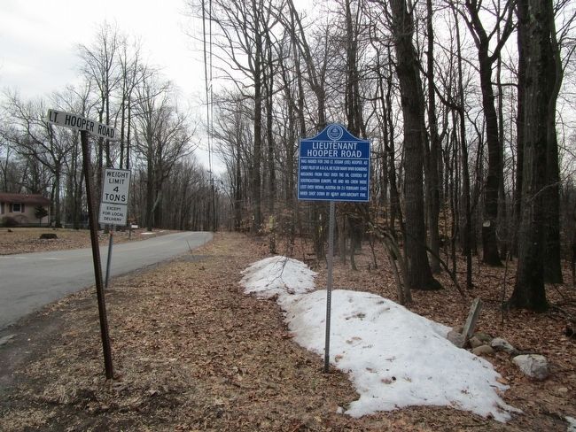
Lieutenant Hooper Road Marker
1 ► New Jersey, Hunterdon County, Alexandria — Lieutenant Hooper Road —  |
| On County Route 579 at Lt. Hooper Road, on the left when traveling west on County Route 579. | |||
| 2 ► New Jersey, Hunterdon County, Alexandria, Alexandria Township — St. Thomas Episcopal of Alexandria — |
| On Sky Manor - Senator Stout Road, on the right when traveling west. | |||
| 3 ► New Jersey, Hunterdon County, Amwell — John Hart's Cave — |
| On Lindbergh Road at Zion Road, on the right when traveling south on Lindbergh Road. | |||
| 4 ► New Jersey, Hunterdon County, Annandale — Annandale 9-11 Memorial — |
| On Beaver Avenue (County Route 626) at Old Allerton Road, on the right when traveling west on Beaver Avenue. | |||
| 5 ► New Jersey, Hunterdon County, Annandale — Annandale Historic District — |
| On Beaver Avenue at Maple Avenue, on the right when traveling west on Beaver Avenue. | |||
| 6 ► New Jersey, Hunterdon County, Annandale — Annandale Reformed Church — |
| On Beaver Avenue at Dewey Avenue, on the right when traveling west on Beaver Avenue. | |||
| 7 ► New Jersey, Hunterdon County, Annandale — Capt. Jacob Gearhart — |
| On River Road, on the right when traveling south. | |||
| 8 ► New Jersey, Hunterdon County, Annandale — Central Railroad Of New Jersey — |
| On Main Street at East Street, on the left when traveling east on Main Street. | |||
| 9 ► New Jersey, Hunterdon County, Annandale — Jones Tavern — |
| On Beaver Avenue, on the right when traveling west. | |||
| 10 ► New Jersey, Hunterdon County, Annandale — The Amwell Line - 1704 — |
| On Hamden Road north of Old Clinton Road, on the right when traveling north. | |||
| 11 ► New Jersey, Hunterdon County, Changewater — Warren Railroad Company — |
| On Musconetcong River Road at Port Colden-Changewater Road, on the left when traveling south on Musconetcong River Road. | |||
| 12 ► New Jersey, Hunterdon County, Cherryville — Cherryville — |
| On Cherryville Road at Cherryville - Stanton Road, on the right when traveling north on Cherryville Road. | |||
| 13 ► New Jersey, Hunterdon County, Clinton — Blacksmith Shop — |
| Near Quarry Road. | |||
| 14 ► New Jersey, Hunterdon County, Clinton — Bonnell’s Tavern |
| On Pittstown Road at Interstate 78, on the right when traveling south on Pittstown Road. Reported missing. | |||
| 15 ► New Jersey, Hunterdon County, Clinton — Bonnell's Tavern — |
| On Pittstown Road (New Jersey Route 173) at West Main Street ( Route 173), on the right when traveling south on Pittstown Road. | |||
| 16 ► New Jersey, Hunterdon County, Clinton — Bunker Hill School House — Red Mill Museum Village — |
| Near W. Main Street at Quarry Road, on the right when traveling west. | |||
| 17 ► New Jersey, Hunterdon County, Clinton — Capt. Archd. S. Taylor — |
| Near Center Street at New Street, on the right when traveling west. | |||
| 18 ► New Jersey, Hunterdon County, Clinton — Christopher Vought House — |
| On Greyrock Road near Beaver Avenue, on the right when traveling north. | |||
| 19 ► New Jersey, Hunterdon County, Clinton — Clinton Historic District — |
| On Leigh Street, on the right when traveling south. | |||
| 20 ► New Jersey, Hunterdon County, Clinton — Cornerstone, 1754 — |
| Near W. Main Street at Quarry Road, on the right when traveling west. | |||
| 21 ► New Jersey, Hunterdon County, Clinton — Dunham's Mill — |
| On Lower Center Street, on the left when traveling north. | |||
| 22 ► New Jersey, Hunterdon County, Clinton — Four Corners — |
| On Center Street at Leigh Street, on the right when traveling west on Center Street. | |||
| 23 ► New Jersey, Hunterdon County, Clinton — Gen. George W. Taylor — |
| On Center Street, on the right when traveling west. | |||
| 24 ► New Jersey, Hunterdon County, Clinton — General George W. Taylor — |
| On Center Street, on the right when traveling west. | |||
| 25 ► New Jersey, Hunterdon County, Clinton — Hunterdon County's Forgotten / The Forgotten History Trail 1780 — Bonnell's Tavern & the Minutemen/Militia / — |
| Near Leigh Street near Riverside Drive, on the left when traveling north. | |||
| 26 ► New Jersey, Hunterdon County, Clinton — Hunterdon Historical Museum — aka "The Red Mill" — |
| On Main Street, on the left when traveling east. | |||
| 27 ► New Jersey, Hunterdon County, Clinton — Hunterdon Museum Of Art — |
| On Main Street, on the left when traveling east. | |||
| 28 ► New Jersey, Hunterdon County, Clinton — Irish Town — |
| On Halstead Street, on the right when traveling north. | |||
| 29 ► New Jersey, Hunterdon County, Clinton — Landsdown Trail — The Clinton Branch of the Lehigh Valley Railroad — |
| Near W. Main Street, on the right when traveling east. | |||
| 30 ► New Jersey, Hunterdon County, Clinton — Lime Kilns — |
| Near Quarry Road. | |||
| 31 ► New Jersey, Hunterdon County, Clinton — Minisink Trail — |
| On Leigh Street at Center Street, on the left when traveling south on Leigh Street. | |||
| 32 ► New Jersey, Hunterdon County, Clinton — Mulligan Quarry — |
| Near Quarry Road. | |||
| 33 ► New Jersey, Hunterdon County, Clinton — Music Hall — |
| On W. Main Street (New Jersey Route 173), on the right when traveling east. | |||
| 34 ► New Jersey, Hunterdon County, Clinton — Red Mill Museum Village — |
| Near W. Main Street at Quarry Road, on the right when traveling west. | |||
| 35 ► New Jersey, Hunterdon County, Clinton — Red Mill Museum Village — |
| On Main Street at Quarry Road when traveling north on Main Street. | |||
| 36 ► New Jersey, Hunterdon County, Clinton — Schoolhouse — |
| Near Quarry Road. | |||
| 37 ► New Jersey, Hunterdon County, Clinton — Tenant House — |
| Near Quarry Road. | |||
| 38 ► New Jersey, Hunterdon County, Clinton — Tenant House — Red Mill Museum Village — |
| Near W. Main Street at Quarry Road, on the right when traveling west. | |||
| 39 ► New Jersey, Hunterdon County, Clinton — The Great Clinton Fire — |
| On Main Street, on the right when traveling east. | |||
| 40 ► New Jersey, Hunterdon County, Clinton — The Lime Kilns — Red Mill Museum Village — |
| Near W. Main Street at Quarry Road, on the right when traveling west. | |||
| 41 ► New Jersey, Hunterdon County, Clinton — The Log Cabin — Red Mill Museum Village — |
| Near W. Main Street near Quarry Road, on the right when traveling west. | |||
| 42 ► New Jersey, Hunterdon County, Clinton — The Mill — Red Mill Museum Village — |
| Near W. Main Street at Quarry Road, on the right when traveling west. | |||
| 43 ► New Jersey, Hunterdon County, Clinton — The Mulligans — Red Mill Museum Village — |
| Near W. Main Street at Quarry Road, on the right when traveling west. | |||
| 44 ► New Jersey, Hunterdon County, Clinton — The Quarry — Red Mill Museum Village — |
| Near W. Main Street at Quarry Road, on the right when traveling west. | |||
| 45 ► New Jersey, Hunterdon County, Clinton — The Red Mill — |
| On Quarry Road west of Main Street, on the right when traveling west. | |||
| 46 ► New Jersey, Hunterdon County, Clinton — Town of Clinton Historic District — |
| On West Main Street north of Old Highway 22, on the right when traveling north. | |||
| 47 ► New Jersey, Hunterdon County, Clinton — Town of Clinton, New Jersey — |
| On Leigh Street, on the right when traveling north. | |||
| 48 ► New Jersey, Hunterdon County, Clinton Township — Amesbury Furnace — |
| Near Chalfonte Drive north of Voegtlens Lane when traveling north. | |||
| 49 ► New Jersey, Hunterdon County, Clinton Township — Hunterdon County Arboretum — “Think of the landscape as a canvas ...” George Bloomer (1898-1978) — |
| Near New Jersey Route 31 0.3 miles north of Stanton Station Road, on the right when traveling north. | |||
| 50 ► New Jersey, Hunterdon County, Clinton Township, Annandale — Camp Buck — |
| On Camp Buck Road, on the right when traveling east. | |||
| 51 ► New Jersey, Hunterdon County, Cokesbury — Cokesbury Methodist Episcopal Church — |
| On Cokesbury Road, on the right when traveling north. | |||
| 52 ► New Jersey, Hunterdon County, Copper Hill — Copper Mines — |
| On U.S. 202-31 at milepost 9.6, on the right when traveling south. | |||
| 53 ► New Jersey, Hunterdon County, Croton — Dr. James Pyatt — 1784 - 1864 — |
| On County Route 579 near Plum Brook Road, on the right when traveling south. | |||
| 54 ► New Jersey, Hunterdon County, East Amwell — Upper Argillite Alley — |
| On New Jersey Route 31 at milepost 13.6, 0.4 miles east of County Route 579, on the right when traveling south. | |||
| 55 ► New Jersey, Hunterdon County, East Amwell — Wertsville (Weart's Corner) — |
| On Wertsville Road at Lindbergh Road, on the right when traveling west on Wertsville Road. | |||
| 56 ► New Jersey, Hunterdon County, Everittstown — Everittstown — |
| On County Route 513 at County Route 519, on the right when traveling east on County Route 513. | |||
| 57 ► New Jersey, Hunterdon County, Everittstown — Everittstown — |
| On County Route 519 at Mount Pleasant Road, on the right on County Route 519. | |||
| 58 ► New Jersey, Hunterdon County, Flemington — Adam Bellis Homestead — |
| On Kuhl Road, on the right when traveling east. | |||
| 59 ► New Jersey, Hunterdon County, Flemington — Bonetown — |
| On Bonetown Road, on the right when traveling south. | |||
| 60 ► New Jersey, Hunterdon County, Flemington — Buchanan's Tavern — |
| On Sergeantsville Flemington Road (County Route 523), on the right. | |||
| 61 ► New Jersey, Hunterdon County, Flemington — Civil War — Major Lambert Boeman — |
| On North Main Street 0.1 miles north of East Main Street, on the right when traveling north. | |||
| 62 ► New Jersey, Hunterdon County, Flemington — Copper Ore — |
| On Mine Street just east of Shields Ave., on the right when traveling east. | |||
| 63 ► New Jersey, Hunterdon County, Flemington — Fleming Castle — a.k.a. Samuel Fleming House — |
| On Bonnell Street, on the right when traveling west. | |||
| 64 ► New Jersey, Hunterdon County, Flemington — Flemington Egg Auction — |
| On Park Avenue, on the right when traveling south. | |||
| 65 ► New Jersey, Hunterdon County, Flemington — Flemington Fairgrounds — |
| On New Jersey Route 31 0.1 miles north of Walter E. Foran Blvd., on the right when traveling north. | |||
| 66 ► New Jersey, Hunterdon County, Flemington — Flemington Public Library — |
| On Maple Street at Main Street, on the right when traveling east on Maple Street. | |||
| 67 ► New Jersey, Hunterdon County, Flemington — Flemington Raid — 🏛️ — |
| On Court Street east of Park Avenue, on the left when traveling east. | |||
| 68 ► New Jersey, Hunterdon County, Flemington — Flemington Railroad Company — |
| On Church Street, on the left when traveling north. | |||
| 69 ► New Jersey, Hunterdon County, Flemington — Fulper Family Residences — |
| On Mine St., on the left when traveling west. | |||
| 70 ► New Jersey, Hunterdon County, Flemington — Fulper House — |
| On Mine Street, on the left when traveling west. | |||
| 71 ► New Jersey, Hunterdon County, Flemington — Fulper Pottery Factory #1 — |
| On Mine Street near Park Avenue, on the right when traveling east. | |||
| 72 ► New Jersey, Hunterdon County, Flemington — Historic Woodlot — Kase Farm — |
| On New Jersey Route 12, on the right when traveling west. | |||
| 73 ► New Jersey, Hunterdon County, Flemington — Hunterdon County Holocaust Memorial — |
| On Capner Street, on the right when traveling west. | |||
| 74 ► New Jersey, Hunterdon County, Flemington — Jacob Francis — 1754 — 1836 — |
| On Church Street 0.1 miles east of Main Street, on the right when traveling west. | |||
| 75 ► New Jersey, Hunterdon County, Flemington — Kase Homestead — |
| On New Jersey Route 12 at Mine Street, on the right when traveling west on New Jersey Route 12. | |||
| 76 ► New Jersey, Hunterdon County, Flemington — Law Office — |
| On Main Street, on the right when traveling south. | |||
| 77 ► New Jersey, Hunterdon County, Flemington — Lehigh Valley Railroad — |
| On N. Main Street, on the left when traveling north. | |||
| 78 ► New Jersey, Hunterdon County, Flemington — Log Cabin & Ground Hog Kiln — Historic Flemington — |
| On Stangl Road. | |||
| 79 ► New Jersey, Hunterdon County, Flemington — Oak Grove School — School #10 — |
| On New Jersey Route 31, on the right when traveling north. | |||
| 80 ► New Jersey, Hunterdon County, Flemington — Old York Road — |
| On Old York Road (New Jersey Route 613 at milepost 1.2), on the right when traveling north. | |||
| 81 ► New Jersey, Hunterdon County, Flemington — Presbyterian Cemetery — |
| On Main Street, on the right when traveling north. | |||
| 82 ► New Jersey, Hunterdon County, Flemington — Purple Heart Memorial — Combat Veterans Wounded — |
| On Court Street, on the right when traveling west. | |||
| 83 ► New Jersey, Hunterdon County, Flemington — Raritan Township Firemen's Monument — John Lesanics Memorial 1927-1974 — |
| On Old Clinton Road at Cherryville Hollow Road, on the left when traveling north on Old Clinton Road. | |||
| 84 ► New Jersey, Hunterdon County, Flemington — Reading Family Mills — |
| On Darts Mill Road (County Route 523) at Darts Mill Road, on the right when traveling north on Darts Mill Road. | |||
| 85 ► New Jersey, Hunterdon County, Flemington — Reading Home — |
| On River Road, on the right when traveling west. | |||
| 86 ► New Jersey, Hunterdon County, Flemington — Samuel Hill House — |
| On Main Street south of Church Street, on the right when traveling south. | |||
| 87 ► New Jersey, Hunterdon County, Flemington — Soldiers Monument — Flemington Veterans Memorial — |
| On North Main Street, in the median. | |||
| 88 ► New Jersey, Hunterdon County, Flemington — South Branch Historic District — |
| On River Road when traveling west. | |||
| 89 ► New Jersey, Hunterdon County, Flemington — South Branch Historic District — |
| On Rockafellows Mill Road, on the right when traveling south. | |||
| 90 ► New Jersey, Hunterdon County, Flemington — South Branch Of Central R.R. — |
| On Main Street, on the right when traveling south. | |||
| 91 ► New Jersey, Hunterdon County, Flemington — Stangl Pottery Outlet & Showroom — |
| On Stangl Road near Mine Street, on the right when traveling south. | |||
| 92 ► New Jersey, Hunterdon County, Flemington — Tuccamirgan Park — |
| On Bonnell Street, on the right when traveling west. | |||
| 93 ► New Jersey, Hunterdon County, Flemington — Uplands — |
| On Barton Hollow Road, on the right when traveling north. | |||
| 94 ► New Jersey, Hunterdon County, Flemington — Vietnam War Dogs Memorial — In Memory Of Vietnam War Dogs and Their Handlers — |
| On Case Boulevard. near Woodside Lane, on the right when traveling south. | |||
| 95 ► New Jersey, Hunterdon County, Flemington, Franklin Township — Nixon Graveyard — |
| On Croton Road (County Road 579) south of Nixon Farm Road, on the right when traveling north. | |||
| 96 ► New Jersey, Hunterdon County, Flemington, Raritan Township — Hardscrabble Hill — |
| On Hardscrabble Hill Road, on the right when traveling west. | |||
| 97 ► New Jersey, Hunterdon County, Flemington, Raritan Township — Raritan Township 9-11 Memorial Clock — |
| On Sergeantsville - Flemginton Road, on the right when traveling south. | |||
| 98 ► New Jersey, Hunterdon County, Flemington, Raritan Township — Raritan Township Vietnam Veterans — Post 506 — |
| On Sergeantsville - Flemington Road, on the right when traveling south. | |||
| 99 ► New Jersey, Hunterdon County, Franklin Township, Pittstown — August Wilhelm Knispel — |
| On Sidney Road, on the right when traveling south. | |||
| 100 ► New Jersey, Hunterdon County, Franklin Township, Pittstown — The Capoolong Creek Trail — Pittstown Branch of the Lehigh Valley Railroad — |
| On Sidney Road (County Road 617) just north of Lower Kingtown Road, on the left when traveling north. | |||
1527 entries matched your criteria. The first 100 are listed above. Next 100 ⊳