66 entries match your criteria.
Historical Markers and War Memorials
in the Crow Nation
By Bill Coughlin, July 23, 2015
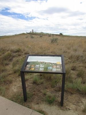
Marker on the Little Bighorn Battlefield
1 ► Montana, Big Horn County, Crow Agency — 1984 Archeological Survey — Little Bighorn Battlefield —  |
| On Little Bighorn Battlefield Road, on the right when traveling north. | |||
| 2 ► Montana, Big Horn County, Crow Agency — Bear Paw Memorial — |
| On Little Bighorn Battlefield Road, on the right when traveling south. | |||
| 3 ► Montana, Big Horn County, Crow Agency — Bear Paw Monument — 1881 — |
| Near Little Bighorn Battlefield Road, on the right when traveling south. | |||
| 4 ► Montana, Big Horn County, Crow Agency — Calhoun Hill — (Little Bighorn Battlefield) — |
| On Little Bighorn Battlefield Road. | |||
| 5 ► Montana, Big Horn County, Crow Agency — Calhoun Hill — Little Bighorn Battlefield — |
| On Little Bighorn Battlefield Road, on the right when traveling north. | |||
| 6 ► Montana, Big Horn County, Crow Agency — Cheyenne Warrior Markers — Little Bighorn Battlefield — |
| On Little Bighorn Battlefield Road. | |||
| 7 ► Montana, Big Horn County, Crow Agency — Chief Plenty Coups — Last Chief of the Crows — 1848 - 1932 — |
| On U.S. 212 at Frontage Road, on the right when traveling west on U.S. 212. | |||
| 8 ► Montana, Big Horn County, Crow Agency — Companies C & E — (Little Bighorn Battlefield) — |
| On Little Bighorn Battlefield Road. | |||
| 9 ► Montana, Big Horn County, Crow Agency — Companies F and I — (Little Bighorn Battlefield) — |
| On Battlefield Tour Road. | |||
| 10 ► Montana, Big Horn County, Crow Agency — Crow's Nest — June 25, 1876 — Morning — |
| On U.S. 212 1 mile east of Interstate 90. | |||
| 11 ► Montana, Big Horn County, Crow Agency — Custer Last Seen — (Little Bighorn Battlefield) — |
| On Little Bighorn Battlefield Road. | |||
| 12 ► Montana, Big Horn County, Crow Agency — Custer’s Advance — Little Bighorn Battlefield — |
| On Little Bighorn Battlefield Road, on the right when traveling south. | |||
| 13 ► Montana, Big Horn County, Crow Agency — Deep Coulee — Little Bighorn Battlefield — |
| On Little Bighorn Battlefield Road, on the right when traveling north. | |||
| 14 ► Montana, Big Horn County, Crow Agency — Deep Ravine — Little Bighorn Battlefield — |
| Near Little Bighorn Battlefield Road, on the right when traveling south. | |||
| 15 ► Montana, Big Horn County, Crow Agency — Deep Ravine — Little Bighorn Battlefield — |
| On Little Bighorn Battlefield Road, on the right when traveling north. | |||
| 16 ► Montana, Big Horn County, Crow Agency — Greasy Grass Ridge — Little Bighorn Battlefield — |
| On Little Bighorn Battlefield Road, on the right when traveling north. | |||
| 17 ► Montana, Big Horn County, Crow Agency — Here We Remember the Fallen — Custer National Cemetery at Little Bighorn Battlefield NM — |
| On Little Bighorn Battlefield Road, on the right when traveling south. | |||
| 18 ► Montana, Big Horn County, Crow Agency — Indian Encampment — Little Bighorn Battlefield — |
| On Little Bighorn Battlefield Road, on the right when traveling south. | |||
| 19 ► Montana, Big Horn County, Crow Agency — Indian Memorial — Little Bighorn Battlefield — |
| On Little Bighorn Battlefield Road, on the right when traveling north. | |||
| 20 ► Montana, Big Horn County, Crow Agency — Keogh – Crazy Horse Fight — Little Bighorn Battlefield — National Park Service, U.S. Department of the Interior — |
| On Little Bighorn Battlefield Road, on the right when traveling north. | |||
| 21 ► Montana, Big Horn County, Crow Agency — Lame White Man Charge — Little Bighorn Battlefield — |
| On Little Bighorn Battlefield Road, on the right when traveling north. | |||
| 22 ► Montana, Big Horn County, Crow Agency — Last Stand Hill, June 25, 1876 — Little Bighorn Battlefield — |
| On Little Bighorn Battlefield Road, on the left when traveling north. | |||
| 23 ► Montana, Big Horn County, Crow Agency — Little Bighorn Battlefield — |
| On Little Bighorn Battlefield Road, in the median. | |||
| 24 ► Montana, Big Horn County, Crow Agency — Little Bighorn Battlefield National Monument — |
| Near Interstate 90 at milepost 510 near U.S. 212. | |||
| 25 ► Montana, Big Horn County, Crow Agency — Little Bighorn Indian Memorial — |
| On Little Bighorn Battlefield Road, on the left when traveling north. | |||
| 26 ► Montana, Big Horn County, Crow Agency — Lone Tipi — June 25, 1876 — Approximately 2:00 p.m. — |
| Near U.S. 212 1 mile east of Interstate 90. | |||
| 27 ► Montana, Big Horn County, Crow Agency — Medicine Tail Coulee — Little Bighorn Battlefield — |
| On Little Bighorn Battlefield Road, on the right when traveling north. | |||
| 28 ► Montana, Big Horn County, Crow Agency — Medicine Tail Coulee Ford — (Little Bighorn Battlefield) — |
| On Little Bighorn Battlefield Road. | |||
| 29 ► Montana, Big Horn County, Crow Agency — Medicine Tail Ford — Little Bighorn Battlefield — |
| On Little Bighorn Battlefield Road, on the right when traveling north. | |||
| 30 ► Montana, Big Horn County, Crow Agency — Memorial Markers — Little Bighorn Battlefield — |
| On Little Bighorn Battlefield Road, on the left when traveling north. | |||
| 31 ► Montana, Big Horn County, Crow Agency — National Cemetery — |
| On U.S. 212 1 mile east of Interstate 90. | |||
| 32 ► Montana, Big Horn County, Crow Agency — Peace Through Unity — Little Bighorn Battlefield — |
| On Little Bighorn Battlefield Road, on the right when traveling north. | |||
| 33 ► Montana, Big Horn County, Crow Agency — Reno’s Retreat — Little Bighorn Battlefield — |
| On Little Bighorn Battlefield Road, on the right when traveling south. | |||
| 34 ► Montana, Big Horn County, Crow Agency — Reno’s Valley Fight — Little Bighorn Battlefield — |
| On Little Bighorn Battlefield Road, on the right when traveling south. | |||
| 35 ► Montana, Big Horn County, Crow Agency — Reno's Skirmish Line - Warrior Counterattack — June 25, 1876 — Approximately 3:00 p.m. — |
| Near U.S. 212 1 mile Interstate 90. | |||
| 36 ► Montana, Big Horn County, Crow Agency — Retreat Crossing — June 25, 1876 — Approximately 4:00 p.m. — |
| Near U.S. 212 1 mile east of Interstate 90. | |||
| 37 ► Montana, Big Horn County, Crow Agency — Seventh Cavalry Horse Cemetery — Little Big Horn — National Park Service, U.S. Department of the Interior — |
| Near U.S. 212 1 mile east of Interstate 90. | |||
| 38 ► Montana, Big Horn County, Crow Agency — Sharpshooter Ridge — |
| Near U.S. 212 1 mile east of Interstate 90. | |||
| 39 ► Montana, Big Horn County, Crow Agency — The Reno-Benteen Defense — June 25-26, 1876 — |
| Near U.S. 212 1 mile east of Interstate 90. | |||
| 40 ► Montana, Big Horn County, Crow Agency — Timber Fight — June 25, 1876 — Approximately 3:15 - 3:55 p.m. — |
| Near U.S. 212 1 mile east of Interstate 90. | |||
| 41 ► Montana, Big Horn County, Crow Agency — Weir Point — Little Bighorn Battlefield — |
| On Little Bighorn Battlefield Road, on the right when traveling north. | |||
| 42 ► Montana, Big Horn County, Crow Agency — Weir Point Fight — (Little Bighorn Battlefield) — |
| On Little Bighorn Battlefield Road. | |||
| 43 ► Montana, Big Horn County, Crow Agency — Wooden Leg Hill — June 25, 1876 — |
| Near U.S. 212 1 mile east of Interstate 90. | |||
| 44 ► Montana, Big Horn County, Garryowen — Garryowen — |
| On Garryowen Road, on the right when traveling south. | |||
| 45 ► Montana, Big Horn County, Garryowen — Garryowen, Montana - Sitting Bull’s Camp — |
| On Frontage Road (Interstate 90 at milepost 514), on the left when traveling south. | |||
| 46 ► Montana, Big Horn County, Garryowen — Tomb of the Unknown Soldier — |
| On I-90 Frontage Road, on the left when traveling south. | |||
| 47 ► Montana, Big Horn County, Hardin — 412 North Custer — Hardin Residential Historic District — |
| On North Custer Avenue near Fifth Street West when traveling north. | |||
| 48 ► Montana, Big Horn County, Hardin — Big Horn County Courthouse — Hardin Commercial Historic District — |
| On West Third Street (Old U.S. Highway 87) at North Crow Avenue, on the right when traveling west on West Third Street (Old U.S. Highway 87). | |||
| 49 ► Montana, Big Horn County, Hardin — Big Horn County Library — Hardin Commercial Historic District — |
| On North Custer Avenue at 5th Street West, on the right when traveling north on North Custer Avenue. | |||
| 50 ► Montana, Big Horn County, Hardin — Burlington Northern Depot — Hardin Commercial Historic District — |
| On East Railway Street near North Central Avenue, on the right when traveling east. | |||
| 51 ► Montana, Big Horn County, Hardin — Captain Ball's Scout — |
| On State Highway 47 near Mehling Road. | |||
| 52 ► Montana, Big Horn County, Hardin — Captain Grant Marsh — |
| On Grant Marsh Loop (Road 147) near State Highway 47. | |||
| 53 ► Montana, Big Horn County, Hardin — Charles S. Eder House — |
| On West Third Street (Old U.S. Highway 87) near North Chouteau Avenue, on the left when traveling west. | |||
| 54 ► Montana, Big Horn County, Hardin — Fort Custer — |
| On East 3rd Street. | |||
| 55 ► Montana, Big Horn County, Hardin — Francis Kopriva House — |
| On North Crawford Avenue near West 6th Street, on the left when traveling north. | |||
| 56 ► Montana, Big Horn County, Hardin — Hardin Commercial Historic District — |
| On North Central Avenue near West 3rd Street (Old U.S. Highway 87), on the right when traveling north. | |||
| 57 ► Montana, Big Horn County, Hardin — Hotel Becker — Hardin Commercial Historic District — |
| On North Central Avenue at 2nd Street West, on the left on North Central Avenue. | |||
| 58 ► Montana, Big Horn County, Hardin — James Reid's Pool Hall — Hardin Commercial Historic District — |
| On North Central Avenue near 2nd Street West, on the left when traveling north. | |||
| 59 ► Montana, Big Horn County, Hardin — Lee Building — Hardin Commercial Historic District — |
| On West 4th Street near North Central Avenue, on the left when traveling west. | |||
| 60 ► Montana, Big Horn County, Hardin — Montana's 1964 Territorial Centennial Train — |
| On East Railway Street near North Central Avenue, on the left when traveling west. | |||
| 61 ► Montana, Big Horn County, Hardin — Schneider Harness and Confectionary — Hardin Commercial Historic District — |
| On North Central Avenue near Second Street West, on the left when traveling north. | |||
| 62 ► Montana, Big Horn County, Hardin — St. Joseph's Catholic Church — |
| On North Custer Avenue near 8th Street West, on the left when traveling north. | |||
| 63 ► Montana, Big Horn County, Hardin — T.E. Gay Building — Hardin Commercial Historic District — |
| On West Third Street (Old U.S. Highway 87) near North Central Avenue, on the left when traveling west. | |||
| 64 ► Montana, Big Horn County, Hardin — The Chicago, Burlington & Quincy Railroad — |
| On State Highway 47 at milepost 6 near 23, on the right when traveling north. | |||
| 65 ► Montana, Big Horn County, St. Xavier — St. Xavier Mission — |
| On Mission Loopl near Fort Smith Avenue (State Highway 313), on the left when traveling north. | |||
| 66 ► Montana, Big Horn County, Wyola — Hay-Corral Battle — Hayfield Fight — |
| On Warman Loop (County Road 40A) near State Highway 313, on the left when traveling north. | |||