261 entries match your criteria. The first 100 are listed. ⊳
Historical Markers and War Memorials
in the Flint Hills Region
By William Fischer, Jr., September 23, 2014
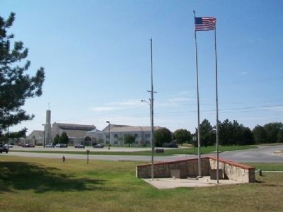
1991 Tornado Victims Memorial
1 ► Kansas, Butler County, Andover — 1991 Tornado Victims —  |
| On Andover Road at 1st Street, on the right when traveling north on Andover Road. | |||
| 2 ► Kansas, Butler County, Augusta — C.N. James Trading Post — Built in 1868 — Oldest House in Augusta — |
| On State Street south of 4th Avenue, on the right when traveling south. | |||
| 3 ► Kansas, Butler County, Beaumont — 1885 Frisco Water Tower — |
| On SE 116th Terrace at SE Main Street, on the left when traveling west on SE 116th Terrace. | |||
| 4 ► Kansas, Butler County, Beaumont — Beaumont Becomes a Railroad Town — Beaumont Historical Marker — |
| On SE 116th Terrace at SE Main Street, on the left when traveling west on SE 116th Terrace. | |||
| 5 ► Kansas, Butler County, Beaumont — Livestock in the Flint Hills — Beaumont Historical Marker — |
| On SE 116th Terrace south of SE Main Street, on the right when traveling east. | |||
| 6 ► Kansas, Butler County, Beaumont — The Beaumont Grass Landing Strip — Beaumont Historical Marker — |
| On SE Main Street at SE 116th Terrace, on the left when traveling south on SE Main Street. | |||
| 7 ► Kansas, Butler County, Beaumont — The Frisco Ponds — Beaumont Historical Marker — |
| Near Southeast Beaumont Road. | |||
| 8 ► Kansas, Butler County, Beaumont — The Historic Beaumont Hotel / The Beaumont Hotel Restoration — Beaumont Historical Marker — |
| On SE Main Street north of SE 116th Terrace, on the right when traveling south. | |||
| 9 ► Kansas, Butler County, El Dorado — Alfred Washington Ellet — Oct. 11, 1820 - Jan. 9, 1895 — Dedicated to the memory of — |
| Near East Central Avenue. | |||
| 10 ► Kansas, Butler County, El Dorado — Cable Tool Drilling Rig — |
| Near East Central Avenue. | |||
| 11 ► Kansas, Butler County, El Dorado — Celebration of Freedom Memorial — |
| On Central Avenue near Gordy Street, on the left when traveling west. | |||
| 12 ► Kansas, Butler County, El Dorado — Flare — |
| Near East Central Avenue. | |||
| 13 ► Kansas, Butler County, El Dorado — Grandma Anderson's House — |
| Near East Central Avenue. | |||
| 14 ► Kansas, Butler County, El Dorado — Kansas Oil Museum — |
| Near East Central Avenue. | |||
| 15 ► Kansas, Butler County, El Dorado — Missouri Pacific Depot Veterans Memorial — |
| On Main Street (U.S. 77) at 3rd Avenue, on the right when traveling north on Main Street. | |||
| 16 ► Kansas, Butler County, El Dorado — Model K Star Spudder — |
| Near East Central Avenue. | |||
| 17 ► Kansas, Butler County, El Dorado — Mrs. Addie Cowley Bradley — |
| Near East Central Avenue. | |||
| 18 ► Kansas, Butler County, El Dorado — Oil Field Boom Towns — |
| Near East Central Avenue. | |||
| 19 ► Kansas, Butler County, El Dorado — Oil Field Lease House — |
| Near East Central Avenue. | |||
| 20 ► Kansas, Butler County, El Dorado — Pole Trailer — |
| Near East Central Avenue. | |||
| 21 ► Kansas, Butler County, El Dorado — Replica of the Statue of Liberty — |
| On Central Avenue (State Highway 254) at Star Street, on the left when traveling west on Central Avenue. | |||
| 22 ► Kansas, Butler County, El Dorado — Signers of the Declaration of Independence — |
| On Central Avenue (State Highway 254) near Gordy Street, on the left when traveling west. | |||
| 23 ► Kansas, Butler County, El Dorado — Star Drilling Machine — |
| Near East Central Avenue. | |||
| 24 ► Kansas, Butler County, El Dorado — Steel Oil Derrick / 1930's Cable-Tool Drilling Rig — |
| Near East Central Avenue. | |||
| 25 ► Kansas, Butler County, El Dorado — The Central Power Unit — |
| Near East Central Avenue. | |||
| 26 ► Kansas, Butler County, El Dorado — The Gypsy Spudder — |
| Near East Central Avenue. | |||
| 27 ► Kansas, Butler County, El Dorado — Tool Rack — |
| Near East Central Avenue. | |||
| 28 ► Kansas, Butler County, El Dorado — Union Tank Car — |
| Near East Central Avenue. | |||
| 29 ► Kansas, Butler County, El Dorado — Veterans Memorial Flagpole — |
| On Central Avenue (State Highway 254) near Gordy Street, on the left when traveling west. | |||
| 30 ► Kansas, Butler County, El Dorado — William Allen White — |
| On Main Street (U.S. 54) at Vine Street, on the right when traveling east on Main Street. | |||
| 31 ► Kansas, Butler County, Towanda — 118 — Towanda — Land of Many Waters — |
| On Interstate 35 at milepost 65, in the median. | |||
| 32 ► Kansas, Chase County, Cottonwood Falls — 94 — A Landmark of Distinction — |
| On Pearl Street at Broadway, on the right when traveling east on Pearl Street. | |||
| 33 ► Kansas, Chase County, Cottonwood Falls — Chase County War Memorial — |
| On Pearl Street at Broadway, on the right when traveling east on Pearl Street. | |||
| 34 ► Kansas, Chase County, Cottonwood Falls — Connecting the Chase County Community — from the Historic Chase County Courthouse to the — Tallgrass Prairie National Preserve — |
| On Broadway at Mill Street, on the right when traveling north on Broadway. | |||
| 35 ► Kansas, Chase County, Cottonwood Falls — Oldest Operating Courthouse in Kansas — 1871 - 1872 — |
| On Pearl Street at Broadway, on the right when traveling east on Pearl Street. | |||
| 36 ► Kansas, Chase County, Cottonwood Falls, Falls Township — Bates Grove and the Area Adjacent to the Cottonwood River Dam — |
| Near Mill Street. | |||
| 37 ► Kansas, Chase County, Cottonwood Falls, Falls Township — Chase County All Veterans Memorial — |
| Near 210th Road. | |||
| 38 ► Kansas, Chase County, Cottonwood Falls, Falls Township — Chase County and the City of Cottonwood Falls — |
| Near Mill Street. | |||
| 39 ► Kansas, Chase County, Cottonwood Falls, Falls Township — Cottonwood River Bridges at Cottonwood Falls — |
| Near Mill Street. | |||
| 40 ► Kansas, Chase County, Cottonwood Falls, Falls Township — Cottonwood River Dam — |
| Near Mill Street. | |||
| 41 ► Kansas, Chase County, Matfield Green — 38th Parallel — |
| On Interstate 35 at milepost 96, on the left when traveling south. | |||
| 42 ► Kansas, Chase County, Matfield Green — 23 — The Bluestem Pasture Region of Kansas — |
| On Interstate 35 at milepost 96, on the left when traveling south. | |||
| 43 ► Kansas, Chase County, Strong City — 22 — Chase County & The Bluestem Pasture Region of Kansas — |
| On U.S. 50, on the right when traveling east. | |||
| 44 ► Kansas, Chase County, Strong City — Strong City — Flint Hills Scenic Byway — |
| On Cottonwood Street (State Highway 177) at the railroad crossing, on the right when traveling south on Cottonwood Street. | |||
| 45 ► Kansas, Chase County, Strong City — W.B. Strong Memorial Railroad Park — Strong City, Kansas — Established 1990 — |
| On Cottonwood Street (State Highway 177) at the railroad crossing, on the right when traveling south on Cottonwood Street. | |||
| 46 ► Kansas, Chase County, Strong City, Strong Township — Curious Outbuildings — |
| Near Kansas 177. | |||
| 47 ► Kansas, Chase County, Strong City, Strong Township — Prairie for the People — |
| Near Kansas 177. | |||
| 48 ► Kansas, Chase County, Strong City, Strong Township — Welcome to Tallgrass Prairie National Preserve / Tallgrass Prairie A Place to Explore — |
| On Kansas 177. | |||
| 49 ► Kansas, Chase County, Strong City, Strong Township — Welcome to the Preserve — |
| Near Kansas 177. | |||
| 50 ► Kansas, Chase County, Tallgrass Prairie National Preserve — Back to Basics — |
| On State Highway 177, on the left when traveling north. | |||
| 51 ► Kansas, Chase County, Tallgrass Prairie National Preserve, Strong Township — Little Barn on the Prairie — |
| Near Kansas 177. | |||
| 52 ► Kansas, Chase County, Tallgrass Prairie National Preserve, Strong Township — Spring Hill Ranch — |
| Near Kansas 177. | |||
| 53 ► Kansas, Chase County, Tallgrass Prairie National Preserve, Strong Township — Vital Necessities — |
| Near Kansas 177. | |||
| 54 ► Kansas, Geary County, Fort Riley — The Atomic Cannon — |
| Near Interstate 70 at milepost 301 at Henry Drive, on the left when traveling west. | |||
| 55 ► Kansas, Geary County, Fort Riley — The Mormon Trail — (South Fork) — |
| Near Henry Drive at Interstate 70. | |||
| 56 ► Kansas, Geary County, Fort Riley, Camp Forsyth — National Rifle Range — 1900-1992 — |
| Near Lookout Drive -or- Thunder Road. | |||
| 57 ► Kansas, Geary County, Fort Riley, Camp Funston — Camp Funston — World War I Headquarters of Maj Gen Leonard Wood — |
| On Huebner Road east of E Street, on the left when traveling east. | |||
| 58 ► Kansas, Geary County, Fort Riley, Camp Funston — Funston Monument — |
| On Huebner Road east of E Street, on the right when traveling east. | |||
| 59 ► Kansas, Geary County, Fort Riley, Camp Whitside — First Capitol of Kansas — |
| On Huebner Road east of 10th Street, on the right when traveling east. | |||
| 60 ► Kansas, Geary County, Fort Riley, Camp Whitside — 24 — First Capitol of Kansas — |
| On Huebner Road east of 10th Street, on the right when traveling east. | |||
| 61 ► Kansas, Geary County, Fort Riley, Main Post — "Duty" — |
| On Henry Avenue north of Custer Avenue, on the left when traveling north. | |||
| 62 ► Kansas, Geary County, Fort Riley, Main Post — 16th Infantry Regiment — 1st Infantry Division — United States Army — |
| Near Sheridan Avenue at Arnold Avenue. | |||
| 63 ► Kansas, Geary County, Fort Riley, Main Post — 9th Armored Division — Activated at Fort Riley July 15, 1942 — Inactivated October 15, 1945 — |
| Near Sheridan Avenue at Arnold Avenue, on the left when traveling west. | |||
| 64 ► Kansas, Geary County, Fort Riley, Main Post — Cholera Epidemic of 1855 — |
| Near Huebner Road, on the left when traveling west. | |||
| 65 ► Kansas, Geary County, Fort Riley, Main Post — Confederate POWs — |
| Near Huebner Road, on the left when traveling west. | |||
| 66 ► Kansas, Geary County, Fort Riley, Main Post — East Riding Hall — Constructed 1889 — |
| On Custer Avenue west of Henry Avenue, on the left when traveling west. | |||
| 67 ► Kansas, Geary County, Fort Riley, Main Post — 27 — Fort Riley — |
| On Huebner Road at Seitz Road, on the right when traveling west on Huebner Road. | |||
| 68 ► Kansas, Geary County, Fort Riley, Main Post — Global War on Terrorism Monument — |
| On Sheridan Avenue at Arnold Avenue, on the left when traveling west on Sheridan Avenue. | |||
| 69 ► Kansas, Geary County, Fort Riley, Main Post — In Memory of Civil War Horses and Mules — |
| Near Henry Avenue at Sheridan Avenue. | |||
| 70 ► Kansas, Geary County, Fort Riley, Main Post — In Memory of the Gallant Dead of the Second U.S. Cavalry — |
| Near Sheridan Avenue at Forsyth Avenue. | |||
| 71 ► Kansas, Geary County, Fort Riley, Main Post — Locomotive "6072" — |
| On Huebner Road at Dickman Avenue/Warehouse Road, on the left when traveling west on Huebner Road. | |||
| 72 ► Kansas, Geary County, Fort Riley, Main Post — M113 Armored Personnel Carrier — |
| Near Cameron Avenue. | |||
| 73 ► Kansas, Geary County, Fort Riley, Main Post — M16 Multiple Gun Motor Carriage — |
| On Henry Avenue. | |||
| 74 ► Kansas, Geary County, Fort Riley, Main Post — M24 Chaffee Light Tank — |
| Near Henry Avenue. | |||
| 75 ► Kansas, Geary County, Fort Riley, Main Post — M3 Personnel Carrier Half-Track — |
| Near Custer Avenue. | |||
| 76 ► Kansas, Geary County, Fort Riley, Main Post — M36 Tank Destroyer — |
| Near Henry Avenue. | |||
| 77 ► Kansas, Geary County, Fort Riley, Main Post — M3A1 37 mm Anti-Tank Gun — |
| Near Cameron Avenue. | |||
| 78 ► Kansas, Geary County, Fort Riley, Main Post — M4A3 Sherman Medium Tank — |
| Near Henry Avenue. | |||
| 79 ► Kansas, Geary County, Fort Riley, Main Post — M5 Stuart Light Tank — |
| Near Henry Avenue. | |||
| 80 ► Kansas, Geary County, Fort Riley, Main Post — Mose Waters' General Store — |
| On Sheridan Avenue 0.1 miles west of Pleasanton Avenue, on the left when traveling west. | |||
| 81 ► Kansas, Geary County, Fort Riley, Main Post — Ogden Monument — |
| Near Henry Avenue north of Custer Avenue, on the left when traveling north. | |||
| 82 ► Kansas, Geary County, Fort Riley, Main Post — Ogden Monument — |
| On Huebner Road 0.4 miles west of Sheridan Avenue, on the left when traveling west. | |||
| 83 ► Kansas, Geary County, Fort Riley, Main Post — Private Robert T. Henry Bridge — |
| On Henry Drive 0.4 miles south of Stuart Avenue, on the right when traveling south. | |||
| 84 ► Kansas, Geary County, Fort Riley, Main Post — Sturgis Stadium — |
| On Godfrey Avenue at Morris Avenue on Godfrey Avenue. | |||
| 85 ► Kansas, Geary County, Fort Riley, Main Post — Third Armored Field Artillery Battalion — |
| Near Sheridan Avenue at Arnold Avenue, on the left when traveling west. | |||
| 86 ► Kansas, Geary County, Fort Riley, Main Post — To the Memory of the Gallant Dead 26th Cavalry — |
| On Sheridan Avenue at Arnold Avenue, on the right when traveling west on Sheridan Avenue. | |||
| 87 ► Kansas, Geary County, Fort Riley, Main Post — To the United States Cavalry — |
| On Sheridan Avenue at Forsyth Avenue, on the left when traveling west on Sheridan Avenue. | |||
| 88 ► Kansas, Geary County, Fort Riley, Main Post — Tuttle Park — |
| On Morris Avenue at Godfrey Avenue, on the right when traveling west on Morris Avenue. | |||
| 89 ► Kansas, Geary County, Fort Riley, Main Post — Vanguard of Freedom — Bicentennial 1775 - 1975 — United States Army — |
| Near Huebner Road, on the left when traveling west. | |||
| 90 ► Kansas, Geary County, Fort Riley, Main Post — West Riding Hall / Polk Hall — |
| On Custer Avenue west of Pleasonton Avenue, on the right when traveling west. | |||
| 91 ► Kansas, Geary County, Fort Riley, Main Post — Wounded Knee and Drexel Mission — |
| On Huebner Road at Sheridan Avenue, on the left when traveling west on Huebner Road. | |||
| 92 ► Kansas, Geary County, Junction City — 1st Infantry Division Memorial — |
| On Washington Street (U.S. 40) at West 5th Street, on the left when traveling north on Washington Street. | |||
| 93 ► Kansas, Geary County, Junction City — 600 Block Washington Street — Historic Buildings — |
| On North Washington Street (Alternate U.S. 77) at West 7th Street, on the right when traveling south on North Washington Street. | |||
| 94 ► Kansas, Geary County, Junction City — 700 Block Washington Street — Historic Buildings — |
| On North Washington Street (Alternate U.S. 77) at East 8th Street, on the right when traveling north on North Washington Street. | |||
| 95 ► Kansas, Geary County, Junction City — 7th Street East & West of Washington — Historic Buildings — |
| On North Washington Street (Alternate U.S. 77) at West 7th Street, on the right when traveling south on North Washington Street. | |||
| 96 ► Kansas, Geary County, Junction City — 800 Block Washington Street — Historic Buildings — |
| On North Washington Street (Alternate U.S. 77) at East 8th Street, on the right when traveling north on North Washington Street. | |||
| 97 ► Kansas, Geary County, Junction City — Buffalo Soldier Memorial — |
| On West 18th Street (State Highway 57) at North Adams Street, on the right when traveling west on West 18th Street. | |||
| 98 ► Kansas, Geary County, Junction City — Civil War Memorial Arch — |
| On Washington Street (U.S. 40) at West 6th Street, on the right when traveling south on Washington Street. | |||
| 99 ► Kansas, Geary County, Junction City — George Smith — Born 1835 - Died 1905 — Pioneer Citizen - Philanthropist — |
| On West 7th Street at North Washington Street (Alternate U.S. 77), on the right when traveling east on West 7th Street. | |||
| 100 ► Kansas, Geary County, Junction City — 104 — Historical Kansas |
| On Interstate 70 at milepost 294, on the right when traveling east. Reported missing. | |||
261 entries matched your criteria. The first 100 are listed above. Next 100 ⊳