68 entries match your criteria.
Potawatomi Trail of Death Historical Markers
In 1838 over 850 Potawatomi Indians were forced by gunpoint off their homeland in Indiana and ‘marched’ approximately 660 miles to the State of Kansas for relocation — causing approximately 42 deaths along the way.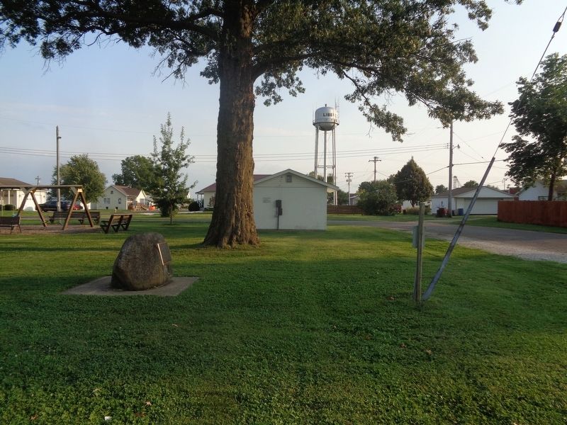
By Jason Voigt, September 7, 2021
Trail of Death Marker
| 1 ► Illinois, Adams County, Liberty — Trail of Death — Regional Historic Trail — Indiana to Kansas — |
| On North Park Street at Hannibal Street, on the right when traveling north on North Park Street. | |||
| 2 ► Illinois, Adams County, Quincy — In Memory of the Potawatomi Indian "Trail of Death" — Indiana to Kansas, September 4 - November 4, 1838 — |
| On Maine Street west of 7th Street, on the right when traveling west. | |||
| 3 ► Illinois, Adams County, Quincy — Indian Removals - A Memorial — |
| On Quinsippi Island Road, on the right when traveling east. | |||
| 4 ► Illinois, Adams County, Quincy — Potawatomi Trail of Death — Mill Creek 1838 — |
| On Rock Quarry Road south of Illinois Route 104, on the left when traveling north. | |||
| 5 ► Illinois, Champaign County, Homer — Potawatomi Trail of Death — Davis' Point Encampment — September 20, 1838 — |
| On County Route 1250 N west of County Route N 300 E, on the right when traveling west. | |||
| 6 ► Illinois, Champaign County, Sadorus — Potawatomi Trail of Death — Sadorus's Grove Encampment — September 22, 1838 — |
| On North West Street at North Front Street, on the left when traveling north on North West Street. | |||
| 7 ► Illinois, Champaign County, Sidney — Potawatomi Trail of Death — Sidney Encampment — September 21, 1838 — |
| On Dunlap Woods north of East Main Street, on the right when traveling north. | |||
| 8 ► Illinois, Macon County, Decatur — Potawatomi Trail of Death — Sangamon Crossing — 24 - 26 September, 1838 — |
| On Dunbar Road at Caleb Road, on the left when traveling south on Dunbar Road. | |||
| 9 ► Illinois, Morgan County, Jacksonville — Potawatami Indians — |
| On South Central Park at Mauvaisterre Street on South Central Park. | |||
| 10 ► Illinois, Piatt County, Monticello — Potawatomi Trail of Death — |
| On West Railroad Street west of North Park Street, on the left when traveling west. | |||
| 11 ► Illinois, Piatt County, Monticello — Trail of Death — Pyatt's Point — Sept. 21, 1838 — |
| On West Center Street west of North Market Street, on the left when traveling west. | |||
| 12 ► Illinois, Pike County, Perry — Potawatomi Trail of Death — |
| On East Main Street at Federal Street on East Main Street. | |||
| 13 ► Illinois, Sangamon County, New Berlin — Potawatomi Trail of Death — McCoys Mill Encampment — Sept 4 - Nov 4, 1838 — |
| On Old Jacksonville Road (County Highway 8) at New Salem Church Road, on the left when traveling west on Old Jacksonville Road. | |||
| 14 ► Illinois, Sangamon County, New Berlin — Potawatomi Trail of Death — Island Grove Encampment — Sept 4-Nov 4, 1838 — |
| On Old Jacksonville Road (County Route 8) 0.1 miles east of Peters Road (County Route 8), on the right when traveling west. | |||
| 15 ► Illinois, Sangamon County, Springfield — Potawatomi Trail of Death — |
| Near East Adams Street west of South 6th Street. | |||
| 16 ► Illinois, Sangamon County, Springfield — Potawatomi Trail of Death — |
| On County Route 1a east of Dave Stockton Drive, on the right when traveling west. | |||
| 17 ► Illinois, Scott County, Exeter — Potawatomi Indians Trail of Death — Exeter Encampment — October 2, 1838 — |
| On Exeter Bluffs Lane at Water Street, on the right when traveling west on Exeter Bluffs Lane. | |||
| 18 ► Illinois, Scott County, Naples — Potawatomi Indians — |
| On Bob Michael Street east of Carroll Street, on the left when traveling east. | |||
| 19 ► Illinois, Vermilion County, Catlin — Potawatomi - A Trail of Death — Sandusky Point Encampment — |
| On North Paris Street, on the right when traveling south. | |||
| 20 ► Illinois, Vermilion County, Danville — Trail of Death 1838 — Ellsworth Park — |
| On West Ellsworth Street south of Oakwood Avenue, on the left when traveling south. | |||
| 21 ► Indiana, Carroll County, Delphi — Trail of Death — September 10, 1838 — "Winnemac's" Old Village — |
| On West Towpath Road west of North Meridian Road, on the left when traveling west. | |||
| 22 ► Indiana, Carroll County, Pittsburg — Trail of Death — Pleasant Run — |
| On County Road N 800 W at County Road W 550 N, on the right when traveling south on County Road N 800 W. | |||
| 23 ► Indiana, Cass County, Logansport — Potawatomi Encampment — Trail of Death — |
| On Michigan Avenue (a.k.a. - St Rd 25) at Fulton Street, on the right when traveling south on Michigan Avenue (a.k.a. - St Rd 25). | |||
| 24 ► Indiana, Fulton County, Rochester — Father Petit and the Potawatomi 'Trail of Death' — Indiana to Kansas, September 4 - November 4, 1838 |
| On U.S. 31 south of County Road W 375 N, on the right when traveling south. Reported permanently removed. | |||
| 25 ► Indiana, Fulton County, Rochester — 25.1949.1 — Michigan Road — |
| On North Old US Highway 31 north of County Road E 350 N, on the right when traveling north. | |||
| 26 ► Indiana, Fulton County, Rochester — Potawatomi "Trail of Death" — Indiana to Kansas, September 4 - November 4, 1838 — |
| On Main Street north of East 9th Street, on the right when traveling north. | |||
| 27 ► Indiana, Fulton County, Rochester — Site of Indian Village Chippewa-Nung — Potawatomi - Trail of Death — |
| On North Old US Highway 31 north of County Road E 350 N, on the right when traveling north. | |||
| 28 ► Indiana, Fulton County, Rochester — Trail of Death — Mud Creek — |
| On State Road 25 south of County Road E 400 S, on the right when traveling south. | |||
| 29 ► Indiana, Fulton County, Rochester — William Polke House — |
| On U.S. 31 south of County Road W 375 N, on the right when traveling south. | |||
| 30 ► Indiana, Marshall County, Plymouth — Chief Menominee — |
| On Peach Road, on the right when traveling north. | |||
| 31 ► Indiana, Marshall County, Plymouth — Menominee Chapel — Potawatomi - Trail of Death |
| On 12th Road west of South Pear Road (a.k.a. - South Peach Road), on the left when traveling west. Reported missing. | |||
| 32 ► Indiana, Marshall County, Plymouth — 50.1949.1 — Trail of Death |
| On West 12th (State Road 17) at Hiawatha on West 12th. Reported missing. | |||
| 33 ► Indiana, Marshall County, Twin Lakes — Potawatomi Indian Village — |
| On South Peach Road, 0.2 miles south of Menominee Drive, on the left when traveling south. | |||
| 34 ► Indiana, Tippecanoe County, Battle Ground — Potawatomi ‘Trail of Death’ Route — |
| On Battleground Avenue. | |||
| 35 ► Indiana, Tippecanoe County, Lafayette — Trail of Death — September 13, 1838 — Lagrange on Wabash River — |
| On County Road S 950 W south of County Road W 75 S, on the right when traveling south. | |||
| 36 ► Indiana, Tippecanoe County, Lafayette — Trail of Death — September 12, 1838 — LaGrange - Logansport State Road — |
| On County Road W 500 N west of Road N 225 W, on the right when traveling west. | |||
| 37 ► Indiana, Warren County, State Line City — Trail of Death — Gopher Hill Cemetery — |
| On County Road S 900 W north of County Road W 950 S, on the right when traveling north. | |||
| 38 ► Indiana, Warren County, Williamsport — The Trail of Death — |
| On East Independence Road near North 800 East, on the right when traveling east. | |||
| 39 ► Indiana, Warren County, Williamsport — Trail of Death — Old Town Park - - Williamsport — |
| On Main Street at South 2nd Street, on the right when traveling east on Main Street. | |||
| 40 ► Kansas, Linn County, Centerville — [Potawatomi] Trail of Death — Indiana to Kansas — |
| 41 ► Kansas, Linn County, Centerville — [Potawatomi] Trail of Death — |
| 42 ► Kansas, Linn County, Centerville — Father Petit and the Potawatomi 'Trail of Death' — (Indiana to Kansas, September 4 - November 4, 1838) — |
| 43 ► Kansas, Linn County, Centerville — Father Petit and the Trail of Death — |
| 44 ► Kansas, Linn County, Centerville — Kanza Indian Site? — |
| 45 ► Kansas, Linn County, Centerville — Potawatomi "Trail of Death" march & death of Fr. Petit — |
| 46 ► Kansas, Linn County, Centerville — Potawatomi Burial Ground — Memorial — |
| 47 ► Kansas, Linn County, Centerville — Priests House — |
| 48 ► Kansas, Linn County, Centerville — St. Mary's Mission — St. Philippine Duchesne Memorial Park — |
| On 1525th Road, on the left when traveling west. | |||
| 49 ► Kansas, Linn County, Trading Post — Sounds of the byway...moccasins and tears. — Frontier Military Historic Byway — |
| 50 ► Kansas, Miami County, Osawatomie — The Potawatomi Trail of Death — Indiana to Kansas — September 3, 1838 to November 4, 1838 — |
| On 6th Street at Lincoln Avenue, on the left when traveling north on 6th Street. | |||
| 51 ► Kansas, Pottawatomie County, St. Marys — Potawatomi Pay Station & St. Marys Mission — |
| On West Bertrand Avenue (U.S. 24) west of North 6th Street, on the right when traveling west. | |||
| 52 ► Kansas, Pottawatomie County, St. Marys — 18 — St. Marys — |
| On East Bertrand Street (U.S. 24) at Grand Avenue, on the right when traveling east on East Bertrand Street. | |||
| 53 ► Kansas, Pottawatomie County, Wamego — 107 — Vieux Cemetery — |
| On Oregon Trail Road, 0.8 miles west of Onaga Road, on the right when traveling west. | |||
| 54 ► Missouri, Carroll County, Carrollton — Trail of Death — |
| On North Mason Street south of U.S. 65, on the right when traveling north. | |||
| 55 ► Missouri, Carroll County, De Witt — Trail of Death — |
| On Jefferson Street east of 7th Street. | |||
| 56 ► Missouri, Chariton County, Brunswick — Trail of Death — |
| Near South Polk Street near East Mulberry Street, on the right. | |||
| 57 ► Missouri, Chariton County, Keytesville — Potawatomi Indians — |
| On West Bridge Street at North Park Street, on the left when traveling east on West Bridge Street. | |||
| 58 ► Missouri, Jackson County, Independence — Trail of Death — |
| On North Dodgion Street at East Truman Road, on the right when traveling south on North Dodgion Street. | |||
| 59 ► Missouri, Jackson County, Independence — Trail of Death — |
| Near East Park Highway (State Highway 78) at South Fisher Road. | |||
| 60 ► Missouri, Lafayette County, Lexington — Trail of Death — Historical Marker — |
| On Broadway (Missouri Route 224) at Highland Avenue, on the right when traveling west on Broadway. | |||
| 61 ► Missouri, Lafayette County, Napoleon — Potawatomi Trail of Death March — 1838 — |
| On East 2nd Street west of State Highway 224, on the left when traveling east. | |||
| 62 ► Missouri, Lafayette County, Wellington — Potawatomi "Trail of Death" March — Sept. - Nov. 1838 — |
| On West 5th Street (State Highway 224) at Walnut Street (State Highway 131) on West 5th Street. | |||
| 63 ► Missouri, Marion County, Monroe City — Trail of Death — |
| On County Route 240 east of County Route 238, on the right when traveling west. | |||
| 64 ► Missouri, Marion County, Palmyra — Potawatomi Emigration — Trail of Death — |
| On East Main Cross, 0.1 miles west of US 61 and US 24 (U.S. 61/24), on the right when traveling west. | |||
| 65 ► Missouri, Marion County, Palmyra — Trail of Death — |
| On County Route 320 at County Route 361, on the left when traveling west on County Route 320. | |||
| 66 ► Missouri, Marion County, West Quincy — Trail of Death — |
| On U.S. 24 west of County Highway 357, on the right when traveling west. | |||
| 67 ► Missouri, Randolph County, Huntsville — 55 — Trail of Death — |
| On North Main Street at East Library Street, on the right when traveling north on North Main Street. | |||
| 68 ► Missouri, Ray County, Richmond — Potawatomi "Trail of Death" March — September - November 1838 — |
| On East South Street west of South Spartan Drive (State Highway 13), on the right when traveling east. | |||